Norvin Green State Forest, Passaic County, New Jersey

I arrived at the parking lot of the Weis Ecology Center at 10:25 a.m., and expected to meet a small group of people between 10:30 and 10:45. When that group didn’t show by 10:50, I  instead accepted an invitation to hike with a trio that I met in the parking lot.

10:51 a.m.: I began by following the green trail southwest, which ran past picnic benches and fields of the Weis Ecology Center and then up a long hill. The trail was not well-blazed, and in fact at the top of the hill I saw white blazes that were not shown on the map, but I followed them and they eventually turned into green blazes.

Green Trail, Norvin Green State Forest, NJ

Green trail

11:31 a.m.: After crossing a stream, the trail resumed its ascent. After about 0.4 miles, the green trail intersected the blue trail. We turned onto the blue trail, also traveling roughly southwest. This led us to the first of a number of scenic views.

Scenic view from blue trail; Norvin Green State Forest, NJ

Scenic view


Scenic view from blue trail; Norvin Green State Forest, NJ

Scenic view

11:44 a.m.: Another scenic view.

Scenic view from blue trail; Norvin Green State Forest, NJ

Scenic view

11:46 a.m.: I pose in front of a boulder. The blue trail turned east around this point.

Posing in front of boulder, Norvin Green State Forest, NJ

Posing in front of boulder

11:47 a.m.: Another boulder.

Boulder, Norvin Green State Forest, NJ

Boulder

11:58 a.m.: After about 0.6 miles, the blue trail intersected the red trail, and we diverged from the blue trail briefly so as to ascend to Wyanokie High Point, which afforded very nice views of the Wanaque Reservoir, with the Manhattan skyline viewable in the hazy distance.

Wyanokie High Point, Norvin Green State Forest, NJ

Wyanokie High Point


Wanaque Reservoir, from Wyanokie High Point, Norvin Green State Forest, NJ

Wanaque Reservoir

Wanaque Reservoir, from Wyanokie High Point, Norvin Green State Forest, NJ

Wanaque Reservoir

I bid farewell to the trio with whom I had began the hike, and continued on my own. (They wanted to do a shorter, slower hike than I had in mind.) I returned to the blue trail, which now turned south.

12:37 p.m.: After 0.6 miles, I reached Carris Hill. At this point, I turned off the blue trail and onto the yellow trail, which ran southeast.

Yellow Trail, Norvin Green State Forest, NJ

Yellow Trail

1:01 p.m.: Another scenic view.

Scenic View from Yellow Trail, Norvin Green State Forest, NJ

Scenic view


Scenic View from Yellow Trail, Norvin Green State Forest, NJ

Scenic view


Boulder and Scenic View, Yellow Trail, Norvin Green State Forest, NJ

Boulder and scenic view

1:05 p.m.: And another scenic view.

Yellow Trail, Norvin Green State Forest, NJ

Yellow trail

Scenic View from Yellow Trail, Norvin Green State Forest, NJ

Scenic view

1:11 p.m.: More views of the Wannaque Reservoir:

Wannaque Reservoir from Yellow Trail, Norvin Green State Forest, NJ

Wannaque Reservoir


Wannaque Reservoir from Yellow Trail, Norvin Green State Forest, NJ

Wannaque Reservoir

1:19 p.m.: Another view of the reservoir:

Panorama, Norvin Green State Forest, NJ

1:52 p.m.: After 0.8 miles, the yellow trail ended. I turned west onto a white trail that ran along Posts Brook.

Posts Brook, Norvin Green State Forest, NJ

Posts Brook

2:06 p.m.: The trail ran beside Chikahoki Falls. [This photo was actually taken the following week. The blue trail runs on the north side of the brook and doesn’t provide a very good view of the waterfall. When I returned to Norvin Green a week later, I was able to cross the brook and take this photo across from the falls.]

Chikahoki Falls, Norvin Green State Forest, NJ

Chikahoki Falls

2:24 p.m.:  After 0.5 miles, the white trail ended and I rejoined the blue trail, now running west. The temperature was in the 80s on this day, and I was feeling hot and tired at this point, which was only about halfway into my hike.

2:56 p.m.: After another 0.9 miles, the blue trail reached the Otter Hole, where the brook falls over two short waterfalls in quick succession.

Otter Hole, Norvin Green State Forest, NJ

Otter Hole

3:25 p.m.: The blue trail ended at the Otter Hole, so I rejoined the green trail, now running north back towards the Weis Ecology Center. Unlike the set of trails running south and west, the green trail running north was mostly level or downhill, so it was easier. As well, the temperature was moderating somewhat.

This was a scenic view along the way.

Scenic view from green trail, Norvin Green State Forest, NJ

Scenic view

3:56 p.m.: Another view from the green trail.

Green Trail, Norvin Green State Forest, NJ

Green trail

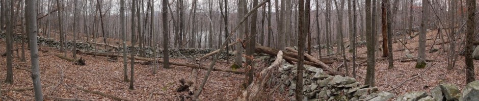
4:05 p.m.: This was the only stone wall that I saw at Norvin Green.

Stone wall, Norvin Green State Forest, NJ

Stone wall

After 2.7 miles on the green trail, I returned to the Weis Ecology Center and my car. So this was about a 6.7 mile hike.

Posted in Hikes | Tagged , , , | Leave a comment

Clarence Fahnestock Memorial State Park, Putnam County, New York

I drove north on the Taconic and turned west on Route 301, parking at the southern end of Canopus Lake.

12:10 p.m.: I hiked north on the white-blazed Appalachian Trail, where in the course of a few minutes I met nine hikers, in five groups, heading south. I thought it would be one of those days in which I had no solitude, but my encounters with others waned after that.

Fahnestock State Park, NY

Starting the hike

12:23 p.m.: After 0.5 miles, I turned left (west) onto the blue-blazed Fahnestock Trail.

Intersection of Appalachian Trail and Fahnestock Trail, Fahnestock State Park, NY

Intersection of Appalachian Trail and Fahnestock Trail

12:39 p.m.:  It was a hot and humid day, so when I came to a large bare rock, I took the opportunity to rest a few minutes and enjoy a Clif bar.

Bare Rock on Fahnestock Trail, Fahnestock State Park, NY

Bare rock

12:57 p.m.: I appreciated the fact that most of my hike was on footpaths, rather than on old woods roads.

Fahnestock Trail, Fahnestock State Park, NY

Fahnestock Trail

1:00 p.m.: There were a number of trees across the trails, but I don’t know if they fell recently (such as during last Sunday’s Hurricane Irene) or if they’ve been down a long time. I think I duck-walked under these two. In another case I was able to step over one, and in one case I sat on the tree and then swung my legs to the other side.

Fallen Trees on Fahnestock Trail, Fahnestock State Park, NY

Fallen trees

1:05 p.m.: After another 0.9 miles, the blue trail turned north and was joined (briefly) by the red-blazed Charcoal Burners trail.

1:12 p.m.:  The trails then passed by Beaver Pond:

Beaver Pond, Fahnestock State Park, NY

Beaver Pond

1:16 p.m.: After 0.3 miles, the red trail continued north, but I stayed with the blue trail, which now turned west once again.

1:33 p.m.: Mossy rocks:

Mossy Rocks at Fahnestock State Park, NY

Mossy rocks

1:51 p.m.: The trail curved, first turning north-northwest, and then southwest. The trail then passed by a large pond which the map does not name. Trees screened most of the pond from the trail, however. Here, a low stone wall afforded some contrast.

Stone Wall at Fahnestock State Park, NY

Stone wall

2:02 p.m.: After 1.7 miles, the blue trail reached an intersection with the yellow-blazed Perkins Trail. I continued on the yellow trail, which continued to the southwest. There is some private property in the middle of Fahnestock, and signs warned hikers to keep to the trails.

2:14 p.m.: After 0.5 miles, the yellow trail crossed Glynwood Road and reentered the woods, where this brand new bridge (with a dead tree wedged against it) crossed Clove Creek.

Bridge over Clove Creek, near Glynwood Road, Fahnestock State Park, NY

Bridge over Clove Creek, near Glynwood Road

2:45 p.m.: The yellow trail then ran alongside the creek for a while. I stopped along the way for a late lunch.

Clove Creek, beside Perkins Trail, Fahnestock State Park, NY

Clove Creek, beside Perkins Trail

2:57 p.m.: An old stone wall:

Stone wall on Perkins Trail, Fahnestock State Park, NY

Stone wall

After 0.6 miles of running parallel to the creek, the trail turned south, away from the creek. The trail then doubled back toward the northeast.

3:21 p.m.: After another 0.7 miles, I came to a scenic view identified on the map, a bare rock that afforded a nice view of the countryside. The heat and humidity was again bothering me, so I rested here for a few minutes.

Bare rock on Perkins Trail, Fahnestock State Park, NY

Bare rock

3:39 p.m.: The trail then led to a clearing, with the trail pretty much continuing straight through the clearing and through a gap in the trees on the far side.

Clearing, Perkins Trail, Fahnestock State Park, NY

Clearing

3:40 p.m.: Another stone wall:

Stone wall, Perkins Trail, Fahnestock State Park, NY

Stone wall

3:48 p.m.: After about another 0.6 miles, the trail led to another clearing, and another starred scenic view. This was not a single point, but an entire cleared hilltop that afforded a nice view to the north.

Scenic view from Perkins Trail, Fahnestock State Park, NY

Scenic view

3:49 p.m.: Just beyond the second clearing was a gated fence, with blazes indicating a turn to the right.

Gate to farmland, Fahnestock State Park, NY

Gate to farmland

A closer look at the tillers:

Tillers in a Field, Fahnestock State Park, NY

Tillers in a field

I first turned right in front of the fence, but after about 0.1 miles the path became too overgrown to follow. I backtracked to the gate and discovered that there was a yellow blaze on the inside of the gate, so I decided that I was supposed to hike inside the fence instead of outside of it. The map just showed that I was to hike south about 0.2 miles. I hiked south, and noted one or two blazes on fenceposts as I hiked, though I didn’t see very many of those blazes.

4:05 p.m.: After a while I didn’t see any blazes at all, but I continued following the fence until it ended. At that point, I saw a very impressive (and thick) stone wall. Obviously, if one clears a field, one has to do something with all the rocks.

Stone Wall, Fahnestock State Park, NY

Stone wall

Unfortunately, I didn’t know where to go from here. There were no blazes. The map showed that the yellow trail was supposed to turn left (east), but from what point? I had been following a fence bordering a huge field with ankle-high grass. I was probably supposed to turn east at some point, but I hadn’t seen any blazes on the fence post indicating a turn to the east, or any path through the ankle-high grass indicating a path.

So as I stood at the southern end of the field, this was the view toward the east. No blazes there.

Edge of field, Fahnestock State Park, NY

Edge of field

To the south, an open gate led to an unmarked trail. I wasn’t terribly concerned about being “lost,” because the map showed that I was at the most 0.3 miles from a road, and I believed that if I found a trail to the east that I would soon encounter the road. I also knew that I could cross the open field to the east and find the road, but I didn’t like the idea of doing that, especially in an area that was private property.Not having much choice, I continued through the open gate onto the unmarked trail (which also did not show on my map).

4:13 p.m.: The trail turned east, the direction I wanted, and soon led to this horse corral.

Horse Corral, Near Fahnestock State Park, NY

Horse corral

As I walked by the corral, I saw a fence with a dirt road behind it, which I realized was the road shown on the map. I found a gate and let myself out and onto the road. Now the only problem was that I had wanted the yellow trail, which led to the east and back to Route 301, whereas the road led to the south-southwest and Route 301, taking me about 0.8 miles in the wrong direction. I had little choice in the matter, though.

I followed the road, which led me to Stonecrop Gardens, a public garden. I walked through the parking lot and continued following the road to Route 301. What should have been a 1.4 mile walk back to my car was now a 2.1 mile walk, because of the unplanned detour.

5:05 p.m.: Made it back to my car, after a 5-hour hike of about 9 miles.

Posted in Hikes | Tagged , , , | Leave a comment

Sterling Forest State Park, Orange County, New York

This was my first hike after the Grand Canyon. Several weeks had passed, in part due to weekend thunderstorms. On this day, I joined the Appalachian Mountain Club, with the understanding that they were going to visit Harriman State Park, specifically some trails that I hadn’t yet hiked. Instead, I was disappointed to learn that the intended leader had been replaced, and the replacement leader had changed the venue. Apparently this was communicated via e-mail to members of the AMC, but since I was not a member, I didn’t know that.

So we went to Sterling Forest, to the very trails that I had hiked just two months earlier. The only difference was that whereas I had done the hike clockwise, the group did it counterclockwise. They also added a hike around Sterling Lake onto the end of the hike.

This is a panoramic view of Greenwood Lake from Bare Rock.

Greenwood Lake, from Bare Rock, Sterling Forest State Park, NY

Greenwood Lake

The following images were taken toward the end of our hike, as we walked around Sterling Lake.

Sterling Lake, Sterling Forest State Park, NY

Sterling Lake


Sterling Lake, Sterling Forest State Park, NY

Sterling Lake


Sterling Lake, Sterling Forest State Park, NY

Sterling Lake

This was about an 8.5-mile hike.

Posted in Hikes | Tagged , , | Leave a comment

Grand Canyon National Park, Arizona – July 13-14, 2011

Wednesday: We woke up about 4:45 a.m., dressed, ate breakfast, finished packing, weighed our duffel bags and left them for the mules to carry to the top of the South Rim (my bag weighed 14 pounds, if I recall correctly, and I was happy to have a mule carry it for me). We began hiking around 5:50 a.m., with Phantom Ranch being around 2788′ above sea level. The intent for starting the hike so early was to try to cover several miles before the sun rose high in the sky. Also, the temperature would be lower at the higher elevations, which would also make it easier for us.

6:04 a.m.: This little bridge spans the Bright Angel Creek.

Bridge over Bright Angel Creek, Phantom Ranch, Grand Canyon

Bridge over Bright Angel Creek

This is another view of the Kaibab Suspension Bridge (also known as “the black bridge”), which we had seen when we arrived on our rafts. However, we were not hiking up the South Kaibab Trail, but instead the easier Bright Angel Trail.

Kaibab Suspension Bridge, Grand Canyon

Kaibab Suspension Bridge

6:08 a.m.:  This is the silver Bright Angel Bridge (also known as “the silver bridge”). We had descended about 200′ to reach this bridge, over a distance of about 1/2 mile.

Bright Angel Bridge, Grand Canyon

Bright Angel Bridge

As you can see, the silver bridge is not very wide. The mules cross the river using the black bridge. The silver bridge only caries people, and it also carries the water pipeline. We were surprised to learn that the South Rim obtains water from the North Rim! Water is piped from the North Rim down into the canyon, through Phantom Ranch, across the river (suspended under the silver bridge), and then is pumped up to the South Rim.

Bright Angel Bridge, Grand Canyon

Bright Angel Bridge

6:37 a.m.: We were not officially on the Bright Angel Trail yet. Rather, we were on the River Trail, which ran for about 1.3 miles from the silver bridge to the “River Resthouse.” Between the bridge and the River Resthouse the River Trail rose and fell a bit, perhaps climbing 200 or 300′ and then giving up almost all of that elevation.

River Trail, Grand Canyon

River Trail

6:39 a.m.: Impressive lens flare.

River Trail, Grand Canyon

River Trail

River Trail, Grand Canyon

River Trail

We passed the River Resthouse about two minutes later, and began climbing the Bright Angel Trail.

6:54 a.m.: On the Bright Angel Trail. At least now my camera was starting to record the sky as blue instead of white:

Bright Angel Trail, Grand Canyon

Bottom of the Bright Angel Trail

7:21 a.m.: Gaining elevation.

Bright Angel Trail, Grand Canyon

Gaining elevation on the Bright Angel Trail

7:30 a.m.: A very fat squirrel. Supposedly the most common injury on the Bright Angel Trail is squirrel bites.

Fat squirrel, Bright Angel Trail, Grand Canyon

Fat squirrel

7:39 a.m.: Gaining more elevation, the path of the trail below us, including switchbacks, can be clearly seen. By advance agreement, we were all hiking at our own pace, or at least we split up into a number of groups. Julie and I hiked together, while others in our party were ahead of us or lagged behind. I should mention that the oldest and youngest members of our group of 9, and in fact of the entire group of 22 that had been on the boats, was a 71-year-old man and his 13-year-old grandson. The Canyoneers crew said that they had previously hosted children as young as 8 or 9. Our guide was actually operating as a “sweep,” bringing up the rear to make sure that no one had any trouble.

Switchbacks on the Bright Angel Trail, Grand Canyon

Switchbacks on the Bright Angel Trail

7:47 a.m.: We arrived at a little oasis. Hikers said they had spent the night at the Bright Angel campground (not far from Phantom Ranch) and did not have potable water, so they were filling up with water from the stream. (They had filters to purify the water.) At that point we were not too far from a rest point that had potable water, so I don’t know if it was really necessary, but of course it’s good to be prudent and to have water available.

Oasis on the Bright Angel Trail, Grand Canyon

Oasis

7:50 a.m.: Julie has crossed over a little stream:

Stream across the Bright Angel Trail, Grand Canyon

Stream on Bright Angel Trail

7:55 a.m.:  Passing an eroded sandstone formation.

Sandstone formation, Bright Angel Trail, Grand Canyon

Sandstone formation

7:59 a.m.: A small waterfall cascaded down the rockface:

Waterfall adjacent to Bright Angel Trail, Grand Canyon

Waterfall adjacent to Bright Angel Trail

8:06 a.m.:  A rock formation is framed by a cactus on the left and a “Century plant” on the right.

Century Plant and Cactus, Bright Angel Trail, Grand Canyon

Century plant and cactus

At 8:08 a.m., we passed an intersection with the Tonto East Trail. Then at 8:14 a.m. we reached Indian Garden, about 3.6 miles into our hike, and at 3800′ elevation (about a 1400′ climb above the river). We were amazed at the good time we were making. There was a rest house and ample water at Indian Garden (in addition to a campsite that I didn’t see). Thermometers registered 69 degrees in the shade and 102 in the sun. The air temperature felt hotter than 69 degrees, but it wasn’t bad. We refilled our Camelbaks, rested for a few minutes, and continued our climb.

8:42 a.m.: Gaining additional elevation:

Bright Angel Trail, Grand Canyon

Gaining elevation

8:58 a.m.: We encountered the mules descending from the South Rim with their passengers. As instructed, we went to the “high side” of the road and gave them plenty of room to pass.

Mule team, Bright Angel Trail, Grand Canyon

Mule team

9:07 a.m.:  More scenery from the Bright Angel Trail.

Bright Angel Trail, Grand Canyon

Bright Angel Trail

9:10 a.m.: I remembered to stop every so often to take pictures:

Bright Angel Trail, Grand Canyon

Bright Angel Trail

9:21 a.m.: We would occasionally run into others from our party, or into complete strangers, and offer to take photos of each other.

Julie and Charlie on Bright Angel Trail, Grand Canyon

Julie and Charlie on Bright Angel Trail

At 9:25 a.m. we reached the Three-Mile Resthouse, meaning we were only 3 miles from the South Rim. Three-Mile Resthouse is at 4748′ elevation, so we had walked about 6.6 miles and climbed about 2300′ at this point.

9:48 a.m.: More beauty.

Scenery from Bright Angel Trail, Grand Canyon

Scenery from Bright Angel Trail

9:55 a.m.: I’ve been told that it’s normal for the canyon atmosphere to be hazy in the summer, and we definitely saw some of that.

Scenery from Bright Angel Trail, Grand Canyon

Scenery from Bright Angel Trail

At the Three-Mile Resthouse, Julie had changed from her pink shirt (which matched the sandstone formations) into her fashionable Yosemite shirt (to match the increasing greenery).

Above Three Mile Resthouse, Bright Angel Trail, Grand Canyon

Above Three Mile Resthouse

10:02 a.m.: Gaining more elevation.

Bright Angel Trail, Grand Canyon

Bright Angel Trail

10:10 a.m.: The views were getting more and more expansive. I understand that the South Kaibab Trail has even better views, but it is a harder climb.

View from Bright Angel Trail, Grand Canyon

View from Bright Angel Trail

10:20 a.m.: As you can see, I have been stitching together many panoramas from this day’s activity. I didn’t have many opportunities to do that in the previous days, because while rafting the boats were constantly moving and so not conducive to panning the camera while taking multiple shots to later stitch together.

View from Bright Angel Trail, Grand Canyon

View from Bright Angel Trail


View from Bright Angel Trail, Grand Canyon

View from Bright Angel Trail


10:34 a.m.: More scenery from the Bright Angel Trail.

Bright Angel Trail, Grand Canyon

Bright Angel Trail


View from Bright Angel Trail, Grand Canyon

View from Bright Angel Trail

10:40 a.m.: The Bright Angel Trail appears as a ribbon far below us.

Bright Angel Trail, Grand Canyon

Bright Angel Trail

At 10:53 a.m., we reached the Mile-and-a-Half Resthouse, at an elevation of 5729′, after hiking about 8.1 miles and climbing 3300′ feet. A thermometer (I believe in the shade) showed 85 degrees. That seemed like a more realistic air temperature than the one I had seen at Indian Gardens that read 69 degrees.

Only 1.5 miles and 1000′ to go at this point. We also began encountering a fair number of day-tourists at this point, who decided to hike down the trail for a mile or until they got to the first resthouse at 1.5 miles.

11:05 a.m.: Getting closer to the rim.

Mile and a Half Point, Bright Angel Trail, Grand Canyon

Mile and a Half Point

Bright Angel Trail, Grand Canyon

Bright Angel Trail

11:23 a.m.: We reached the “second tunnel.”

Second Tunnel, Bright Angel Trail, Grand Canyon

Second Tunnel

11:30 a.m.: A nice view.

Bright Angel Trail, Grand Canyon

Bright Angel Trail

11:37 a.m.: Almost at the top.

Bright Angel Trail, Grand Canyon

Bright Angel Trail

11:48 a.m.: The “first tunnel.”

First Tunnel, Bright Angel Trail, Grand Canyon

First Tunnel

By 11:55 a.m., we had reached the South Rim, at 6860′ elevation, having hiked about 9.6 miles and climbed over 4400′, not including some additional ups and downs from Phantom Ranch to the river and along the River Trail. It had taken Julie and me six hours, but we were fine, not being sore or overheated. I felt it was an easier hike than the 7.1 mile, 4800′ elevation gain from Little Yosemite Valley to the top of Half Dome the year before (and plus, we had to then leave Half Dome and descend the same distance and elevation). We eventually reunited with the rest of our party. We learned that a couple of older teenage boys had done the hike in an amazing four hours! Another pair of hikers, with our guide Dave accompanying them, had required 8 hours. So Julie and I were right in the middle of the pack, at 6 hours.

Our reservations on the shuttle back to Flagstaff were for 6:00 p.m., so we had little choice but to spend a lot of time hanging out at the top of the South Rim. There had been an earlier shuttle, but we had no way of knowing how long the hike would take, so we had all been conservative and had booked seats on the later shuttle. So we ate ice cream; talked; went to the mule barn to collect our duffel bags, which the mules had kindly carried for us; visited a couple of gift shops, etc., and finally it was time to take the shuttle. The group rode back to Flagstaff, checked back into the hotel, reclaimed the possessions we had left there, and finally were able to enjoy hot showers.

Thursday: Julie and I bid farewell to the others in our group, took a taxi to the airport and caught the commuter flight to Phoenix, where we once again parted ways, returning to our homes.

It was an amazing trip, and I highly recommend white-water rafting in the Grand Canyon and hiking up the Bright Angel Trail, especially if you can do so with such excellent company as I enjoyed.

Posted in Hikes, Vacations | Tagged , , | Leave a comment

Grand Canyon National Park, Arizona – July 12, 2011

Tuesday: I wasn’t sure whether to be happy or sad about the third day, which would be our last day on the river. I was enjoying the rafting, but at the same time thought it would be interesting and fun to visit Phantom Ranch and hike up the Bright Angel Trail. I also had heard that Phantom Ranch had showers, which was appealing. I had sand in my hair from the sandy beaches/campsites, and the 45 degree Colorado River was not conducive to bathing. (Baby wipes are used by many campers to freshen up when there is no suitable body of water.)

8:06 a.m.: Back on the river, I was finally able to get a few good shots of white water rapids. This is Nevills Rapid, at mile 76:

Nevills Rapid, Mile 76, Colorado River, Grand Canyon

Nevills Rapid, Mile 76


Nevills Rapid, Mile 76, Colorado River, Grand Canyon

Nevills Rapid, Mile 76


8:19 a.m.: By mile 78, other geological layers had appeared, namely Shinumo quartzite and Hakatai shale.

Mile 78, Colorado River, Grand Canyon

Mile 78

8:25 a.m.:  You’ll note that we are now seated inside the boat. In calm water we could even sit on the outrigger (perhaps it’s more proper to call them the pontoons). Generally, though, we found it more comfortable to sit on padded benches, and that was also our position for going through almost every rapid. For one or two of the largest rapids, though, we were instructed to sit on the floor of the boat, for safety. This is one such case, Hance Rapid, where numerous large rocks constrict the channel and form powerful hydraulics:

Hance Rapid, Mile 78, Colorado River, Grand Canyon

Hance Rapid, Mile 78


In this second photo going through Hance Rapid, you can see the yellow padded benches where passengers in the front of the boat (ahead of the articulated hinge) sat, as well as the white benches in the rear of the boat. (The white material was just a cover, under which were the sleeping pad mats that we used while camping.)

Hance Rapid, Mile 78, Colorado River, Grand Canyon

Hance Rapid, Mile 78


8:41 a.m.: After Hance Rapid, we quickly resumed our places on the more comfortable benches. Here we are going through Sockdolager Rapid, at mile 79. For the geologists, Vishnu schist, Zoroaster granite, and Hotauta conglomerate had appeared. In fact, other than lava flows downstream at mile 179, we had now seen all the formations int he Grand Canyon rock sequence at this point. The crew told us that this first part of the river was the most scenic (perhaps to cheer up those of us who were only riding with them for 2-1/4 days), though the lower canyon offered more rapids than we had seen in the upper half.

Sockdolager Rapid, Mile 79, Colorado River, Grand Canyon

Sockdolager Rapid, Mile 79

8:59 a.m.: Approaching Grapevine Rapid, mile 82:

Grapevine Rapid, Mile 82, Colorado River, Grand Canyon

Grapevine Rapid, Mile 82


9:18 a.m.: 83-Mile Rapid:

83-Mile Rapid, Colorado River, Grand Canyon

83-Mile Rapid


9:34 a.m.:  This is the Kaibab Suspension Bridge, at mile 88, marking the end of our rafting adventure.

Kaibab Suspension Bridge, Mile 88, Colorado River, Grand Canyon

Kaibab Suspension Bridge, Mile 88


Kaibab Suspension Bridge, Mile 88, Colorado River, Grand Canyon

Kaibab Suspension Bridge, Mile 88


Upon beaching the boats, the nine of us who were leaving the party offloaded our dry bags and removed our duffel bags from them, offloaded our ammo cans and removed the personal items from them, and took whatever else we had aboard. We bid farewell to the Canyoneers crew. The nine of us were replaced with 12 passengers who had hiked down the Bright Angel trail that morning. (I don’t know what time they had to start the hike.)

One of the crew led us to Phantom Ranch, where we would spend the rest of the day and the night. The nine of us were put in a ten-person cabin, with bunk beds and air conditioning. The tenth bunk wasn’t wasted, as we were being joined by David, a guide that Canyoneers had hired to lead us out of the canyon the next day. (It would be hard to get lost on the trail, as there are only two or three trails that branch off of it, and they are hard to spot compared to the very well-traveled Bright Angel trail. Still, Canyoneers apparently thought it prudent to hire a guide.) Phantom Ranch was nice except that they’d had a water line break, so the promised showers were not available. They had a supply of potable water, and we filled up our Camelbaks for the next day’s hike. They also had non-potable water, which we used to fill buckets to pour into toilets so that they would flush. We heard that it wasn’t the first time that Phantom Ranch had experienced such a water supply disruption. The Bright Angel Creek ran right behind our cabin, and it was warm enough to tolerate sitting in it for a few minutes.

11:34 a.m.: While planning for the trip, I had spotted one or two hikes in the vicinity of Phantom Ranch that I was interested in, including one to one or two waterfalls. However, I foolishly forgot to bring a print-out of the hikes with me. Julie also didn’t want to go on a hike, as she was concerned about the next day’s 9.6 mile hike climbing 4400′, and none of the others in our party were interested. Therefore, I felt that I had little choice but to remain at Phantom Ranch. If I had brought the print-out with me, I might have been tempted to go on the hike on my own. In the evening, our guide David appeared, and we learned that after he had dropped off the 12 people replacing us at the boats, he had gone on a hike by himself to the waterfalls. I wish that I could have known that and gone with him. As it was, I did little that afternoon, other than take a nap.

Some of the scenery at Phantom Ranch:

Phantom Ranch, Grand Canyon

Phantom Ranch, Grand Canyon


Phantom Ranch, Grand Canyon

Phantom Ranch


Phantom Ranch, Grand Canyon

Phantom Ranch

Prickly pear cactus:

Prickly pear cactus

Prickly pear cactus

Mules travel up and down the Bright Angel trail and the Kaibab Trail. They carry passengers or supplies. Canyoneers had arranged for our duffel bags to be carried out by mules the next morning, so that we would only have to carry water and snacks on our hike out of the canyon.

Mules at Phantom Ranch, Grand Canyon

Mules


A ranger presented a program in the afternoon and one in the evening. I missed about 90% of the afternoon program because of my nap, but the evening program was on condors. I don’t think I saw any condors at the Grand Canyon, and I was also disappointed that I didn’t see any sheep or other large animals. Other than a heron, smaller birds, lizards and squirrels, I didn’t see any animals at all.

Condor program, Phantom Ranch, Grand Canyon

Condor program


After the talk, the ranger led us a short distance to some rocks and used an ultraviolet light to show us a scorpion, as they fluoresce under such light. We then returned to our cabin.


Next: Day Four below the Rim.

Posted in Vacations | Tagged , | Leave a comment

Grand Canyon National Park, Arizona – July 11, 2011

Monday: The wake-up call was “coffee,” and it came around 5:30 in the morning. After breakfast, we took down the tents and packed up our gear, then we boarded the boats and got underway. Continue reading

Posted in Vacations | Tagged , , | 2 Comments

Grand Canyon National Park, Arizona – July 8-10, 2011

Friday: I flew from LaGuardia to Charlotte, then on to Phoenix, then to Flagstaff, where I checked into the Holiday Inn Express in the mid-afternoon. Continue reading

Posted in Vacations | Tagged , | Leave a comment

Stonetown Circular Trail, Passaic County, New Jersey

I spotted this hike on the NY-NJ Trail Conference’s “North Jersey Trails” map. I like doing loops, so as not to have to cover the same territory twice on one hike, and I also like hikes of about 8–10 miles, so this was perfect. This hike covers a number of different properties, as I will describe. I moved in a clockwise direction. I later found reviews that others had written about this hike, and many of them moved in a counterclockwise direction. It doesn’t matter, though the character of the east and west portion are different.

I drove on I-287 to Wanaque, took Ringwood Avenue north, then took West Brook Road across the Wanaque Reservoir, turned right onto Stonetown Road and left on Mary Roth Drive into the Recreational Area, where I parked.

10:57 a.m.: I began hiking north on Stonetown Road, following the red triangular blaze of the Stonetown Circular Trail, which would guide me all day. After 0.3 miles, I turned left onto Magee Road. I followed that for another 0.2 miles, crossing a bridge, then followed the red triangular blazes into the woods to the right. This is land owned by the Passaic River Coalition.

11:35 a.m.: At first the trail was only wooded, but I soon came to a few rocks, over which the trail scrambled.

Stonetown Circular Trail, Passaic River Coalition, NJ

Rocks on trail

11:39 a.m.: More rocks.

Stonetown Circular Trail, Passaic River Coalition, NJ

Rocks

11:40 a.m.: After about 0.6 miles in the woods, I came to a bit of a scenic view.

Scenic view, Stonetown Circular Trail, Passaic River Coalition, NJ

Scenic view

11:51 a.m.: This dead tree caught my eye.

Dead tree, Stonetown Circular Trail, Passaic River Coalition, NJ

Dead tree

11:54 a.m.: I don’t know how old this bi-level hunting platform is, but it was well-constructed.

Hunting platform, Stonetown Circular Trail, Passaic River Coalition, NJ

Hunting platform

Hunting platform, Stonetown Circular Trail, Passaic River Coalition, NJ

Hunting platform

Hunting platform, Stonetown Circular Trail, Passaic River Coalition, NJ

Hunting platform

Hunting platform, Stonetown Circular Trail, Passaic River Coalition, NJ

Hunting platform

12:06 p.m.: After another 0.7 miles, I reached the second scenic view on the trail.

Scenic view, Stonetown Circular Trail, Passaic River Coalition, NJ

Scenic view

12:10 p.m.: This is Tory Rocks. According to legend, British Tories hid out in the caves here during the American Revolution. The rocks didn’t look that big or the “caves” too extensive to me, but maybe I missed something.

Tory Rocks, Stonetown Circular Trail, Passaic River Coalition, NJ

Tory Rocks

Looking down at a scramble:

Tory Rocks, Stonetown Circular Trail, Passaic River Coalition, NJ

Tory Rocks

After successfully making my way down, here’s a view looking up at the rocks.

Tory Rocks, Stonetown Circular Trail, Passaic River Coalition, NJ

Tory Rocks

12:26 p.m.: On the western half of the hike, I encountered a few abandoned cars. Here was the first, a quarter mile from Tory Rocks: a Volkswagen Beetle crushed by a falling tree.

Crushed Volkswagen Beetle, Stonetown Circular Trail, Passaic River Coalition, NJ

Crushed Volkswagen Beetle

Crushed Volkswagen Beetle, Stonetown Circular Trail, Passaic River Coalition, NJ

Another view of the crushed Volkswagen Beetle

12:38 p.m.: Another scramble.

Scramble, Stonetown Circular Trail, Passaic River Coalition, NJ

Scramble

Trees, Stonetown Circular Trail, Passaic River Coalition, NJ

Trees

Crossed trees.

Crossed trees, Stonetown Circular Trail, Passaic River Coalition, NJ

Crossed trees

The trail continued through a stand of young birch trees.

Birch trees, Stonetown Circular Trail, Passaic River Coalition, NJ

Birch trees

1:17 p.m.: I was moving slowly. In part it was because I was on my own, so I didn’t feel rushed to keep up with someone else, and I was stopping to explore, take photos, etc. In part it was because it was a hot and humid day, so I stopped frequently to sip some water and cool off. At this point in the hike, 0.4 miles past the VW, I had just exited the Passaic River Coalition land and entered Norvin Green State Forest. The trail intersected Burnt Meadow Road and the orange-blazed Sonoma Trail. I continued on the red trail.

Red Trail, Norvin Green State Forest, NJ

Red trail

1:25 p.m.: I crossed several small brooks on the hike.

Brook, Norvin Green State Forest, NJ

Brook

1:52 p.m.: A pickup on its side. I’m not sure how it ended up on its side: if that was an accident, or if someone did that after it had been abandoned.

Wrecked pickup, red trail, Norvin Green State Forest, NJ

Wrecked pickup

It didn’t appear to have been there very long, either—certainly not many years.

Wrecked pickup, red trail, Norvin Green State Forest, NJ

Wrecked pickup

Around this time the trail exited Norvin Green State Forest and entered Long Pond Ironworks State Park.

2:08 p.m.: I only saw two people on my entire hike. The first was a man who walked past me carrying fishing poles as I was examining debris from the truck. He told me that he had seen a rattlesnake on the trail in the direction I was heading. That slowed me even more, as I made sure to walk slowly and to keep an eye on where I was stepping. But I didn’t see or hear the rattler.

Small clearing, Long Pond Ironworks State Park, NJ

Small clearing

2:15 p.m.: About 0.8 miles after the intersection with the orange trail, the red trail came to high-voltage power lines, which were sizzling overhead.

Transmission lines, Long Pond Ironworks State Park, NJ

Transmission lines

I found a big feather, which I believe is the tail feather of a wild turkey.

Wild turkey feather

Wild turkey feather

Beside the tower of the electric transmission line was a frame and rear bumper of a vehicle. If someone was going to go so far as to remove the rest of the vehicle, why leave the frame and rear bumper?

Vehicle parts, Long Pond Ironworks State Park, NJ

Frame and bumper of vehicle

2:23 p.m.: The trail moved past rocks.

Rocks, Long Pond Ironworks State Park, NJ

Rocks

2:26 p.m.: After another 0.2 miles, the red trail intersected the white-blazed Horse Pond Mountain Trail and the teal-blazed Highlands Trail. The Highlands Trail continued to run with the red trail for most of the remainder of the hike.

2:27 p.m.: Another nice rock.

Boulder, Long Pond Ironworks State Park, NJ

Boulder

2:38 p.m.: The red trail again passed under the transmission lines, with a scenic view of Monksville Reservoir (to the northwest of the much larger Wanaque Reservoir).

Monksville Reservoir, Long Pond Ironworks State Park, NJ

Monksville Reservoir

2:49 p.m.: The red trail once again passed under the transmission lines. Here they may be seen cutting across the Monksville Reservoir and heading for the Monksville Dam (a spillway between the Monksville Reservoir and the Wanaque Reservoir).

Monksville Reservoir and Dam, Long Pond Ironworks State Park, NJ

Monksville Reservoir and Dam

3:00 p.m.: This low-elevation area was flat and easy to traverse, so I made better time. After another 0.9 miles, the red-blazed and Highlands trails crossed Stonetown Road. Across the road, the land on the eastern part of the Stonetown Circular Trail is owned by the North Jersey District Water Supply Commission. Just in the woods on the eastern side of the trail, I encountered the second person I saw that day, another man. This one looked like he was hiking, as I saw no fishing poles. I decided this was about the halfway point in the hike, and I finally stopped for lunch.

Stream, North Jersey District Water Supply Commission, NJ

Stream

3:48 p.m.: After another 1.3 miles, the trail intersected the HT Connector, a short trail that led to a parking area. I continued on the red trail, which was climbing from around 400’ (the elevation of the reservoirs) to the top of “Board Mountain” (which at just 860’ in elevation is not a mountain).

3:50 p.m.: I crossed a brook, and a splash of movement attracted my attention, as a frog sought temporary refuge underwater. See him?

Brook, North Jersey District Water Supply Commission, NJ

Brook

How about now? (It helps to know where to look, right?)

Frog hiding underwater

Frog hiding underwater

I knew that he couldn’t hold his breath for long, and he soon came up for air. He decided that he wasn’t afraid of me, and didn’t flee as I passed by.

Frog coming to surface for air

Frog coming to the surface for air

Closeup of frog

Closeup of frog

4:27 p.m.: The heat and humidity were wearing on me, but after another 0.4 miles, I finally made it to the top of Board Mountain.

View from Board Mountain, North Jersey District Water Supply Commission, NJ

View from Board Mountain

4:41 p.m.: A nice flat rock. I was then descending Board Mountain, and as soon as I had dropped to around 600’ elevation, the trail began to ascend again on “Bear Mountain” (which no relation to the famous Bear Mountain in New York).

Flat rock south of Board Mountain, North Jersey District Water Supply Commission, NJ

Flat rock on trail

4:46 p.m.: A large black rat snake was stretched leisurely across the road. He was so big that I had to make a stitched panorama to get all of him into one photo. My clicking photo lens apparently bothered him, as he soon reared up impressively, and then slithered along the ground to a hollow tree trunk, which he entered.

Black rat snake

Black rat snake

Black rat snake

Black rat snake

5:12 p.m.: After another 0.8 miles, I made it to the top of Bear Mountain, which at around 920’ is still not quite a mountain. As soon as I got there, I heard a large animal in the woods and caught a flash of red. I’m almost certain that it was a deer, but I didn’t get a good look, much less a photo.

View from Bear Mountain, North Jersey District Water Supply Commission, NJ

View from Bear Mountain (N.J.)

View from Bear Mountain, North Jersey District Water Supply Commission, NJ

View from Bear Mountain (N.J.)

I descended Bear Mountain. After another 0.7 miles, I came to a woods road which I believed to be an extension of Windbeam Lane, which connects to Stonetown Road. I was feeling tired, because of the heat, humidity, distance, elevation, etc., and thought about cutting the hike short. (It would have saved me ½ mile and another 600’ of elevation gain and 600’ of elevation descent.) But when I hiked 0.1 miles along the woods road, I discovered that there was a fence with a locked gate blocking access. The North Jersey District Water Supply Commission is kind enough to allow the red-blazed and Highlands trail to cut through their property, as well as the HT connector, but otherwise they don’t want people accessing their property, and they prefer that people stick to the marked trails. So I had no choice but to continue to the end of the loop.

6:28 p.m.: After another 0.9 miles, I had ascended the last mountain of the day, Windbeam Mountain. At least this peak deserved its name, being over 1000’ in elevation. Windbeam Mountain affords views to both the west and the east.

View from Windbeam Mountain, North Jersey District Water Supply Commission, NJ

View from Windbeam Mountain

View from Windbeam Mountain, North Jersey District Water Supply Commission, NJ

View from Windbeam Mountain

Steep Descent South of Windbeam Mountain, North Jersey District Water Supply Commission, NJ

Steep Descent on south side of Windbeam Mountain

View descending Windbeam Mountain, North Jersey District Water Supply Commission, NJ

View descending Windbeam Mountain

View descending Windbeam Mountain, North Jersey District Water Supply Commission, NJ

View descending Windbeam Mountain

A forest fire about a year earlier had killed a number of trees on the south side of Windbeam Mountain.

After another 0.3 miles, the red trail turned toward the right, while the Highlands Trail continued on straight (south). I followed the red trail another 0.5 miles back to Stonetown Road and my car.

All together, the hike was about 9.6 miles. It took me 8 hours, which was a very slow pace. Reading reviews by others, they did it in 5.5-7 hours. Sometimes I’m fast, sometimes I’m slow.

Posted in Hikes | Tagged , , | Leave a comment

Sterling Forest State Park, Orange County, New York

I had intended to park along Route 17A and hike the Highlands Trail, but there were no other cars in that area, and there was a sign that read something like, “Seasonal hunting and parking by permit only.” I really have difficulty parsing such signs, and didn’t know if that meant that a hiker wanting to park there would need a permit, or if a permit was only required by a hunter.

I then intended to drive to a location where Route 5 had a parking area near the Appalachian Trail, but I guess I drove by Route 5 and it wasn’t marked. I then was looking for another road crossing the Appalachian Trail, and apparently the road has been renamed. So I was having all sorts of problems. I turned around and drove east of Route 17A, missing the turnoff to the visitor center for Sterling Forest, and ended up crossing Route 17 and entering Harriman.

1:19 p.m.: I found a sign for river access to the Ramapo River, which I had crossed over the week before in my Harriman/Sterling hike. I entered there and found a nice parking area with several areas for launching kayaks or canoes (or maybe larger boats). There were no vehicles there and I didn’t see any craft on the water.

Ramapo River, NY

Ramapo River

Ramapo River, NY

Ramapo River

I then returned to Route 17A, drove west again, this time finding the turnoff to the Visitor Center, State Route 84. After three miles on that route, I turned onto Old Forge Road and finally found the Visitor Center. I asked the man at the desk about the “seasonal hunting and parking by permit only” sign, and he said that the signs did not apply to hikers and that I could have parked at that area. By this time, I decided it was too late to return there, so I instead began my hike on trails that started from the Visitor Center. Oh, parking at the Visitor Center was limited to 20 minutes, but the Rutgers Highlands Environmental Research Institute across the road had a large parking lot that was marked as offering visitor parking. There were about 20 or 30 vehicles there, and I found a spot and parked.

1:45 p.m.: I began hiking on the blue-blazed Lake trail, then after 0.4 miles switched to the yellow-blazed Lakeville-Ironworks Trail, a 0.5 mile trail that presented some of the history of the iron mining and forging that had been conducted in the area for two centuries.

Daughters of American Revolution Plaque, Lakeville-Ironworks Trail, Sterling Forest State Park, NY

Daughters of American Revolution Plaque

2:02 p.m.: It looked like there was a mine shaft under this ledge, with a metal gate added to bar access.

Mine shaft, Lakeville-Ironworks Trail, Sterling Forest State Park, NY

Mine shaft

I believe this is a Eastern Ribbon Snake:

Eastern ribbon snake

Eastern Ribbon Snake

A few surviving structures remain from the iron works. A sign indicated that these dated from the 1920s.

Ironworks Structures, Lakeville-Ironworks Trail, Sterling Forest State Park, NY

Ironworks structures

The yellow trail then ended back at the blue trail, which I followed for another 0.25 miles. I then followed the red-blazed Fire Tower Connector trail due south, and uphill. This was an old woods road, and in fact I met a State truck driving down it as I was hiking up. After 0.5 miles, the Fire Tower Connector trail ended at the Fire Tower trail, which continued either straight ahead or to the left. I somehow turned left when I should have continued straight. I think the problem was that I saw a sign that said “Fire Tower,” and I thought that meant the Fire Tower was in the indicated direction. Instead, the sign just meant that it was the Fire Tower trail.

2:45 p.m.: I came to a paved (but abandoned) road and kept going. I found a stand of dead trees in one spot:

Fire Tower Trail, Sterling Forest State Park, NY

Fire Tower Trail

After 0.8 miles, I began hearing road traffic, which didn’t make sense, because I shouldn’t have been anywhere near a road. That’s when I realized that I had foolishly turned in the wrong direction, and had hiked almost all the way to the end of the Fire Tower trail, which dead-ends at a parking lot near Route 84. I stopped for a late lunch and then backtracked. After another 0.8 miles, I returned to the intersection of the Fire Tower trail and Fire Tower Connector trail, I turned in the correct direction.

3:49 p.m.: After another 0.8 miles, I finally arrived at the fire tower, probably an hour later than I should have been there.

Fire tower, Sterling Forest State Park, NY

Fire tower

Looking up at the fire tower:

Fire tower, Sterling Forest State Park, NY

Fire tower

View from fire tower, Sterling Forest State Park, NY

View from fire tower

View from fire tower, Sterling Forest State Park, NY

View from fire tower

Another view of the fire tower:

Fire tower, Sterling Forest State Park, NY

Fire tower

I then continued on the Fire Tower trail, which also at this point joined the blue-blazed Sterling Ridge Trail and the teal-blazed Highlands Trail. This part of the trail was a footpath, which was fine with me, because I really don’t like walking on woods roads.

4:11 p.m.: I encountered an interesting tree growing out of the rocks.

Highlands Trail, Sterling Forest State Park, NY

Highlands Trail

4:28 p.m.: I reached an overlook that is noted on my map. After about 0.6 miles, the trails diverged, with the blue-blazed and Highlands Trail continuing to the southwest, while I continued on the red-blazed Fire Tower trail, which now turned northwest. The trail again became a woods road.

Fire Tower Trail, Sterling Forest State Park, NY

Fire Tower Trail

4:53 p.m.: After about 0.5 miles, the Fire Tower trail reached Jennings Creek, with a “seasonably flooded” area.

Jennings Creek, Sterling Forest State Park, NY

Jennings Creek

I continued another 0.15 miles, until the Fire Tower trail reached an intersection with the orange-blazed Bare Rock trail, which I followed toward the northwest.

5:25 p.m.: This overlook from the Orange trail includes a view of the fire tower:

Scenic view from orange trail, Sterling Forest State Park, NY

Scenic view from orange trail

I zoomed in for a better view of the tower, and also cropped the photo to gain an even closer view:

Fire tower as seen from orange trail, Sterling Forest State Park, NY

Fire tower as seen from orange trail

5:47 p.m.: After 1.2 miles on the orange trail, I reached Bare Rock, an overview of Greenwood Lake to the west. I could see (and hear) motor boats racing around on the lake.

Greenwood Lake, from Bare Rock, Sterling Forest State Park, NY

Greenwood Lake

I continued on the orange trail, this time heading east back toward my car.

6:15 p.m.: I encountered a few shrubs of Mountain Laurel. This was the nicest:

Mountain Laurel

Mountain Laurel

Mountain Laurel

Mountain Laurel

Mountain Laurel

Mountain Laurel

6:46 p.m.: After about 1.9 miles, the trail led me back to the blue trail around Sterling Lake, which had barely a ripple:

Sterling Lake, Sterling Forest State Park, NY

Sterling Lake

Sterling Lake, Sterling Forest State Park, NY

Sterling Lake

After another 0.75 miles, I arrived back at my car at 7:00 p.m., having completed a hike of about 9.15 miles. When I had parked it, the parking lot was almost full. When I returned, my car was the last one left.

I really wouldn’t recommend this hike. Part of the hike ran along footpaths, which I enjoy, but probably 80% of the hike was on trails that ran along wood roads, including zones with large rocks that were difficult to walk over.

Posted in Hikes | Tagged , , , | Leave a comment

Harriman State Park/Sterling Forest State Park, Orange County, New York

2:28 p.m.: I got off to a very late start this day, but finally got in a good hike. I had read of a scramble on the Appalachian Trail (AT) that I decided to investigate. I drove to Harriman State Park and parked in the Elk Pen off Arden Valley Road. I started west on the AT as it followed the road for 0.2 miles, crossing over the New York State Thruway (I-87), the Ramapo River and the Metro-North railroad tracks, with all views toward the south.

Here’s I-87:

Arden Valley Road Crossing I-87

Arden Valley Road crossing I-87

In this area, the Ramapo River was all but hidden, invisible to the drivers on I-87 or passengers on the train. Crossing a bridge spanning it was one of the few ways to see it.

Ramapo River, NY

Ramapo River

The Metro-North line:

Arden Valley Road Crossing Metro-North Line

Arden Valley Road crossing Metro-North Line

The Arden Valley Road then immediately dead-ended at Route 17. It seems to be at a blind curve in the road, so one has to stop, look and listen before dashing safely across the road. A break in the foliage on the west side of Route 17 shows where the AT resumes.

2:35 p.m.: The transition from an open road to a dark forest was nice.

Appalachian Trail, West of Route 17, NY

Appalachian Trail

The trail quickly began climbing, starting at around 500′ elevation.

Appalachian Trail, West of Route 17, NY

Appalachian Trail

A stitched panorama that came out nicely:

Appalachian Trail, west of Route 17, NY

Appalachian Trail

Still climbing. The steepest part is called Agony Grind. Looking at my NY-NJ Trail Conference map, it appears as though Harriman continues a bit on the west side of I-87, and then as the AT enters Agony Grind, the map shows that the land belongs to the Appalachian National Scenic Trail. The National Trails System Act of 1968 protected the AT and, while in some cases the National Park Service acquired land, in other cases the land is owned by the states, local government, land trusts and private landowners. So if a map shows that the a particular part of the AT is running through land labeled “Appalachian National Scenic Trail,” does that mean that the NPS owns the land? That’s my guess, but I’m unsure.

Agony Grind, Appalachian Trail, NY

Agony Grind

Agony Grind, Appalachian Trail, NY

Agony Grind

Agony Grind, Appalachian Trail, NY

Agony Grind

2:47 p.m.: It didn’t take long to gain a little altitude.

View from Agony Grind, Appalachian Trail, NY

View from Agony Grind

Here’s a nice scramble:

Scramble on Appalachian Trail, NY

Scramble

Looking down the same scramble:

Scramble on Appalachian Trail, NY

Scramble

Around this time I encountered an older man heading east, who asked me how far it was to the road, so I told him that it was about a half mile away. He seemed pretty tired and said that he thought he had just finished Agony Grind. I told him that I believed I had just finished it, and that it would be downhill for him. As I continued on toward the west, I didn’t find the trail overly steep, so I wonder what part he had found to be so strenuous. I passed another older man right after that, also heading east, who said that I looked familiar and he asked if I had met him before. I said that anything was possible, as I enjoy hiking on Sundays.

2:59 p.m.: Another overlook.

Scenic view, Appalachian Trail, Orange County, NY

Scenic view

3:14 p.m.: Flowers.

Flowers, Appalachian Trail, Orange County, NY

Flowers

The outdoors sure looks greener than it did a month or so ago.

Green outdoors, Appalachian Trail, Orange County, NY

Green outdoors

3:19 p.m.: When I’d met the first man, who asked me the distance to the road, I asked him if he had seen a turnoff to the blue trail, and he said that he hadn’t seen it. I don’t know how he could have missed it, since there’s a big cairn in the middle of the trail, with three blazes signifying the beginning of Harriman’s Sapphire trail.

Intersection of Appalachian Trail with Sapphire trail, Harriman State Park, NY

AT meets Sapphire Trail

I continued on the AT, though.

Appalachian Trail, Orange County, NY

Bare rock on AT

3:27 p.m.: After an hour, I had hiked a mile on the AT, including the stretch that ran along Arden Valley Road. Covering a mile in an hour is slow progress on a hike, but maybe not when there is a lot of scrambling involved. On the right side of this stitched panorama, the AT continues to the west. A wooden box contains a log book. I glanced through it. Most people seem to write nicknames, or at most a first name. There were a handful of entries for the most recent days. I flipped back to the winter, and found that then there were only one or two names per month. To the left side of the panorama is the beginning of the blue-blazed trail into Sterling Forest. I turned left (southwest) onto that trail.

Appalachian Trail Intersects Blue Trail into Sterling Forest, NY

Intersection of AT with Sterling Forest’s blue trail

3:44 p.m.: I needed two maps this afternoon. For the beginning and end of the hike, I needed the Northern Harriman Bear Mountain Trails map (No. 119) and for the middle part, I needed the Sterling Forest Trails map (No. 100). Sterling Forest State Park, established in 1998, has almost 22,000 acres, including a number of stone walls. The blue-blazed trail was short, only about ½ mile, and it descended from around 1,160′ to 800′ elevation, so only 17 minutes passed before I reached the end of it, where it dead-ended in the yellow-blazed loop. I followed the yellow-blazed Indian Hill trail to the left, i.e., moving clockwise on the trail.

Indian Hill Trail, Sterling Forest State Park, NY

Indian Hill Trail

3:50 p.m.: At least one giant tree (a white oak?) has survived in the forest.

Large tree, Sterling Forest State Park, NY

Large tree

3:53 p.m.: For about 0.1 mile, the trail ran along a woods road, which was constructed between two very wide stone walls.

Trail Between Stone Walls, Sterling Forest State Park, NY

Trail between stone walls

Stone walls, Sterling Forest State Park, NY

Stone walls

4:03 p.m.: At first, it appeared that this tree had fallen and had hung-up on another tree. But then I realized that it wasn’t a dead, fallen tree, but rather was a live tree. So, what’s the story?

Sideways tree, Sterling Forest State Park, NY

Sideways tree

Here’s the base of the tree. Did it fall over in a storm but refuse to die?

Sideways tree, Sterling Forest State Park, NY

Sideways tree

4:09 p.m.: I reached an overlook on the trail.

Overlook from Indian Hill Trail, Sterling Forest State Park, NY

Overlook from Indian Hill Trail

4:20 p.m.: More stone walls. There were many farms in this area, long ago.

Stone walls, Sterling Forest State Park, NY

Stone walls

Stone walls, Sterling Forest State Park, NY

Stone walls

4:27 p.m.: Another overlook, toward the east (Harriman). I rested here for a while, and a young woman hiked past me, continuing on the yellow-blazed trail in the same direction I was going.

View of Harriman State Park, Seen from Sterling Forest State Park, NY

View of Harriman

View of Harriman State Park, Seen from Sterling Forest State Park, NY

View of Harriman

I continued on, and found that there was an even better overlook, but the aforementioned young woman had stopped to eat a snack there, and I didn’t want to stop to take photos there, out of fear it might make her nervous to be alone in the woods and have a strange guy stop near her.

4:39 p.m.: This stitched panorama of 28 shots came out very well. Every “step” in front of me is about 5′ down. I’m glad that the trail didn’t go in that direction, as it would have been quite a scramble.

Bare rock, Indian Hill Trail, Sterling Forest State Park, NY

Bare rock

4:43 p.m.: I cross a brook that the map shows is unnamed, running from a tiny unnamed lake.

Unnamed brook, Indian Hill Trail, Sterling Forest State Park, NY

Unnamed brook

4:44 p.m.: The woman apparently finished her snack, caught up to me and passed me just as I came to an intersection with the red-blazed Furnace Loop. She continued to the right, while I turned left onto the southern portion of the Furnace Loop, having covered 1.5 miles on the yellow trail.

Furnace Loop, Sterling Forest State Park, NY

Furnace Loop

4:59 p.m.: After about 0.5 miles, descending from 900′ to 700′ elevation, the aptly-named Furnace Loop led me to the Southfields Iron Furnace (N 41.25381 W 74.18214), located next to a decent-sized river (that isn’t named on my map) and County Road 19 (“Orange Turnpike”). The Southfields Iron Furnace was built in 1805 and rebuilt in 1836. When was it abandoned? Maybe one could find answers in: Ransom, James M., Vanishing Ironworks of the Ramapos, if only I had a copy of it. According to the January 2000 issue of “The Sterling Messenger,” which had been the newsletter of the Sterling Forest Partnership, Inc., the furnace was stabilized by Scenic Hudson, with the intent of making the site accessible to the public. The property is surrounded by a chain-link fence, but I could see that the furnace has been reinforced with steel beams and some sort of roof. Scenic Hudson was probably involved before the Sterling Forest was established as a state park in 1998, or before these lands were added to it. If the state is now responsible for funding, probably nothing will ever be done.

Southfields Iron Furnace, Sterling Forest State Park, NY

Southfields Iron Furnace

Here’s the adjacent river, which is not named on my map.

River adjacent to Southfields Iron Furnace, Sterling Forest State Park, NY

River

River adjacent to Southfields Iron Furnace, Sterling Forest State Park, NY

River

The only bad thing about this hike is that there’s no good way to make a loop out of it, so I had to walk along the Orange Turnpike for about 0.6 miles. There needs to be an extra trail or two through Sterling Forest/Harriman State Parks, to avoid this necessity. The Orange Turnpike then dead-ended at Route 17, and I walked north on that about 200′, crossed to the east side, walked east all two blocks of Railroad Avenue (in the hamlet of Southfields), and then after I did my stop/look/listen hurried across the tracks of the Metro-North line.

5:22 p.m.: I continued walking north alongside the tracks for about 200′, until I found my objective, white blazes indicating a trail to the east.

Trail to East of Metro-North Line

Trail marker to east of Metro-North Line

Here is the Nurian trail of Harriman State Park, just to the east of the tracks.

Nurian Trail, Harriman State Park, NY

Nurian Trail

5:25 p.m.: My map shows a “Southfields Pedestrian Bridge” across I-87, but doesn’t address how the Nurian trail crosses the Ramapo River. Well, it also had a pedestrian bridge. Cute, isn’t it? There is very old, faded paint on the right side of the steel. I think it might have said “BRIDGE,” which seems rather silly.

Pedestrian bridge across Ramapo River, NY

Pedestrian bridge across Ramapo River

South and north views of the river, from mid-stream.

Ramapo River, NY

Ramapo River

Ramapo River, NY

Ramapo River

5:28 p.m.: A stitched panorama of the “Southfields Pedestrian Bridge.” I wonder who commissioned this? Is it to serve the residents of Southfields? Or to serve the bus stop at the intersection of routes 17 and 19, where the Short Line sometimes drops off hikers from New York City? In any case, I was happy to cross it.

Southfields Pedestrian Bridge over I-87

Southfields Pedestrian Bridge over I-87

5:38 p.m.: On the east side of I-87, the trail turned north for 0.2 miles, following the unmaintained Arden Road. The trail then turned east, climbing Green Pond Mountain. I continued on the unblazed Arden Road for about 100′, as the map showed “Road Monument 1894.” Well, here it is: “This road was built in 1894 by E.H. Harriman to show the advantages of level roads in hilly countries.” Well, duh! I think I literally said that. What’s stupider, a bridge that is labeled “BRIDGE,” or building a road to show the advantages of level roads in hilly countries? Was that the first level road built in a hilly country in the history of humanity? I would have thought that the Romans or Mayans would have done something like that.

Road monument, 1894

Road monument, 1894

I knew that I still had plenty of sunlight left, but I was feeling a little tired, so I considered continuing along the level Arden Road for 0.85 miles, rather than following the Nurian trail up the hilly country, which would add about 0.6 miles and some elevation to the hike. I would not normally follow an unblazed and unmaintained trail, but as the map showed Arden Road continuing to run just to the east of I-87, I wasn’t worried about getting lost. However, after walking about another 100′ to the north, I saw that the “road” was blocked by tall vegetation. I had no choice but to backtrack 200′ and follow the Nurian trail uphill, climbing from about 500′ elevation to 800′ elevation.

Nurian Trail, Harriman State Park, NY

Nurian Trail

The white-blazed Nurian trail finally hit level ground, turning northeast, then running along a woods road.

6:11 p.m.: After following the Nurian trail from Arden Road for a mile, it turned toward the east, but I instead continued toward the north, on the red-blazed Stahahe Brook trail.

6:19 p.m.: The Stahahe Brook trail crossed the Stahahe Brook. At one point, I spotted a deer grazing in the middle of the trail, but she moved off before I could get very close.

Stahahe Brook, Harriman State Park, NY

Stahahe Brook

The trail ended after 0.8 miles, and continued heading northeast as the Arden-Surebridge trail.

6:29 p.m.: The trail ran alongside a fence to the left. Both sides of the fence are in Harriman, so why is there a fence there? Is it a remnant from when it was private land? Harriman has been state land since 1910 and I doubt the fence has been there a century. Maybe parts of Harriman were added later? Anyway, the fence bothered me, because I spotted a tiny fawn on the other side, and when I tried to take a photo of her, my camera focused on the nearby wire instead of on the fawn. I tried switching into manual focus and couldn’t get the mode to work.

Fawn Beside Arden-Surebridge Trail, Harriman State Park, NY

Fawn behind wire fence

I found a better spot where I could photograph through the wire, but the fawn had moved off a bit by then. In the past, I have only seen such tiny fawns in close proximity to their mothers. I didn’t see her.

Fawn Hiding in the Grass

Fawn

After 0.4 miles, the trail returned me to the Elk Pen, where I had parked. So I estimate that this was a 7 mile hike, with a good scramble, and it took me a little over 4 hours.
Posted in Hikes | Tagged , , , | Leave a comment