Harriman State Park, Orange County, New York

The weather finally cooperated, so I drove to Harriman, where I parked in the Elk Pen off Highway 17 and began climbing the Appalachian Trail (AT) northbound (actually east-southeast) into the park. There’s a pretty steep 400′ climb up Green Pond Mountain at the start of the hike, from about 600′ to 1000′ elevation, which made me stop to catch my breath for a moment. But I was fine the rest of the day, with the elevation for the most part pretty steady from 1100′ to 1300′. I carried my fleece jacket with me, but it spent most of the time in my backpack, as the weather was warm enough, especially when coupled with my exertion.

Here’s a tree that has fallen and gotten hung up on another tree:

Tree Hung up on Second Tree

Tree hung up on second tree

In a number of places the grass was a vibrant green. I believe that owing to the mild winter, the vegetation started growing earlier this year than last year. That is, it was was still green in late April 2011, but I think the grass is taller this year than last year at that time.

Appalachian Trail, Harriman State Park, NY

Appalachian Trail

I don’t have comments for every photo, but Harriman has a very nice blend of bare rock, trees, elevation changes/views, water, sky, etc.

Appalachian Trail, Harriman State Park, NY

Looking downhill


Appalachian Trail, Harriman State Park, NY

Scenic view


Appalachian Trail, Harriman State Park, NY

Bare rock


Appalachian Trail, Harriman State Park, NY

Appalachian Trail


Appalachian Trail, Harriman State Park, NY

Appalachian Trail

After 1.0 mile on the AT, Island Pond came into view. I had been on the trail the year before, so this was not new territory for me.

Island Pond, Harriman State Park, NY

Island Pond

This is another view of the rotary gravel sorter that I photographed the year before, which was used to separate iron from gravel.

Antique Rotary gravel sorter

Rotary gravel sorter

After another 0.7 miles, I came to the Lemon Squeeze. The previous time I was on this trail, I was with a group that turned off here onto another trail. This time I was on my own, and I wanted to continue on the AT, which meant going through the Lemon Squeeze.

Lemon Squeeze, Appalachian Trail, Harriman State Park, NY

Lemon Squeeze

This doesn’t look so bad: more of a ducking action than a squeezing action.

Lemon Squeeze, Appalachian Trail, Harriman State Park, NY

Lemon Squeeze

After ducking under the rock in the previous photo, I found myself in a small boulder-enclosed clearing that offered a patch of sunlight and a few trees. How does one get out of here? The blazes say straight ahead, but it doesn’t look like there’s much of an opening there between those rocks.

Lemon Squeeze, Appalachian Trail, Harriman State Park, NY

Lemon Squeeze

Oh, maybe the entrance that I had to duck through wasn’t the Lemon Squeeze, after all. This definitely looks much more like a squeeze. Somehow I made it through there, trying not to scratch either myself or my backpack on the walls.

Lemon Squeeze, Appalachian Trail, Harriman State Park, NY

Lemon Squeeze

The AT turned northeast at this point, and continued up Island Pond Mountain, offering sun and green grass.

Island Pond Mountain, Harriman State Park

Island Pond Mountain


Island Pond Mountain, Harriman State Park, NY

Island Pond Mountain


The terrain was far from uniform, though. Some spots were shady and thus there wasn’t much grass, some spots were wet and sloppy, and this spot was shady and rocky:

Appalachian Trail, Harriman State Park, NY

Appalachian Trail


About 1.5 miles past the Lemon Squeeze, the AT turned briefly onto an old woods road called Surebridge Mine Road.

Surebridge Mine Road, Harriman State Park, NY

Surebridge Mine Road

Just past the turn I came to Greenwood Mine. Here’s a nice piece of rock that I found in the road:

Rock

Rock

This is Greenwood Mine, now a water-filled hole:

Greenwood Mine, Harriman State Park, NY

Greenwood Mine

I continued on the AT, which very soon left the woods road for another footpath, this time climbing Fingerboard Mountain:

Fingerboard Mountain, Harriman State Park, NY

Fingerboard Mountain


Fingerboard Mountain, Harriman State Park, NY

Fingerboard Mountain

I had earlier reflected on the wide range of colors I was seeing, with green grass, blue skies, brown for tree trunks and dead leaves, and white and gray for the bare rock. But I was missing red. Finally, I found some vegetation that had at least some red to it.

Fingerboard Mountain, Harriman State Park, NY

Fingerboard Mountain

This looked like a good place for lunch, and also a good place for a 360′ panoramic shot. (The larger version is 700 KB, so don’t load this unless you have a fast connection.)

360° Panorama on Fingerboard Mountain, Harriman State Park, NY


About 0.7 miles past Greenwood Mine, I came to the lean-to shelter at Fingerboard Mountain.

Shelter on Fingerboard Mountain, Harriman State Park, NY

Shelter on Fingerboard Mountain

At this point I left the AT, turning onto the blue-blazed Hurst trail. This was only 0.4 miles long, crossing under telephone lines and dead-ending at Seven Lakes Road. Here’s a shot of the road, with a bicyclist, and Lake Tiorati behind.

Seven Lakes Road & Lake Tiorati, Harriman State Park, NY

Seven Lakes Road & Lake Tiorati

Lake Tiorati:

Lake Tiorati, Harriman State Park, NY

Lake Tiorati

Having now hiked 4.3 miles from my car, I decided it was time to head back. There are so many trails at Harriman that it’s almost always possible to make at least a partial loop. Leaving Seven Lakes Drive, I began hiking south-southwest on a woods road that is shown on the map but not labeled there. It was very easy to follow, though. At first it was lushly carpeted:

Woods Road, Harriman State Park, NY

Woods road

The ground changed a bit, but it was still easy to follow the woods road:

Woods Road, Harriman State Park, NY

Woods road

I had planned to turn off the woods road at the unmaintained Bottle Cap trail, but I missed the turnoff, and decided that rather than backtrack and look for it, I would just continue on the woods road.

Woods Road, Harriman State Park, NY

Woods road

After 0.9 miles, the woods road ended at the red-blazed Arden-Surebridge trail, and I turned right (west) onto that. My map showed unnamed mine workings in the area, and these water-filled pits could be the remnants of a mine.

Mine Workings on Arden-Surebridge Trail, Harriman State Park, NY

Mine workings


Mine Workings on Arden-Surebridge Trail, Harriman State Park, NY

Mine workings

They say that moss grows on the north side of a tree, and that seems fairly accurate.

Mossy tree

Mossy tree

I continued on the red-blazed trail for 1.7 miles, past “Times Square” (a boulder that marks an intersection with a number of trails) and back to the Lemon Squeeze. Then I rejoined the Appalachian Trail and followed it back another 1.7 miles to the Elk Pen and my car.

Appalachian Trail, Harriman State Park, NY

Appalachian Trail

I estimate the hike was 8.6 miles. It was a pretty day and a lot of fun.

Posted in Hikes | Tagged , , , | Leave a comment

Splitrock Reservoir, Morris County, New Jersey

Splitrock Reservoir is a popular location for area fishermen, and is encircled by a 13.8-mile trail. There are rolling hills but the elvation change doesn’t appear too steep. Unfortunately, I got there around 11:00 a.m., and it was also an overcast yucky cool day, so there was no way that I was going to hike 13.8 miles. Instead, I hiked a bit on a trail to the south of the reservoir, and also hiked a short distance around the reservoir before turning back. I probably only hiked about 3 miles.

The parking area is right off Split Rock Road, at the southern end of the reservoir. Finding the trail was a bit challenging, as it wasn’t obvious from the parking area. I crossed Split Rock Road and followed a dirt road up a hill behind the parking area to see if I could find any blazes. The road soon ended, and apparently was just to service a transmission line tower.

Driveway to powerline tower, Splitrock Reservoir, NJ

Powerline

While standing near the tower, I saw a footpath from there that led south into the woods, and even though it wasn’t blazed, I followed it for about 0.1 or 0.2 miles, and finally found the blue-blazed Splitrock trail. I followed the trail, which soon led to a boulder.

Boulder on blue trail, Splitrock Reservoir, NJ

Boulder


After a while, the trail crossed a woods trail and then immediately after that a stream:

Woods road and stream on blue trail, Splitrock Reservoir, NJ

Woods road and stream

Crossing the stream meant carefully balancing across rocks, and took a while.

Stream on blue trail, Splitrock Reservoir, NJ

Stream

The trail turned west, and then north. Another boulder:

Boulder on blue trail, Splitrock Reservoir, NJ

Boulder

This rock seemed out of place,and reminded me of the caprock of Schunemunk, which is a reddish-purple matrix studded with pebbles of white quartz and pink sandstone:

Matrix of quartz and sandstone

Matrix of quartz and sandstone

A fallen tree with one of the trail markers:

Fallen tree

Fallen tree

Another boulder:

Boulder on blue trail, Splitrock Reservoir, NJ

Boulder

I passed an extended family that was hiking with a small- to medium-sized dog that was off its leash. People always seem to ignore the fact that if dogs are allowed on trails at all, they are supposed to be leashed. The dog didn’t bother me at this moment, though later I encountered the same people and the dog starting barking at me and charged me. I ignored it, and happily it didn’t bite me.

Here’s a spot where one can see a bit of the reservoir:

Scenic View, Blue Trail, Splitrock Reservoir, NJ

Scenic view

A stitched panorama:

Stitched panorama, Blue Trail, Splitrock Reservoir, NJ

Stitched panorama

I’ve reached the end of the blue-blazed trail, and I turned right onto the white-blazed Four Birds trail.

White-blazed Four Birds trail, Splitrock Reservoir, NJ

White-blazed Four Birds trail

Before long the white-blazed trail led me back under the transmission line, where someone (probably the utility) had cut a lot of brush. I heard motors and wondered if someone was working (with a chainsaw) on Sunday, but my question was soon answered when a couple of young men rode up on dirt bikes. They nodded at me and continued on. I don’t know if they were allowed to be there, but as with dogs off-leash, many people don’t follow the rules.

Transmission lines, Splitrock Reservoir, NJ

Transmission lines

The white trail then crossed Split Rock Road and brought me within site of the reservoir again. I hiked a short distance and found a woods road that the map showed led to a scenic view on the shore of the reservoir:

Woods road, Splitrock Reservoir, NJ

Woods road

Following the woods road did indeed lead me to the reservoir.

Splitrock Reservoir, NJ

Splitrock Reservoir

I stopped here for lunch, though as it was an exposed area, it was getting pretty cold.

Splitrock Reservoir, NJ

Splitrock Reservoir

I then followed the woods road back to the white-blazed trail and returned south, which is when I ran into the people with the unleashed dog that suddenly became nasty toward me.

When I reached Split Rock Road again, I turned east toward the parking area. This soon led across a dam at the southern end of the reservoir:

Dam, Splitrock Reservoir, NJ

Dam

South of the dam, there is Split Rock Furnace, a 32-foot high charcoal furnace built during the Civil War, which is well-camouflaged in the brown vegetation of winter:

Split Rock Furnace, Splitrock Reservoir, NJ

Split Rock Furnace

The furnace only operated about ten years. Iron was important in New Jersey and New York from the 1730s through the 1890s, when high-grade iron ore was discovered in Minnesota. No doubt there will be a greater contrast in the middle of summer when the furnace is surrounded by greenery. But at the beginning of April, it blends very well with the fallen leaves:

Split Rock Furnace, Splitrock Reservoir, NJ

Split Rock Furnace

A panoramic view of the south side of the dam:

Split Rock Furnace & Spillway of Dam, Splitrock Reservoir, NJ

Split Rock Furnace and the spillway of the dam


Posted in Hikes | Tagged , | Leave a comment

Ken Lockwood Gorge & Columbia Trail, Hunterdon & Morris Counties, NJ

The plan was to join a group that advertised they were going to hike Schooley’s Mountain in Morris County, New Jersey. I drove about 90 minutes to get there. I had never been with this particular group before. I learned that they had a few members in their 30s, but that most seemed to be in their 60s or 70s. They announced that one of the men there had bad knees, hips, etc. and it was hard for him to hike up and downhill. But he had brought his bicycle and did fine on flat surfaces, so would we mind if instead of hiking up and down a mountain, we just followed a flat trail, so that he could join us (on his bike)?

Well, I minded, but I was not a member of this group, and just suffered in silence. As I’ve noted before, I enjoy mountains because the elevation change provides more of a workout, and also provides better views.

So we piled into a few people’s cars and shuttled to Ken Lockwood Gorge in adjacent Hunterdon County, where the drivers parked and we began hiking (or in one case biking) along the south fork of the Raritan River. For mid-February, the weather was unseasonably mild, probably in the 40s and 50s.

10:25 a.m.: The Raritan River is an important river in New Jersey, and this area is popular for trout fishing. As a hike, it is insanely boring.

Raritan River, Ken Lockwood Gorge, Hunterdon County, NJ

Raritan River


Raritan River, Ken Lockwood Gorge, Hunterdon County, NJ

Raritan River


Raritan River, Ken Lockwood Gorge, Hunterdon County, NJ

Raritan River

Here’s a photo that shows the river and the “trail” that we were
following, which was a service road.

Trail beside Raritan River, Ken Lockwood Gorge, Hunterdon County, NJ

Trail through Lockwood Gorge


After about a mile or two, we exited the gorge.

Bridge over Raritan River, Outside Ken Lockwood Gorge, Hunterdon County, NJ

Bridge over Raritan River


We then began hiking along the Columbia Trail, advertised by Hunterdon County as a 7-mile greenway. This is a rails-to-trails project that had formerly been a railroad bed, specifically, the High Bridge Branch of the Central Railroad of New Jersey. The branch of the railroad was in service from 1876 to 1976, with the rails removed in 1980.

Columbia Trail, Hunterdon County, NJ

Columbia Trail

Local residents enjoyed placing plastic gnomes and assorted “gnome homes” along this trail. Some people on the hike thought that was charming, while I considered it to be littering.

The stone station and a bit of track remain at a town called Califon. A sign states that the founder of the town intended to call it California, as he had spent time there, but a sign painter ran out of room and abbreviated to Califon. A wooden station had been built here when the branch opened in 1876, but residents felt that the town had achieved a significant-enough stature by 1893 that they deserved better, and cooperated with the railroad to build this beautiful little fieldstone station that still stands.

Califon Station, Hunterdon County, NJ

Califon Station


An old building along the trail.

Old building beside Columbia Trail, Hunterdon County, NJ

Old building


The Willow Grove Farm breeds Clydesdale horses and offers rentals for trail rides. I probably would have enjoyed that more than walking along the “trail.”

Clydesdale on Columbia Trail, Hunterdon or Morris County, NJ

Clydesdale

Another old building:

Old building beside Columbia Trail, Hunterdon or Morris County, NJ

Old building

This cow looked as bored as I felt:

Cow beside Columbia Trail, Hunterdon or Morris County, NJ

Cow

We walked through a forest of precisely spaced Christmas trees, which sounds fascinating . . .

Christmas Tree Farm, Columbia Trail, Morris County, NJ

Christmas tree farm

. . . until one realizes that they were only about 3′ tall.

Christmas tree farm, Columbia Trail, Morris County, NJ

Raritan River, NJ

A few of the intrepid hikers (and biker) investigate a bridge that had recently had a new deck applied. We stopped here for lunch.

Bridge on Columbia Trail, Morris County, NJ

Bridge

The bridge afforded a pretty view:

View from Columbia Trail, Morris County, NJ

View from bridge

The Raritan River had recently flooded, and at least one homeowner decided to have his house raised to avoid future floods:

Flooded house beside Raritan River, Morris County, NJ

Flooded house

Another homeowner, where Columbia Trail crosses Middle Valley Road in Washington Township, has a collection of old cars that is slowly rusting away.

Auto graveyard, Columbia Trail, Morris County, NJ

Auto Graveyard


We finally returned to where I had left my car. I think the hike was only about 8.5 miles, but with the monotonous hike along totally flat ground, it seemed like a longer distance.

Posted in Hikes | Tagged , | Leave a comment

Hudson Highlands State Park, Westchester County, NY

It was a very cold day, but I hadn’t been hiking in several weeks and the sky was bright and clear, so I decided not to be deterred by the cold weather. Before I left home, it was around 10 degrees at Bear Mountain. I don’t know what the temperature was when I was hiking in the area, though I’ll guess it was fluctuating between the teens and 20s.

I decided to hike the Camp Smith Trail, which is supposed to be the most strenuous hike in Westchester County. (That’s not necessarily saying much, as Westchester County is still pretty flat.) I drove on Route 6/202 past Camp Smith, a New York National Guard base, and parked at the former toll booth for the Bear Mountain Bridge.

10:42 a.m.: The southeastern end of the Camp Smith Trail began right behind the building. The trail is well-blazed for the most part, and there are signs (and in places yellow ropes) warning hikers not to veer to the east, which would put them into Camp Smith.

Former Toll Booth, Bear Mountain Bridge

Former toll booth for the Bear Mountain bridge

10:48 a.m.: I headed northwest, and the trail quickly gained about 200′ elevation.

Camp Smith Trail, Hudson Highlands State Park, NY

Camp Smith Trail

I encountered varied terrain. Rocky areas:

Camp Smith Trail, Hudson Highlands State Park, NY

Rocky terrain

10:54 a.m.: No snow, but several ice crystals.

Ice crystals

Ice crystals

11:11 a.m.: Some bare rock.

Bare rock on Camp Smith Trail, Hudson Highlands State Park, NY

Bare rock

11:21 a.m:  The Hudson was never far away.

Hudson River from Camp Smith Trail, Hudson Highlands State Park, NY

Hudson River

11:24 a.m.: A view of Iona Island. There were a few patches of ice, which I was careful to avoid.

Iona Island, New York

Iona Island

11:44 a.m.: The trail climbed to about 700′ in elevation, but then descended again to about 400′. This view was taken near Broccy Creek, where there is another parking area off Route 6/202.

Camp Smith Trail near Broccy Creek, Hudson Highlands State Park, NY

View from Camp Smith Trail, near Broccy Creek

11:46 a.m.: Another icy patch. I only had to walk a few feet to one side to avoid it.

Icy patch on hiking trail

Icy patch

12:19 p.m.: Gaining elevation again.

Hudson River, from Camp Smith Trail, Hudson Highlands State Park, NY

Hudson River

1:02 p.m.: Back around 700′ in elevation

Scenic View from Camp Smith Trail, Hudson Highlands State Park, NY

Scenic view

1:14 p.m.: Finding Anthony’s Nose was the only tricky part. One following the blue-blazed Camp Smith Trail could easily miss the short-side trail to Anthony’s Nose. It is blazed white in places, though I also saw blue blazes there. A sign would be nice. But I found it, and as you can see, it’s almost right above the Bear Mountain Bridge. On the far side of the bridge is the famous park of that name. I don’t know who planted the American flag, but it’s a nice touch.

While hiking, I alternated between being cold and hot, so I would unzip my parka and take my gloves off when I got hot, and reverse the process when I got cold. On Anthony’s Nose, the wind was quite fierce, and after just a few minutes of having my hands exposed to take photos, I began to lose feeling in my fingers. It was good timing that a tugboat and barge came by while I was there, and I was able to frame them between the American flag and the bridge.

Bear Mountain Bridge, Viewed from Anthony's Nose, Hudson Highlands State Park, NY

Bear Mountain Bridge, seen from Anthony’s Nose

Even though it was very cold, there were other hikers on the trail. One was a man who had lost a bet on the Denver Broncos vs. Pittsburgh Steelers football game of the previous week, so he had to strike a “Tebow” pose. I photographed him emulating the Denver quarterback, and he took this photo of me standing on Anthony’s Nose.

Posing on Anthony's Nose

Posing on Anthony’s Nose

Earlier in the hike, when I first began to warm up, I took off my poncho, but quickly became too cold. I then tried putting it on over my backpack instead of between my body and backpack, and that worked well. After descending from Anthony’s Nose, I continued toward the northeast. If it had been summer, it would have been nice to have lunch at a scenic spot such as Anthony’s Nose, but on this very cold and windy day there was no way anyone would be eating up there. I found a calm spot and sat on a log. When I finished lunch, I put my poncho on first and the backpack over it and resumed hiking. I later discovered that the water in my Camelbak sipping tube had frozen. So another benefit of wearing the poncho over the backpack is that keeps the water sipping tube from freezing.

After 4.3 miles, I came to the end of the Camp Smith Trail. I continued on the Appalachian Trail southbound. (It’s easier to see the AT blazes going northbound, but the southbound blaze leads one pretty much straight ahead down the side of a hill, and then turning left.) I followed the AT 0.6 miles down to Route 9D. I then walked along Route 9D to the intersection with the Bear Mountain Bridge and Route 6/202, and followed 6/202 for 2.5 miles back to my car.

Along the way I took a shot of icicles cascading down the rockface near the road:

Icicles on rock face

Icicles on rock face

And one last shot of the Hudson.

Hudson River, seen from Route 6/202

Hudson River

Walking along Route 6/202 isn’t fun, as there’s not much of a shoulder, so I had to frequently step off into brush as cars would pass. I prefer hiking in some sort of loop rather than hiking forward and then back on the same trail, so that’s why I followed the road at the end.

So that was my 7.4 mile hike in very cold weather.

Posted in Hikes | Tagged , , , | Leave a comment

Coney Island Polar Bear Plunge, Brooklyn, New York

I thought it would be a good idea to check out the polar bear plunge on Coney Island on New Year’s Day. Unfortunately, my date was not ready when I arrived to pick her up, and she also directed me to park about a mile from where the swimmers were, so by the time we walked down the boardwalk, the crowds had thinned out considerably. Still, there were some bathers who dashed into the water for a second or third round, so we saw a few of these hardy souls in action.

This was an unusually warm January 1st (and a warm winter in general). However, the wind picked up as we were watching the festivities, so it did become uncomfortably cold.

Polar Bear Plunge, Coney Island, NY

“Polar Bear” plunge

On the boardwalk: I wonder if the lady with the red scarf was smiling at me. I was just taking a photo of the mob, and hadn’t noticed her until looking at the photo.

Coney Island Boardwalk

Crowd on boardwalk

On the boardwalk:

Astroland's Burger Boy, Coney Island Boardwalk, NY

Astroland’s Burger Boy

On the boardwalk:

Decorative fish adorn wall on Coney Island boardwalk

Decorative fish

I wonder if this fellow ever saw the Alfred Hitchcock film, “The Birds”.

Seagulls on Coney Island boardwalk

Seagulls

Posted in Miscellaneous | Tagged | Leave a comment

Wawayanda State Park, Sussex County, New Jersey

I had planned on hiking with the Appalachian Mountain Club, but arrived at the meeting place a few minutes late and they were gone. I continued on my own to Wawayanda, which I understand is pronounced “way way yonder,” a cutesy name with spelling that is falsely suggestive of a Native American origin.

I drove into the park entrance of Warwick Turnpike and parked at the office.

9:55 a.m.: I began hiking north on the blue-blazed Hoeferlin trail, which was thoroughly covered with leaves.

Hoeferlin Trail, Wawayanda State Park, NJ

Hoeferlin trail

After 0.2 miles I came to the intersection with the Appalachian Trail, but the NY-NJ Trail Conference map showed a number of mines on the blue trail north of this intersection, so I decided to continue on the blue trail to see if anything was visible. I continued on another 0.75 miles, until the blue trail intersected a dirt road, which was past what the map showed as the “Green Mine” and two unnamed mines. At this point, I was less than a mile from the border with New York State. However, I didn’t seen anything that looked like a mine, and I backtracked south 0.75 miles on the blue trail.

10:25 a.m.: I turned west (southbound) on the Appalachian Trail.

Appalachian Trail, Wawayanda State Park, NJ

Appalachian Trail

I practiced spotting crushed leaves or depressions in the trail that would indicate the path, and only looking for blazes after deciding which way the trail went.

Crushed leaves mark the trail, in Wawayanda State Park, NJ

Crushed leaves mark the trail

The route I took this day was very flat, for the most part, ranging between 1100′ and 1300′ of elevation. Here, a few rocks help hikers descend a very short hill.

Stepping stones lead downhill, at Wawayanda State Park, NJ

Stepping stones lead downhill

The AT crosses an old woods road.

Old woods road, Wawayanda State Park, NJ

Old woods road

10:49 a.m.: After 0.75 miles, I passed north of Kazmar Pond.

Kazmar Pond, Wawayanda State Park, NJ

Kazmar Pond

Puncheon leads across a muddy area near the pond. They could have used a few more pieces of it.

Puncheon near Kazmar Pond, Wawayanda State Park, NJ

Puncheon

A stream led from Kazmar Pond:

Stream from Kazmar Pond, Wawayanda State Park, NJ

Stream

10:58 a.m.: After another 0.3 miles, the AT briefly joined the blue-blazed Iron Mountain Trail, which runs entirely on a woods road. The stream from Kazmar Pond fed into Wawayanda Creek, substantial enough that a bridge was needed to cross it. The AT thus made use of the obsolete bridge on the Iron Mountain Trail, which dates from the 1890s. I’m not entirely satisfied with this shot, as the berries aren’t as focused as I would prefer, but in the background one may see the bridge.

Old Bridge on Iron Mountain Trail, Wawayanda State Park, NJ

Old bridge on Iron Mountain Trail

A closer shot of the bridge.

Old bridge on Iron Mountain Trail, Wawayanda State Park, NJ

Old bridge on Iron Mountain Trail

Sign on bridge on Iron Mountain Trail, Wawayanda State Park, NJ

Sign on bridge

The weight limit was removed from both signs. Other than perhaps park vehicles, there should not be any vehicles on the Iron Mountain Trail.

A view from the bridge.

View from Bridge on Iron Mountain Trail, Wawayanda State Park, NJ

View from bridge

11:07 a.m.: After the bridge, the AT almost immediately split off the Iron Mountain Trail. The AT thus continued as a footpath. Here, hikers had to stoop to get under a tree that has fallen.

Fallen tree on Appalachian Trail, Wawayanda State Park, NJ

Fallen tree

I saw a number of old blazes. These abandoned trails are not shown on the NY-NJ Trail Conference map or on the park map. Here, traces of a red blaze and a second, perhaps blue blaze.

Abandoned trails, Wawayanda State Park, NJ

Abandoned trails

More puncheon:

Puncheon on Appalachian Trail, Wawayanda State Park, NJ

More puncheon

11:20 a.m.: More remnants of abandoned trails. Here, a double red blaze:

Abandoned trail, Wawayanda State Park, NJ

Another abandoned trail

11:33 a.m.: The trail briefly ran between two stone walls:

Stone walls frame the Appalachian Trail, Wawayanda State Park, NJ

Stone walls

The trail crossed Barrett Road, where I passed a couple sitting and talking. I didn’t take any photos or record the time, but I believe it was after I encountered the two stone walls above and before I encountered the view below. I thought of walking 1/4 mile up Barrett Road to check out the High Breeze Farm Historic Site, but there was a fair amount of traffic on the road and it didn’t seem very safe for pedestrians to walk along the road. So I just quickly crossed and reentered the woods.

11:53 a.m.: As I noted, this hike did not have many elevation changes, but there were a couple of spots where the surrounding countryside dropped off enough that I had a bit of a scenic view. This spot was not “starred” as a scenic view on the NY-NJ Trail Conference map.

Scenic view, Wawayanda State Park, NJ

Scenic view

Scenic view, Wawayanda State Park, NJ

Scenic view

Scenic view, Wawayanda State Park, NJ

Scenic view

12:04 p.m.: I thought I would stitch together panoramas of a couple of trees. Here’s one that’s standing:

Panorama of standing tree, Wawayanda State Park, NJ

Panorama of standing tree

. . . and one that’s fallen, hanging up in other trees.

Panorama of fallen tree, Wawayanda State Park, NJ

Panorama of fallen tree

12:11 p.m.: After 0.7 miles of hiking from Barrett Road, I approached Livingston Creek. I encountered a number of trees that were marked with orange paint or tape, and it also looked as though some trees had been removed from the area. I don’t know if a new trail is being planned or what is happening there. I met three men, a woman and two dogs heading up from the creek as I was about to descend.

Livingston Creek, Wawayanda State Park, NJ

Livingston Creek


Livingston Creek, Wawayanda State Park, NJ

Livingston Creek

A small bridge crosses the creek. I don’t think it was needed, but perhaps the creek is much wider at other times of the year.

Livingston Creek, Wawayanda State Park, NJ

Livingston Creek

12:28 p.m.: The trail passed through a rough stone wall:

Appalachian Trail cuts through stone wall, Wawayanda State Park, NJ

Crossing a stone wall

A view of the top of the wall:

View along a stone wall, Wawayanda State Park, NJ

View along the stone wall

12:41 p.m.: As I approached Wawayanda Mountain, I passed a dozen or more hikers from the Appalachian Mountain Club, who were no doubt the hikers I had wanted to join but whom I had missed by a few minutes. Here is some bare rock near the top of the mountain:

Bare rock near top of Wawayanda Mountain

Bare rock

12:43 p.m.: I passed an unmaintained blue trail. A box holds log books in which hikers can record their observations.

Old Trail and Log book near top of Wawayanda Mountain, NJ

Old trail and log book

12:49 p.m.: As I noted, my hike was pretty level, so how was I approaching the peak of a mountain? Well, maybe I was on a plateau, but to the west and north the terrain soon began to drop sharply. I wasn’t going that far, though. This was as far as I went on the Appalachian Trail, around 1.1 miles past Livingston Creek (and about 0.1 mile past the aforementioned box with the log books). A cairn marked the start of a very short side trail which led a tenth of a mile to Pinwheel Vista.

Cairn marking side trail to Pinwheel Vista, Wawayanda Mountain, NJ

Cairn marking side trail to Pinwheel Vista

Cairn and side trail to Pinwheel Vista, Wawayanda Mountain, NJ

Cairn and side trail to Pinwheel Vista

12:51 p.m.: I climbed Pinwheel Vista, which I’ve read is frequently crowded. I was all alone, though, and ate lunch. The temperature was fine, but it was a little windy, so I didn’t linger too long.

Scenic View from Pinwheel Vista, Wawayanda Mountain, NJ

Scenic view from Pinwheel Vista

Scenic view from Pinwheel Vista, Wawayanda Mountain, NJ

Scenic view from Pinwheel Vista

Scenic view from Pinwheel Vista, Wawayanda Mountain, NJ

Scenic view from Pinwheel Vista

After lunch, I followed the blue side trail 0.1 miles back to the Appalachian Trail, and then backtracked on the AT 0.1 miles to the unmaintained trail that was blazed blue. A sign there read “Old AT Vista, 0.8 miles.” My NY-NJ Trail Conference map showed unmaintained trails running to Barry Lakes, and I contemplated investigating to see if I could make a loop out of this route, rather than backtracking on the AT. I met a man and dog and asked the man if he was familiar with the blue trail, but he wasn’t. I started up the blue-blazed trail, and soon encountered a couple. I asked them if the trails led to Barry Lakes, and the lady said that the trail led to a fort, and then she corrected herself to say an old campsite, but that the trail grew hard to follow after that. I decided to investigate anyway.

1:25 p.m.: On the way, I found a nice strip of bare rock. For an unmaintained trail, this path was very easy to follow. The blazes weren’t as bright as those on a maintained trail, but I don’t remember seeing any downed trees or branches blocking the path.

Bare rock, unmaintained trail to Old AT Vista, Wawayanda State Park, NJ

Bare rock


1:29 p.m.
: After about 0.6 miles (rather than the 0.8 miles shown on the sign), the path forked, with a white trail leading to the left (east) and the blue trail turning right (west).

Trail to Old AT Vista, Wawayanda State Park, NJ

Trail to Old AT Vista

About 100 yards past that point, the blue trail reached the old vista. Blazes indicated that the blue trail continued down Wawayanda Mountain to Route 94.

Old AT Vista, Wawayanda State Park, NJ

Old AT Vista

I returned to the fork and took the white trail, which almost immediately led to a fine stone wall. I can only guess that’s what the lady meant when she mentioned a fort or an old camp.

Stone wall along old path of Appalachian Trail, Wawayanda State Park, NJ

Stone wall

The white blazes continued east, toward Barry Lakes, as shown on my map. This trail was indeed unmaintained, and there were many downed trees and branches that I had to avoid. Still, it was easy to follow the general route, as the white blazes continued running parallel to the fine wall.

Stone wall along old path of Appalachian Trail, Wawayanda State Park, NJ

Stone wall

My shoelace somehow caught a branch, but I managed not to fall.

Shoelace caught by a branch

Shoelace caught by a branch

1:47 p.m.: The stone wall came to an end, and the white blazes continued across the woods. I followed.

Old Appalachian Trail Route, Wawayanda State Park, NJ

Old Appalachian Trail route

The trail crossed a stream, which might well be the south end of Livingston Stream. My map shows that the stream ended just before the trail, but the map could be off a bit.

Stream in Wawayanda State Park, NJ

Stream

Stream in Wawayanda State Park, NJ

Stream

1:59 p.m.: Another great wall appeared, with the white blazes again following it.

Stone wall along Old AT, Wawayanda State Park, NJ

Stone wall

2:01 p.m.: The wall t-boned into another wall, with Barry Lakes in the background.

Stone Walls on North Side of Barry Lakes, Wawayanda State Park, NJ

Stone walls on north side of Barry Lakes

I’m not sure how this strange turn in the tree developed.

Tree with unusual shape, Wawayanda State Park, NJ

Tree with odd shape


2:07 p.m.
: My map showed a residential neighborhood in the middle of Wawayanda State Park, bordering the east end of Barry Lakes. The trick was to get to the east side of the lakes, when I was on the west side. The white-blazed footpath I was following turned into a white-blazed woods road. The map showed several woods roads on the west side. The map also showed that a path led between the two lakes and the neighborhood, and I thought it was the same path that I was following. However, whenever I came within sight of the lakes, I didn’t see a boundary between them or a place to cross.

Woods road on north side of Barry Lakes, Wawayanda State Park, NJ

Woods road north of Barry Lakes


2:29 p.m.
: I decided that I was on a woods road that would take me about a mile past where I wanted to go, which was unacceptable. Therefore, I just bushwhacked, i.e., made my own path through the woods, by walking close to the perimeter of the lake. I decided that I had missed the place to cross in between the two lakes, and just continued to circle around the southern lake.

Barry Lakes, Wawayanda State Park, NJ

Barry Lakes

I soon came to the end of the lake and walked through a commercial parking lot to Wawayanda Road. I estimate that I had followed the white blazes 1.6 miles from the Old AT Vista to Wawayanda Road. I later learned that the AT had formerly been routed between the two lakes, along the white trail through the woods that I took, past the Old AT Vista, and then down the mountain following the now-unmaintained blue trail. It was rerouted in the 1960s to its current path. I am sure that some maintenance has been done on the “unmaintained trails” in the past 50 years, but perhaps they aren’t currently being maintained. In any event, it was easy for me to follow these trails, though as I noted the white-blazed trail did have many downed trees and branches.

2:42 p.m.: Wawayanda Road soon left the residential area and re-entered the park proper.

Entrance to Wawayanda State Park, NJ

Park Entrance

Parts of Wawayanda Road were gravel, though later it was paved.

Wawayanda Road, Wawayanda State Park, NJ

Wawayanda Road

2:59 p.m.: There were some nice wetlands within the park.

Wetlands, Wawayanda State Park, NJ

Wetlands


3:15 p.m.
: After 2 miles on Wawayanda Road, I turned right onto the Black Eagle loop. I followed this 0.8 miles until it ended at the blue-blazed Hoeferlin trail.

Black Eagle Loop, Wawayanda State Park, NJ

Black Eagle Loop

3:29 p.m.: The Hoeferlin trail was where I had begun my hike, north of Wawayanda Road and the parking lot. Now I was on the same trail, but south of Wawayanda Road. I followed the trail another 0.75 miles back to my car.

Hoeferlin Trail, Wawayanda State Park, NJ

Hoeferlin Trail

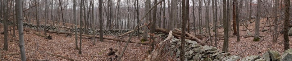
3:41 p.m.: I returned to my car, having hiked about 11.5 miles in 5-3/4 hours. The 2 mile per hour pace was a fast pace, helped in great part by the fact that most of the hiking was on level ground, and also that 2 miles was walking along Wawayanda Road.
Posted in Hikes | Tagged , , | Leave a comment

Manitoga, Putnam County, New York

My goal this week was to hike along the Appalachian Trail near the Bear Mountain Bridge. I decided to park at Manitoga and hike through their trails to reach the AT. Manitoga was the estate of the industrial designer Russel Wright. It has 4 miles of trails.

My car was the only one in the parking lot. It appears that house and landscape tours are only offered May through October, though as far as I know, the property remains open throughout the year for hiking. The parking lot was not marked, and I didn’t even know whether to park north-south or east-west. I guess when you’re the first car in an unmarked lot, you can set the rules.

I didn’t think that it was all that obvious to find the start of the trails, but I finally walked across a muddy field (“Mary’s Meadow”) and found the trailhead, which led uphill on a series of stones placed as steps. As with every set of trails I can think of, the trails are blazed for travel in both directions (i.e., typically a tree will have a blaze on one side for those hiking in one direction, and a blaze on the opposite side for those hiking in the opposite direction). However, a note indicated that the trails were aesthetically placed and designed for travel in the clockwise direction. If one wanted to go counterclockwise, he would find the blazes had a black circle in the center of them, to show that he’s going in the wrong/non-preferable direction. [I think that even if the trail designer intends a trail to be traveled in only one direction, for safety the trail needs to be blazed in both directions, in case one needs to backtrack if a trail is blocked, if someone is sick or injured, if there’s not enough time left to complete the hike as the designer intended, etc. In addition, many times I have passed one blaze without immediately seeing the next blaze and without being certain of the direction of the trail, and I have looked back to see the blazes on the trees that I have already passed, which help me to line up the direction in which I should continue to travel.]

Manitoga, Westchester County, NY

Trailhead

The land was pretty, with a stream flowing through it.

Manitoga, Westchester County, NY

Stream

Unfortunately, I soon discovered that there were many downed trees, limbs and branches, which made hiking very difficult.

Manitoga, Westchester County, NY

Fallen tree

In some places, trees had fallen a while ago and the path had been cleared by chainsaw.

Path cleared by chainsaw, Manitoga, Westchester County, NY

Path cleared by chainsaw

However, in other places, there were trees that had just fallen down in the snowstorm of eight days earlier, and they had not been cleared. There were also downed trees that had been dead quite a while, and in those cases it’s hard to tell when they fell. It could be that these trails were never cleared after Hurricane Irene came through in August.

Fallen tree at Manitoga, Westchester County, NY

Fallen tree

Here a large tree has fallen, only to be caught by a much smaller tree. It should probably be taken down, for safety.

Fallen tree at Manitoga, Westchester County, NY

Fallen tree

Branches block the trail.

Trail blocked by branches, Manitoga, Westchester County, NY

Trail blocked by branches

More branches and limbs:

Fallen branches at Manitoga, Westchester County, NY

Fallen branches


Tree limbs block path at Manitoga, Westchester County, NY

Tree limbs block path

In addition to the trails being blocked by fallen trees, it was hard to find the trails at times because of the heavy leaf cover. Also, some of the blazes were on trees that had fallen, which also made it harder to follow the path.

Fallen trees at Manitoga, Westchester County, NY

Fallen trees

Storm-wrecked tree at Manitoga, Westchester County, NY

Storm-wrecked tree

After about 1-1/2 hours, I gave up, as it wasn’t fun constantly detouring or climbing over downed trees. I never made it to the Appalachian Trail that day, so I don’t know what shape it was in.

Manitoga looks like a nice place to revisit someday, but it’ll be a big effort to clear its trails.

Posted in Hikes | Tagged , | Leave a comment

Connetquot River State Park Preserve, Suffolk County, NY

A freak snowstorm left snow covering most of the upstate parks, and I suspected that the scheduled hikes were all canceled. However, New York City itself had very little snow and Long Island was clear, so I decided to go on my own to this park in central Long Island.

I had not been able to learn much about it before visiting, other than it had at one time been a hunting and fishing club for wealthy people. Also, the Connetquot River is six miles long, and there were said to be trails on both sides of the river. I envisioned a scenic hike within frequent sight of the river. Unfortunately, the reality was quite different. I saw a pond, and also a canal, but I don’t recall seeing a river. If the trails ran on both sides of the river, they ran far enough away from it that one couldn’t see or hear the river.

Near the entrance is a large building. Originally Snedecor’s Tavern, it was established around 1820. Between 1866 and 1973, it served as the clubhouse of the South Side Sportsmen’s Club of Long Island.

Clubhouse, Connetquot River State Park, NY

Clubhouse

This is the main pond, with swans.

Main pond, Connetquot River State Park, NY

Main pond

I initially missed the trail markers, and began walking along West Club Road, a paved road that runs north.

West Club Road, Connetquot River State Park, NY

West Club Road

Rainbow Bridge crosses a manmade canal that was dug with hand tools about 100 years ago. It was designed to provide cool waters for the trout.

Rainbow Bridge, Connetquot River State Park, NY

Rainbow Bridge, over hand-dug canal


Canal, Connetquot River State Park, NY

Canal

Here’s a dragonfly resting on the ground. I don’t have a macro lens for my camera, and usually all my attempts at a macro shot end in failure. This is a very rare exception!

Dragonfly

Dragonfly

There were a lot of deer present. I first saw a doe in a field, and left the road to try to get a better shot of her. A groundsmen drove by and mentioned that there were usually some buck present in the area. Continuing on the road, I soon found this buck, and then I saw many other deer. In fact, whereas at the big parks it is rare for me to see deer, here they were as common as squirrels in some other parks.

Deer, Connetquot River State Park, NY

Deer

The road intersected the green trail, and I thought that I was continuing to the north. However, I found myself back at the buildings near the entrance, and realized that I must have turned the wrong way when I reached the green trail. Having only walked about 2.5 miles at that point, I now found the blue trail, an 8.4 mile loop, and decided to follow that. These trails were all on dirt roads. There were a few other hikers, but I saw more equestrians. The riders were all women, with the exception of one man riding alone.

Blue Trail, Connetquot River State Park, NY

Blue trail

Another deer:

Deer, Connetquot River State Park, NY

Deer

There were still a few Fall colors, but most are gone now:

Fall colors, Connetquot River State Park, NY

Fall colors

The ground was generally sandy, and in a few cases really looked like beach sand:

Sandy Terrain, Connetquot River State Park, NY

Sandy trail

Around the halfway point on the blue trail, I figured out how to take a shortcut and cut 1.2 miles from the loop. I did so. It really was monotonous. I’m used to hiking in parks that have scenic views, that have bare rock in places, or glacier boulders. Here it was just dirt roads, trees, and deer.

Connetquot River, NY

Connetquot River

So I hiked about 10.7 miles at the park, over the course of four hours, or a little more. While I was not impressed with the park, I was happy to get the exercise, and to mark the fourth Sunday in a row that I went hiking.

Posted in Hikes | Tagged , | Leave a comment

Minnewaska State Park Preserve, Ulster County, New York

I joined the Jewish Outdoors Club for this trip to Ulster County, about 80 miles northwest of New York City. I drove through Manhattan picking up three other hikers on the way. We were told to arrive at the park at 10:00 a.m., and that we would begin hiking promptly at 10:30 a.m. We arrived right at 10:00 a.m., though the group ended up waiting on stragglers (as always happens, despite the threats to the contrary), and we didn’t begin hiking until around 10:40 a.m.

10:47 a.m.: We began hiking south (counterclockwise) on the red trail (Lake Minnewaska Carriageway), traveling along the west side of Lake Minnewaska. The fall colors continue to impress.

Fall Colors, Lake Minnewaska, Minnewaska State Park Preserve

Fall colors along Lake Minnewaska

I haven’t mastered picking an exposure when there is a sharp contrast between the sky and the foreground. Either the foreground is well-exposed but the sky is overexposed and washed out, or else (as here), the sky is well-exposed but the foreground is too dark. Maybe someday I’ll learn how to take multiple exposures and blend them together with HDR software.

Lake Minnewaska, Minnewaska State Park Preserve

Lake Minnewaska

Lake Minnewaska, Minnewaska State Park Preserve

Lake Minnewaska

11:07 a.m.: After 0.8 miles, we approached the south of the lake and arrived at the yellow trail, which we followed to the west. After another 0.2 miles, the trail diverged into two yellow trails (confusing!), the Hamilton Point Carriageway and the Milbrook Mountain Carriageway. These two trails are divided by the Palmaghatt Ravine. We followed the Millbrook Mountain Carriageway to the southwest, to the south of the ravine. We began to see a lot of bare rock and continuous scenic views of the ravine.

11:23 a.m.: After another 0.6 miles, we stopped briefly at Patterson’s Pellet for a photo opportunity.

11:35 a.m.: The trails so far had all been “carriageways,” which are very easy trails with shale surfaces, with gentle grades. Many of these are used for skiing in the winter. I took this photo only a couple of minutes before we left the carriageway for a red-blazed footpath (the Gertrude’s Nose Trail) that would take us to Gertrude’s Nose.

View from Millbrook Mountain Carriageway, Minnewaska State Park Preserve

View from Millbrook Mountain Carriageway

11:42 a.m.: About 0.4 miles after Patterson’s Pellet, we diverted from the yellow trail (which turned southeast, away from the ravine) to follow the red trail, which continued toward the southwest, parallel to the ravine.

View from Gertrude's Nose Trail, Minnewaska State Park Preserve, NY

View from Gertrude’s Nose Trail

View from Gertrude's Nose Trail, Minnewaska State Park Preserve, NY

View from Gertrude’s Nose Trail

View from Gertrude's Nose Trail, Minnewaska State Park Preserve, NY

View from Gertrude’s Nose Trail

View from Gertrude's Nose Trail, Minnewaska State Park Preserve, NY

View from Gertrude’s Nose Trail

11:51 a.m.: This is most of the group, except for myself and four others who were standing next to me and also taking photos.

JOC Group Photo, Minnewaska State Park Preserve, NY

JOC Group Photo

11:59 a.m.: A number of people mentioned that they preferred the footpath to the easier shale carriageways, as it provided more of a workout.

Footpath, Minnewaska State Park Preserve, NY

Footpath

View from Gertrude's Nose Trail, Minnewaska State Park Preserve, NY

View from Gertrude’s Nose Trail

View from Gertrude's Nose Trail, Minnewaska State Park Preserve, NY

View from Gertrude’s Nose Trail


12:14 p.m.
:

Fall Foliage on Gertrude's Nose Trail, Minnewaska State Park Preserve, NY

Fall Foliage on Gertrude’s Nose Trail

12:19 p.m.:

Scenic view from Gertrude's Nose Trail, Minnewaska State Park Preserve, NY

Scenic view

12:25 p.m.:

Scenic view from Gertrude's Nose Trail, Minnewaska State Park Preserve, NY

Scenic view

12:27 p.m.: Walking along a wide path and keeping a safe distance from the sheer cliff face.

Sheer Cliff, Gertrude's Nose Trail, Minnewaska State Park Preserve, NY

Sheer cliff

12:38 p.m.:

Gertrude's Nose Trail, Minnewaska State Park Preserve, NY

Gertrude’s Nose Trail


Gertrude's Nose Trail, Minnewaska State Park Preserve, NY

Gertrude’s Nose Trail


Scenic view from Gertrude's Nose Trail, Minnewaska State Park Preserve, NY

Scenic view

1:08 p.m.: After 1.0 mile on the red trail, we reached Gertrude’s Nose, the southernmost point on the trail, at which point we turned to the northeast, away from the ravine. I don’t know if I realized when we reached Gertrude’s Nose, as there were so many scenic views that it was hard to correlate them to the map, which only showed a few. So if you know what Gertrude’s Nose looks like and don’t see the photo here, it could be that I didn’t photograph it, or it could be that I photographed it but didn’t select it as among the most pleasing photos to include in this hike description.

Scenic View from Gertrude's Nose Trail, Minnewaska State Park Preserve, NY

Scenic view

1:46 p.m.: Even though we no longer had a view of the Palmaghatt Ravine, we still had nice views of the surrounding countryside, including farmland.

Scenic View from Gertrude's Nose Trail, Minnewaska State Park Preserve, NY

Scenic view

2:00 p.m.:

Farmland below Gertrude's Nose Trail, Minnewaska State Park Preserve, NY

Scenic view of farms


Farmland below Gertrude's Nose Trail, Minnewaska State Park Preserve, NY

Farmland

2:05 p.m.:

Scenic view below Gertrude's Nose Trail, Minnewaska State Park Preserve, NY

Scenic view

2:45 p.m.: After Gertrude’s Nose, we continued along the red trail for 1.6 miles, where it rejoined the yellow trail (Millbrook Mountain Carriageway). We almost immediately turned north onto another red-blazed trail, the Millbrook Mountain Trail. The first 0.5 miles of this trail ran through the Mohonk Preserve, and this included a trail that had standing water in some places, with many slippery leaves. I slipped on leaves and fell once, as did several others. We finally crossed the Coxing Krill, seen below, at which point we re-entered the Minnewaska State Park Preserve:

Coxing Krill, Minnewaska State Park Preserve, NY

Coxing Krill

3:13 p.m.: After another 0.7 miles, we returned to Lake Minnewaska, leaving the red-blazed Millbrook Mountain Trail for the red-blazed Lake Minnewaska Carriageway. (You’d think they could find more colors.) This time we traveled north while skirting the eastern bank of the lake.

Lake Minnewaska, NY

Lake Minnewaska

3:43 p.m.: After 0.5 miles, we stopped for a while at rock ledges that offered a nice view of the lake.

Lake Minnewaska, NY

Lake Minnewaska


Posing by Lake Minnewaska

I pose in front of Lake Minnewaska

I think this was advertised as an 8-mile hike, but I estimate it was only about a 6.5-mile hike. In any case, it was fun.

Posted in Hikes | Tagged , | Leave a comment

(Return to) Norvin Green State Forest, Passaic County, NJ

I arrived at Norvin Green State Forest for the second week in a row. This time, I joined about 20 people with the Jewish Outdoors Club.

We followed the green trail southwest from the Weis Ecology Center for 0.4 miles, then continued on the blue trail for about 0.2 miles, which I had seen the week before.

We then followed some trails I hadn’t seen before. We turned east onto the yellow trail and followed that for 0.4 miles, at which point it turned southeast for another 0.3 miles. We then followed the red trail west for about 0.1 miles, and then took the white trail south for 1.4 miles.

This took us to Posts Brooks and back to trails I had seen the week before. We continued on the white trail as far as Chikahoki Falls, then backtracked and continued north on the yellow trail for 0.8 miles, then the blue trail 0.8 miles to Wyanokie High Point, and then continued on the blue trail 0.6 miles, and the green trail 0.4 miles back to the Weis Ecology Center. With the unplanned (but welcomed) detour to the Chikahoki Falls, this was close to a 6 mile hike. The temperature was in the 60s, and the hiking was much more comfortable than the week before.

As I had documented most of this area the week before, I am only presenting a few photos here.

Colorful Fall foliage:

Fall foliage, Norvin Green State Forest, NJ

Fall foliage

I like the geometric patterns sometimes formed by rocks, fallen trees, etc.

Boulders and Fallen Trees, Norvin Green State Forest, NJ

Boulders and fallen trees

More Fall foliage:

Fall foliage, Norvin Green State Forest, NJ

Fall foliage

Following the trail:

Footpath in Norvin Green State Forest, NJ

Footpath

A scenic view:

Scenic view, Norvin Green State Forest, NJ

Scenic view

One of the hikers did some yoga poses for us:

Yoga pose, Norvin Green State Forest, NJ

Yoga pose

A nice view of the Wanaque Reservoir:

Wanaque Reservoir, seen from Norvin Green State Forest, NJ

Wanaque Reservoir

Another scenic view:

Scenic view, Norvin Green State Forest, NJ

Scenic view

Another view of the reservoir.

Wanaque Reservoir, seen from Norvin Green State Forest, NJ

Wanaque Reservoir

Posted in Hikes | Tagged , , | Leave a comment