2:28 p.m.: I got off to a very late start this day, but finally got in a good hike. I had read of a scramble on the Appalachian Trail (AT) that I decided to investigate. I drove to Harriman State Park and parked in the Elk Pen off Arden Valley Road. I started west on the AT as it followed the road for 0.2 miles, crossing over the New York State Thruway (I-87), the Ramapo River and the Metro-North railroad tracks, with all views toward the south.
Here’s I-87:

Arden Valley Road crossing I-87
In this area, the Ramapo River was all but hidden, invisible to the drivers on I-87 or passengers on the train. Crossing a bridge spanning it was one of the few ways to see it.

Ramapo River
The Metro-North line:

Arden Valley Road crossing Metro-North Line
The Arden Valley Road then immediately dead-ended at Route 17. It seems to be at a blind curve in the road, so one has to stop, look and listen before dashing safely across the road. A break in the foliage on the west side of Route 17 shows where the AT resumes.
2:35 p.m.: The transition from an open road to a dark forest was nice.

Appalachian Trail
The trail quickly began climbing, starting at around 500′ elevation.

Appalachian Trail
A stitched panorama that came out nicely:

Appalachian Trail
Still climbing. The steepest part is called Agony Grind. Looking at my NY-NJ Trail Conference map, it appears as though Harriman continues a bit on the west side of I-87, and then as the AT enters Agony Grind, the map shows that the land belongs to the Appalachian National Scenic Trail. The National Trails System Act of 1968 protected the AT and, while in some cases the National Park Service acquired land, in other cases the land is owned by the states, local government, land trusts and private landowners. So if a map shows that the a particular part of the AT is running through land labeled “Appalachian National Scenic Trail,” does that mean that the NPS owns the land? That’s my guess, but I’m unsure.

Agony Grind

Agony Grind

Agony Grind
2:47 p.m.: It didn’t take long to gain a little altitude.

View from Agony Grind
Here’s a nice scramble:

Scramble
Looking down the same scramble:

Scramble
Around this time I encountered an older man heading east, who asked me how far it was to the road, so I told him that it was about a half mile away. He seemed pretty tired and said that he thought he had just finished Agony Grind. I told him that I believed I had just finished it, and that it would be downhill for him. As I continued on toward the west, I didn’t find the trail overly steep, so I wonder what part he had found to be so strenuous. I passed another older man right after that, also heading east, who said that I looked familiar and he asked if I had met him before. I said that anything was possible, as I enjoy hiking on Sundays.
2:59 p.m.: Another overlook.

Scenic view
3:14 p.m.: Flowers.

Flowers
The outdoors sure looks greener than it did a month or so ago.

Green outdoors
3:19 p.m.: When I’d met the first man, who asked me the distance to the road, I asked him if he had seen a turnoff to the blue trail, and he said that he hadn’t seen it. I don’t know how he could have missed it, since there’s a big cairn in the middle of the trail, with three blazes signifying the beginning of Harriman’s Sapphire trail.

AT meets Sapphire Trail
I continued on the AT, though.

Bare rock on AT
3:27 p.m.: After an hour, I had hiked a mile on the AT, including the stretch that ran along Arden Valley Road. Covering a mile in an hour is slow progress on a hike, but maybe not when there is a lot of scrambling involved. On the right side of this stitched panorama, the AT continues to the west. A wooden box contains a log book. I glanced through it. Most people seem to write nicknames, or at most a first name. There were a handful of entries for the most recent days. I flipped back to the winter, and found that then there were only one or two names per month. To the left side of the panorama is the beginning of the blue-blazed trail into Sterling Forest. I turned left (southwest) onto that trail.

Intersection of AT with Sterling Forest’s blue trail
3:44 p.m.: I needed two maps this afternoon. For the beginning and end of the hike, I needed the Northern Harriman Bear Mountain Trails map (No. 119) and for the middle part, I needed the Sterling Forest Trails map (No. 100). Sterling Forest State Park, established in 1998, has almost 22,000 acres, including a number of stone walls. The blue-blazed trail was short, only about ½ mile, and it descended from around 1,160′ to 800′ elevation, so only 17 minutes passed before I reached the end of it, where it dead-ended in the yellow-blazed loop. I followed the yellow-blazed Indian Hill trail to the left, i.e., moving clockwise on the trail.

Indian Hill Trail
3:50 p.m.: At least one giant tree (a white oak?) has survived in the forest.

Large tree
3:53 p.m.: For about 0.1 mile, the trail ran along a woods road, which was constructed between two very wide stone walls.

Trail between stone walls

Stone walls
4:03 p.m.: At first, it appeared that this tree had fallen and had hung-up on another tree. But then I realized that it wasn’t a dead, fallen tree, but rather was a live tree. So, what’s the story?

Sideways tree
Here’s the base of the tree. Did it fall over in a storm but refuse to die?

Sideways tree
4:09 p.m.: I reached an overlook on the trail.

Overlook from Indian Hill Trail
4:20 p.m.: More stone walls. There were many farms in this area, long ago.

Stone walls

Stone walls
4:27 p.m.: Another overlook, toward the east (Harriman). I rested here for a while, and a young woman hiked past me, continuing on the yellow-blazed trail in the same direction I was going.

View of Harriman

View of Harriman
I continued on, and found that there was an even better overlook, but the aforementioned young woman had stopped to eat a snack there, and I didn’t want to stop to take photos there, out of fear it might make her nervous to be alone in the woods and have a strange guy stop near her.
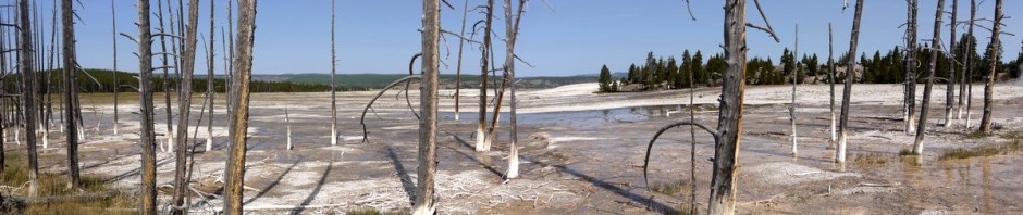
4:39 p.m.: This stitched panorama of 28 shots came out very well. Every “step” in front of me is about 5′ down. I’m glad that the trail didn’t go in that direction, as it would have been quite a scramble.

Bare rock
4:43 p.m.: I cross a brook that the map shows is unnamed, running from a tiny unnamed lake.

Unnamed brook
4:44 p.m.: The woman apparently finished her snack, caught up to me and passed me just as I came to an intersection with the red-blazed Furnace Loop. She continued to the right, while I turned left onto the southern portion of the Furnace Loop, having covered 1.5 miles on the yellow trail.

Furnace Loop
4:59 p.m.: After about 0.5 miles, descending from 900′ to 700′ elevation, the aptly-named Furnace Loop led me to the Southfields Iron Furnace (N 41.25381 W 74.18214), located next to a decent-sized river (that isn’t named on my map) and County Road 19 (“Orange Turnpike”). The Southfields Iron Furnace was built in 1805 and rebuilt in 1836. When was it abandoned? Maybe one could find answers in: Ransom, James M., Vanishing Ironworks of the Ramapos, if only I had a copy of it. According to the January 2000 issue of “The Sterling Messenger,” which had been the newsletter of the Sterling Forest Partnership, Inc., the furnace was stabilized by Scenic Hudson, with the intent of making the site accessible to the public. The property is surrounded by a chain-link fence, but I could see that the furnace has been reinforced with steel beams and some sort of roof. Scenic Hudson was probably involved before the Sterling Forest was established as a state park in 1998, or before these lands were added to it. If the state is now responsible for funding, probably nothing will ever be done.

Southfields Iron Furnace
Here’s the adjacent river, which is not named on my map.

River

River
The only bad thing about this hike is that there’s no good way to make a loop out of it, so I had to walk along the Orange Turnpike for about 0.6 miles. There needs to be an extra trail or two through Sterling Forest/Harriman State Parks, to avoid this necessity. The Orange Turnpike then dead-ended at Route 17, and I walked north on that about 200′, crossed to the east side, walked east all two blocks of Railroad Avenue (in the hamlet of Southfields), and then after I did my stop/look/listen hurried across the tracks of the Metro-North line.
5:22 p.m.: I continued walking north alongside the tracks for about 200′, until I found my objective, white blazes indicating a trail to the east.

Trail marker to east of Metro-North Line
Here is the Nurian trail of Harriman State Park, just to the east of the tracks.

Nurian Trail
5:25 p.m.: My map shows a “Southfields Pedestrian Bridge” across I-87, but doesn’t address how the Nurian trail crosses the Ramapo River. Well, it also had a pedestrian bridge. Cute, isn’t it? There is very old, faded paint on the right side of the steel. I think it might have said “BRIDGE,” which seems rather silly.

Pedestrian bridge across Ramapo River
South and north views of the river, from mid-stream.

Ramapo River

Ramapo River
5:28 p.m.: A stitched panorama of the “Southfields Pedestrian Bridge.” I wonder who commissioned this? Is it to serve the residents of Southfields? Or to serve the bus stop at the intersection of routes 17 and 19, where the Short Line sometimes drops off hikers from New York City? In any case, I was happy to cross it.

Southfields Pedestrian Bridge over I-87
5:38 p.m.: On the east side of I-87, the trail turned north for 0.2 miles, following the unmaintained Arden Road. The trail then turned east, climbing Green Pond Mountain. I continued on the unblazed Arden Road for about 100′, as the map showed “Road Monument 1894.” Well, here it is: “This road was built in 1894 by E.H. Harriman to show the advantages of level roads in hilly countries.” Well, duh! I think I literally said that. What’s stupider, a bridge that is labeled “BRIDGE,” or building a road to show the advantages of level roads in hilly countries? Was that the first level road built in a hilly country in the history of humanity? I would have thought that the Romans or Mayans would have done something like that.

Road monument, 1894
I knew that I still had plenty of sunlight left, but I was feeling a little tired, so I considered continuing along the level Arden Road for 0.85 miles, rather than following the Nurian trail up the hilly country, which would add about 0.6 miles and some elevation to the hike. I would not normally follow an unblazed and unmaintained trail, but as the map showed Arden Road continuing to run just to the east of I-87, I wasn’t worried about getting lost. However, after walking about another 100′ to the north, I saw that the “road” was blocked by tall vegetation. I had no choice but to backtrack 200′ and follow the Nurian trail uphill, climbing from about 500′ elevation to 800′ elevation.

Nurian Trail
The white-blazed Nurian trail finally hit level ground, turning northeast, then running along a woods road.
6:11 p.m.: After following the Nurian trail from Arden Road for a mile, it turned toward the east, but I instead continued toward the north, on the red-blazed Stahahe Brook trail.
6:19 p.m.: The Stahahe Brook trail crossed the Stahahe Brook. At one point, I spotted a deer grazing in the middle of the trail, but she moved off before I could get very close.

Stahahe Brook
The trail ended after 0.8 miles, and continued heading northeast as the Arden-Surebridge trail.
6:29 p.m.: The trail ran alongside a fence to the left. Both sides of the fence are in Harriman, so why is there a fence there? Is it a remnant from when it was private land? Harriman has been state land since 1910 and I doubt the fence has been there a century. Maybe parts of Harriman were added later? Anyway, the fence bothered me, because I spotted a tiny fawn on the other side, and when I tried to take a photo of her, my camera focused on the nearby wire instead of on the fawn. I tried switching into manual focus and couldn’t get the mode to work.

Fawn behind wire fence
I found a better spot where I could photograph through the wire, but the fawn had moved off a bit by then. In the past, I have only seen such tiny fawns in close proximity to their mothers. I didn’t see her.

Fawn
After 0.4 miles, the trail returned me to the Elk Pen, where I had parked. So I estimate that this was a 7 mile hike, with a good scramble, and it took me a little over 4 hours.