I had intended to park along Route 17A and hike the Highlands Trail, but there were no other cars in that area, and there was a sign that read something like, “Seasonal hunting and parking by permit only.” I really have difficulty parsing such signs, and didn’t know if that meant that a hiker wanting to park there would need a permit, or if a permit was only required by a hunter.
I then intended to drive to a location where Route 5 had a parking area near the Appalachian Trail, but I guess I drove by Route 5 and it wasn’t marked. I then was looking for another road crossing the Appalachian Trail, and apparently the road has been renamed. So I was having all sorts of problems. I turned around and drove east of Route 17A, missing the turnoff to the visitor center for Sterling Forest, and ended up crossing Route 17 and entering Harriman.
1:19 p.m.: I found a sign for river access to the Ramapo River, which I had crossed over the week before in my Harriman/Sterling hike. I entered there and found a nice parking area with several areas for launching kayaks or canoes (or maybe larger boats). There were no vehicles there and I didn’t see any craft on the water.

Ramapo River

Ramapo River
I then returned to Route 17A, drove west again, this time finding the turnoff to the Visitor Center, State Route 84. After three miles on that route, I turned onto Old Forge Road and finally found the Visitor Center. I asked the man at the desk about the “seasonal hunting and parking by permit only” sign, and he said that the signs did not apply to hikers and that I could have parked at that area. By this time, I decided it was too late to return there, so I instead began my hike on trails that started from the Visitor Center. Oh, parking at the Visitor Center was limited to 20 minutes, but the Rutgers Highlands Environmental Research Institute across the road had a large parking lot that was marked as offering visitor parking. There were about 20 or 30 vehicles there, and I found a spot and parked.
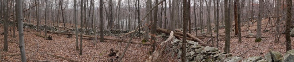
1:45 p.m.: I began hiking on the blue-blazed Lake trail, then after 0.4 miles switched to the yellow-blazed Lakeville-Ironworks Trail, a 0.5 mile trail that presented some of the history of the iron mining and forging that had been conducted in the area for two centuries.

Daughters of American Revolution Plaque
2:02 p.m.: It looked like there was a mine shaft under this ledge, with a metal gate added to bar access.

Mine shaft
I believe this is a Eastern Ribbon Snake:

Eastern Ribbon Snake
A few surviving structures remain from the iron works. A sign indicated that these dated from the 1920s.

Ironworks structures
The yellow trail then ended back at the blue trail, which I followed for another 0.25 miles. I then followed the red-blazed Fire Tower Connector trail due south, and uphill. This was an old woods road, and in fact I met a State truck driving down it as I was hiking up. After 0.5 miles, the Fire Tower Connector trail ended at the Fire Tower trail, which continued either straight ahead or to the left. I somehow turned left when I should have continued straight. I think the problem was that I saw a sign that said “Fire Tower,” and I thought that meant the Fire Tower was in the indicated direction. Instead, the sign just meant that it was the Fire Tower trail.
2:45 p.m.: I came to a paved (but abandoned) road and kept going. I found a stand of dead trees in one spot:

Fire Tower Trail
After 0.8 miles, I began hearing road traffic, which didn’t make sense, because I shouldn’t have been anywhere near a road. That’s when I realized that I had foolishly turned in the wrong direction, and had hiked almost all the way to the end of the Fire Tower trail, which dead-ends at a parking lot near Route 84. I stopped for a late lunch and then backtracked. After another 0.8 miles, I returned to the intersection of the Fire Tower trail and Fire Tower Connector trail, I turned in the correct direction.
3:49 p.m.: After another 0.8 miles, I finally arrived at the fire tower, probably an hour later than I should have been there.

Fire tower
Looking up at the fire tower:

Fire tower

View from fire tower

View from fire tower
Another view of the fire tower:

Fire tower
I then continued on the Fire Tower trail, which also at this point joined the blue-blazed Sterling Ridge Trail and the teal-blazed Highlands Trail. This part of the trail was a footpath, which was fine with me, because I really don’t like walking on woods roads.
4:11 p.m.: I encountered an interesting tree growing out of the rocks.

Highlands Trail
4:28 p.m.: I reached an overlook that is noted on my map. After about 0.6 miles, the trails diverged, with the blue-blazed and Highlands Trail continuing to the southwest, while I continued on the red-blazed Fire Tower trail, which now turned northwest. The trail again became a woods road.

Fire Tower Trail
4:53 p.m.: After about 0.5 miles, the Fire Tower trail reached Jennings Creek, with a “seasonably flooded” area.

Jennings Creek
I continued another 0.15 miles, until the Fire Tower trail reached an intersection with the orange-blazed Bare Rock trail, which I followed toward the northwest.
5:25 p.m.: This overlook from the Orange trail includes a view of the fire tower:

Scenic view from orange trail
I zoomed in for a better view of the tower, and also cropped the photo to gain an even closer view:

Fire tower as seen from orange trail
5:47 p.m.: After 1.2 miles on the orange trail, I reached Bare Rock, an overview of Greenwood Lake to the west. I could see (and hear) motor boats racing around on the lake.

Greenwood Lake
I continued on the orange trail, this time heading east back toward my car.
6:15 p.m.: I encountered a few shrubs of Mountain Laurel. This was the nicest:

Mountain Laurel

Mountain Laurel

Mountain Laurel
6:46 p.m.: After about 1.9 miles, the trail led me back to the blue trail around Sterling Lake, which had barely a ripple:

Sterling Lake

Sterling Lake
After another 0.75 miles, I arrived back at my car at 7:00 p.m., having completed a hike of about 9.15 miles. When I had parked it, the parking lot was almost full. When I returned, my car was the last one left.
I really wouldn’t recommend this hike. Part of the hike ran along footpaths, which I enjoy, but probably 80% of the hike was on trails that ran along wood roads, including zones with large rocks that were difficult to walk over.