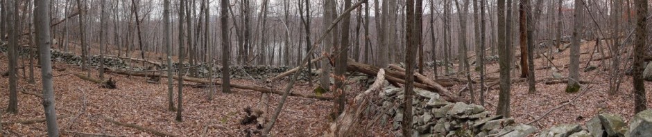
(Return to) Black Rock Forest, Orange County, New York

On October 3, YBS and I paid our first visit to Black Rock Forest, hiking through the eastern part of the preserve. We returned two weeks later, with our friend Bombastic, and checked out the western part of the preserve.

We first stopped a few miles south of the forest, at a lookout point on Highway 9W that afforded a beautiful view of the Hudson. (The asterisks below each photo indicate the camera/photographer, with the guide appearing at the end of the post.)

Hudson River from Highway 9W Overlook, Orange County, NY

Hudson River *

Continuing on, we drove past Mountain Road, where we had turned off last time, and continued on to Angola Road. We turned off there and drove west, then south on Mine Hill Road, which was extremely steep. I can’t imagine how the people who live on that road get to and from their homes when there is snow on the ground. We found a three-car parking area that luckily only had one car in it, and found the trailhead across the street:

Trailhead on Mine Hill Road, Black Rock Forest, Orange County, New York

Trailhead on Mine Hill Road *

The Mine Hill trail is marked with diamond-shaped yellow blazes, and is steep at first.

 Mine Hill Trail, Black Rock Forest, Orange County, New York

Mine Hill Trail *

After gaining some elevation, we had a peak through the trees at the surrounding area:

Scenic View from Mine Hill Trail, Black Rock Forest, Orange County, New York

Scenic View from Mine Hill Trail *

The Mine Hill trail ended after 0.2 miles, and we turned right (southwest) onto Sackett trail, blazed with a yellow circle. (I don’t know why they didn’t switch colors instead of or in addition to shape.) We had another nice view from this trail:

Scenic View from Sackett Trail, Black Rock Forest, Orange County, New York

Scenic View from Sackett Trail *

After 0.4 miles, the Sackett trail dead-ended at the Stillman trail, again blazed yellow, this time in a square shape. We turned right, continuing to the south. The leaves were changing color:

Tree canopy in Fall colors

Tree canopy in Fall colors *

We found a downed tree and each had to try climbing it.

Climbing a fallen tree

Climbing a fallen tree **

After 0.7 miles, the Stillman trail dead-ended at a nice overlook:

Scenic View from Stillman Trail, Black Rock Forest, Orange County, New York

Scenic View from Stillman Trail *

We backtracked 0.4 miles to an intersection with the Short Cut trail, blazed with a yellow triangle, and turned right (east) on that. After 0.2 miles, the trail reached Hall Road, and we turned right (south) onto that. After about 0.15 miles, we reached a gate, and continued past it onto the blue-blazed Compartment trail (which was also teal-blazed, as part of the Highlands trail). We found an sign from almost 40 years earlier, when the forest had still been owned by Harvard University:

Ancient sign on Highline Trail, Black Rock Forest, Orange County, New York

Ancient sign on Highline Trail *

Continuing about 0.2 miles from the gate, we encountered a stream. This ran off Sutherland Pond, which is the only (or one of the only) bodies of water in the forest open for swimming. I believe that most of the bodies of water are manmade and used for reservoirs, but that Sutherland Pond is natural. Downhill, the stream runs into Mineral Spring Brook.

Stream to Mineral Spring Brook, Black Rock Forest, Orange County, New York

Stream to Mineral Spring Brook *

Right after the spring, the blue-blazed trail ended at the white-blazed Scenic trail that made a very sharp turn at this point, so that we had a choice of either going south or southwest on the trail. The teal-blazed Highlands trail continued on the portion of the Scenic trail that led to the southwest. I actually missed this turnoff and continued northwest on what was probably a ditch formed by runoff (or perhaps it was an unmaintained trail). This was blocked by a couple of fallen logs, which should have been a clue to me that it wasn’t a trail, or at least not an active trail. Trying to show off for YBS and Bombastic, I thought I would hop over one log and then the other. Instead, I tripped over the first one and fell, partially breaking my fall with my arms but still hitting my chin on the second log. I felt stupid and was glad that they didn’t capture that on film. I had about 1/4” cut on my chin and an abrasion about the size of a dime. Luckily I had a couple of cotton handkerchiefs with me, which helped to stop the bleeding. We continued on in this unmaintained trail for about 0.2 miles, ducking another obstacle, with me even commenting that it wasn’t maintained well, until I realized that I hadn’t seen blazes in a while. I then led the group back past the obstacles and killer logs, and found the white and teal blazes of the real trail. I reminded YBS and Bombastic not to just blindly follow me, but to keep looking for blazes themselves.

After 0.6 miles, we came to a nice flat rock and broke for lunch, around 2:15. We continued on, and very soon reached Jupiter’s Boulder. YBS and I climbed it, and Bomby took our photo:

Posing on Jupiter's Boulder, Black Rock Forest, Orange County, New York

Posing on Jupiter’s Boulder ****

Here’s a self-portrait that I took of YBS and myself:

Self-Portrait on Jupiter's Boulder, Black Rock Forest, Orange County, New York

Self-Portrait on Jupiter’s Boulder *

We encouraged Bomby to climb the boulder, but she declined. It afforded a nice view of the surroundings, which I used to make this nice panorama:

View from Jupiter's Boulder, Black Rock Forest, Orange County, New York

View from Jupiter’s Boulder *

After another 0.8 miles on the Scenic trail (and Highlands trail), we reached Mineral Spring Brook. It was pleasant hiking along the brook, as the sound of water is very relaxing.

Mineral Spring Brook, Black Rock Forest, Orange County, New York

Mineral Spring Brook ***

Mineral Spring Brook, Black Rock Forest, Orange County, New York

Mineral Spring Brook *

The map shows the trail crossing the brook once, but we actually crossed it three times. The first crossing to the west was a very easy crossing at a narrow point. The second and third crossings were at wider points that required some balancing, and those second and third crossings were very close together, so I would say that they were selected “for fun” rather than for any necessity. Here I demonstrate to YBS how to balance on a log:

Posing at Mineral Spring Brook, Black Rock Forest, Orange County, New York

Posing at Mineral Spring Brook ***

The brook continues:

Mineral Spring Brook, Black Rock Forest, Orange County, New York

Mineral Spring Brook ***

After another 0.2 miles we reached a ridge with a change in elevation. The brook has a nice waterfall here. Before we got there, we played on the wall for a few minutes.

Rock wall on Highlands Trail, Black Rock Forest, Orange County, New York

Rock wall on Highlands Trail ***

Rock wall on Highlands Trail, Black Rock Forest, Orange County, New York

Rock wall on Highlands Trail ***

Here’s the waterfall. I didn’t get a very good wide-angle view of it, but here’s a stitched panorama and a few more shots:

Mineral Spring Falls, Black Rock Forest, Orange County, New York

Mineral Spring Falls *

Mineral Spring Falls, Black Rock Forest, Orange County, New York

Mineral Spring Falls *

Posing at Black Rock Forest, Orange County, New York

Posing at Black Rock Forest ***

Mineral Spring Falls, Black Rock Forest, Orange County, New York

Mineral Spring Falls *

Posing at Mineral Spring Falls, Black Rock Forest, Orange County, New York

Posing at Mineral Spring Falls ***

Mineral Spring Falls, Black Rock Forest, Orange County, New York

Mineral Spring Falls ***

[Edited September 2012: This was the upper falls. I don’t think we realized there was also a lower falls. On my return trip on September 23, 2012, I also visited the lower falls.]

Aware that the days are getting shorter and that we were off to a late start, we began our return trip. There were no loop trails here, so we backtracked east on the Scenic trail. At one point we walked through a stand of young trees that made for an interesting effect.

Scenic Trail, Black Rock Forest, Orange County, New York

Scenic Trail ***

We backtracked 1.6 miles, then continued on the blue-blazed Compartment trail for about 0.2 miles, and then took a detour to the right onto the white-blazed Split Rock trail. After 0.1 miles, we reached a lookout over Sutherland Pond, though it was a bit hard to get a good photo of the pond through the trees:

Sutherland Pond, Black Rock Forest, Orange County, New York

Sutherland Pond *

Sutherland Pond, Black Rock Forest, Orange County, New York

Sutherland Pond ***

[Edited September 2012: On my next trip to the forest, I hiked about 100′ farther, and the trail climbed a rock ledge and afforded a beautiful view of the pond. See my entry for September 23, 2012.]

We then backtracked to the Compartment trail and continued to the right. After another 0.2 miles it intersected the a branch of the square-yellow-blazed Stillman trail that we had not been on earlier. That ran for 0.5 miles and then intersected the Sackett trail, which afforded us a few nice photos as the day was coming to an end.

Sackett Trail, Black Rock Forest, Orange County, New York

Sackett Trail *

Scenic view from Sackett Trail, Black Rock Forest, Orange County, New York

Scenic view from Sackett Trail ***

After 0.4 miles, we reached the Mine Hill trail and took that back to the car. So I believe the hike was about 7¾ miles.

* Taken by me with my GF1.
** Taken by YBS with my GF1.
*** Taken by YBS with my FX35.
**** Taken by Bomby with my FX35.

Posted in Hikes | Tagged , , , | Leave a comment

Black Rock Forest, Orange County, New York

My friend YBS and I visited Black Rock Forest, a privately-owned preserve in the Hudson Highlands, on the west side of the Hudson. It was the first time either of us had been there. I learned of it through the New York-New Jersey Trail Conference’s map set of the West Hudson Trails. The forest is off Highway 9W, immediately west of Storm King Mountain and north of the United States Military Academy at West Point.

The Black Rock Forest does not seem to be well-publicized. I believe we entered through the main entrance on Reservoir Road but yet there was no sign to guide us. In fact, the map shows that Reservoir Road does not intersect 9W but rather passes under it. Luckily, the Forest’s website provided guidance that we were to turn east onto Mountain Road, then make a very sharp turn right and pass through a tunnel under Highway 9W.

Turning off 9W onto Mountain Road and almost immediately making the very sharp turn to the right, we were faced with a very narrow tunnel. YBS’s first thought was that it was too narrow for a car and was only intended for pedestrians, but I pointed out that the signs indicated that it was for vehicle traffic. (The following two photos of the tunnel were actually taken on the way out, heading east at the end of the day.)

Entrance tunnel, Black Rock Forest, Orange County, New York

Entrance tunnel

Looks narrow from inside, as well:

Entrance tunnel, Black Rock Forest, Orange County, New York

Entrance tunnel

11:23 a.m.: We followed Reservoir Road about 1/4 mile to the parking lot, at about 750′ elevation. We began hiking on the red-blazed Duggan trail, which began at a kiosk near the parking lot:

Kiosk, Black Rock Forest, Orange County, New York

Kiosk

The Duggan trail was a footpath that ran downhill to about 600′ in elevation:

Duggan Trail, Black Rock Forest, Orange County, New York

Duggan Trail

11:36 a.m.: After 0.4 miles, the Duggan trail ended at Ben’s bridge:

Ben's Bridge, Black Rock Forest, Orange County, New York

Ben’s Bridge

We then turned left on the blue-blazed Reservoir trail, which climbed steadily, closely followed a stream. There are a number of reservoirs, ponds and streams in the forest. This stream led from the Upper Reservoir to a water filtration plant:

Stream from Upper Reservoir, Black Rock Forest, Orange County, New York

Stream from Upper Reservoir

A flatter section of the stream:

Stream from Upper Reservoir, Black Rock Forest, Orange County, New York

Stream from Upper Reservoir

Peace!

Posing in Black Rock Forest, Orange County, New York

Posing in Black Rock Forest

12:19 a.m.: After 0.5 miles, the blue-blazed trail ended at about 920′ in elevation, and we turned right onto the yellow-blazed Stillman trail (which is also part of the teal-blazed Highlands Trail), climbing the aptly-named Mt. Misery:

Stillman Trail climbing Mt. Misery, Black Rock Forest, Orange County, New York

Stillman Trail Climbing Mt. Misery

Mt. Misery peaks out at 1,268′, so it’s not a very long climb, but the trail is steep.

View from Mt. Misery, Black Rock Forest, Orange County, New York

View from Mt. Misery

I strike a pose:

Posing in Black Rock Forest, Orange County, New York

Posing in Black Rock Forest

Going down Mt. Misery was also a very steep descent, though gravity helped us. The trail crossed White Oak Road, one of several well-maintained roads through the park, where we met two people in an SUV. The Forest’s website indicates that the Forest is still actively used by scientists conducting forestry research, and driving on the roads in the Forest (other than the entrance road to the parking lot) requires permission. I don’t know if that means that everyone we saw driving is a scientist. The people in the SUV gave YBS a copy of the map published by the Forest (which we could have picked up from the kiosk near the parking lot). They said it was superior to the NY/NJ Trail Conference map I was carrying, but I disagree.

1:01 p.m.: We crossed the road and continued on the Stillman trail. We soon reached the Aleck Meadow Reservoir:

Aleck Meadow Reservoir, Black Rock Forest, Orange County, New York

Aleck Meadow Reservoir

A panoramic view:

Aleck Meadow Reservoir, Black Rock Forest, Orange County, New York

Aleck Meadow Reservoir

The trail continued past the spillway of the reservoir:

Spillway of Aleck Meadow Reservoir, Black Rock Forest, Orange County, New York

Spillway of Aleck Meadow Reservoir

YBS noticed giant tadpoles in the reservoir. I understand that bullfrogs have very big tadpoles, so maybe that’s what they were:

Bullfrog tadpoles

Bullfrog tadpoles

A tree had fallen across the trail, but was caught up so that it was about 4′ off the ground. I tested my balance:

Climbing fallen tree

Climbing fallen tree

The reservoir was around 1,040′ in elevation, and then we began a gradual ascent (not as bad as Mt. Misery’s) up to Black Rock, at 1,410′. We weren’t sure how great an overlook to expect, and stopped for lunch at a flat rock, which in hindsight was at a very minor overlook.

1:58 p.m.: After lunch, we walked about 100′ and found this stunning view, which marked the real Black Rock:

Black Rock Forest, Orange County, New York

Here’s a telephoto view of the Hudson River:

Hudson River from Black Rock Forest, Orange County, New York

Hudson River from Black Rock Forest

We then began a gradual descent. After having traveled about 1.7 miles on the Stillman trail, we reached the “Two Gates” area and turned south onto Continental Road. The Continental Army used this road as a direct route across the mountains from West Point to New Windsor and Newburgh.

2:21 p.m.: After 0.4 miles, we came to an intersection with the White Oak Road, with a huge white oak tree at the intersection. The tree is around 250 years old:

White Oak on White Oak Road, Black Rock Forest, Orange County, New York

White Oak on White Oak Road

We continued on Continental Road, and after abut 0.3 miles came to the Chatfield Stone House. Dating to the 1830s, it’s the oldest building in Black Rock Forest. It was gutted by a fire in 1912 but reconstructed in 1932. It was locked, so we couldn’t see inside:

Chatfield Stone House, Black Rock Forest, Orange County, New York

Chatfield Stone House

We continued south on the Continental Road another 0.5 mile, then turned right (west) for a short detour on the white-blazed Scenic trail. I should note that YBS is a great hiking companion, as he was cheerful, hiked at a good pace, and was agreeable to hiking different trails to “see the sights.”

2:56 p.m.: After 0.5 mile on the Scenic trail, we turned right onto the blue-blazed Spy Rock trail, which ended after about 0.15 miles at Spy Rock. At 1,461′, this is the high point of the Forest. My map said that sentinels from George Washington’s camp at Newburgh had used Spy Rock to monitor British vessels sailing up the Hudson from Haverstraw Bay. However, we felt that the view was inferior from Spy Rock, especially compared to that we’d enjoyed at Black Rock. The most interesting feature of Spy Rock was a pine that had struggled to find a foothold on the rock. I think this is the view looking east:

Spy Rock, Black Rock Forest, Orange County, New York

Spy Rock

Here’s the tree from a different angle; I think looking north:

Spy Rock, Black Rock Forest, Orange County, New York

Posing at Spy Rock

We backtracked to the Scenic trail, passing a dead branch with an interesting shape and texture:

Textured tree branch

Textured tree branch

The Fall temperatures allowed us to enjoy some red mixed in with the greenery:

Fall colors, Black Rock Forest, Orange County, New York

Fall colors

Fall colors, Black Rock Forest, Orange County, New York

Fall colors

We returned east on the Scenic trail to the Continental Road, then continued on the Scenic trail another 0.3 miles along a woods road called Bog Meadow Road. The Scenic Trail then departed from the woods trail, continuing to the right (south) 0.5 miles through an area that was a little swampy.

3:50 p.m.: The trail then turned northeast, climbing to a series of overlooks, the first being a climb of about 200 or 300′ to Rattlesnake Hill, where we enjoyed views toward the west of Bog Meadow Pond:

Bog Meadow Pond, from Rattlesnake Hill, Black Rock Forest, Orange County, New York

Bog Meadow Pond, from Rattlesnake Hill

We continued hiking on the Scenic trail:

Scenic Trail, Black Rock Forest, Orange County, New York

Scenic Trail

4:27 p.m.: I believe this was the Hill of Pines, at 1,400′ of elevation:

View from Hill of Pines, Black Rock Forest, Orange County, New York

View from Hill of Pines

View from Hill of Pines, Black Rock Forest, Orange County, New York

View from Hill of Pines

After another mile, the Scenic trail intersected the blue-blazed Swamp trail. We turned right (east) onto that trail, and saw a few stone walls:

Stone wall on Swamp Trail, Black Rock Forest, Orange County, New York

Stone wall on Swamp Trail

After 0.3 miles, the Swamp trail ended at the Old West Point Road, which is marked as an unmaintained woods road. We followed this north less than 0.1 miles, to the southwest end of Upper Reservoir, where we met a couple hiking with two dogs. We then followed an unmaintained trail about 0.3 miles counterclockwise around the eastern perimeter of the reservoir.

Hmm; name that object?

Unknown object, Black Rock Forest, Orange County, New York

Unknown object

5:00 p.m.: YBS enjoys a view of the reservoir:

Reservoir, Black Rock Forest, Orange County, New York

Reservoir

An old still?

Unknown object, Black Rock Forest, Orange County, New York

Unknown object

We then picked up the yellow-blazed Stillman trail again, following a different part of it for 0.9 miles to the northeast, back to the parking area, having completed a hike of about 8.5 miles in about 6-1/4 hours.

The Forest was very nice. We encountered other hikers or joggers there at times, but it was still not a very crowded place, and there were a couple of hours (along the Scenic trail) where we did not see anyone else.

Posted in Hikes | Tagged , , | 1 Comment

New York (Bronx) Botanical Gardens

I drove through the post-tornado wreckage to pick up a date in Forest Hills, and then we drove to the botanical gardens. Continue reading

Posted in Miscellaneous | Tagged | Leave a comment

Tornado Damage in Kew Gardens Hills, Queens, New York

Thursday, September 16, 2010: The tornado hit while I was at work. I took the subway home. The E train was too full, as the Long Island Railroad was not running out of Penn Station, so those riders took the E train to Jamaica station to catch trains out there. But I was able to ride the local M train. There was a long line of people waiting for the local bus, with an MTA employee telling people at the end of the line that there was no service. Luckily I was at the end of the line and heard that, and began walking to Kew Gardens Hills. I saw many downed trees and a few smashed cars. In some cases the trees were blocking the sidewalk and I had to walk in the street.

Friday morning, September 17, 2010: I took a few photos before catching the bus to work.

This tree appeared to be perched precariously on a building on the northeast corner of Main Street and Jewel Avenue. It was removed in the early evening of Friday, probably by the city or its contractor. It was probably judged a safety concern. See my photos from Sunday morning for a view of the roof damage left behind.

Tree on building, Main St. & Jewel Ave., Kew Gardens Hills, NY

Tree on building

One of the worst-hit blocks was 69th Road between Main Street and 147th Street:

Storm damage, 69th Road, Kew Gardens Hills, NY

Storm damage on 69th Road

About three trees in a row were downed on the right side of the street, and two or three in a row on the left side of the street. Few trees were left standing on the block.

Storm damage, 69th Road, Kew Gardens Hills, NY

Storm damage on 69th Road

Storm damage, 69th Road, Kew Gardens Hills, NY

Storm damage on 69th Road

The vehicle doesn’t look badly damaged, even though a tree is resting on it.

Tree fallen onto car, 69th Road, Kew Gardens Hills, NY

Tree fallen onto car

Tree fallen onto car, 69th Road, Kew Gardens Hills, NY

Tree fallen onto car

This Accord did not fare as well:

Crushed Honda Accord, 69th Road, Kew Gardens Hills, NY

Crushed Honda Accord

Another view:

Crushed Honda Accord, 69th Road, Kew Gardens Hills, NY

Crushed Honda Accord

Continuing down the block:

Storm damage, 69th Road, Kew Gardens Hills, NY

Storm damage on 69th Road

Storm damage, 69th Road, Kew Gardens Hills, NY

Storm damage on 69th Road

The end of the block, at the intersection of 69th Road with 147thStreet.

Storm damage, 69th Road, Kew Gardens Hills, NY

Storm damage on 69th Road & 147th St.

Continuing past 147thStreet:

Storm damage, 69th Road, Kew Gardens Hills, NY

Storm damage on 69th Road

Storm damage, 69th Road, Kew Gardens Hills, NY

Storm damage on 69th Road

Moving over to 69th Avenue (I think; or maybe 68th Drive):

Storm damage, 69th Avenue, Kew Gardens Hills, NY

Storm damage on 69th Ave.

Sunday morning, September 19, 2010: : As promised, here is the damaged roof that had a tree leaning against it. As you can see, a log remains in the roof, and it has lost some plywood and support beams.

Damaged building, Main St. & Jewel Ave., Kew Gardens Hills, NY

Damaged building at Jewel Ave. & Main  Street

Another badly hit block was 70th Avenue, between 141st Street and 137th Street:

Damaged car on 70th Ave., Kew Gardens Hills, NYC

Damaged car on 70th Ave.

Car covered with branches on 70th Ave., Kew Gardens Hills, NYC

Car covered with branches


Storm damage on 70th Ave., Kew Gardens Hills, NYC

Storm damage on 70th Ave.


Storm Damage on 70th Ave., Kew Gardens Hills, NYC

Storm damage on 70th Ave.

Storm Damage on 70th Ave., Kew Gardens Hills, NYC

Storm damage on 70th Ave.

Another view of this car. The tree caught the left rear fender as it fell, shoving the rear of the car sideways a foot or two.

Storm damage on 70th Ave., Kew Gardens Hills, NYC

Storm damage on 70th Ave.

Most of the trees fell onto the sidewalk or street, but there were a few that hit buildings. I couldn’t tell if the roof of this home was damaged.

Tree resting on house on 70th Ave., Kew Gardens Hills, NYC

Tree resting on house on 70th Ave.

On 137th Street, between 70thAvenue and Jewel Avenue. This is the most severely flattened car that I have seen:

Flattened car, 137th St., Kew Gardens Hills, NYC

Flattened car on 137th St.

The same tree smashed a Volkswagen Beetle:

Flattened Volkswagen Beetle, 137th St., Kew Gardens Hills, NYC

Flattened Volkswagen Beetle on 137th St.

Another view showing the Beetle in the foreground and the other car in the background:

Flattened cars, 137th St., Kew Gardens Hills, NYC

Flattened cars on 137th St.

On Main Street, between 68th Road and 68th Avenue:

Crushed brick wall on Main St., Kew Gardens Hills, NYC

Crushed brick wall on Main St.

Another view, stitched panorama:

Crushed brick wall on Main St., Kew Gardens Hills, NYC

Crushed brick wall on Main St.

Posted in Miscellaneous | Tagged | Leave a comment

Abram S. Hewitt State Forest, Passaic County, New Jersey

I went on my first hike with the Jewish Outdoors Club. I gave a lift to three other people from Queens, driving to West Milford, NJ. The state forest borders Wawayanda State Park, where I have hiked previously.

There were around 24 hikers, and we met in a supermarket parking lot, then hiked along a road for a short while before entering the forest. We entered on a footpath called the Jeremy Glick Trail, named posthumously for a West Milford man who died a hero on September 11, 2001.

After climbing partway up a steep hill, we reached a rock that afforded a view of the countryside:

Scenic view, Jeremy Glick Trail, Abram S. Hewitt State Park, NJ

Scenic view

We continued on the trail:

Hiking on the Jeremy Glick Trail, Abram S. Hewitt State Park, NJ

Hiking on the Jeremy Glick Trail

Another view of the footpath:

Jeremy Glick Trail, Abram S. Hewitt State Park, NJ

Jeremy Glick Trail

Another nice view:

Scenic view, Jeremy Glick Trail, Abram S. Hewitt State Park, NJ

Scenic view

A narrow wedge of rock has split away from the main bedrock, with a deep crevice in between:

Split outcrop, Jeremy Glick Trail, Abram S. Hewitt State Park, NJ

Split outcrop

For some reason, in this shot the party was almost all lined up single-file, even though the path was wide enough that they could have spread out a bit:

Hikers lined up on outcrop, Jeremy Glick Trail, Abram S. Hewitt State Park, NJ

Hikers lined up on outcrop

A nice panorama:

Panorama, Jeremy Glick Trail, Abram S. Hewitt State Park, NJ

Panorama

The group divided in half, with the slower group opting for a 6-mile hike and the faster group opting for an 8.4-mile hike. Naturally, I jumped at the chance to do the longer hike.

There were a number of spots requiring a scramble up or down. Here, it was almost like a natural staircase leading down:

Scramble, Abram S. Hewitt State Park, NJ

Scramble

I soon regretted having taken the longer hike, because the leader was moving at a very fast pace and because it was 93 degrees that day. I had to fall behind and rest for several minutes to cool down and slow down my heart rate. I don’t know if the leader realized they had lost someone and didn’t care, or if they didn’t know. I had two friends in that group, and at least they phoned to check up on me. I caught up to them and told them to go ahead as I continued at a slower pace. I eventually continued on and made it to this beautiful overlook of Greenwood Lake, a 7-mile long lake on the New York/New Jersey border, which as you can see is dotted by dozens of pleasure boats. There, I met another couple of guys from our group, and also saw a few that had taken the shorter route, as we were near the common area where we planned to meet.

Greenwood Lake, Abram S. Hewitt State Park, NJ

Greenwood Lake

An even wider panorama of Greenwood Lake:

Greenwood Lake, Abram S. Hewitt State Park, NJ

I then hiked a little farther to Surprise Pond, where the reassembled group of 24 enjoyed lunch.

Surprise Pond, Abram S. Hewitt State Park, NJ

Surprise Pond

Some of the group has spotted a turtle near the “beach” of Surprise Pond:

Hikers look at turtle in Surprise Pond, Abram S. Hewitt State Park, NJ

Hikers look at turtle in Surprise Pond

Additional views of the turtle:

Snapping turtle

Snapping turtle

Snapping turtle

Snapping turtle

After lunch, we began a hike out of the forest, passing over a few streams via stepping stones:

Hikers cross stream, Abram S. Hewitt State Park, NJ

Hikers cross stream

The loop trail ended with what appeared to be an eroded woods road, though one write-up suggests that it was never a road and is just a footpath that became widened and eroded from a century of hiking. I’m not sure that I believe that.

Leaving the forest:

Woods road, Abram S. Hewitt State Park, NJ

Woods road

Posted in Hikes | Tagged , | Leave a comment

(Return to) South Beacon Mountain and Scofield Ridge, Dutchess County, NY

I led three friends on a hike, and selected to repeat my solo hike from May 9, 2010.

I took very few photos, as I had photographed the trails before and I was focusing on leading the hike. Two of my friends were taking their own photos, so they have keepsakes from the hike. I only have four photos to share.

At the top of the incline railway, I took a series of shots that I stitched into a panoramic view of Beacon and the Hudson River:

Beacon, Hudson River, and Newburgh-Beacon Bridge, New York

Beacon, Hudson River, and Newburgh-Beacon Bridge, New York

On the first hike, I had remembered another wrecked vehicle in addition to the ones appearing on that webpage. I thought I had taken photos of it but they weren’t in my camera. I rectified that on the second visit. Can you identify this car?

Identify this car

Identify this car

Here’s a closeup. Does that help?

Identify this car

Identify this car

Give up?

It’s a Volkswagen 1600 “square back.” I’m not sure what model year. They were introduced in 1962 but not sold in the U.S. until the 1966 model. They were made until 1973.
One of my friends snapped a photo of me acting silly:

Posing on Scofield Ridge, Beacon, NY

Posing on Scofield Ridge

Posted in Hikes | Tagged , , , | Leave a comment

Breakneck Ridge to South Beacon Mtn., Putnam/Dutchess County, NY

I had previously hiked in Beacon on May 9th of this year, and wanted to return to the area and sample another set of trails. I selected the Breakneck Ridge trail, which begins in Putnam County before crossing over into Dutchess County.

I took this photo by the side of Route 9D, just north of the short tunnel through Breakneck Ridge. The trailhead is to the east side of the road, closer to the tunnel, and may be seen here. The path leads through a few trees and then begins climbing the ridge.

Breakneck Ridge Tunnel, Route 9D, New York

Breakneck Ridge tunnel

I don’t have any shots of the ridge itself, but it required a lot of scrambling. Here is a toad that I encountered along the way:

Toad

Toad

As I gained altitude on the ridge, the scenery grew nicer. Sitting in the Hudson River, not far from the eastern shore, is Pollepel Island, site of Bannerman’s Castle, a former munitions factory. You can also see the railway of the Metro-North Hudson Line. There is a flag stop at Breakneck Station, about 0.7 miles north of the trailhead to Breakneck Ridge.

Bannerman's Castle, Pollepel Island, New York

Bannerman’s Castle, Pollepel Island

Here is a close-up of what is left of the castle. As may be seen, the roof has collapsed, along with the interior floors, and one of the walls has collapsed.

Bannerman's Castle, Pollepel Island, New York

Bannerman’s Castle

Here’s a stitched panoramic view showing the Hudson to the north, as far as the Newburgh-Beacon Bridge:

Hudson River, from Pollepel Island to Newburgh-Beacon Bridge, New York

Hudson River, from Pollepel Island to Newburgh-Beacon Bridge

Climbing farther leads to an overlook on which people have planted a U.S. flag and POW/MIA flag. Across the Hudson River is Storm King Mountain:

Storm King Mountain, from Breakneck Ridge, NY

Storm King Mountain, from Breakneck Ridge

Here’s a stitched panorama, with Storm King Mountain in the center, and the Hudson stretching out to the north (right) and south (left).

Storm King Mountain, from Breakneck Ridge, NY

Storm King Mountain, from Breakneck Ridge

You know you are gaining some elevation when birds are flying below you:

Bird

Bird

At the top of the ridge, at around 1000′ of elevation, was a nice overlook and an impressive cairn:

Cairn at overlook, Breakneck Ridge Trail, Hudson Highlands State Park, New York

Cairn at overlook

I continued following the Breakneck Ridge trail. This gathering of branches looked artificial, as though someone had tried building a lean-to.

Branches gathered to build a lean-to?

Branches gathered to build a lean-to?

Here’s a colorful arachnid, which I imagine is a Harvestman:

Harvestman

Harvestman

This rock had a nice crack in it:

Split boulder, Breakneck Ridge Trail, Hudson Highlands State Park, NY

Split boulder

This was another rock that had cracked; I stuck my camera lens into the crack and took a photo of the surrounding countryside and Hudson beyond:

Hudson River as seen through split Boulder, Breakneck Ridge Trail, Hudson Highlands State Park, NY

Hudson River as seen through split Boulder

I kept going on the Breakneck Ridge trail until I reached the fire tower on the top of South Beacon Mountain. I had been to this spot on May 9th, coming from the Casino Trail.

Fire tower, South Beacon Mountain, Hudson Highlands State Park, NY

Fire tower on South Beacon Mountain

A 360 degree panorama:

360 Degree Panorama from Base of Fire Tower on South Beacon Mountain, Hudson Highlands State Park, NY

360 Degree Panorama from Base of Fire Tower on South Beacon Mountain, NY

A shot of the Hudson Highlands:

Hudson Highlands, Hudson Highlands State Park, NY

Hudson Highlands

I backtracked on the Breakneck Ridge trail, descending from South Beacon Mountain. I noted that this tree had selected a challenging place to grow: a depression in a rock, in which it was unlikely to find much soil:

Tree growing out of rock

Tree growing out of rock

I then departed from the Breakneck Ridge trail and took the Wilkinson Memorial trail. This essentially paralleled the Breakneck Ridge Trail, but at a lower elevation. Thus, there was not much to see, but it was an easier and faster route back to my car. Here’s another shot of Pollepel Island and Bannerman Castle:

Bannerman's Castle, Pollepel Island, New York

Bannerman’s Castle at Pollepel Island

Here’s a shot looking north, at Denning’s Point, Beacon Point Park and Riverfront Park, and the Newburgh-Beacon Bridge:

Denning's Point, Beacon Point Park and Riverfront Park, and the Newburgh-Beacon Bridge, NY

Denning’s Point, Beacon Point Park and Riverfront Park, and the Newburgh-Beacon Bridge

The Wilkinson Memorial Trail finally returned me to Route 9D, about 3/8 of a mile from the trailhead at Breakneck Point. I could see my car parked on the shoulder of the road from the trailhead, and it only took me about 5 minutes to walk back to it.

This was only about an 8 mile hike, but it took me about 9 hours (!), because of the scrambling required along Breakneck Ridge at the beginning (and also in a few other places, such as getting up to the peak of South Beacon Mountain).

Posted in Hikes | Tagged , , , , | Leave a comment

Yosemite National Park, California – July 8, 2010

Thursday: This is the interior of the restaurant. I like the architecture. The National Park Service tries hard to design buildings that blend into the parks. I shot this at ISO 400, lens wide open (f/3.5), no flash, hand-held at 1/6 second! I don’t know how I held the camera as steady as I did, but it’s not bad.

Interior, Curry Village Pavillion, Yosemite National Park, California

Curry Village Pavillion


Julie and I checked out of our cabins and loaded our cars. By coincidence, she was also driving a Jetta, borrowed from a relative in Southern California. She was heading back there to drop off the car and visit more people, before flying back to her hometown. Driving toward the southern exit, by which we’d entered the park, we stopped at the Wawona Hotel to grab a park shuttle to the Mariposa Grove. Yosemite has three groves of giant sequoias, with Mariposa being the largest grove. It is very close to the southern entrance of the park, but there is very limited parking there, and it is highly recommended that people park at Wawona and ride the shuttle.

We soon entered a land of big trees. Still recovering from the 14.2-mile hike to Half Dome and back, we elected to buy tickets for a tram ride through the grove, rather than to hike through.

Mariposa Grove, Yosemite National Park, California

Mariposa Grove

This is the Fallen Monarch tree. I am used to trees decaying within a few years after falling, but this tree has been on the ground a very long time. Wikipedia has a photo from about a century ago of a cavalry troop standing on this tree.

Fallen Monarch, Mariposa Grove, Yosemite National Park, California

The tram ride continues:

Mariposa Grove, Yosemite National Park, California

Mariposa Grove

Mariposa Grove, Yosemite National Park, California

Mariposa Grove

This is the Faithful Couple–two sequoias that grew close together, with their trunks eventually merging into one:

Faithful Couple, Mariposa Grove, Yosemite National Park, California

Faithful Couple

This is the Clothespin Tree. The Mariposa Grove, along with Yosemite Valley, were the first parts of the park that were protected by the government. In the early decades of the government’s stewardship, efforts were made to prevent forest fires. However, scientists later discovered that fires are essential to allowing the sequoias to grow and reproduce, and so controlled fires are now allowed. The sequoias are so big and sturdy that fire doesn’t usually destroy them, though a few trees have very serious scars as a result. This tree has a hole burned completely through it, in the shape of a clothespin.

Clothespin Tree, Mariposa Grove, Yosemite National Park, California

Clothespin Tree

A closer view:

Clothespin Tree, Mariposa Grove, Yosemite National Park, California

Clothespin Tree

This is the Mariposa Tree:

Mariposa Tree, Mariposa Grove, Yosemite National Park, California

Mariposa Tree

Here is the Fallen Tunnel Tree. It fell over during 1969:

Fallen Tunnel Tree, Mariposa Grove, Yosemite National Park, California

Fallen Tunnel Tree

Loggers cut down some sequoias, but the giant trees tend to shatter upon impact, as may be seen in the next photograph. This led many loggers to focus on other trees.

Shattered sequoia tree, Mariposa Grove, Yosemite National Park, California

Shattered sequoia tree

This is the Telescope Tree. Fire has burned a hole into which one can enter and look up and see the sky.

Telescope Tree, Mariposa Grove, Yosemite National Park, California

Telescope Tree

A fallen and broken tree:

Fallen Sequoia Tree, Mariposa Grove, Yosemite National Park, California

Fallen sequoia tree

I don’t think these close-growing trees have been named. At least I didn’t see a sign.

Close-growing sequoia trees, Mariposa Grove, Yosemite National Park, California

Close-growing sequoia trees

More big trees beside a trail:

Mariposa Grove, Yosemite National Park, California

Mariposa Grove

Julie poses in front of one of the giant sequoias:

Julie poses in front of giant sequoia, Mariposa Grove, Yosemite National Park, California

Julie poses in front of giant sequoia

As you’ve seen, I’ve been using my stitching software to piece together complete or near-complete shots of these trees, though that has introduced some interesting perspective distortion.

Julie poses in front of giant sequoia, Mariposa Grove, Yosemite National Park, California

Julie poses in front of giant sequoia

Julie and I pose in a cut through the California Tree. Fire had left a big hole, and in 1895 tour guides enlarged the hole, allowing a stage coach to drive through:

Posing in front of California Tree, Mariposa Grove, Yosemite National Park, California

Posing in front of California Tree

The Grizzly Giant, the second largest tree in the grove, and the 25th largest living sequoia (measured by volume):

Grizzly Giant, Mariposa Grove, Yosemite National Park, California

Grizzly Giant

Giant sequoia theme, Fresno Airport, California

Giant sequoia theme at Fresno airport

The tram ride over, Julie and I rode the shuttle back to our cars at Wawona, and bid farewell. I drove back to Fresno, arriving several hours before my flight. The Fresno airport cutely incorporates a giant sequoia theme into its terminal:

I rode a turboprop from Fresno to San Francisco, and then rode a redeye flight to Cleveland from around 11:00 p.m. (Pacific time) to 6:30 a.m. (Eastern time). From there, I flew back to New York.

Posted in Vacations | Tagged , | Leave a comment

Yosemite National Park, California – July 7, 2010

Wednesday: The trailhead to Half Dome starts near the Happy Isles bus stop, which is about a mile from Curry Village. We had debated walking there, but because we already planned at least a 14.2-mile hike, and because I worried about finding the Happy Isles bus stop, we decided to ride the shuttle there. The shuttle came around 7:30 a.m., and we were at Happy Isles around five minutes later, quickly crossing a bridge and finding the trailhead at 7:39 a.m.

7:40 a.m.: The Mist Trail closely follows the Merced River and is frequently in sight of it. The trail runs south for the first 0.5 mile, then turns east for the next 2.1 miles.

Merced River along Mist Trail, Yosemite National Park, California

Merced River along Mist Trail

8:02 a.m.: We crossed over a footbridge over the Merced. If you like lens flare, you’ll love this shot:

Merced River along Mist Trail, Yosemite National Park, California

Merced River along Mist Trail

It’s amazing that the Merced can be so slow and placid in some stretches, and so wild in others.

Merced River along Mist Trail, Yosemite National Park, California

Merced River along Mist Trail

8:17 a.m.: This is Vernal Fall, about 317′ high. The right side of the photo may give you an idea of the mist that comes off the waterfall, and it is this mist that gives the trail its name. Because the morning started off cool, I was still wearing a long-sleeved polyester shirt over my short-sleeved poly shirt, and it became a bit damp from the mist. The legs of my cotton-polyester pants were soaked from hiking up the trail through the mist, but they dried quickly. After passing through the mist, we had to negotiate a steep section of the Mist Trail, leading up to the top of Vernal Fall.

Vernal Fall, Yosemite National Park, California

Vernal Fall

8:41 a.m.: We have made it to the top of Vernal Fall, seen here at the point of the fall:

Top of Vernal Fall, Yosemite National Park, California

Top of Vernal Fall

Here’s a panorama showing a wider view of the top of Vernal Fall.

Top of Vernal Fall, Yosemite National Park, California

Top of Vernal Fall

And an even-wider panorama:

Scenic view from top of Vernal Fall, Yosemite National Park, California

Scenic view from top of Vernal Fall

The railing at the edge is reinforced. The Park Service does what it can to protect people. Just upstream from the fall is an enticing area called the Emerald Pool, banked with smooth granite called the Silver Apron. A prominent sign warns visitors not to enter these areas, but it seems that almost every year a visitor will disregard the sign, enter into the Emerald Pool, and be caught in the current and swept to his death over Vernal Fall.

Top of Vernal Fall, Yosemite National Park, California

Reinforced railing at top of Vernal Fall

A rainbow in the valley below Vernal Fall:

Rainbow below Vernal Fall, Yosemite National Park, California

Rainbow below Vernal Fall

White water:

Merced River from top of Vernal Fall, Yosemite National Park, California

Merced River from top of Vernal Fall

8:56 a.m.: We continued hiking, almost always climbing in elevation.

Merced River along Mist Trail, Yosemite National Park, California

Merced River along Mist Trail

9:17 a.m.: Nevada Fall then came into view, with its 594′ drop. Whereas the Mist Trail led to and passed the top of the Vernal Fall, this was the closest we came to the Nevada Fall. Another trail, the John Muir Trail, leads to the top of Nevada Fall.

Nevada Fall, Yosemite National Park, California

Nevada Fall

After negotiating another steep climb, the Mist Trail hit more level ground and then ended at an intersection with the John Muir Trail. We could have backtracked on the John Muir Trail to reach the top of Nevada Fall, but our objective was Half Dome. At this point we had gained about 1500′ in elevation since we began the hike at Happy Isles.

We continued on the John Muir Trail, heading northeast. For 0.6 mile, the trail followed the Merced River.

10:09 a.m.: We stopped at one point to admire the river:

Merced River along John Muir Trail, Yosemite National Park, California

Merced River along John Muir Trail


The John Muir Trail then deviated from the Merced River, continuing 0.5 miles northeast, still relatively flat. However, the trail then turned north for about 1.3 miles, climbing from about 6000′ to 7000′ over several short switchbacks.

10:54 a.m.: We were now hiking through forested land. The great thing about carrying a camera is that it gives one an excuse to stop to catch his breath.

John Muir Trail, Yosemite National Park, California

John Muir Trail

11:15 a.m.: Another short break.

John Muir Trail, Yosemite National Park, California

John Muir Trail

12:07 p.m.: Around 7000′ in elevation, the John Muir Trail turned sharply east, but we continued instead on the 2-mile Half Dome trail. After not having seen Half Dome for a while, it now came into view, at the top left. I believe that I could make out the cable and climbers at the top 400′ of Half Dome:

Half Dome Trail, Yosemite National Park, California

Half Dome Trail

12:15 p.m.: After hiking for a few more minutes, we came to an even more appealing lookout. Half Dome is almost hidden at top left, behind two dead tree trunks. (Move the slide bar to the right to see more of the photo. Or click for a larger version, especially if you have a widescreen monitor!)

Scenic view from Half Dome Trail, Yosemite National Park, California


This detail may be the Clark Range.

Clark Range from Half Dome Trail, Yosemite National Park, California

Clark Range

12:26 p.m.: We continue our hike, drawing ever closer to Half Dome.

Half Dome, Yosemite National Park, California

Half Dome

At this point, the hikers on Half Dome stopped looking like little specks, and were recognizable as people wearing a kaleidoscope of colors.

Half Dome, Yosemite National Park, California

Half Dome

We began climbing the base of Half Dome. I always admire and appreciate the efforts of trail builders, who had moved rocks and/or cut steps into the base, allowing thousands of people to enjoy Half Dome.

12:57 p.m.: As we approached the last 400′ of Half Dome, I remembered to photograph the surroundings:

View from shoulder of Half Dome, Yosemite National Park, California

View from shoulder of Half Dome

12:59 p.m.: Julie gets a good look at the cables.

Julie reacts to climbers on cables at Half Dome, Yosemite National Park, California

Julie reacts to climbers on cables at Half Dome

1:03 p.m.: A closer look at the cables leading to the top of Half Dome. The final pitch or 400′ or so is at a 30 to 45 degree slope, with few footholds on the slippery granite. Thus, cables were installed decades ago, in fact closely following a route established a century ago to the top. The cables run through poles that are set into the rock every ten feet or so, with a wooden plank at the base of the poles. It is strongly advised to wear gloves to ascend the cables, to protect one’s hands. Two people in front of us started to ascend and after a few feet decided they needed gloves. Luckily, there is a small pile of abandoned gloves at the base of the cables. While littering is generally discouraged, this is an exception, as the gloves prove helpful for those who come without them. I had debated what kind of gloves to buy. Leather gloves would provide good protection, but I wondered if they would provide a satisfactory grip. I ended up buying cloth gardening gloves that had a rubber coating on the palms. They provided very good grip, though on the way down the rubber became ripped in one place. So they were perfectly suitable, but only good for one climb of Half Dome.

It is strongly advised to remain within the two cables, which run in parallel about 3′ apart. Hikers can comfortably grip both cables as they ascend or descend. If they meet someone coming the other way, they can let go of one of the cables and allow the other to pass. The climb does take some upper body strength, and I suggest the best technique is to rest on the wooden planks at the base of each pair of poles, and wait until the person above you clears the next plank. Then quickly ascend to the next wooden plank and rest there until the person above you clears the next one, etc.

Climbers on cables at Half Dome, Yosemite National Park, California

Climbers on cables at Half Dome


Climbers on cables at Half Dome, Yosemite National Park, California

Climbers on cables at Half Dome

2:30 p.m.: I’m not sure how long it took to climb the cables, but there was a line of people above us, moving slowly, and everyone was patient and not trying to rush anyone else. When we reached the top of the cables, we rested for a few minutes. Julie went ahead of me, scrambling the last 50′ or so (which is not that steep and doesn’t require cables), and I joined her after resting a while longer. Here’s Julie at the top, saying, “Was this supposed to be hard?” It had taken us about 6-1/2 hours to hike about 7.1 miles, climbing 4800′ in elevation.

Julie on visor of Half Dome, Yosemite National Park, California

Julie on visor of Half Dome

Julie on visor of Half Dome, Yosemite National Park, California

Julie on visor of Half Dome

A stitched panorama, covering almost 360 degrees of the view at the top:

Panorama on top of Half Dome, Yosemite National Park, California

Here I am at the top:

Posing on visor of Half Dome, Yosemite National Park, California

Posing on visor of Half Dome

Posing on visor of Half Dome, Yosemite National Park, California

Posing on visor of Half Dome

Posing on visor of Half Dome, Yosemite National Park, California

Posing on visor of Half Dome

Posing on visor of Half Dome, Yosemite National Park, California

Posing on visor of Half Dome

There were at least a pair of marmots at the top. One of the other hikers was feeding them peanuts. They hibernate during the long winter months, when no one hikes to the top of Half Dome with peanuts for them.

Marmot

Marmot

Marmot

Marmot

Marmot

Marmot

In this shot, one can see the Yosemite Valley below, maybe including a bit of Curry Village.

Yosemite Valley, from top of Half Dome, Yosemite National Park, California

Yosemite Valley, from top of Half Dome

2:53 p.m.: It looked as though a thunderstorm was developing a few miles away, so we decided it was prudent to leave, as lightning has killed people at the top of Half Dome. On the way up, we saw descending hikers who appeared confused as to the best way to descend. Some were facing down, while others were descending backwards. I was worried that descending might be as strenuous as climbing, but it turned out to be quite easy to go downhill. We were both comfortable facing forward, and found that gravity was our friend in making for an easy descent.

Descending from top of Half Dome, Yosemite National Park, California

Descending from top of Half Dome

Descending from top of Half Dome, Yosemite National Park, California

Descending from top of Half Dome

5:47 p.m.: We returned on the same path we had come, only taking one short detour from the John Muir Trail to visit the facilities at Little Yosemite Valley, a campsite where some hikers spend the night on the way to Half Dome, instead of doing it all in one day as we did. It was nice to see the Merced River again.

Merced River along John Muir Trail, Yosemite National Park, California

Merced River along John Muir Trail

Nevada Fall, Yosemite National Park, California

Nevada Fall

6:01 p.m.: I took another photograph of Nevada Fall on the descent:

We returned to the trailhead at Happy Isles around 7:30 p.m., just under 12 hours since we had began the 14.2-mile hike. The blister that had started to develop on Mt. Dana did not prove to be a problem on the Half Dome hike. My legs felt a little weak, but I didn’t suffer from any serious pain that day or the next. My conditioning over the past few months had worked.

Next: Giant sequoias of Mariposa Grove.

Posted in Hikes, Vacations | Tagged , , | Leave a comment

Yosemite National Park, California – July 6, 2010

Tuesday: I had met Julie briefly the evening before, near Curry Village’s grocery store, and we agreed to meet the next morning for breakfast. There is a hearty all-you-can-eat buffet available at a restaurant in Curry Village, and I enjoyed cereal and milk, sliced peaches and pears, orange juice and coffee. Of course, the restaurant also had pancakes, eggs, and meats from various and sundry animals.

The park service does provide a free shuttle within Yosemite Valley. It’s too bad that they don’t also have free shuttles to more distant locations, such as Glacier Point, Mt. Dana, or the Mariposa Grove of Giant Sequoias, all of which I visited by driving to them. After breakfast we rode the shuttle to the El Capitan stop. Here’s El Capitan: with its granite walls rising 3,000′, it is a favorite of rock climbers. I didn’t see anyone climbing, but they would just be tiny specks on the wall. I do not like this photo very much because of the perspective distortion. I should have been farther away (and/or higher) or at least taken a couple of shots to make a panorama.

El Capitan, Yosemite National Park, California

El Capitan

Here is a nicer shot, of the Merced River, which is south of El Capitan:

Merced River, Yosemite National Park, California

Merced River

These are Cathedral Spires, across the Merced from El Capitan. I also wish I’d made a panorama of this shot:

Cathedral Spires, Yosemite National Park, California

Cathedral Spires

We returned to Curry Village, and registered for a rafting trip. I had to return to my cabin to change into more suitable clothing and to switch cameras. For rafting, I took my compact digital camera, a Panasonic DMC-FX35. We had to carry the raft about 100′ from the concession facility to the bank of the Merced. The raft wasn’t all that heavy, but obviously it was very bulky, and on the sides it had four handles (right front, right rear, left front, left rear). That would be great if there were four people to carry a raft, but as there were only two of us, those handles didn’t help, because if we each held onto the front handles on either side, the rear of the raft would drag on the ground (which presumably would eventually wear a hole in the material), and if one of us carried by a front handle and the other by a rear handle, the raft would tilt either and drag a front or rear corner on the ground. So we tried carrying the raft on our heads, which was not all that comfortable. We also tried carrying by a metal D-ring at the front and rear, but that was hard on the hands. Somehow, we finally got the raft to the river.

Rafting on the Merced River, Yosemite National Park, California

Rafting on the Merced River

As you can see in this next shot, there were areas along the route that were very shallow. I guess that’s why they have rafts instead of kayaks, which would probably run aground. The Merced passes under three or four bridges along the route, and rafting is not allowed when the river is too high. So the season in late May through September. On the other hand, because most of the snow (or all of it?) melts by August, the river can be low in August and September, meaning that people may have to carry their raft through some especially low areas. So it sounds as though late May through July is the best time to go.

Merced River, Yosemite National Park, California

Merced River

Julie is enjoying the scenery, with Half Dome behind her:

Julie on the Merced River with Half Dome behind her, Yosemite National Park, California

Julie on the Merced River with Half Dome behind her

A bridge comes into view:

Bridge over the Merced River, Yosemite National Park, California

Bridge over the Merced River

Above the bridge, one can see Yosemite Falls, the highest waterfall in North America, with a 2425′ drop:

Bridge over the Merced River, Yosemite National Park, California

Bridge over the Merced River, Yosemite National Park, California

Another bridge:

Stone Bridge over the Merced River, Yosemite National Park, California

Stone Bridge over the Merced River

A closer view of Yosemite Falls:

Rafting on the Merced River in sight of Yosemite Falls, Yosemite National Park, California

Rafting on the Merced River in sight of Yosemite Falls

A nice panorama shot:

Rafting on the Merced River, Yosemite National Park, California

Rafting on the Merced River

There are plenty of mule deer at Yosemite, and they are not very shy:

Mule Deer beside Merced River, Yosemite National Park, California

Mule Deer beside Merced River

Mule deer, Yosemite National Park, California

Mule deer

After our rafting trip and lunch, we decided to drive up to Glacier Point. (We did not want to do anything too strenuous this day, as we were saving our energy to hike up to Half Dome on Wednesday.) This is a view from an overlook on Glacier Point Road.

Scenic view from overlook on Glacier Point Road, Yosemite National Park, California

Scenic view from overlook on Glacier Point Road

After about an hour’s drive, we arrived at Washburn Point, near the end of Glacier Point Road. Half Dome, our objective for the next day, appears roughly at the center of the shot. From Washburn Point, one has almost the perfect vantage point to understand why the rock formation is called “Half Dome,” as the wall on the left appears almost vertical, as though someone sliced a dome in half. The peak of Half Dome is at 8842′. The upper waterfall is Nevada Fall, with a 594′ drop. The dome to its left is Liberty Cap, with a peak at 7076′, and the shorter formation to its left is Mount Broderick, with a peak at
6706′. The lower waterfall is Vernal Fall, with a 317′ drop.

Half Dome from Washburn Point, Yosemite National Park, California

Half Dome from Washburn Point

Here’s another view just focusing on Half Dome, Mount Broderick, Liberty Cap, Nevada Fall and Vernal Fall:

Half Dome, Mount Broderick, Liberty Cap, Nevada Fall and Vernal Fall; Yosemite National Park, California

Half Dome, Mount Broderick, Liberty Cap, Nevada Fall and Vernal Fall

This is a view of the Clark Range, which separates the drainage basins of the Illilouette Creek from the uppermost portions of the Merced River:

Clark Range, Yosemite National Park, California

Clark Range

We then drove just a few short minutes to the end of Glacier Point Road, to Glacier Point itself, at 7214′ in elevation. This is a photo of a California ground squirrel, commonly seen in Yosemite. They live in burrows in the ground, instead of in trees. They appear as if they have a white collar.

California ground squirrel

California ground squirrel

This is a stitched panorama. I failed to take a shot of the rock in the lower right corner, so there is a blank (black) area in the lower right corner. Starting at the right of the photo, we can again see Half Dome. (We’ve moved to the left of our previous viewpoint from Washburn Point, so we can see more of the near-vertical wall of Half Dome than we could see from Washburn Point.) In the lower center of the photo, one can see Yosemite Valley and Curry Village. (There’s a tiny bit of aqua that is Curry Village’s swimming pool.) That is, we have driven an hour to reach a point that is very close to Curry Village, only 3200′ higher. At the left of the panorama, you can see Yosemite Falls:

Yosemite Falls, Half Dome, Yosemite Valley and Curry Village; from Glacier Point, Yosemite National Park, California

Yosemite Falls, Half Dome, Yosemite Valley and Curry Village

I’ll assume that someone accidentally dropped some human food, rather than doing so intentionally. The Park Service says that human food isn’t healthy for animals, but they don’t know any better. (Some human food isn’t that healthy for humans, either.)

California ground squirrel eating cheese puff

California ground squirrel eating cheese puff

Next: Half Dome!

Posted in Vacations | Tagged , , , | Leave a comment