My friend YBS and I visited Black Rock Forest, a privately-owned preserve in the Hudson Highlands, on the west side of the Hudson. It was the first time either of us had been there. I learned of it through the New York-New Jersey Trail Conference’s map set of the West Hudson Trails. The forest is off Highway 9W, immediately west of Storm King Mountain and north of the United States Military Academy at West Point.
The Black Rock Forest does not seem to be well-publicized. I believe we entered through the main entrance on Reservoir Road but yet there was no sign to guide us. In fact, the map shows that Reservoir Road does not intersect 9W but rather passes under it. Luckily, the Forest’s website provided guidance that we were to turn east onto Mountain Road, then make a very sharp turn right and pass through a tunnel under Highway 9W.
Turning off 9W onto Mountain Road and almost immediately making the very sharp turn to the right, we were faced with a very narrow tunnel. YBS’s first thought was that it was too narrow for a car and was only intended for pedestrians, but I pointed out that the signs indicated that it was for vehicle traffic. (The following two photos of the tunnel were actually taken on the way out, heading east at the end of the day.)

Entrance tunnel
Looks narrow from inside, as well:

Entrance tunnel
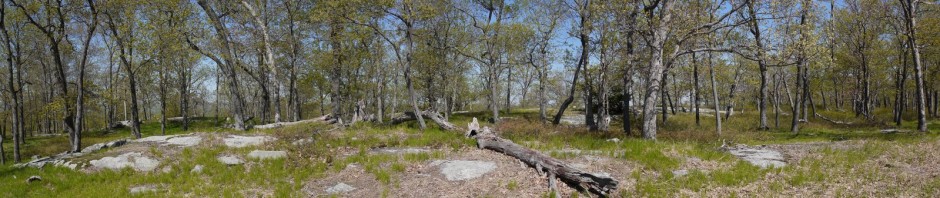
11:23 a.m.: We followed Reservoir Road about 1/4 mile to the parking lot, at about 750′ elevation. We began hiking on the red-blazed Duggan trail, which began at a kiosk near the parking lot:

Kiosk
The Duggan trail was a footpath that ran downhill to about 600′ in elevation:

Duggan Trail
11:36 a.m.: After 0.4 miles, the Duggan trail ended at Ben’s bridge:

Ben’s Bridge
We then turned left on the blue-blazed Reservoir trail, which climbed steadily, closely followed a stream. There are a number of reservoirs, ponds and streams in the forest. This stream led from the Upper Reservoir to a water filtration plant:

Stream from Upper Reservoir
A flatter section of the stream:

Stream from Upper Reservoir
Peace!

Posing in Black Rock Forest
12:19 a.m.: After 0.5 miles, the blue-blazed trail ended at about 920′ in elevation, and we turned right onto the yellow-blazed Stillman trail (which is also part of the teal-blazed Highlands Trail), climbing the aptly-named Mt. Misery:

Stillman Trail Climbing Mt. Misery
Mt. Misery peaks out at 1,268′, so it’s not a very long climb, but the trail is steep.

View from Mt. Misery
I strike a pose:

Posing in Black Rock Forest
Going down Mt. Misery was also a very steep descent, though gravity helped us. The trail crossed White Oak Road, one of several well-maintained roads through the park, where we met two people in an SUV. The Forest’s website indicates that the Forest is still actively used by scientists conducting forestry research, and driving on the roads in the Forest (other than the entrance road to the parking lot) requires permission. I don’t know if that means that everyone we saw driving is a scientist. The people in the SUV gave YBS a copy of the map published by the Forest (which we could have picked up from the kiosk near the parking lot). They said it was superior to the NY/NJ Trail Conference map I was carrying, but I disagree.
1:01 p.m.: We crossed the road and continued on the Stillman trail. We soon reached the Aleck Meadow Reservoir:

Aleck Meadow Reservoir
A panoramic view:

Aleck Meadow Reservoir
The trail continued past the spillway of the reservoir:

Spillway of Aleck Meadow Reservoir
YBS noticed giant tadpoles in the reservoir. I understand that bullfrogs have very big tadpoles, so maybe that’s what they were:

Bullfrog tadpoles
A tree had fallen across the trail, but was caught up so that it was about 4′ off the ground. I tested my balance:

Climbing fallen tree
The reservoir was around 1,040′ in elevation, and then we began a gradual ascent (not as bad as Mt. Misery’s) up to Black Rock, at 1,410′. We weren’t sure how great an overlook to expect, and stopped for lunch at a flat rock, which in hindsight was at a very minor overlook.
1:58 p.m.: After lunch, we walked about 100′ and found this stunning view, which marked the real Black Rock:

Here’s a telephoto view of the Hudson River:

Hudson River from Black Rock Forest
We then began a gradual descent. After having traveled about 1.7 miles on the Stillman trail, we reached the “Two Gates” area and turned south onto Continental Road. The Continental Army used this road as a direct route across the mountains from West Point to New Windsor and Newburgh.
2:21 p.m.: After 0.4 miles, we came to an intersection with the White Oak Road, with a huge white oak tree at the intersection. The tree is around 250 years old:

White Oak on White Oak Road
We continued on Continental Road, and after abut 0.3 miles came to the Chatfield Stone House. Dating to the 1830s, it’s the oldest building in Black Rock Forest. It was gutted by a fire in 1912 but reconstructed in 1932. It was locked, so we couldn’t see inside:

Chatfield Stone House
We continued south on the Continental Road another 0.5 mile, then turned right (west) for a short detour on the white-blazed Scenic trail. I should note that YBS is a great hiking companion, as he was cheerful, hiked at a good pace, and was agreeable to hiking different trails to “see the sights.”
2:56 p.m.: After 0.5 mile on the Scenic trail, we turned right onto the blue-blazed Spy Rock trail, which ended after about 0.15 miles at Spy Rock. At 1,461′, this is the high point of the Forest. My map said that sentinels from George Washington’s camp at Newburgh had used Spy Rock to monitor British vessels sailing up the Hudson from Haverstraw Bay. However, we felt that the view was inferior from Spy Rock, especially compared to that we’d enjoyed at Black Rock. The most interesting feature of Spy Rock was a pine that had struggled to find a foothold on the rock. I think this is the view looking east:

Spy Rock
Here’s the tree from a different angle; I think looking north:

Posing at Spy Rock
We backtracked to the Scenic trail, passing a dead branch with an interesting shape and texture:

Textured tree branch
The Fall temperatures allowed us to enjoy some red mixed in with the greenery:

Fall colors

Fall colors
We returned east on the Scenic trail to the Continental Road, then continued on the Scenic trail another 0.3 miles along a woods road called Bog Meadow Road. The Scenic Trail then departed from the woods trail, continuing to the right (south) 0.5 miles through an area that was a little swampy.
3:50 p.m.: The trail then turned northeast, climbing to a series of overlooks, the first being a climb of about 200 or 300′ to Rattlesnake Hill, where we enjoyed views toward the west of Bog Meadow Pond:

Bog Meadow Pond, from Rattlesnake Hill
We continued hiking on the Scenic trail:

Scenic Trail
4:27 p.m.: I believe this was the Hill of Pines, at 1,400′ of elevation:

View from Hill of Pines

View from Hill of Pines
After another mile, the Scenic trail intersected the blue-blazed Swamp trail. We turned right (east) onto that trail, and saw a few stone walls:

Stone wall on Swamp Trail
After 0.3 miles, the Swamp trail ended at the Old West Point Road, which is marked as an unmaintained woods road. We followed this north less than 0.1 miles, to the southwest end of Upper Reservoir, where we met a couple hiking with two dogs. We then followed an unmaintained trail about 0.3 miles counterclockwise around the eastern perimeter of the reservoir.
Hmm; name that object?

Unknown object
5:00 p.m.: YBS enjoys a view of the reservoir:

Reservoir
An old still?

Unknown object
We then picked up the yellow-blazed Stillman trail again, following a different part of it for 0.9 miles to the northeast, back to the parking area, having completed a hike of about 8.5 miles in about 6-1/4 hours.
The Forest was very nice. We encountered other hikers or joggers there at times, but it was still not a very crowded place, and there were a couple of hours (along the Scenic trail) where we did not see anyone else.
Was in All those locations on Monday Oct. 14…. enjoyed your blog and pictures were excellent. It is a well kept secret… thanks for sharing.