It was a very cold day, but I hadn’t been hiking in several weeks and the sky was bright and clear, so I decided not to be deterred by the cold weather. Before I left home, it was around 10 degrees at Bear Mountain. I don’t know what the temperature was when I was hiking in the area, though I’ll guess it was fluctuating between the teens and 20s.
I decided to hike the Camp Smith Trail, which is supposed to be the most strenuous hike in Westchester County. (That’s not necessarily saying much, as Westchester County is still pretty flat.) I drove on Route 6/202 past Camp Smith, a New York National Guard base, and parked at the former toll booth for the Bear Mountain Bridge.
10:42 a.m.: The southeastern end of the Camp Smith Trail began right behind the building. The trail is well-blazed for the most part, and there are signs (and in places yellow ropes) warning hikers not to veer to the east, which would put them into Camp Smith.

Former toll booth for the Bear Mountain bridge
10:48 a.m.: I headed northwest, and the trail quickly gained about 200′ elevation.

Camp Smith Trail
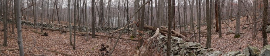
I encountered varied terrain. Rocky areas:

Rocky terrain
10:54 a.m.: No snow, but several ice crystals.

Ice crystals
11:11 a.m.: Some bare rock.

Bare rock
11:21 a.m: The Hudson was never far away.

Hudson River
11:24 a.m.: A view of Iona Island. There were a few patches of ice, which I was careful to avoid.

Iona Island
11:44 a.m.: The trail climbed to about 700′ in elevation, but then descended again to about 400′. This view was taken near Broccy Creek, where there is another parking area off Route 6/202.

View from Camp Smith Trail, near Broccy Creek
11:46 a.m.: Another icy patch. I only had to walk a few feet to one side to avoid it.

Icy patch
12:19 p.m.: Gaining elevation again.

Hudson River
1:02 p.m.: Back around 700′ in elevation

Scenic view
1:14 p.m.: Finding Anthony’s Nose was the only tricky part. One following the blue-blazed Camp Smith Trail could easily miss the short-side trail to Anthony’s Nose. It is blazed white in places, though I also saw blue blazes there. A sign would be nice. But I found it, and as you can see, it’s almost right above the Bear Mountain Bridge. On the far side of the bridge is the famous park of that name. I don’t know who planted the American flag, but it’s a nice touch.
While hiking, I alternated between being cold and hot, so I would unzip my parka and take my gloves off when I got hot, and reverse the process when I got cold. On Anthony’s Nose, the wind was quite fierce, and after just a few minutes of having my hands exposed to take photos, I began to lose feeling in my fingers. It was good timing that a tugboat and barge came by while I was there, and I was able to frame them between the American flag and the bridge.

Bear Mountain Bridge, seen from Anthony’s Nose
Even though it was very cold, there were other hikers on the trail. One was a man who had lost a bet on the Denver Broncos vs. Pittsburgh Steelers football game of the previous week, so he had to strike a “Tebow” pose. I photographed him emulating the Denver quarterback, and he took this photo of me standing on Anthony’s Nose.

Posing on Anthony’s Nose
Earlier in the hike, when I first began to warm up, I took off my poncho, but quickly became too cold. I then tried putting it on over my backpack instead of between my body and backpack, and that worked well. After descending from Anthony’s Nose, I continued toward the northeast. If it had been summer, it would have been nice to have lunch at a scenic spot such as Anthony’s Nose, but on this very cold and windy day there was no way anyone would be eating up there. I found a calm spot and sat on a log. When I finished lunch, I put my poncho on first and the backpack over it and resumed hiking. I later discovered that the water in my Camelbak sipping tube had frozen. So another benefit of wearing the poncho over the backpack is that keeps the water sipping tube from freezing.
After 4.3 miles, I came to the end of the Camp Smith Trail. I continued on the Appalachian Trail southbound. (It’s easier to see the AT blazes going northbound, but the southbound blaze leads one pretty much straight ahead down the side of a hill, and then turning left.) I followed the AT 0.6 miles down to Route 9D. I then walked along Route 9D to the intersection with the Bear Mountain Bridge and Route 6/202, and followed 6/202 for 2.5 miles back to my car.
Along the way I took a shot of icicles cascading down the rockface near the road:

Icicles on rock face
And one last shot of the Hudson.

Hudson River
Walking along Route 6/202 isn’t fun, as there’s not much of a shoulder, so I had to frequently step off into brush as cars would pass. I prefer hiking in some sort of loop rather than hiking forward and then back on the same trail, so that’s why I followed the road at the end.
So that was my 7.4 mile hike in very cold weather.