Wednesday was similar to the previous day in Banff, in that we got a late start, first intending one hike, and then switching to another. We drove to Lake Agnes, about a 45 minute drive north of Canmore, and arrived to find that all the local parking lots were full. We were then directed to an overflow parking lot located a few miles south on the highway. We waited in line for the free shuttle bus to Lake Agnes, until we heard that the last return bus would leave Lake Agnes at 5:30 p.m. As happened the previous day, I did not have confidence that we would be able to travel to Lake Agnes, hike, and return before 5:30.
Instead, we left and drove south to the Cascade Mountain area, where we found a nice nearly-empty parking lot waiting for us at the trailhead for the C-Level Cirque. “C-level” refers to coal mining operations conducted here from 1904-22. I will explain “cirque” later.
The trail began with a warning sign to be cautious around mine openings. However, the only mine openings we saw were encircled by chain link fences, so it was not as though hikers were at risk of accidentally falling into a mine while hiking on the trail.

Trailhead and Warning Sign
This tree appears to be covered with an epiphyte:

Tree with epiphyte
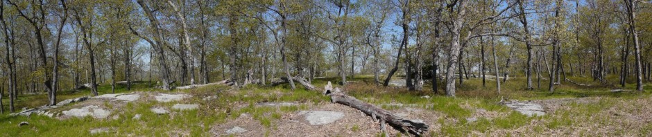
There were a number of dead trees along the trail:

Dead trees
Most of the mining holes were not even very visible. This was perhaps the most obvious one, and as noted above, a fence protects people from falling into it.

Mining hole
A more interesting part of the trail, showing soil, rocks, and trees:

Trail
The Cascade Mountain range came into view through the trees, and I saw there were still a few spots of snow:

Cascade Mountains
A close-up showing remnants of snow:

Close-up of Cascade Mountains, with snow
After hiking 3.9 km (2.4 miles) from the parking lot, we reached the “cirque,” a bowl-shaped depression created in the distant past by a glacier. This is shown in the following stitched-panorama. Please note the narrow light-colored ribbon on the right side of the image, which is a trail.

Cirque
We followed this narrow trail, though it was more challenging, as in places it was narrow and was tilted toward the left, as though it wanted to toss us off into the cirque. We had read that at the end there was a beautiful spot to relax and watch small animals, but we didn’t make it quite that far. We reached a point where the trail disappeared over a small hill, but the trail was steep at that point and also slippery with gravel. A few other hikers made it, some with hiking sticks and some without, but I decided that I wasn’t comfortable and we stopped at that point.
We began our return to the entrance of the cirque, stopping along the way to photograph a golden-mantled ground squirrel:

Golden-mantled ground squirrel
He seemed to enjoy posing for the camera:

Golden-mantled ground squirrel
Another view.

Golden-mantled ground squirrel
A final view:

Golden-mantled ground squirrel
I believe that I also saw a hoary marmot there in the cirque, but was not able to photograph it.
Continuing our return on the narrow path to the side of the cirque, we passed a young man who was continuing to the end. At the entrance, we stopped to speak with a lady who turned out to be his aunt. She was an avid and very fit hiker, but as it was their second hike of the day, she decided to stop at the entrance of the cirque and not to follow him on the narrow side path. We stayed there for about half an hour, listening to some of her adventures of hiking around the world, until he returned from his explorations.
We then began our return to the car.
In the mining area, there are one or two old buildings. While they are missing roofs, doors, and windows, the concrete walls are sturdy:

Mining building
Near the trail head, we spotted a pair of Speyeria zerene butterflies:

Speyeria zerene
We then returned to the car. This in-and-out hike was therefore 7.8 km (4.8 miles) and had an elevation gain of about 455 m (1,500′), according to the Town of Banff’s website. (Another source says the gain is 2,500′, obviously a big difference. I could not say which is more correct.).