The Jewish Outdoors Club 5th Annual Fun Day was held in Norvin Green State Forest this year. Two hundred people bought tickets, though I don’t know if they all made it there. We met near the Weiss Ecology Center. I had been to the Forest twice the previous year, so this was familiar ground for me.
10:17 a.m.: People begin appearing, with some driving or carpooling and others arriving via a chartered bus:

The crowd gathers
Participants could chose from a number of hikes, including a very strenous hike, a strenuous hike (split into two groups), a moderate hike (split into four groups, I believe), and an easy hike. The idea behind splitting a particular hike into multiple groups was to make it more manageable for hike leaders and sweeps to keep their group together. I took the strenous hike, and our group left first and was supposed to go clockwise on the trails, whereas the second group left a few minutes later and was supposed to go counter clockwise on the trails. However, there was some confusion and both groups ended up going in the same direction, and the strenuous groups and once even one or two of the moderate groups would run into each other.
The very strenuous hike was going to the Otter Hole, which I had visited the year before. There was a social component to this event, and also a scheduled barbecue, so I decided to take the strenuous hike (but not the very strenuous hike) so that I would be sure to return to the starting area in time to enjoy the barbecue. We began our hike around 10:40 a.m., leaving the Weis Ecology Center and hiking south-southwest on the green trail.
11:08 a.m.: We turned south onto the blue trail, began climbing a hill, which began to give us nice views of the surrounding county:

Scenic view

Scenic view

Overexposed sky
I decided to try high dynamic range (HDR) imaging. That is a method of combining two or more images. One problem that is encountered is when one part of the scene, such as the sky, is significantly brighter than another part of the scene, such as the ground. A human eye and brain can enjoy the scene and see it as a vivid blue sky (or a cloudy gray sky, which we faced at the start of the hike) and a ground covered with greenery. However, both film and digital cameras can’t match the eye’s dynamic range. Thus, in some cases a camera will give us a choice between a properly exposed ground and an overexposed sky . . .
. . . or a properly exposed sky and an underexposed ground::

Underexposed ground
[Or the camera may give us a middle image in which the sky is overexposed while the ground is underexposed.]
HDR uses software to combine two or more images, preferably one that is significantly overexposed and one that is significant underexposed, like the two thumbnails shown above. It then combines the properly exposed sky from one and the properly exposed ground from the other, yielding magic:

HDR composite
11:33 a.m.: We detoured from the blue trail onto the red trail, just to climb to Wyanockie High Point, which offered views of Wanaque Reservoir and Manhattan in the distance. Here’s another HDR shot:

Wanaque Reservoir
11:44 a.m.: And my last HDR shot of the day:

Another View from Wyanockie High Point
11:49 a.m.: The group lingered at Wyanockie High Point for a while:

Hikers at Wyanockie High Point
We backtracked on the red trail back to the blue trail, and continued south.
12:16 p.m.: There were other hills to climb:

Hikers ascend blue trail
Come on, it’s not that steep!

You can do it!
12:34 p.m.: “With dice in the front and Brooklyn’s in the back.” Okay, that’s my tribute to the late Adam Yauch of the Beastie Boys. Here I experiment with depth of field, holding the camera close to the ground and focusing on two nearby rocks with a low aperture stop. (This is probably Carris Hill, where we were supposed to turn onto the yellow trail, but we missed the turn.)

Carris Hill?
12:50 p.m.: Hike leader Nachi wonders if this is dangerous: a tree has fallen and snapped in half. The lower half is lying flat on the ground and is no problem, but the upper half is hung up in the branches of another tree.

Broken tree
1:12 p.m.: We arrived at the Chikaholi Falls on Posts Brook, which is when we realized that we had missed the turn-off to the yellow trail. I’m not sure what happened, as both Nachi and I were looking for the yellow blazes. So we actually hiked longer than we had anticipated.
Here is a poor view of the falls, from the trail. (I had a better shot of the falls the year before, when I crossed the brook so that I was able to see the falls head on, instead of looking at it from the side.)
, Norvin Green State Forest, NJ")
Chikaholi Falls
1:15 p.m.: We turned east onto the white trail, and begin heading back toward the starting point.

White trail
1:21 p.m.: A view of a gentle part of the brook:

Posts Brook
1:27 p.m.: The white trail turned north, away from the brook. Here is some bare rock:

Bare rock
1:38 p.m.: Someone with good eyes spotted this nice little toad, who posed for a close-up:

Toad
1:52 p.m.: The white trail led us to the red trail, and we turned east on that briefly, fording a stream:

Fording a stream
After a very short distance on the red trail, we turned north-northwest on the yellow trail.
2:16 p.m.: It’s interesting when a tree falls and its roots carry along a few big rocks:

Fallen tree
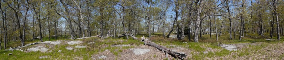
2:34 p.m.: The yellow trail led back to the blue trail, which then led to the green trail. Here we are almost back at the starting point.

Green trail
I’m too lazy now to try to add up the mileage from my map, but Nachi estimated that the hike was about 6.5 miles, factoring in the fact that we missed the turn at Carris Hill and hiked farther than we had planned.
Around 2:40 p.m., we returned in time to enjoy the barbecue. Unfortunately, the burgers were already gone, but I was told they were overdone and that I wouldn’t have liked them anyway. I did enjoy salad, a hot dog, and chicken, so I didn’t leave hungry.