My friends and I hiked a 7.5-mile section of the Appalachian Trail (AT). We met at the intersection of Old West Point Road East and Graymoor Village, where Old West Point Road East transitions from a paved road to a dirt road.
After shuttling my car to Dennytown Road in Clarence Fahnestock Memorial State Park, we returned to Old West Point Road. We hiked down the dirt portion for 200′ and turned left (north) onto the AT.
11:32 a.m.: Almost immediately after turning north on the AT, we found this ancient saw blade resting against a rock:

Old saw blade
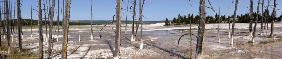
11:50 a.m.: We were hiking along a ridge line, at about 700-800′ of elevation, and looking toward the west we could see the ground drop away. (U.S. Highway 9 was running toward the west, at about 500′ of elevation.)

View from Appalachian Trail
11:56 a.m.: A densely packed stand of 5 or 6 trees had fallen:

Fallen trees
The NY-NJ Trail Conference map 101 (East Hudson Trails) shows that after 3/4 of a mile we should have arrived at a side trail leading east toward a starred scenic view. However, we were not paying close attention and I do not recall any side trail.
12:28 p.m.: When we were 1.5 miles into our hike, we came to a blue blaze marking a path to the left (northwest). The map showed this as leading to a scenic view from Denning Hill, and we detoured 0.1 miles to investigate. This is the view:

View from Denning Hill
12:45 p.m.: Returning to the AT, after another 0.7 miles the trail made a hairpin curve to the south, before turning north again after another tenth of a mile. (As the crow flies, this was about 0.3 miles east of Denning Hill, and about 0.35 miles south of Ft. Defiance Hill.) There was a scenic view here, as well:

View from Appalachian Trail
12:55 p.m.: We dropped down from about 900′ elevation to 700′ elevation. Here my friends reach the bottom of that hill:

Descending a hill
12:56 p.m.: It looks as though a tree toppled over with roots remaining in the ground, and therefore remained alive:

Fallen tree lives
1:01 p.m.: We climbed another hill back up to around 800′ elevation:

Hill
1:09 p.m.: A small rock ledge. I hiked up the small hill to take a closer look, while my friends remained on the trail.

Rock ledge
1:22 p.m.: The trail passed over puncheon through an area that the map shows can be swampy:

Puncheon
1:29 p.m.: At 0.6 miles beyond the hairpin curve, the Appalachian Trail then crossed Old Albany Post Road, one of the oldest unpaved roads in the U.S. still in use. The crossing was right at an intersection with Chapman Road. We did not immediately see where to pick up the AT on the north side of the Post Road (as a vehicle was parked in front of it). We therefore walked northeast on the Post Road about 200′, until we came to a marker indicating the edge of the Federal land through which the AT is routed. We also spotted this historic marker of the Old Albany Post Road:

Historic marker, Old Albany Post Road
1:33 p.m.: A driver was passing by on the road, so we flagged him down and asked him where to re-enter the woods on the AT northbound. He directed us back about 200′ to the intersection with Chapman Road, where I realized that a vehicle had blocked our view of the trail. Re-entering the woods, we immediately came to a colorful scene. After so many months of winter and nothing but dormant vegetation, it is nice to see greenery!

Appalachian Trail
We reached the edge of NY-NJ Trail Conference map 101, and we switched to map 103, also within the East Hudson Trails map set.
1:44 p.m.: We began to encounter ancient rock walls.

Rock wall
1:51 p.m.: More fallen trees:

Fallen tree
1:51 p.m.: Another rock wall:

Rock wall
We stopped for a leisurely lunch, then continued on northward.
2:49 p.m.: At a mile from Old Albany Post Road, we reached a scenic view on Canopus Hill, at around 800′ elevation:

View from Canopus Hill
3:02 p.m.: A dead tree:

Dead tree
3:09 p.m.: After another 0.5 miles we reached a small stream, which was just south of Canopus Hill Road:

Stream at Canopus Hill Road
We crossed the road and re-entered the forest.
3:24 p.m.: We encountered an ancient stone foundation. I would have guessed it was a root cellar, though I later found a website that stated that it was a building used as a Smallpox inoculation station during the Revolutionary War.

Revolutionary War Smallpox Inoculation Station
3:26 p.m.: Investigating a vine:

Vine
3:32 p.m.: More stone walls:

Stone walls
3:50 p.m.: A broken tree:

Broken tree
3:56 p.m.: Another mile past Canopus Hill Road, the AT crossed South Highland Road. Continuing to the north on the AT, we immediately crossed a stream and this memorial marker. An Internet search did not turn up any details, besides other hikers who were also curious.

Memorial marker
4:04 p.m.: Another stone wall:

Stone wall
Around 4:15 p.m., 0.5 miles past South Highland Road, we entered Fahnestock State Park.
4:52 p.m.: After another mile, we reached an intersection with Fahnestock’s red-blazed Catfish Loop trail. We stayed on the AT.
5:16 p.m.: The AT in Fahnestock included some bare rock, though this piece was covered with lichen:

Appalachian Trail
5:31 p.m.: About 1.2 miles beyond the intersection with the Catfish Loop Trail, we reached Dennytown Road, where I had left my car. We then drove back to the starting point, where my companions reclaimed their own cars. As noted at the beginning of the post, I estimate this was about a 7.5 mile hike.
Charlie, I live in the area and my social circle hikes the region extensively. I posted the image of the ‘memorial’ to several places where I was certain someone would know the answer to your question, ‘Who was this guy?’
All I can say is that general consensus is that “Rick” may have been nothing more than a a pet – or a cigarette lighter. The panel is mixed on the matter but it’s certainly not a human.
Peace,
Jeff
Thank you all for this information. We just moved to Dennytown Road, surrounded by stone walls that I have been very curious about. Although there does not seem to be a single explanation, my curiosity is somewhat satisfied… as I look out the window, my imagination races !
Linda