I recruited Yigal and Nachi to go hiking with me, and Nachi recruited three other people. I suggested three or four hikes to Nachi, and he selected Storm King, which I had never visited before.
Storm King State Park sits on the west side of the Hudson River, across from Cold Spring. I have admired Storm King Mountain a number of times from hikes on the east side of the Hudson, and was glad to finally hike it.
Storm King State Park includes Butter Hill, which is actually slightly higher in elevation than Storm King Mountain. There is a loop around Storm King Mountain, and a larger loop in the south of the park, with the two loops being joined by a connecting trail. We hiked the majority of trails in the park.
There are a number of parking areas near the park. We chose the parking lot on U.S. Highway 9W adjacent to the head of the orange trail. The temperature was about 85 degrees, and it was very humid, with overcast skies and a chance of rain. We began hiking a few minutes before 11:00.
11:09 a.m.: The parking lot was at 940′ elevation, and our hike commenced with a 0.2 mile scramble that gained 200′, at which point we reached the ruins of Spy House, formerly a summer home of parks commissioner Dr. Edward Partridge.

Ruins of Spy House
11:25 a.m.: Continuing our climb, after another 0.2 miles we reached a lookout that afforded a view toward the south, with Highway 9W carving a serpentine path through the trees of Storm King State Park and Black Rock Forest. Our cars are visible in the parking area of this photo.

US 9W, as seen from Butter Hill
After another 0.1 miles, the orange trail came to an end. We continued our climb on the yellow trail, and after another 0.1 miles we reached the peak of Butter Hill, complete with a National Geodetic Survey reference mark. At 1381′ elevation, Butter Hill was the highest point we would reach this day.
12:12 p.m.: The yellow trail soon led us to a series of scenic views, including views toward the north, the northeast, the east, and the southeast. The Hudson River curves east after passing Storm King Mountain, so the following view, toward the north, makes it look as though we are standing above the middle of the river.

Hudson River
Following are three of the features in the above panorama: Here is the Newburgh-Beacon Bridge:

Newburgh-Beacon Bridge
Here is the Cornwall Yacht Club. Better views are available here. The breakwater has been referred to as an old barge. I think of a barge as a rectangular vessel that does not rise far out of the water, whereas this looks like a streamlined ship with a tall hull. In any event, I don’t care for the look of old wrecks rotting away, so it’s not my favorite choice for a breakwater.

Cornwall Yacht Club
This is a close-up of Bannerman’s Castle on Pollepel Island.

Bannerman’s Castle, Pollepel Island
After another 0.9 miles, including a break for lunch, the yellow trail intersected the white-blazed by-pass trail. We followed that west 0.4 miles to the blue-blazed Howell trail. After another 0.1 miles west on the blue trail, we reached an intersection with an unmaintained trail, that was nonetheless still easy to follow, with faded white blazes. This was 0.5 mile east of where we had left our cars, and two of Nachi’s recruits left us at this point. (They had warned us in advance that they preferred a shorter hike.)
The four of us remaining soldiered on to the south, following the blue trail in the direction of the U.S. Military Academy at West Point. This part of the blue trail was a connector between a loop around Storm King Mountain and a loop in the southern part of the park. Over the course of 0.6 miles, this connecting trail dropped in elevation from around 1050′, down to 540′, before climbing back to 640′. It then intersected another white trail, the Stillman Spring trail, which we followed to the east.
The Stillman Spring trail was 0.75 miles in length, and led us down to Storm King Highway (New York route 218), at 220′ elevation, and not far from the Hudson River. After walking along the road for about 100′, we re-entered the woods to the west. We were once again on the blue trail, being a different part of the same blue trail we had been on earlier. We soon faced a grueling climb uphill. One or two of our party had grumbled earlier in the hike that we were moving too slowly and stopping too often at the many scenic views around Storm King Mountain, and this was a good opportunity for them to enjoy a more strenuous hiking experience.
The sky became increasingly cloudy, and at times we were hit by drops of water. I put my camera in my backpack and put on the rain cover, missing out on taking photos of a few scenic views. One of these was Pitching Point, a scenic view to the northeast that was about 100′ off the blue trail, at 500′ in elevation. The trail soon turned into a scramble as we rapidly gained elevation, with the map showing scenic views at 750′, 900′ and 980′.
3:28 p.m.: At one of those views, I stopped and took a number of shots toward the north and northeast, which stitched together into a very nice panorama. This shows Storm King Mountain on the west side of the Hudson, the Hudson with Pollepel Island and the Newburgh-Beacon Bridge in the far distance, and Breakneck Ridge and Mount Taurus on the east side of the Hudson, overshadowed by a menacing sky:

Storm King Mountain & Hudson Highlands
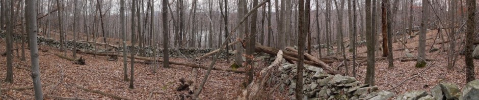
3:44 p.m.: We soon reached a flatter section of the blue trail, ranging between around 1000′ and 1180′:

Storm King State Park
4:16 p.m.: We arrived at another scenic view shown on our map, called North Point. Highway 9W was once again visible, including the parking lot where we had left our vehicles. This is an HDR shot:

View from North Point
This is a normal (non-HDR) shot from North Point:

View from North Point
After 2 miles on this segment of the blue trail, we reached yet another white-blazed trail, this one called the Bobcat trail. We followed this 0.4 miles, which led to the southern parking lot on Highway 9W. This was not where we had left our cars, though–they were at the northern parking lot.
By this time the rain had increased from a few drops to an actual sprinkle. We contemplated putting on raingear, but suspected that with the heat it would be uncomfortable. The rain was actually refreshing, cooling off the temperature and the hikers. Also, I was wearing polyester clothing, which I knew would dry quickly. Thus, we opted to forgo the raingear.
We followed the shoulder of Highway 9W to the north for 0.8 miles, back to the parking lot with our cars, around 5:00 p.m. Thus, we were hiking for 6 hours, though with a few stops to enjoy lunch and scenery. While we saw a few hikers on the northern loop around Storm King Mountain, we did not see anyone else on the southern loop, and I commented that it was nice being able to find such solitude a little more than an hour outside New York City.
I believe that our hike covered 6.7 miles, gaining at least 1300′ (and losing the same amount) over the course of the day.
Great photos, Charlie!