I wanted to do a moderate hike, and checked the New York-New Jersey Trail Conference website for suggestions. A contributor named Jane Daniels had suggested this 7.6-mile route in northern Westchester County, New York, that visits two sanctuaries. I decided to give it a try.
I woke up early on Sunday morning, and left home by 7:30 a.m., driving north about an hour.
The hike begins at the Hunt-Parker Memorial Sanctuary, a 318-acre property owned by the Bedford Audubon Society. I parked in the small parking lot, and found a kiosk with a map of the sanctuary. Following Jane’s directions, I followed the orange-blazed trail uphill, starting around 8:30 a.m. A “blazed” trail means that trees are marked with a splash of color, typically with spray paint, though sometimes with a plastic or metal marker.
8:37 a.m.: I saw quite a few stone walls on these hikes. Someone had gone to a lot of trouble to collect stones and pile them in walls that were a foot or two high, apparently to delineate property boundaries. At the far right of this photo, you can see a tree with orange blazing. The trail is on the right side of the wall; I stepped over it to take this shot. To the left of the orange-blazed tree, you can see a branch on the ground with an interesting shape to it. I’ll have a closer shot of that in a moment.

Stone wall
Here’s another view of the wall, from a different angle.

Stone wall
As promised, here’s a closer photo of that oddly-shaped branch:

Fallen branch
8:39 a.m.: Here’s yet another wall:

Stone wall
8:50 a.m.: The orange trail came to an end, and the blue trail began. And here’s a very strangely-shaped tree root. It looked like a giant spider was trying to hide behind that tree, so that it could pounce on an unsuspecting hiker. Scary! The blue trail makes a loop, and I was moving clockwise on it.

Tree root shaped like spider
8:51 a.m.: The blue trail led me through a break in this particular stone wall. Whoever is in charge of blazing the trail must have run out of dark blue paint, and used light blue paint part of the time.

Stone wall
9:02 a.m.: The trail leads to a short wooden bridge over a tiny stream.

Bridge
Here are two views of the tiny stream:

Stream

Stream
9:15 a.m.: The blue trail continued. In addition to looking for blaze marks on trees, in many cases the hiker can follow a path left by other hikers. Here, leaves crushed by others mark the way:

Crushed leaves show path to follow
9:29 a.m.: Here is a more substantial stream, which I encountered after having covered about half of the blue trail. Following the directions, I left the blue trail and continued on the white trail.

Stream
9:32 a.m.: Jane’s description is that the white trail goes through wetlands on puncheon. I don’t think I’ve ever seen that word before. My dictionary defines it as a plank road. Well, I found the plank road, but the wetlands appeared to be bone dry.

Puncheon
I met a woman on this trail, the first person I’d seen since beginning the hike. I asked if this was the way to North Salem Road and the Mt. Holly Sanctuary. She confirmed that the white trail led to the road, but did not believe there was an entrance to the Mt. Holly Sanctuary anywhere nearby. But I had my directions, which did not fail me. The white trail soon ended at the road, I turned left, walked past a house on the right and found an AT&T pole, which had a metal gate next to it. An AT&T right of way led between the house on the right and another house on the left. Is it really okay for a hiker to walk along an AT&T right of way? I don’t know. A right of way (or an easement, in legal terms), gives AT&T the right to plant poles and to run wires underground, and to have their people come onto the property to service their easement. But does it also allow AT&T to give permission to someone else to enter the property for an unrelated reason? And has AT&T consented to this? Interesting questions, and I don’t know the answers. But I continued to follow the directions for the hike and no one challenged me.
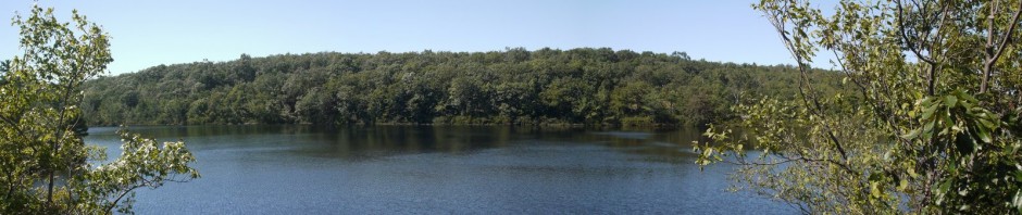
9:50 a.m.: I soon entered the Mt. Holly Sanctuary, 209 acres owned by The Nature Conservancy, and found a pond, with another rock wall right in front of it.

Rock wall
9:53 a.m.: Now following a yellow-blazed trail, I continued to walk for a while along wetlands that were actually wet.

Wetlands
9:58 a.m.: Still wet.

Wetlands
9:59 a.m.: Some types of algae are healthy to eat, right?

Algae
10:10 a.m.: Still wet.

Muddy area
10:39 a.m.: I then hiked along a blue trail and then a red trail. At one point, I met a couple and a dog on the trail. It was only mid-morning, but I had worked up an appetite, so I sat down on one of the walls and enjoyed lunch.

Stone wall
10:47 a.m.: This looked like a manicured lawn and was right next to a building. I don’t know if the building and lawn were also part of the Mt. Holly Sanctuary, or if it is private property adjacent to the sanctuary, so I did not investigate.

Lawn
10:51 a.m.: While I know nothing of geology, this rock looked out of place. The other rocks were dark, and were smaller or bigger, and weren’t round. I wonder what the story was with this guy:

Round rock
10:53 a.m.: A fallen tree with lichens, and a lot of them:

Fallen tree with lichens
At this point, the route that Jane mapped out exited the Mt. Holly Sanctuary, again making use of the AT&T easement. I walked the short distance along North Salem Road back to where I had exited the Hunt-Parker Memorial Sanctuary. A man in a truck passed me. I re-entered the Hunt-Parker sanctuary, retracing my steps along the
white trail over the nonexistent wetlands. Rejoining the blue trail, I continued moving clockwise on it, covering new territory.
11:44 a.m.: I came across some thorny bushes. Do you think this would hurt? Luckily, I avoided learning the hard way.

Thorns bush
11:53 a.m.: I came to more puncheon. (See, I learned a new word!) This time there was actually some water. But my path was blocked by a fallen branch. Luckily I was able to hop over it.

Fallen branch on puncheon
12:02 p.m.: Another fallen tree with lichen:

Fallen tree with lichens
I completed the blue loop, which took me back to the orange trail, then hiked downhill to my car.
Jane had estimated the 7.6 mile hike should take 5-1/2 hours, but
it only took me 4 hours.