I met Martin and Lisa at Sam’s Point Preserve at 10:00 a.m. Our cars were the first ones in the parking lot at the Conservation Center, though we were immediately followed by another car carrying a couple not with our group. This other couple had brought along snowshoes, which they strapped to their backpacks, and they began hiking a few minutes before us.
We signed into the guest register, paid the $10 parking fee (ouch!), and learned that the famed Ice Caves were closed. They can reportedly have ice in them into the Summer months, so I didn’t think it would be much of a novelty to find ice in them in the Winter. As it turned out, in the Winter there was so much ice that the caves could not be safely entered.
10:25 a.m.: We began hiking counterclockwise on the Loop Road, which circles Lake Maratanza, and within 15 minutes had hiked the 0.65 miles to the scenic overlook of Sam’s Point. On clear days, one can see from the Hudson Highlands in the southeast to High Point State Park and the Kittatinnies in the southwest.

Sam’s Point
10:49 a.m.: Driving to the park I didn’t see much snow, but the park is at a higher elevation and still retained plenty of snow. This part of Loop Road was easy to walk on, though, as the snow was thin and well-compacted, so we didn’t have a problem with sliding or sinking into the snow. At the beginning of the day, the sky showed some promising blue. Note also the dwarf pine barrens, a rare plant community occurring at upper elevations in Sam’s Point and Minnewaska State Park Preserve. My hiking companions mentioned that in the Spring, the area is famous for blueberries.

Loop Road
11:05 a.m.: After another 0.6 miles, we left Loop Road and continued on Ice Caves Road, which also led to Verkeerder Kill Falls Trail. While we knew the Ice Caves were closed, we decided to see the entrance, and descended the slope and stairs a short distance.

Entrance to Ice Caves
This was as far as we could go. Where the trail descended below the overhanging rocks, the steps were coated with thick ice.

Entrance to Ice Caves
A detail in which the ice can be seen:

Entrance to Ice Caves
We climbed the short distance that we had descended and backtracked about 0.2 of a mile on Ice Caves Road to the turnoff to Verkeerder Kill Falls Trail, a footpath that is shared by the Long Path.
11:22 a.m.: We turned onto the trail, which almost immediately left Sam’s Point Preserve and entered Minnewaska State Park Preserve. We found the snow here to be a little thicker, though still compacted and not too slick.
11:36 a.m.: Frost flowers on the trail:

Frost flowers
11:42 p.m.: A view from the trail:

Verkeerder Kill Falls Trail
12:02 p.m.: As we approached Verkeerder Kill and the Falls, the trail exited Minnewaska State Park Preserve and entered private property. It is nice of the property owners to allow hikers to use their land to visit the Falls.
After hiking 1.7 miles on the Falls Trail, we reached the “Kill,” which is a Dutch word for a water channel:

Verkeerder Kill

Verkeerder Kill
This is the top of the 180′ Verkeerder Kill Falls:

Point of Verkeerder Kill Falls
Another view of the water around the top of the falls.

Verkeerder Kill
A short distance beyond the Falls, an observation point allowed hikers to see at least the top part of the Falls. We stopped here for lunch, noting that our blue sky had disappeared, replaced by clouds:

Verkeerder Kill Falls
We continued on the Verkeerder Kill Falls Trail for another 0.3 miles, climbing about 160′ in elevation. The hike had been primarily flat to this point, other than the short detour we took to descend to the opening of the Ice Caves. The trail then reached a three-way intersection, with the Scenic Trail and the red-blazed High Point Trail. We turned left onto the High Point Trail.
1:01 p.m.: The High Point Trail had deeper snow, and it also had more hills and a few scrambles. There were also slippery spots. Here my companions contemplate climbing a few feet of rock.

A scramble on the High Point Trail
As Lisa noted, scrambles are easier for those with long legs.

A scramble on the High Point Trail
At one point, I stepped into a puddle of cold water that was about a foot deep, with water running into the top of my left boot. I eventually stopped to replace my wet sock with dry ones from my backpack.
1:29 p.m.: We followed bare rock, though in many places it was covered with snow.

High Point Trail
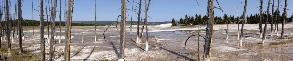
2:11 p.m.: From the High Point Trail, we could see an antenna farm at Sam’s Point Preserve, to the west. We knew that we would eventually be hiking past there, but for now the High Point Trail was taking us north.

Antenna farm
2:16 p.m.: The High Point Trail took us through “The Badlands,” more dwarf pine barrens.

High Point Trail
2:30 p.m.: The ground was visibly icy here, and in a few places we were practically reduced to crawling to obtain traction.

High Point Trail
2:32 p.m.: After 2.4 miles on the High Point Trail, during which we gained another 300′ in elevation, we reached a side path to the west that would take us to the High Point Carriageway. The sign indicated that we were only 0.1 miles from the carriageway, and 2.4 miles from the Conservation Center.

High Point Trail
2:38 p.m.: The Carriageway was about 100′ lower than High Point Trail, and the 0.1 mile path was slippery in places. When we reached the High Point Carriageway, another sign told us that we were 2.8 miles from the Conservation Center. In light of the previous sign, we had expected to be 2.5 miles away. Someone’s math was off. We turned south on the Carriageway.

High Point Carriageway
2:47 p.m.: While the Carriageway was wide and relatively flat, snow here was even deeper, about 6″. In places the surface was strong enough to support our weight for a few steps, but then we would break through, which made for strenuous hiking. We saw snowshoe trails, perhaps from the couple we had seen at the beginning of the day. The snowshoes, with their greater surface area, allowed for the users to avoid sinking into the snow in many of the places where our boots broke through the surface.

High Point Carriageway
3:28 p.m.: We finally passed the antenna farm, and turned onto the Loop Road, with a sign indicating that we were only 1.1 miles from the Conservation Center.
3:51 p.m.: There were a few ruined buildings on the Loop Road, which had apparently been used long ago by blueberry pickers.

Ruins

Ruins
We returned to the Conservation Center shortly after 4:00 p.m., having hiked about 8 miles.