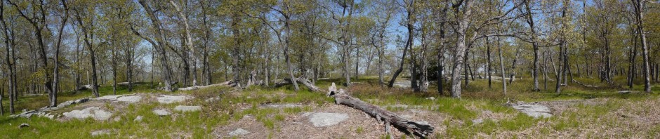
Shore Parkway Greenway (western section), Brooklyn, Kings County, New York

The Shore Parkway Greenway is a walking and bicycle path that runs on the bay side of the Shore Parkway automobile route. The Greenway exists in two noncontiguous sections, separated by Coney Island. The western section runs 4.3 miles, from Bay Parkway at the southern end, passed under the Verrazano-Narrows Bridge, and continues to Bay Ridge Avenue at the northern end. [The eastern section runs from 68th Street in Brooklyn to 84th Street in Queens.]

We parked on Bay Parkway, at GPS coördinates 40.5948/-74.0012, where a large parking lot is provided. We then began walking north on the western section of the parkway:

Shore Parkway and Verrazano–Narrows Bridge, Brooklyn, Kings County, New York

Shore Parkway and Verrazano–Narrows Bridge

When completed in 1964, the Verrazano-Narrows Bridge was the longest suspension bridge in the world, with a center span of 4260′:

Verrazano–Narrows Bridge

Verrazano–Narrows Bridge

A laughing gull (Leucophaeus atricilla) flew past us:

Laughing gull, Brooklyn, Kings County, New York

Laughing gull

This double-crested cormorant (phalacrocorax auritus) put on a good display of swimming and diving, moving north at the same pace that we were walking:

Double-crested cormorant, Brooklyn, Kings County, New York

Double-crested cormorant

This is a Forster’s tern (sterna forsteri). Terns were at one point considered a subfamily of gulls, but now are recognized as a separate family:

Forster's tern, Brooklyn, Kings County, New York

Forster’s tern

A boat passes in front of Hoffman Island, an island created in Lower New York Bay in 1872 by the addition of landfill to natural shoals, and unused since World War II:

Boat Passing East of Hoffman Island, Lower New York Bay, New York

Hoffman Island

A double-crested cormorant in flight:

Double-crested cormorant, Brooklyn, Kings County, New York

Double-crested cormorant

The NYPD keeps boaters safe:

NYPD Patrol Boat, Lower New York Bay, New York

NYPD Patrol Boat

We spotted common chicory (cichorium intybus) growing beside one tree:

Common chicory, Brooklyn, Kings County, New York

Common chicory

A substantial piece of lumber appears as driftwood:

Driftwood, Brooklyn, Kings County, New York

Driftwood

We also saw a couple of very large cubes of styrofoam while we were on the walk. Other marine debris included what appeared to be a dock bumper painted “No Step,” i.e., warning people not to step on it, that may have torn loose during a storm:

Marine debris, Brooklyn, Kings County, New York

Marine debris

Batya pointed out the Statue of Liberty, about 4 miles to the north in Upper New York Bay. My telephoto lens brought her closer:

Statue of Liberty, Upper New York Bay, New York

Statue of Liberty

A Forster’s tern rests on a rock:

Forster's tern, Brooklyn, Kings County, New York

Forster’s tern

A speedboat in the Narrows, which separates Upper New York Harbor from Lower New York Harbor:

Speedboat, Brooklyn, Kings County, New York

Speedboat

The Bayonne Golf Club:

Bayonne Golf Club, Bayonne, Hudson County, New Jersey

Bayonne Golf Club

We reached Bay Ridge Avenue, at the northern end of the Greenway. We had lunch on the American Veterans Memorial Pier, and enjoyed seeing the 1928 Delaware Bay oyster schooner A.J. Meerwald:

A.J. Meerwald at American Veterans Memorial Pier, Brooklyn, Kings County, New York

A.J. Meerwald at American Veterans Memorial Pier

After lunch, we began our return walk, reversing our path and walking south.

Here, a sightseeing boat passes in front of the Orange Sun, a Swiss tanker (Liberian-flagged) dedicated to shipping fruit juice:

Orange Sun, Brooklyn, Kings County, New York

Orange Sun

A sailboat passes east of Hoffman Island:

Sailboat passing east of Hoffman Island, Lower New York Bay, New York

Sailboat passing east of Hoffman Island

Batya had fun:

Batya enjoys Lower New York Bay, Brooklyn, Kings County, New York

Batya enjoys Lower New York Bay

This was an easy 8.6-mile walk, on pavement, with hardly any elevation change.

Posted in Hikes | Tagged | 1 Comment

Norvin Green State Forest, Passaic County, New Jersey

I only have a few photos from this hike in Norvin Green State Forest, as I have been to this park a number of times.

We got off to a late start, and upon arriving at Norvin Green parked on West Brook Road. We had thought of investigating the northern part of the park, where one of my hiking partners had been injured a year earlier.

We descended from the road to West Brook, losing the trail blazes along the way, though the fallen trees spanning the brook looked familiar. We carefully crossed, not wanting to fall into the water:

West Brook, Norvin Green State Forest, Passaic County, New Jersey

West Brook

Unfortunately, having crossed to the far side, we couldn’t find the blazes. This was entirely my fault, as I should have made sure to reacquire the blazes before crossing the brook. We gave up and crossed back to the side of the brook closest to the road. We then did find the blazes and followed them to a different crossing point. However, we didn’t feel like repeating the crossing, and given our late start it seemed unlikely at this point that we would be able to complete the hike. I am now beginning to wonder whether I will ever complete the hike of the northern section of Norvin Green.

We returned to the car and drove to the southern part of Norvin Green, parking near the Otter Hole, where we had lunch. We then hiked up the teal-blazed Highland Trail. Here, Batya makes another water crossing, though this was much easier than our earlier round-trip over West Brook.

Water crossing, Norvin Green State Forest, Passaic County, New Jersey

Water crossing

We spotted a shy toad:

Toad, Norvin Green State Forest, Passaic County, New Jersey

Toad

We encountered a number of scenic views:

Scenic view, Norvin Green State Forest, Passaic County, New Jersey

Scenic view

This view looking to the east shows the Wanaque Reservoir, adjacent to the forest:

Wanaque Reservoir, Passaic County, New Jersey

Wanaque Reservoir

Mountain laurel (Kalmia latifolia):

Mountain laurel, Norvin Green State Forest, Passaic County, New Jersey

Mountain laurel

Another scenic view:

Scenic view, Norvin Green State Forest, Passaic County, New Jersey

Scenic view

We probably only hiked about 4.5 or 5 miles this day. I was not very satisfied with the hike, as I’m accustomed to longer hikes. Also, the drive back to New York City was painful. Traffic made it hard for me to get back to Queens when I lived there, but it takes even longer for Batya and me to drive back to Brooklyn.

Posted in Hikes | Tagged , | Leave a comment

High Point State Park, Sussex County, New Jersey

On Memorial Day, Batya and I drove a couple of hours to High Point State Park, which has the highest elevation in New Jersey, of 1803′ above sea level. The occasion was the annual Jewish Outdoors Club “Fun Day.” This event was planned to be smaller in size than the previous year’s event, and only 157 tickets were sold. Batya and I had hoped to join the group that Nachi was leading, which was the only strenuous hike offered.

N.J. charges admission for this park, at least starting with Memorial Day weekend. On weekdays, they charge $5 for a car with N.J. plates, or $10 for a car with other plates. On weekends, that is doubled! Thus, in addition to paying for the JOC event (which included a delicious barbecue at the end), and paying to drive across New Jersey and for the expensive Hudson River crossings, we had to pay $20 to enter the park.

The JOC was set up just inside the entrance. The parking lot was mostly full, but I parked on a grassy strip off the road. However, the JOC organizer came up to Batya’s side of the car, tapped on the window, greeted us with a great big smile as though she personally knew us, and told us that the parking area was closed off and that we would have to drive to another lot that was a 5 minute walk away. I started the car and drove to the parking lot adjacent to Lake Marcia, a 20-acre natural lake that offers lifeguard-protected swimming:

Lake Marcia, High Point State Park, Sussex County, New Jersey

Lake Marcia

We walked back to the entrance where the JOC was stationed, which took longer than 5 minutes. When we arrived back at the JOC station, we discovered a half-dozen other cars were parked on the grassy strip from which we had been evicted. I was not amused. Whereas the previous JOC Fun Days had several registration tables, there was only one this day, and I had to stand in line for about 15 minutes to register our presence. Meanwhile, Nachi’s group left to begin their hike. If we had not been evicted from the grassy strip where others were allowed to park after us, we would have been able to register in time to join Nachi’s hike. This left me very annoyed.

Batya and I decided that we would hike on our own, rather than join the non-strenuous hikes that would invariably travel at a snail’s pace. We walked back past Lake Marcia and began hiking on the Monument Trail, which provided us with this view toward the east:

Eastern View from the Monument Trail, High Point State Park, Sussex County, New Jersey

Eastern View from the Monument Trail

A war veterans’ monument was built in 1928-29. The obelisk is 221′ tall, 34′ square at the base, though tapering to 19′ square at the top.

Exterior of War Veterans' Monument, High Point State Park, Sussex County, New Jersey

Exterior of War Veterans’ Monument

Of course, Memorial Day was the perfect day to visit such a place, and to enter and climb such a monument. Here, I record the upward view:

Interior view of War Veterans' Monument, High Point State Park, Sussex County, New Jersey

Interior view of War Veterans’ Monument

And the view looking down:

Interior View of War Veterans' Monument, High Point State Park, Sussex County, New Jersey

Interior view of War Veterans’ Monument

Small windows at the top of the monument provide views of the park, as well as nearby New York to the north and Pennsylvania to the west.

View from top of War Veterans' Monument, High Point State Park, Sussex County, New Jersey

View from top of War Veterans’ Monument

Posters inside the monument detail the nation’s debt to veterans from the State of New Jersey, in addition to providing details about the monument itself:

Notable New Jersey Veterans, High Point State Park, Sussex County, New Jersey

Notable New Jersey Veterans

War Veterans' Monument Data, High Point State Park, Sussex County, New Jersey

War Veterans’ Monument Data

Descending from the top of the 221′ monument, we continued our hike along the Monument Trail. This is a stitched panoramic shot of the surrounding countryside:

View from Monument Trail, High Point State Park, Sussex County, New Jersey

View from Monument Trail

A flowering plant along the trail:

Flowering plant, High Point State Park, Sussex County, New Jersey

Flowering plant

The trail crossed a small stream at a couple of points:

Stream crossing on Monument Trail, High Point State Park, Sussex County, New Jersey

Stream crossing on Monument Trail

Much of the Monument Trail was flat, passing through a wooded area:

Wooded area on Monument Trail, High Point State Park, Sussex County, New Jersey

Wooded area on Monument Trail

There were a few rock outcrops, but not many:

Rock Outcrop on Monument Trail, High Point State Park, Sussex County, New Jersey

Rock Outcrop on Monument Trail

The trail afforded a few nice views of the surrounding landscape, including this view of Port Jervis, New York, the Delaware River, and the Mid-Delaware Bridge:

View of Port Jervis, High Point State Park, Sussex County, New Jersey

View of Port Jervis

The trail again crossed a stream, though I can’t say whether it was the same stream as before, or a different one. This crossing featured many nice rocks.

Stream Crossing on Monument Trail, High Point State Park, Sussex County, New Jersey

Stream Crossing on Monument Trail

The Monument Trail is a loop of only 3.7 miles. We completed it and began walking back past Lake Marcia to the pavilion where the JOC had set up its operations for the day. Here is a parting shot of the War Veterans’ Monument:

War Veterans' Monument, High Point State Park, Sussex County, New Jersey

War Veterans’ Monument

We had been a bit worried that we would arrive late for lunch, but instead Batya and I were the first ones there. We enjoyed such delicacies as cole slaw, potatoes, salad, hamburgers, hot dogs, tortilla chips and salsa, pasta with pesto sauce, watermelon, and cookies. While we missed the chance to socialize with others on our hike, we were able to chat with a few people over lunch, before the long drive back to Brooklyn.

Posted in Hikes | Tagged , | Leave a comment

Palisades Interstate Park, Bergen County, New Jersey

In 2012, I had enjoyed a number of hikes with a small group of people whom I had met through the Jewish Outdoors Club and mutual friends. In 2013, the small group wasn’t very active, and I was also not hiking as much, as I was busy dating Batya (who featured in a couple of my hikes from 2013). Batya and I were married on March 31, 2014, and I hope we will be able to enjoy many hikes together. On Mother’s Day, we met Martin, Yaffa, and Yona for a hike in Palisades Interstate Park.

In 1900, the governors of New York and New Jersey formed the Palisades Interstate Park Commission to protect the Palisades cliffs, which were being damaged by quarry operators. The commission later developed a highway and many other parks in the two states.

We met in the parking lot at State Line Lookout, near the northern end of the Palisades and near the border between New York and New Jersey.

10:40 a.m.: We walked a short distance northward along a promenade and along a chained-off road (Old Route 9W), before turning right (northeast) onto the Long Path.

10:58 a.m.: The Long Path led downhill toward the Hudson River.

Hudson River from Palisades, Palisades Interstate Park, Bergen County, New Jersey

Hudson River

While most of the park is within New Jersey, a tiny portion is within Rockland County, New York. I believe this lookout that the group is enjoying came after we passed the New York-New Jersey border marker, and that the spot is called High Gutter Point:

High Gutter Point, Palisades Interstate Park, Rockland County, New York

High Gutter Point

11:03 a.m.: Here, the Long Path descends toward the Hudson. The high point of the cliffs is about 540′ above the water.

Descending the Long Path, Palisades Interstate Park, Rockland County, New York

Descending the Long Path

11:15 a.m.: The Long Path turned northwest, and we came to a small bridge over a wet area. Note the skunk cabbage. This area is known as Skunk Hollow: freed slaves and their descendants lived here from the early 1800s through the early 1900s.

Skunk cabbage in Skunk Hollow, Palisades Interstate Park, Bergen County, New Jersey

Skunk cabbage in Skunk Hollow

We left the Long Path, turning right (northeast) onto the white-blazed Shore Trail. A sign warned hikers that the Shore Trail would lead over a rock scramble and a steeper climb up the cliffs than the gentler descent we’d just experienced. (Note the misspelling of “ascent.”)

Misspelled warning sign, Palisades Interstate Park, Bergen County, New Jersey

Misspelled warning sign

11:28 a.m.: We reached Peanut Leap Cascade, a waterfall of about 50′ in height, adjacent to a small rocky beach. For scale, Martin stands in front of the fall.

Martin in front of Peanut Leap Cascade, Palisades Interstate Park, Bergen County, New Jersey

Martin in front of Peanut Leap Cascade

Batya and I also posed in front of the waterfall:

Batya and Charlie in front of Peanut Leap Cascade, Palisades Interstate Park, Bergen County, New Jersey

Batya and Charlie in front of Peanut Leap Cascade

The nearby beach includes a couple of swings hanging from a tree.

Batya on a swing, Palisades Interstate Park, Bergen County, New Jersey

Batya on a swing

Here’s another look at Peanut Leap Cascade, with the ruins of what had once been an Italianate garden designed by Mary Lawrence on her family’s “Cliffside” estate.

Peanut Leap Cascade and Italianate ruins, Palisades Interstate Park, Bergen County, New Jersey

Peanut Leap Cascade and Italianate ruins

A shoreline view from the rocky beach:

Shoreline view, Palisades Interstate Park, Bergen County, New Jersey

Shoreline view

12:20 p.m.: After relaxing a half hour at Peanut Leap Cascade, we continued along the Shore Trail, heading southeast and skirting the Hudson River, in places having to hike over rocks. Here, Yaffa, Yona and Martin detour a bit from the path to give some space to a pair of hapless Canadian Geese, who had foolishly chosen to build a nest right on the trail.

Hiking past nesting Canadian geese, Palisades Interstate Park, Bergen County, New Jersey

Hiking past nesting Canadian geese

The goose was hissing at us, while the gander just stood by. Batya and I skirted by them, and I took a photo of the pair. These geese can attack people with their bills and wings, leaving bruises or even drawing a little blood, though they won’t cause serious injury. Luckily we were able to pass by without this pair feeling too threatened by us.

Canadian Geese guarding nest, Palisades Interstate Park, Bergen County, New Jersey

Canadian geese guarding nest

12:36 p.m.: We entered the Giant Stairs area, where a jumble of rocks makes for challenging hiking.

Batya, Yona, and Yaffa Hiking on the Giant Stairs, Palisades Interstate Park, Bergen County, New Jersey

Batya, Yona, and Yaffa Hiking on the Giant Stairs

The shoreline from the Giant Stairs:

Shoreline from the Giant Stairs, Palisades Interstate Park, Bergen County, New Jersey

Shoreline from the Giant Stairs

Martin on the Giant Stairs:

Martin hiking on the Giant Stairs, Palisades Interstate Park, Bergen County, New Jersey

Martin hiking on the Giant Stairs:

White blazes suggest the path that hikers should follow:

Shoreline Path along the Giant Stairs, Palisades Interstate Park, Bergen County, New Jersey

Shoreline Path along the Giant Stairs

12:53 p.m.: My bride navigates the Giant Stairs:

Batya on the Giant Stairs, Palisades Interstate Park, Bergen County, New Jersey

Batya on the Giant Stairs

It was a beautiful day for hiking, with blue skies and hawks flying overhead. The weather was 80 degrees: warm, but not too hot, and not too humid.

Hudson River from the Giant Stairs, Palisades Interstate Park, Bergen County, New Jersey

Hudson River from the Giant Stairs

At one point, we passed a woman sitting on a rock, with another woman and man standing by her. The man was on his cell phone calling for help, reporting that the woman had twisted an ankle and that they needed assistance. There was nothing we could do to help, so we continued on. After a while, we stopped to rest, and I was able to photograph the back of a red-tailed hawk, resting in a tree:

Red-tailed hawk, Palisades Interstate Park, Bergen County, New Jersey

Red-tailed hawk

2:20 p.m.: We reached the intersection with the blue and white-blazed Forest View Trail, which led up a series of stairs and switchbacks the 500′ to the top of the Palisades:

Forest View Trail, Palisades Interstate Park, Bergen County, New Jersey

Forest View Trail

At the top, we returned to the parking lot, with the hike being about 4-5 miles.

3:17 p.m.: Our hiking companions drove off, while Batya and I hiked a little more on the paved Old 9W. We spotted a gray catbird (Dumetella carolinensis) along the path:

Gray catbird, Palisades Interstate Park, Bergen County, New Jersey

Gray catbird

As we returned to the car, we saw NYPD helicopters flying overhead and saw/heard them hovering below the cliffs. I speculated that they were involved with rescuing the woman whom we had heard had twisted her ankle. Crowds were gathered, but there was nothing to see from our vantage point, as the cliff blocked our view of the helicopters. I later read an article that the woman had broken her ankle and had been lifted to safety by the helicopters. Another article said that she’d been rescued at 6:00 p.m., but the helicopter activity we had seen had been much earlier, probably around 3:30 p.m. So either the article was wrong, or the earlier helicopters were unsuccessful in reaching her and another successful attempt was made after Batya and I left the Palisades.

We probably hiked about 6 miles, and as noted, the elevation loss and gain wasn’t great, but it was still nice to get out after so many months of not hiking.

Posted in Hikes | Tagged , | Leave a comment

Black Rock Forest, Orange County, New York

This was my third trip to the western part of Black Rock Forest. I only took a few photos. For a more complete record of this part of the park, see my blog post from 2010.

It was Batya’s first trip to the forest. We parked on Mine Hill Road, and hiked up Mine Hill Trail, which always gives nice views:

View from Mine Hill Trail, Black Rock Forest, Orange County, New York

View from Mine Hill Trail

Fall had set in, and the colors were quite muted, though we still found a few wildflowers.

Wildflowers, Black Rock Forest, Orange County, New York

Wildflowers

We took the Sackett Trail and Short Cut Trail to Hall Road, which soon led to the gate:

Hall Road Gate, Black Rock Forest, Orange County, New York

Hall Road Gate

Beyond the gate, we continued on the Highlands Trail, finding a nice splash of yellow Fall colors:

Yellow Fall colors, Black Rock Forest, Orange County, New York

Yellow Fall colors

As well as some red:

Red Fall colors, Black Rock Forest, Orange County, New York

Red fall colors

We passed Jupiter’s Boulder, and we were reflecting on the fact that we hadn’t encountered any other hikers. I suddenly recalled that unlike the publicly owned parks, Black Rock Forest is owned by a private group, and at times it is open to hunting and closed to hikers. Not being a hunter, I had no idea when hunting season was, but I checked my smartphone and learned that we were within bow hunting season, but not yet rifle hunting season. We heard some gunfire, but realized that must be from a shooting range, such as at nearby West Point. We were dressed in bright colors, so I wasn’t too worried about being mistaken for a deer by any bowhunters, but I also didn’t want to be ticketed for trespassing.

As we approached Mineral Spring Brook, we ran into one of the local targets. We assured him that we did not have any bows and arrows, and he relaxed. He was relatively close and not terribly skittish; I hope that he survived the hunting season!

Deer, Black Rock Forest, Orange County, New York

Deer


Deer, Black Rock Forest, Orange County, New York

Deer

We continued on past Mineral Spring Falls, thinking that if we had to leave the park (to avoid continued trespassing), that we could exit at Old Mineral Springs Road and follow the road back to the car. However, that proved unnecessary, as we found a kiosk that clarified that the park is only closed to hikers during rifle hunting season. Soon after reading that notice, we saw a few other hikers on the trails.

Therefore, we backtracked and spent some time at Mineral Spring Falls, and then began to retrace our steps through the park, back toward the car.

Batya hiking on a trail covered with fallen leaves:

Hiking on a trail covered with fallen leaves, Black Rock Forest, Orange County, New York

Hiking on a trail covered with fallen leaves

A hilltop as seen from near Jupiter’s Boulder:

Hilltop seen from Jupiter's Boulder area, Black Rock Forest, Orange County, New York

Hilltop seen from Jupiter’s Boulder area

Bright red berries:

Red berries, Black Rock Forest, Orange County, New York

Red berries

The Mine Hill Trail provided another nice view in the late afternoon, as we hiked down to my car:

View from Mine Hill Trail, Black Rock Forest, Orange County, New York

View from Mine Hill Trail


Posted in Hikes | Tagged , , , | Leave a comment

Ward Pound Ridge Reservation, Westchester County, NY

On my third trip to Ward Pound Ridge Reservation, I brought my girlfriend, Batya. Unlike my first two hikes in the park, which were hot, this day was cool, overcast, and it was also drizzling a bit. Thus, I wasn’t taking as many photos or recording as complete a description of the hike as I had previously. See my previous blog post for this park, here, for a more complete description of this hike and the trails.

We parked at the Trailside Nature Museum and hiked on the orange trail past the museum’s outdoor Delaware wigwam.

9:47 a.m.: Many of the trails in the park are flat and gentle:

Orange trail, Ward Pound Ridge Reservation, NY

Orange trail

10:29 a.m.: The trail passes by rocks:

Rocks beside the trail, Ward Pound Ridge Reservation, NY

Rocks beside the trail


Mossy rocks and fallen trees, Ward Pound Ridge Reservation, NY

Mossy rocks and fallen trees

11:01 a.m.: As mentioned, it was a misty, rainy day. We saw a number of riders on horseback, but only one or two other groups of hikers.

Misty trail, Ward Pound Ridge Reservation, NY

Misty trail

11:05 a.m.: We reached Raven Rocks, which affords a nicer view on clearer days:

View from Raven Rocks, Ward Pound Ridge Reservation, NY

View from Raven Rocks


View from Raven Rocks, Ward Pound Ridge Reservation, NY

View from Raven Rocks

11:28 a.m.: We continued our hike, on a wet, rocky trail:

Wet and rocky trail, Ward Pound Ridge Reservation, NY

Wet and rocky trail

It was the second week of Fall, and while the trees still showed a lot of green, there were also many fallen leaves:

Fallen leaves and fallen trees, Ward Pound Ridge Reservation, NY

Fallen leaves and fallen trees

12:25 p.m.: We took a lunch break at the Indian Rock Shelter, and then continued our hike:

Fallen leaves and fallen trees, Ward Pound Ridge Reservation, NY

Fallen leaves and fallen trees

Rock covered with lichen:

Rock covered with lichen, Ward Pound Ridge Reservation, NY

Rock covered with lichen

Wildflowers:

Wildflowers, Ward Pound Ridge Reservation, NY

Wildflowers

12:45 p.m.: Batya hikes below a fallen tree:

Hiking below a fallen tree, Ward Pound Ridge Reservation, NY

Batya walks below a fallen tree

1:17 p.m.: At the end of the hike, we were rewarded with some pretty Fall foliage:

Fall foliage, Ward Pound Ridge Reservation, NY

Fall foliage


Fall foliage, Ward Pound Ridge Reservation, NY

Fall foliage

Because of the misty weather, we shortened the hike a bit, but still had a nice time in the park. We then went to watch the move Gravity.

Posted in Hikes | Tagged , | Leave a comment

Norvin Green State Forest, Passaic County, New Jersey (northern section)

This was my fourth trip to Norvin Green. However, on previous hikes I visited the section of the forest to the south of West Brook Road. This time, I decided to investigate the trails to the north of West Brook Road. I brought along three friends, Nachi, Jon, and Yitz. My intent was to complete a lollipop loop hike, which would have been about 8 miles. However, the hike didn’t go as planned.

10:17 a.m.: The NY-NJ Trail Conference map shows a parking area along West Brook Road, near between two driveways near the Hill Top Airport. It’s not always easy figuring out where the parking areas are when arriving, and we had the same problem here. The eastern driveway had a wide spot with what looked like a beautiful gravel parking area, at GPS coordinates 41.0857, -74.3318. But the guys with me thought that it might be a problem to park within what appeared to be a private driveway. We thus went past the western driveway, parking on the south side of West Brook Road, at GPS coordinates 41.0860, -74.3330.

10:30 a.m.: We crossed to the north side of West Brook Road, stepped over the guardrail, and made our way down the trail to West Brook.

West Brook, Norvin Green State Forest, NJ

West Brook

I don’t know if this was a high water day or not, but it was no trivial matter crossing the brook without getting wet. We carefully stepped over slippery rocks, and climbed over logjams:

Logjam at West Brook, Norvin Green State Forest, NJ

Logjam at West Brook

11:00 a.m.: We began a steep climb on the blue-blazed Hewitt Butler trail. Along the way we spotted a large branch that had fallen and been absorbed by the growth of twin trees. I have seen trees grow around wire fences, stones, and signs. But I would have thought that a fallen branch would have decomposed and wouldn’t have survived long enough to have been absorbed by these trees. Perhaps the fact that the branch is elevated from the ground has kept it from decomposing.

Trees growing around fallen branch, Norvin Green State Forest, NJ

Trees growing around fallen branch

11:12 a.m.: After climbing about 500′, we reached Manaticut Point, which rewarded us with a view to the south. It was a cloudy day:

View from Manaticut Point, Norvin Green State Forest, NJ

View from Manaticut Point

We continued left (to the west) on the blue trail. There were many fallen trees:

Fallen tree, Norvin Green State Forest, NJ

Fallen tree

11:37 a.m.: At one point the trail descended, and I made my way down, photographing back up at Yitz (left) and Jon (right):

Descent past rocks on Hewitt Butler trail, Norvin Green State Forest, NJ

Descent past rocks on Hewitt Butler trail

Deer droppings:

Deer droppings

Deer droppings

Noon: Another panoramic shot:

Norvin Green State Forest, NJ

Scenic View

There were many fungi:

Mushroom, Norvin Green State Forest, NJ

Mushroom

12:23 p.m.: I have been impressed by the large size of some of the root balls of fallen trees, and we found a huge one on this hike. Here I pose in front of it:

Posing in front of root ball, Norvin Green State Forest, NJ

Charlie posing in front of root ball

This shot of Yitz shows the entire root ball. It was most impressive:

Posing in front of root ball, Norvin Green State Forest, NJ

Yitz posing in front of root ball

Another shot of Yitz with the root ball:

Yitz posing in front of root ball, Norvin Green State Forest, NJ

Yitz posing in front of root ball

Another mushroom:

Mushroom, Norvin Green State Forest, NJ

Mushroom

A colorful rock:

Colorful rock, Norvin Green State Forest, NJ

Colorful rock

12:38 p.m.: We had turned right (north) onto the white-blazed Overlook Rock trail, and when we reached Overlook Rock, if afforded a decent view. I took a few shots that I used to generate this fused HDR view:

View from Overlook Rock, Norvin Green State Forest, NJ

View from Overlook Rock

12:55 p.m.: We left Overlook Rock, continuing north on the white-blazed trail. Before long, I encountered a red eft:

Red eft

Red eft

As I was photographing the young salamander, Jon, Yitz and Nachi had gone on ahead. Yitz called back to me, saying something like, “Charlie, get up here, Nachi has fallen and hurt himself badly!” I was about 50 yards behind them, and quickly caught up. I was glad to see that Nachi was standing up, but he was holding one of his hands in the other. There was a handkerchief wrapped around his hand, red with blood, with more blood dripping onto the ground. Nachi had slipped and hit either a rock or stick that was very sharp, resulting in a deep cut into his palm. Of the four of us, Nachi himself was the one with the most first aid expertise, and he directed us to find more cloth bandages in his backpack, which we wrapped around his hand.

We had gotten off to a late start on the hike, and also we had been traveling very slowly, so even though we were over two hours into the hike, we hadn’t even traveled two miles. I can’t explain the very slow pace, but it worked in our favor, as we realized that we would have to abandon the hike and find medical care for Nachi. Yitz questioned whether we should phone 911, and while I thought that was unnecessary overkill, they decided to do so. He phoned and reported the accident, expressing concern over the risk of blood loss. (I don’t know much about medicine, but didn’t think there was a concern of blood loss from a hand injury.) The 911 operator instructed us to phone when we were ten minutes from the road, and they would send an ambulance.

We began retracing our steps, except that whereas we had moved at a ridiculously slow pace going into the hike, we now moved at a very fast pace, returning to the road after about 45 minutes. As we approached the road, we decided that we didn’t need an ambulance, and that I would simply drive Nachi to a hospital. Yitz phoned the 911 operator and let them know of our change of plans, while I programmed my GPS to lead us to the nearest hospital.

At the hospital, the medical staff was suitably impressed by Nachi’s deep palm laceration, and phoned a nearby hand surgeon, who drove to the hospital and stitched Nachi back together. We then drove back to Queens, and took Nachi to the drugstore to fill a prescription for antibiotics and painkillers.

Bandaged hand after hiking injury

Nachi’s bandanged hand

I hope to return to the northern part of Norvin Green State Forest someday soon, and complete the hike.

Posted in Hikes | Tagged , , | Leave a comment

Yellowstone National Park, Wyoming – August 23-25, 2013

Friday: We had wanted to visit the Mud Volcano area south of Canyon, but a lady at the Camper Services building told us that the area was still closed because of fire danger or damage. We had been lucky that the Grand Loop road had reopened on Thursday, enabling us to go to Grand Teton without a great detour. [The Mud Volcano area reopened on August 26, after our trip.]

I was not tired or sore from the 14 mile hike of the day before, but neither Julie nor Yigal were in the mood for any significant hikes. They did agree to a small hike up a hill behind the Grand Prismatic Spring.

There was some confusion over where the trail started; I had recalled signs to a trail from within one of the geyser basins, but we visited the Midway Geyser Basin and didn’t see the trail. We therefore continued on, finding a parking lot one mile south of the basin. The parking lot was full, but we parked nearby and walked back to the parking lot. The parking lot was adjacent to an old steel bridge that crossed the Firehole River, leading to Fountain Freight Road. The bridge and road were now closed to vehicle traffic, and open only to hikers and bikers.

11:25 a.m.: A hot spring besides the road:

Hot Spring, Yellowstone National Park, Wyoming

Hot Spring

We were now in the right area. We crossed the bridge and walked north along Fountain Freight Road, thinking we would find a trail that would lead us to a nice view of the Grand Prismatic Spring, and that the same trail would also lead us to Fairy Falls, a 200′ waterfall. This was mistaken thinking on our part, and perhaps we were misled by our Moon Yellowstone and Grand Teton, or perhaps we simply misread the book. Reviewing the book now, I realize that it is discussing two separate trails. There are rough unmarked trails that only lead to observation points for the spring, whereas the trailhead for the Fairy Falls hike was farther north on the Fountain Freight Road than we hiked.

11:51 a.m.: We passed two rough trails leading up a hill to our left, but we continued north, reaching a third rough trail that led up a second hill to our left. We realized that we were passing Grand Prismatic Spring, on our right. Therefore, I led the way up the unmarked trail for this second hill, gaining a bit of elevation and indeed enjoying a better perspective of Grand Prismatic Spring:

Grand Prismatic Spring, Yellowstone National Park, Wyoming

Grand Prismatic Spring

We saw a man with a camera and tripod on the southern hill that we had just passed, which was higher in elevation. We realized that would present an even better view, and also thought that might be the way to Fairy Falls. We debated descending to Fountain Freight Road, returning south and ascending that first hill, but that would “waste” our efforts of having gained elevation by climbing this second hill. We therefore descended a bit into the valley between the two hills and then began climbing the southern hill. This took us cross-country, but saved us from descending all the way to Fountain Freight Road.

We were in an area affected by the 1988 fire, but I also decided that we were walking on ground that had seen volcanic activity in the much more distant past. At one point I found a nice piece of obsidian, but of course I left it there, per the principal of taking nothing but photographs.

Julie and Yigal made it up the southern hill before me, and Julie snapped my photo with her Nikon D3100. I see that the camera focused on some nearby branches rather than on me, but it’s still an interesting effect. I was wearing my Auburn colors that day:

Climbing a hill, Yellowstone National Park, Wyoming

Climbing a hill

12:15 p.m.: When we reached the top of the southern hill, we had an even nicer view of the Grand Prismatic Spring than we had enjoyed from the hill to the north:

Grand Prismatic Spring, Yellowstone National Park, Wyoming

Grand Prismatic Spring

Grand Prismatic Spring, with Excelsior Geyser in the background:

Grand Prismatic Spring and Excelsior Geyser, Yellowstone National Park, Wyoming

Grand Prismatic Spring and Excelsior Geyser

We met a young man on the hill, also named Charlie, who was working on a Ph.D. in mechanical engineering. I gave him one of my business cards.

We looked for a trail to the west, still thinking that we might find a trail to Fairy Falls. However, we realized that the trail on this hill had only led to the viewpoint for the spring, and we began our descent back to the road.

The trail was distinct, but not especially easy, and we went slowly. It would be nice for the Park Service to make an effort to mark the trail and make it a bit friendlier for hikers.

Back on the Fountain Freight Road, we decided not to search any more for the Fairy Falls trail, and therefore returned to the car.

We didn’t do much else that day, paying another visit to Boiling River on the Montana border. With hindsight being 20/20, I wished we had found the time for one or two other things. One-time CBS correspondent Charles Kuralt had named Beartooth Highway in the park’s northeastern corner the most beautiful roadway in America, and it would have been nice to have been able to drive this road.  Most of the Yellowstone that we experienced was relatively flat, but there are tall mountains on the eastern side, and it would have been nice to have seen more of them.

Saturday: Julie left us in the morning, driving back to Jackson for her return flight to Pittsburgh (via Dallas). For Yigal and myself, it was our day of rest, and there was little for us to do. Earlier in the week I had purchased a book, Ranger Confidential, and on Saturday I read half of it, finishing the second half the next day, on the flight home. On most days, the temperatures had been in the 40s (or maybe even the 30s) at night, rising up to the high 70s or low 80s during the day. But Saturday the temperatures probably only rose to the 50s at Canyon, and it was raining (and hailing) on and off through the day, so that at times we had to seek shelter in my tent.

Sunday: As Julie was not available to chauffeur Yigal and me back to the West Yellowstone airport, I had arranged to hire a shuttle service. Yellowstone Roadrunner appeared promptly at 9:00 a.m. at our campsite and dropped us off at the airport at 10:30 a.m.

We then flew back to JFK airport in New York, via Salt Lake City.

Posted in Hikes, Vacations | Tagged , | Leave a comment

Grand Teton National Park, Wyoming – August 22, 2013

Thursday: We were on the road by about 7:15 a.m., with Julie driving. I was happy to let her do most of the driving on the trip, though she had added me as a driver, so I was able to provide relief at times. Yigal was satisfied to sit in the back seat. The drive south through Yellowstone to Grand Teton National Park took us about 2-1/2 hours.

8:59 a.m.: We only stopped once for a couple of minutes, to photograph the Teton Range from across Jackson Lake:

Teton Range across Jackson Lake, Grand Teton National Park, Wyoming

Teton Range across Jackson Lake

9:46 a.m.: We arrived at Jenny Lake, elevation 6783′. Jenny Lake, and Leigh Lake to the north, were named for Richard and Jenny Leigh. He was an Englishman who trapped beavers, and she was a Shoshone Indian. Tragically, Jenny and their six children died of smallpox in 1876.

Before walking to the boat dock, Julie and I stopped at the restroom, only to be called out immediately by Yigal announcing there was a bear outside. I dashed out, and sure enough there was a bear about 50′ away, but by the time I brought my camera up, the bear had turned tail and was heading away from us into the bushes, so I didn’t take the shot. I didn’t have much time to study the bear, but am almost certain it was a small black bear, though Yigal insisted it was a grizzly.

We walked to the boat dock, where a park ranger asked if anyone had seen a bear. We reported our sighting. She asked how many cubs we had seen with the bear (none) or if the bear had a yellow tag in her left ear (we didn’t see that). A board on the dock listed a few recent bear sightings, all of them black bears. We rode the shuttle boat about a mile to the western shore of the lake, which saved us from hiking 2.4 miles around the lake’s perimeter.

The last boat was scheduled to return to the eastern shore at 6:00 p.m. (the schedule changes frequently, depending in part on when sundown is), and we wanted to be sure that we didn’t miss that.

Jenny Lake, Grand Teton National Park, Wyoming

Jenny Lake

9:52 a.m.: Another view of Jenny Lake, as we grew close to the dock below Inspiration Point:

Jenny Lake, Grand Teton National Park, Wyoming

Jenny Lake

10:11 a.m.: We began climbing the trail to Inspiration Point, detouring very slightly to visit Hidden Falls, about 0.5 miles from the lake.

Hidden Falls, Grand Teton National Park, Wyoming

Hidden Falls

Here Yigal and I pose at the falls. Yigal had gotten sunburned the day before and decided that it would help if he wore a garment over his head. It wasn’t very fashionable, but protected his skin. He doesn’t use sunscreen, whereas I didn’t mind applying it in the high-altitude sun:

Posing at Hidden Falls, Grand Teton National Park, Wyoming

Posing at Hidden Falls

My Auburn baseball cap had been ignored most of the trip, but this day I ran into a number of Southerners. I saw a family from Vanderbilt who were not at all friendly. I ran into another man wearing an Auburn cap at this point, and greeted him with a “War Eagle” cheer. Shortly afterward I ran into a woman who greeted me and who said that she was a Florida Gator, and then a while after that a man greeted me and said that his party was from Alabama, and that he himself had gone to graduate school at Auburn. [I also exchanged waves one day with people from Clemson, and at the airport on my way out of town, one of the TSA men introduced himself as being an LSU fan, from Baton Rouge.] Yigal was impressed that my Auburn cap drew so much attention.

10:29 a.m.: We continued our climb to Inspiration Point. We noticed hikers stopping to pose in front of a boulder overlooking the hills below, and we stopped to take our own photos there:

Charlie on Climb to Inspiration Point, Grand Teton National Park, Wyoming

On Climb to Inspiration Point

10:31 a.m.: Right afterwards we reached Inspiration Point, which provided a modest view of Jenny Lake. The majority of the hikers stopped at this point, after a one mile hike that gained 400′. We were just getting started, though.

Jenny Lake from Inspiration Point, Grand Teton National Park, Wyoming

Jenny Lake from Inspiration Point

10:55 a.m.: After leaving Inspiration Point, we entered Cascade Canyon and began our hike to the west. Here’s Julie posing in front of the mountains:

Julie on Cascade Canyon Trail, Grand Teton National Park, Wyoming

Julie on Cascade Canyon Trail

11:08 a.m.: Hikers told us that they had seen one male and two female moose on the trail, and we finally came to a clearing where the Cascade Creek included a small island on which the two cows were sitting. We didn’t see the bull moose at that time, though we saw him on the return trip.

Moose Relaxing on Island in Cascade Creek, Grand Teton National Park, Wyoming

Moose relaxing on island in Cascade Creek

A close-up of the moose:

Moose Relaxing on Island in Cascade Creek, Grand Teton National Park, Wyoming

Moose relaxing on island in Cascade Creek

A detail of one of the moose:

Detail of Resting Moose, Grand Teton National Park, Wyoming

Detail of Resting Moose

The Cascade Canyon Trail ran due west for 3.6 miles, climbing only 640.’ However, we then reached an intersection which provided the choice of going northwest into North Fork Cascade Canyon, or southwest into South Fork Cascade Canyon. We turned northwest onto the Lake Solitude Trail into North Fork Cascade Canyon, and the trail climbed steeply, gaining about 1300′ over the next 2.4 miles.

12:39 p.m.:  A fused High Dynamic Range image of Cascade Creek (or one of its feeder streams) crossing the trail:

Cascade Creek at Lake Solitude Trail, Grand Teton National Park, Wyoming

Cascade Creek at Lake Solitude Trail

12:53 p.m.: A fused HDR shot of the Cathedral Group from within North Fork Cascade Canyon.

Cathedral Group from North Fork Cascade Canyon, Grand Teton National Park, Wyoming

Cathedral Group from North Fork Cascade Canyon

After hiking for 7 miles and gaining 2300′ in elevation, we arrived at our objective: Lake Solitude, at 9035′ elevation. After enjoying the lake for a while, we would return the way we came. The trail did continue, forming a loop through Paintbrush Canyon before returning to Jenny Lake, but that loop would entail something like a 19 to 21 mile hike and 3800′ gain in elevation, as opposed to our 14 mile round-trip hike gaining 2300′ in elevation. Thus, the loop hike was more suited to backpackers doing the hike over the course of two days. I wish that we could have done it, but we didn’t have the equipment or experience for backpacking.

As it was, Yigal had been complaining bitterly for days about our plans to hike 14 miles. I had pointed out to him that he had hiked 8 miles with me on a number of occasions in New York, and he responded that his muscles had been sore for days afterwards. I also mentioned that the 14 mile hike had been Julie’s idea, though she responded that if she hadn’t suggested the hike first, I would have found it on my own–and that’s likely true. In the end, Yigal enjoyed the hike and was probably the strongest of the three of us.

1:32 p.m.: Lake Solitude:

Lake Solitude, Grand Teton National Park, Wyoming

Lake Solitude

Fused HDR image of Lake Solitude:

Lake Solitude, Grand Teton National Park, Wyoming

Lake Solitude

After eating lunch and relaxing at the lake, where Yigal actually went swimming, we began our return hike. This would be an easier 7 miles, as it would be downhill.

3:11 p.m.This is another shot of the Cathedral Group, taken from roughly the same location as before:

Cathedral Group from North Fork Cascade Canyon, Grand Teton National Park, Wyoming

Cathedral Group from North Fork Cascade Canyon

3:18 p.m.: This adorable little creature is a pika, which is related to the rabbit. There are quite a few of them at Glacier National Park, but I don’t believe that I saw one there, so I was very happy to be able to see and photograph one at Grand Teton.

Pika, Grand Teton National Park, Wyoming

Pika

4:49 p.m.: Passing by the island in the stream, the two moose cows were gone, but other hikers pointed to the bull moose resting nearby:

Bull moose, Grand Teton National Park, Wyoming

Bull moose

5:41 p.m.: A raven posed for a photo at the end of our 14-mile hike. We returned to the boat dock shortly before 6 p.m., making either the last boat or next-to-last boat for the day, and thereby saving ourselves from having to walk an extra 2.4 miles around to the western part of the lake.

Raven, Grand Teton National Park, Wyoming

Raven

The boat brought us back to the eastern shore of the lake, where we walked the short distance to the parking lot. I drove back north toward Yellowstone.

At one point we saw a coyote in a field, but naturally my camera was in the trunk of the car, so that’s yet another photo that I missed.

By the time we returned to Yellowstone it was dark, and at one point we had to wait patiently for bison to get out of our way. Even though we arrived back at camp late, the showers were still open at the Camper Services building, for which I was grateful.

Coming up: A brief hike on Friday above the Grand Prismatic Spring, a day of rest on Saturday, and we bid farewell to the parks.

Posted in Hikes, Vacations | Tagged , | Leave a comment

Yellowstone National Park, Wyoming – August 21, 2013

Wednesday: As the fires south of Canyon blocked our direct path to Grand Teton, we postponed our hike there, hoping that we could go on Thursday. Instead, we decided to spend the day investigating the geyser basins in the Old Faithful area. We drove west from Canyon, then turned south at the Norris Junction, stopping first three miles south of the junction, at Artist Paintpots, within the Gibbon Geyser Basin.

9:23 a.m.: A 0.6 mile loop trail led through a series of springs, geysers, fumaroles, and mud pots. The fumaroles were generating a fair amount of water vapor:

Artist Paintpots, Yellowstone National Park, Wyoming

Artist Paintpots

The trail included a hill which provided a nice elevated view of the small basin:

Artist Paintpots, Yellowstone National Park, Wyoming

Artist Paintpots

Another elevated view of the basin:

Artist Paintpots, Yellowstone National Park, Wyoming

Artist Paintpots

This photo provides a good illustration that thermal features may be hidden under a few inches of a thin crust. Therefore, it is imperative to remain on the trail when visiting geothermal features of Yellowstone.

Artist Paintpots, Yellowstone National Park, Wyoming

Artist Paintpots

Continuing south, we passed a bison by the side of the road. Many of the bison have retained patches of their winter coats, apparently not caring if they are fashionable or not.

Bison, Yellowstone National Park, Wyoming

Bison

A detail of the bison’s head:

Bison (detail), Yellowstone National Park, Wyoming

Bison (detail)

Another bison, grazing alone in a field framed by a river, mountains and sky:

Bison, Yellowstone National Park, Wyoming

Bison

At the Madison Junction, we continued south, arriving at the Fountain Paint Pot area, within the Lower Geyser Basin.

10:42 a.m.: Overflowing hot springs have killed a stand of trees, and minerals from the water have given the dead trees a “bobby socks” effect:

Fountain Paintpots, Yellowstone National Park, Wyoming

Fountain Paintpots

This is Celestine Pool:

Celestine Pool, Fountain Paintpots, Yellowstone National Park, Wyoming

Celestine Pool

While the hot waters kill off trees and vegetation, some bacteria do grow and thrive in the hot water:

Bacteria mats, Fountain Paintpots, Yellowstone National Park, Wyoming

Bacteria mats

Bubbles rise to the surface of a mud pot:

Fountain Paintpots, Yellowstone National Park, Wyoming

Fountain Paintpots

The Clepsydra Geyser erupts nearly constantly, spitting out 675 gallons per minute, to a height of 10-40′. It was named for an ancient Greek water clock:

Clepsydra Geyser, Fountain Paintpots, Yellowstone National Park, Wyoming

Clepsydra Geyser

Leaving the Fountain Paint Pot area, we took a detour from the Grand Loop Road to drive north on the one-way Firehole Lake Drive. However, the Great Fountain Geyser was not showing any sign of life during our brief stop there, and I did not record any memorable photos on the Drive. Returning to the Grand Loop Road, we again turned south.

11:56 a.m.: Our next stop was Midway Geyser Basin, where a pedestrian bridge led us across the Firehole River. Runoff from a hot spring poured into the river:

Hot Spring Runoff into Firehole River, Midway Geyser Basin, Yellowstone National Park, Wyoming

Hot Spring Runoff into Firehole River

This is Turquoise Pool, about 100′ in diameter, with a temperature of 142-160 degrees Fahrenheit.

Turquoise Pool, Midway Geyser Basin, Yellowstone National Park, Wyoming

Turquoise Pool

This is Opal Pool:

Opal Pool, Midway Geyser Basin, Yellowstone National Park, Wyoming

Opal Pool

I’m posing in front of Grand Prismatic Spring, which looks prettier from the hill behind me. We’ll climb up there on Friday for a better look.

Posing in Front of Grand Prismatic Spring, Midway Geyser Basin, Yellowstone National Park, Wyoming

Posing in Front of Grand Prismatic Spring

A ground-level panorama of Grand Prismatic Spring:

Grand Prismatic Spring, Midway Geyser Basin, Yellowstone National Park, Wyoming

Grand Prismatic Spring

12:46 p.m.: Returning to the car and continuing south, our next stop was Biscuit Basin, an isolated thermal group that is part of the Upper Geyser Basin. These are Black Diamond and Opal Pools:

Black Diamond and Opal Pools, Biscuit Basin, Yellowstone National Park, Wyoming

Black Diamond and Opal Pools

The runoff seen in the next two photos is low enough in temperature to allow mustard-colored bacteria or algae to flourish:

Biscuit Basin, Yellowstone National Park, Wyoming

Biscuit Basin


Biscuit Basin, Yellowstone National Park, Wyoming

Biscuit Basin

Sapphire Pool is about 18′ x 30′, with temperatures of 200 degrees Fahrenheit:

Sapphire Pool, Biscuit Basin, Yellowstone National Park, Wyoming

Sapphire Pool

Jewel Geyser erupts for about a minute every 5-10 minutes, reaching a height of 10-30′:

Jewel Geyser, Biscuit Basin, Yellowstone National Park, Wyoming

Jewel Geyser

2:11 p.m.: We returned to the Upper Geyser Basin, which we had briefly visited the previous day to see Old Faithful. She was still putting on a good show:

Jewel Geyser, Upper Geyser Basin, Yellowstone National Park, Wyoming

Old Faithful

We explored more of the Upper Geyser Basin. This is Beach Spring

Beach Spring, Upper Geyser Basin, Yellowstone National Park, Wyoming

Beach Spring

Ear Spring, which is 4′ x 6′, is said to be shaped like a human ear.

Ear Spring, Upper Geyser Basin, Yellowstone National Park, Wyoming

Ear Spring

Sawmill Geyser was showing signs of life:

Sawmill Geyser, Upper Geyser Basin, Yellowstone National Park, Wyoming

Sawmill Geyser

Belgian Pool:

Belgian Pool, Upper Geyser Basin, Yellowstone National Park, Wyoming

Belgian Pool

Beauty Pool, 60′ in diameter, has a depth of 25′, with a temperature of 164 to 175 degrees Fahrenheit, which is cool enough to allow bacteria and algae growth:

Beauty Pool, Upper Geyser Basin, Yellowstone National Park, Wyoming

Beauty Pool

Chromatic Pool:

Chromatic Pool, Upper Geyser Basin, Yellowstone National Park, Wyoming

Chromatic Pool

A pedestrian bridge led across Firehole River:

Firehole River, Upper Geyser Basin, Yellowstone National Park, Wyoming

Firehole River

There were many benches facing Giant Geyser, with people waiting for the next eruption. We joined them for about 1/2 hour, but eventually grew bored and left. The geyser can reach a height of 150-250′, so it would certainly have been nice to see it erupt. The reality is that Old Faithful is probably the only large geyser that erupts with any regularity, so one must be lucky to see other large geysers, or have a lot of patience, or else settle for Old Faithful and a number of the small geysers.

Giant Geyser, Upper Geyser Basin, Yellowstone National Park, Wyoming

Giant Geyser

Grotto Geyser has an unusual formation that is nearly 8′ high.

Grotto Geyser, Upper Geyser Basin, Yellowstone National Park, Wyoming

Grotto Geyser

A cute chipmunk was kind enough to pose for me, as the geysers were not cooperating:

Chipmunk, Yellowstone National Park, Wyoming

Chipmunk

3:47 p.m.: This time we saw Old Faithful from a distance, with Old Faithful Lodge behind it:

Old Faithful, Upper Geyser Basin, Yellowstone National Park, Wyoming

Old Faithful

Anemone Geyser:

Anemone Geyser, Upper Geyser Basin, Yellowstone National Park, Wyoming

Anemone Geyser

5:20 p.m.: We drove on to the West Thumb Geyser Basin, where we saw a number of elk, including this cow and calf:

Elk Cow and Calf, West Thumb Geyser Basin, Yellowstone National Park, Wyoming

Elk Cow and Calf

A boardwalk ran along Yellowstone Lake, but the wind was kicking up and I decided against venturing down there.

Yellowstone Lake, West Thumb Geyser Basin, Yellowstone National Park, Wyoming

Yellowstone Lake

We began retracing our path back to the campsite. On the drive south, we had temporarily skipped Black Sand Basin, another isolated group of the Upper Geyser Basin. We stopped there now.

6:05 p.m.: Cliff Geyser is situated right on the edge of Iron Creek. It can erupt up to 40′ high, and produce a tremendous amount of steam. We were lucky enough to see it in action, at least to a certain extent:

Cliff Geyser, Black Sand Basin, Yellowstone National Park, Wyoming

Cliff Geyser

Emerald Pool is 27′ x 38′, with a depth of 25′. Lower temperatures (154 degree Fahrenheit) have allowed yellow bacteria and algae to grow on the lining of the pool:

Emerald Pool, Black Sand Basin, Yellowstone National Park, Wyoming

Emerald Pool

Spouter Geyser erupts almost constantly, with jets shooting to a height of 5-7′.

Spouter Geyser, Black Sand Basin, Yellowstone National Park, Wyoming

Spouter Geyser

We then returned to the campsite. While we had not encountered any rain during the day, as we returned to the Canyon area it began to rain. The campsite was muddy in some areas, with the ground saturated enough to leave puddles standing in other areas. My tent was dry, though I had left my duffel bag in the vestibule of the tent formed by the rain fly. The vestibule does not have a floor to it, and water that had run under the vestibule had wet the bottom of my duffel bag. While the duffel bag is plastic coated on the inside, it is not waterproof, and I discovered that one shirt was very wet. Water had gotten into Julie’s tent, and the yoga mats that she used as a sleeping bag cushion were wet.

We went to the Camper Services building, where in addition to showers, we availed ourselves of the laundry facilities. I went through my duffel bag, finding a few other damp items, though nothing else soaked as that one shirt had been. I threw all the wet and damp clothes into a washer, together with the dirty clothes that I had accumulated. The building was also a nice dry place to hang out during the rainstorm.

Afterwards, we returned to the campsite. Julie felt that she could not sleep in her tent, owing to the damp condition, and she instead slept in the car. That would not have worked for my long legs, but she found it to be not terribly uncomfortable. I was happy that my new tent was dry. As for the problem with the floorless vestibule, I used a plastic bag and sandals to elevate my bag off the ground. When we went out during the day, I moved the duffel bag into the tent, so that it would be dry even if it rained heavily.

One good piece of news that we learned upon visiting the Camper Services building was that the road south of Canyon had re-opened, so that we would be able to have a direct drive to Grand Teton in the morning!

Coming up: Thursday we hike 14 miles in Grand Teton National Park.

Posted in Vacations | Tagged , | Leave a comment