Phoenix Mountain Preserve, Phoenix, Arizona

This was my first Daddy-Daughter hike, as Shaina said she wanted to go hiking with me, while her Mommy stayed home.

We went out for about an hour and a half. We parked at 33.5428, -112.0153, and started out on the 304 trail. When we reached the bench at 33.5464, -112.01214, we detoured from the trail and began climbing a hill to the North-Northwest.

Shaina climbing, Phoenix Mountain Preserve, Phoenix, Arizona

Shaina climbing

As beautiful as the scenery was from the trail, the view was even better as we gained a little elevation:

Shaina enjoying the view, Phoenix Mountain Preserve, Phoenix, Arizona

Shaina enjoying the view

We soon reached the top of the hill, where Shaina found a good resting spot. At the bottom of the hill, to the left of the photo, you can see that several trails meet at a bench. There are also tiny figures there, which are people.

Shaina resting at the top of a hill, Phoenix Mountain Preserve, Phoenix, Arizona

Shaina resting at the top

This is a view toward the south, showing the parking lot where we left our car, and in the distance, downtown Phoenix:

Phoenix Mountain Preserve, Phoenix, Arizona

Phoenix Mountain Preserve

Descending the hill, Shaina showed her appreciation for her achievement. We rain into a large group of hikers, several of whom congratulated her for being an accomplished hiker despite her young age.

Celebrating a Daddy-Daughter hike, Phoenix Mountain Preserve, Phoenix, Arizona

Shaina celebrating her first Daddy-Daughter hike

.

Posted in Hikes | Leave a comment

Phoenix Mountain Preserve, Phoenix, Arizona

We once again parked at coordinates 33.5407, -112.0183, and followed trail 200. We then followed trail 202A, climbing a peak to around 1760′ elevation. So it was again about a 1.5 or 2 mile hike, with an elevation gain of about 400′.

It wasn’t much of a hike for Batya and me, but it was good practice for Shaina. Since our last hike was so successful, we presented her with her very own backpack with a water bladder, just like her parents have! She was very excited. Here she is taking a break to eat veggie straws, one of her favorite activities.

Shaina hiking, Phoenix Mountain Preserve, Phoenix, Arizona

Shaina hiking

It was a windy day, and clearly Shaina could have used a headband or scrunchie to keep the hair out of her face. Oh, well.

Shaina hiking, Phoenix Mountain Preserve, Phoenix, Arizona

Shaina hiking

I noted a strange indentation in one of the rock walls. Is there a geologist available to explain this?

Strange indentation in rock, Phoenix Mountain Preserve, Phoenix, Arizona

Strange indentation in rock

.

Posted in Hikes | 1 Comment

Phoenix Mountain Preserve, Phoenix, Arizona

Batya and I have continued to enjoy the Phoenix Mountain Preserve, which is adjacent to our neighborhood. We typically climb to Piestewa Peak. Having already photographed that hike once, I don’t feel compelled to document each time we climbed it.

We have also taken short strolls in the Preserve with Shaina. Today’s hike was a little more exciting, because instead of just walking down trail 302 or 304 for a few minutes and then returning, we actually had a destination, climbing to the top of what is apparently called “RJ Peak.” So I thought it deserved a blog entry.

We parked at coordinates 33.5407, -112.0183, then followed trail 200, then at the intersection with trail 202A, we followed an unnamed trail that has a series of switchbacks to the top of the peak.

The hike was only about a mile or so, and the elevation gain was only a few hundred feet, but it was a good day for our 4-year-old hiker.

Climbing RJ Peak, Phoenix Mountain Preserve, Phoenix, Arizona

Climbing RJ Peak

.

Posted in Hikes | Leave a comment

Phoenix Mountain Preserve, Phoenix, Arizona

On today’s visit to the Phoenix Mountain Preserve, we decided on a loop hike of about 6.3 miles, moving clockwise along trails 302/304, 1A, VOA, 100, 8, and 304.

We have a map of the park (Green Trails Map No. 2813S), but it’s a bit challenging to follow, as the trails in the park are not well marked. Besides the formal trails that appear on the maps, there are also many informal trails, where hikers decided to make their own shortcuts. I think we generally followed the route given above, but sometimes we would encounter an intersection between trails, and without the trails being marked, we would be unsure whether this was an intersection shown on the map or not.

I don’t have much commentary to offer for the following photos. Other than Piestewa Peak, none of the mountains (hills) in the park are named on the map, so it’s not as though I can tell you: “This is So-and-so Peak.”

Phoenix Mountain Preserve, Phoenix, Arizona

Phoenix Mountain Preserve


Phoenix Mountain Preserve, Phoenix, Arizona

Phoenix Mountain Preserve


Phoenix Mountain Preserve, Phoenix, Arizona

Phoenix Mountain Preserve


Phoenix Mountain Preserve, Phoenix, Arizona

Phoenix Mountain Preserve


Phoenix Mountain Preserve, Phoenix, Arizona

Phoenix Mountain Preserve

This is a barrel cactus, specifically, a fishhook barrel cactus. See, I finally had a comment!

Fishhook barrel cactus

Fishhook barrel cactus

Here’s a stand of them:

Stand of barrel cactus

Stand of barrel cactus


Phoenix Mountain Preserve, Phoenix, Arizona

Phoenix Mountain Preserve

This is one of the intersections between trails 1A and 302. One of them? Yeah, both are loop trails, and they run together for a while, so this could be where they depart from each other at the west end or at the east end.

Phoenix Mountain Preserve, Phoenix, Arizona

Intersection of trails 1A and 302

Another panorama view:

Phoenix Mountain Preserve, Phoenix, Arizona

Phoenix Mountain Preserve


Phoenix Mountain Preserve, Phoenix, Arizona

Phoenix Mountain Preserve

I believe this is the mortal remains of a saguaro cactus:

Dead saguaro cactus

Dead saguaro cactus


Phoenix Mountain Preserve, Phoenix, Arizona

Phoenix Mountain Preserve


Phoenix Mountain Preserve, Phoenix, Arizona

Phoenix Mountain Preserve

Purple flowers:

Purple flowers, Phoenix Mountain Preserve, Phoenix, Arizona

Desert flowers


Phoenix Mountain Preserve, Phoenix, Arizona

Phoenix Mountain Preserve

I should note that there are many animals that live in the Phoenix Mountain Preserve, though there is so much foot traffic that the animals may remain hidden. We have only seen squirrels and a roadrunner, but there are many larger animals. Some of them venture out of the Preserve and into the surrounding neighborhoods. I have seen javelina and coyotes near our house. There are also bobcat and many other creatures.

Posted in Hikes | Leave a comment

Piestewa Peak, Phoenix Mountain Preserve, Phoenix, Arizona

In our first visit to the Phoenix Mountain Preserve, Batya and I climbed toward Piestewa Peak — except that we didn’t quite make it to the top, having to cut the hike short to get our daughter from preschool. Batya later went with a friend and reached the summit.

Finally, on my grandmother’s birthday (she would have been 118), Batya and I returned together and reached the top.

Here is a 360-degree panorama from the peak:

Panorama from Piestewa Peak, Phoenix Mountain Preserve, Phoenix, Arizona

Panorama from Piestewa Peak

It’s nice to be able to hike in January without having to wear a heavy jacket. There’s not much snow in Phoenix.

Posted in Hikes | Leave a comment

Papago Park, Phoenix, Arizona

A visit to Papago Park counts more as a stroll than a hike, but it was a fun outing for Batya, two-year-old Shaina, and me. The park is located near the Phoenix Zoo and the Desert Botanical Garden. One part of the park is adjacent to the zoo, with parking at the zoo parking lot. We visited the larger part of the park, Papago West Park, with parking at 626 N. Galvin Parkway.

There are a few trails in Papago Park, with little elevation gain. The trails are stroller friendly.

The park does feature several sandstone buttes that people can climb, if they desire. The longest trail, the Double Butte Loop Trail, is only 2.2 miles.

Papago Park, Phoenix, Arizona

Papago Park


Posted in Hikes | Leave a comment

Piestewa Peak, Phoenix Mountain Preserve, Phoenix, Arizona

Anyone reading through my blog may wonder why I didn’t hike in 2019 or 2020. Shortly after Batya and I returned from our vacation in Banff, we learned that she was expecting a baby. Because of morning sickness that lasted through most of the pregnancy, she wasn’t up for hiking, and while she encouraged me to go on my own (or with friends), I didn’t want to do so. On June 16, 2019 (Father’s Day), our daughter Shaina was born!

When Shaina was 3 months old, Batya and I decided to take her down to Florida to meet my mother. Unfortunately, my mother had a stroke as we were on the way to the airport. We were able to take Shaina into the hospital to meet her, and have a few photos of them together. Unfortunately, my mother never recovered, and after 6 months in a nursing home, she passed away at the beginning of the Covid pandemic, on April 1, 2020. I had primarily started this blog in order to share my hikes with my mother, and I’m sorry that she can no longer read about the beautiful places that I visit.

After successfully working remotely from Brooklyn for the first 9 months of the pandemic, I decided that I could just as easily work remotely from anywhere. We flew to Phoenix in January 2021, made an offer on a house, and moved to Arizona in April 2021. After the first boiling summer, and with Shaina in preschool, Batya and I decided to go for a short hike in Phoenix Mountain Preserve, which is only a few blocks from our house.

The most popular trail there climbs to the top of Piestewa Peak. Formerly known by the non-politically-correct term “Squaw Peak,” it was renamed to Piestewa Peak in 2003, in honor of Lori Piestewa, a Native American soldier killed in the Iraq war. This is an in-and-out trail climbing approximately 1300′ over a course of 1.25 miles, and is very popular. Some locals climb the trail daily. There are also trail runners, with some climbing and descending the trail two or more times per day. Others will make the climb barefoot. Because of the short distance, many hikers don’t carry any water. In the summer, though, hikers are most likely to be found on the trail in the early morning or late afternoon. With the extreme heat and the steep climb, there have been a number of emergency rescues.

Piestewa Peak Trailhead, Phoenix Mountain Preserve, Phoenix, Arizona

Piestewa Peak Trailhead

Warning signs at the trailhead explain the risks involved. I think it’s silly to call a 1.25 mile, 1300′ elevation hike “extremely difficult,” as such a term brings to mind something like Yosemite’s Half Dome or the Grand Canyon’s Bright Angel trail. But in the summer, the heat warnings need to be taken seriously. Note that while dogs are not allowed on this trail, they are welcome on many other trails in the Preserve.

Piestewa Peak warning signs, Phoenix Mountain Preserve, Phoenix, Arizona

Piestewa Peak Warning Signs

Even though we were hiking on a (relatively) cool November day, Batya and I still took our time, enjoying the view, and we wore our typical hiking boots and carried plenty of water.

Batya hiking up Piestewa Peak trail, Phoenix Mountain Preserve, Phoenix, Arizona

Batya beginning the hike

Scenery from the trail:

Piestewa Peak Trailhead, Phoenix Mountain Preserve, Phoenix, Arizona

Phoenix Mountain Preserve

Sometimes I miss the forested hikes that I enjoyed in the mid-Atlantic states and elsewhere, but there is also a certain beauty to the desert.

Phoenix Mountain Preserve, Phoenix, Arizona

Phoenix Mountain Preserve

A panorama:

Phoenix Mountain Preserve, Phoenix, Arizona

Phoenix Mountain Preserve

Another panorama:

Phoenix Mountain Preserve, Phoenix, Arizona

Phoenix Mountain Preserve

Our house is in the adjacent Biltmore Highlands neighborhood, clearly visible from the trail up to Piestewa Peak.

Biltmore Highlands neighborhood, Phoenix, Arizona

Biltmore Highlands

We almost made it to the top, but had to cut the hike short to go get Shaina from preschool. See our next visit to the Phoenix Mountain Preserve for images from the top of Piestewa Peak.

On the way down:

Batya descending Piestewa Peak trail, Phoenix Mountain Preserve, Phoenix, Arizona

Batya descending

Some areas of the trail are dirt, typically sloped and rarely flat. Other areas of the trail are rocks, forming hundreds of uneven steps. The trail was developed in the 1930s.

Posted in Hikes | Leave a comment

Plain of Six Glaciers, Banff National Park, Alberta, Canada

On Tuesday, we returned to Lake Louise, getting an early start, driving to the overflow parking lot and taking a shuttle bus to the lake. The sky was notably clearer today. It was a nice reprieve from the smoke, and nice to see blue skies. The mountain seen directly in the center is Mount Victoria, home to Victoria Glacier. On this day, we were hiking in that direction, to the Plain of Six Glaciers.

Lake Louise, Banff National Park, Alberta, Canada

Lake Louise

The hike began by moving counterclockwise around the northwest side of the lake, at first on level ground.

Here we have reached the far end of Lake Louise, which is fed by run-off from the glaciers:

Lake Louise, Banff National Park, Alberta, Canada

Lake Louise

We began gaining elevation. This was the wall to our right, i.e., northwest of the trail:

Wall Northwest of Trail, Banff National Park, Alberta, Canada

Wall Northwest of Trail

There were still some wildflowers to be seen. While the sky is overexposed in this photo, I like the contrast of the grass, flowers, trees, mountains, glaciers, and sky. The center of this photo features Mount Lefroy:

Wildflowers and Mount Lefroy, Banff National Park, Alberta, Canada

Wildflowers and Mount Lefroy

Here we have another view of Mt. Lefroy and to the right, Mt. Victoria, with Victoria Glacier. To the right of the photo is our trail, continuing on closer to the glaciers:

Mt. Lefroy and Mt. Victoria, Banff National Park, Alberta, Canada

Mt. Lefroy and Mt. Victoria

Here is Batya on the trail, with Lake Louise barely visible on the right side of the photo:

Batya posing on the trail, Banff National Park, Alberta, Canada

Batya posing on the trail

This is a stitched panorama, showing Mt. Lefroy on the left, Mt. Victoria in the center, and Collier Peak on the right:

Mts. Lefroy and Victoria, Collier Peak, Banff National Park, Alberta, Canada

Mts. Lefroy and Victoria, Collier Peak

The seasonal snow was long gone by this time of year, but the glaciers were still there, providing a little water as the sun melted a tiny portion of them:

Snowmelt from Collier Peak, Banff National Park, Alberta, Canada

Snowmelt from Collier Peak

We were nearing the end of the trail. Here, a man hiking in front of us can be seen for scale:

Knife-Edge Trail, Banff National Park, Alberta, Canada

Knife-Edge Trail

The same trail and the man can be seen at the far right in this stitched panorama, showing Mt. Lefroy at center, with Mt. Victoria (and Victoria Glacier) to the right:

Mts. Lefroy and Victoria, Banff National Park, Alberta, Canada

Mts. Lefroy and Victoria

Lake Louise was again visible as we looked back from our starting point:

Looking back toward Lake Louise, Banff National Park, Alberta, Canada

Looking back toward Lake Louise

The trail seemed to end at the bottom of a scree slope. There was no sign indicating it was the end of the trail, but a large number of people were sitting and standing there. The spot provided a nice view of Abbot Pass between Mount Lefroy and Mount Victoria:

Abbot Pass, Banff National Park, Alberta, Canada

Abbot Pass

Zooming in on the pass:

Abbot Pass, Banff National Park, Alberta, Canada

Abbot Pass

Zooming to 200mm, my telephoto lens captured the alpine hut at the top of Abbot Pass, constructed in 1922:

Hut on Abbot Pass, Banff National Park, Alberta, Canada

Hut on Abbot Pass

Another tourist was kind enough to photograph us below the pass:

Charlie and Batya below Abbot Pass, Banff National Park, Alberta, Canada

Charlie and Batya below Abbot Pass

We began hiking back. Here is yet another view of Lake Louise in the distance:

Lake Louise, Banff National Park, Alberta, Canada

Lake Louise

This Colombian ground squirrel was a small fellow, so I presume it was a youngster:

Young Colombian Ground Squirrel, Banff National Park, Alberta, Canada

Young Colombian Ground Squirrel

There is also a teahouse on the trail of the Plain of Six Glaciers:

Batya at the Plain of Six Glaciers Teahouse, Banff National Park, Alberta, Canada

Batya at the Plain of Six Glaciers Teahouse

It looks as though there was a landslide at one point in this location:

Slide, Banff National Park, Alberta, Canada

Slide

We reached the lake, and soon completed our last hike in Banff:

Lake Louise and Fairmont Chateau, Banff National Park, Alberta, Canada

Lake Louise and Fairmont Chateau

The Plain of Six Glaciers hike is about 8.7 miles (14 km), with an elevation gain of about 1925′ (587 m). The hike did not seem especially strenuous to us.

The next day, we would check out of our hotel in Canmore, have one last hike in the area, and then drive back to Calgary for our flight home.

Posted in Hikes, Vacations | Tagged | Leave a comment

Sulphur Mountain, Banff National Park, Alberta, Canada

After the previous day’s long hike, we decided to take it easy. We drove to the Town of Banff, within the national park. Whereas Canmore, where we were staying, has a population of about 14,000, the Town of Banff has fewer than 8,000 people. Banff is much smaller, though, and therefore has about 8 times the population density of Canmore.

In Banff, we drove to the base of Sulphur Mountain, where we took the gondola to the top. Here, too, our copy of the Lonely Planet failed us. Published in April 2016, the edition alleged that the gondola trip was $40 (Canadian) for an adult. Instead, each ticket was $64. Of course, perhaps the price had been $40 two years earlier when the book was being prepared for publication, but in any case, a price increase of over 50% seems unreasonable over a two-year period. Nevertheless, what I considered a high price for an eight-minute ride didn’t deter the hordes of tourists.

After eight minutes, we were 670m (2200′) higher, at the top of Sulphur Mountain. The gondola terminal at the top of the mountain was a three-story building that included a restaurant, gift shop, small museum, and observation deck.

Here is the view looking due north, toward the Town of Banff and Tunnel Mountain:

Town of Banff and Tunnel Mountain, Banff National Park, Alberta, Canada

Town of Banff and Tunnel Mountain

This is a stitched panorama facing southwest, toward the Sundance Range:

Sundance Range, Banff National Park, Alberta, Canada

Sundance Range

Batya on the observation deck, with a mirrored bear:

Batya with mirrored bear, Banff National Park, Alberta, Canada

Batya with mirrored bear

This is the view looking northwest, toward Sanson’s Peak, one of the high spots on Sulphur Mountain:

Sanson's Peak, Banff National Park, Alberta, Canada

Sanson’s Peak

We walked along the boardwalk and soon reached Sanson’s Peak, where a small meteorological observatory building is still standing. This view is facing the northwest:

Batya and Charlie on Sanson's Peak, Banff National Park, Alberta, Canada

Batya and Charlie on Sanson’s Peak

This is a view from Sanson’s Peak back toward the southeast, showing the gondola terminal atop Sulphur Mountain:

Gondola Terminal on Sulphur Mountain, Banff National Park, Alberta, Canada

Gondola Terminal on Sulphur Mountain

Back at the observation deck on Sulphur Moutain, I took a 200-degree panorama of the view centered on the west. Thus, the left side of the panorama shows a helipad adjacent to the gondola terminal and the southeast peak, the central part of the panorama shows the Sundance Range of mountains to the west, and the right side of the panorama shows  Sanson’s Peak to the northwest:

Stitched Panorama from Observation Deck of Sulphur Mountain, Banff National Park, Alberta, Canada

Stitched Panorama from Observation Deck of Sulphur Mountain

Having spent about two hours at the top, we rode the gondola down the mountain. We had to share the four-person gondola with another couple, who boarded first and faced each other, so we had to do the same, rather than sitting side-by-side. This gave me the opportunity to photograph Batya enjoying the ride:

Batya enjoying the gondola ride, Banff National Park, Alberta, Canada

Batya enjoying the gondola ride

The view from the gondola, looking east

View from the gondola on Sulphur Mountain, Banff National Park, Alberta, Canada

View from the gondola on Sulphur Mountain

For those wanting a workout and not wanting to spend big bucks for an 8-minute ride, a nice hiking trail with numerous switchbacks works its way up and down the mountain:

Hiking trail up Sulphur Mountain, Banff National Park, Alberta, Canada

Hiking trail up Sulphur Mountain

Our next stop was the Cave & Basin National Historic Site, where admission was free when we showed our park pass. The Banff National Park, and indeed the entire Canadian national park system, had its origin here, when Canadian Pacific Railway employees “discovered” the hot springs (known to the indigenous people long before). Thermal treatments were considered healthful, and businesses began proliferating. This led the government to step in and declare a national park in order to preserve the springs.

This is the original cave:

Cave & Basin National Historic Site, Banff National Park, Alberta, Canada

Cave & Basin National Historic Site

There was also a small museum at the site. Outside, we enjoyed a 2.3km (1.4 mile) level hike known as the Marsh Loop.

This photo from the Marsh Loop shows Mt. Norquay to the left, and Cascade Mountain to the right:

Mt. Norquay and Cascade Mountain, Banff National Park, Alberta, Canada

Mt. Norquay and Cascade Mountain

A high dynamic range photo of Mt. Norquay:

x, Banff National Park, Alberta, Canada

Mt. Norquay

Our last stop in Banff was a visit to Cascades of Time Garden (also called Cascade Garden).  :

Cascades of Time Garden, Banff National Park, Alberta, Canada

Cascades of Time Garden

The gardens, which date to 1935, include the Parks Canada administration building:

Parks Canada Administration Building, Banff National Park, Alberta, Canada

Administration Building

The park includes about 50,000 annuals that are tended to by the staff. The garden can typically be enjoyed from May until September, depending upon the weather:

Flowers at Cascades of Time, Banff National Park, Alberta, Canada

Flowers at Cascades of Time

In addition to the flowers, planted on terraces, the park includes stone walls, ponds, and a number of gazebos made with burl wood:

Cascades of Time Garden, Banff National Park, Alberta, Canada

Cascades of Time Garden

If you are in Banff in the summer, it’s worth a trip to the gardens.

Batya in Cascades of Time, Banff National Park, Alberta, Canada

Batya in Cascades of Time


Posted in Vacations | Tagged | Leave a comment

Healy Pass and Simpson Pass, Banff National Park, Alberta, Canada

We spent Saturday (our Sabbath) in Canmore, enjoying a nice walk through downtown in the afternoon. When we had checked into our room on Monday afternoon, I noticed a black and white rabbit hopping around outside, and correctly inferred that it was a domestic rabbit, as wild rabbits are brown (other than the winter morph of the snowshoe hare).  On Saturday afternoon, I noticed additional rabbits hopping around town, and saw some establishments that had placed pans of water out for them. I later learned that the rabbits date from the 1980s, when someone released them. They are considered undesirable, out of fear that predators will enter Canmore to eat the rabbits, and possibly then endanger dogs or even people.

Canmore is allegedly trying to eradicate the rabbits, but their efforts haven’t accomplished much other than waste money, and there are many rabbit lovers who oppose the efforts.

On Sunday, we returned to Banff, driving again to Sunshine Village. This time, we weren’t contemplating taking the shuttle bus to the easy Garden Path Trail, but instead had set our sights on the moderate/difficult Healy Pass and Simpson Pass hike.

We began hiking southwest on the Healy Pass Trail:

Healy Pass Trail, Banff National Park, Alberta, Canada

Healy Pass Trail

The trail began passing through a wooded area:

Woods adjacent to Healy Pass Trail, Banff National Park, Alberta, Canada

Woods adjacent to Healy Pass Trail

We soon crossed over Sunshine Creek:

Sunshine Creek, Banff National Park, Alberta, Canada

Sunshine Creek

Another view:

Sunshine Creek, Banff National Park, Alberta, Canada

Sunshine Creek

There were a few colorful wildflowers, as can be seen in this (mostly-unfocused) photograph:

Wildflowers, Banff National Park, Alberta, Canada

Wildflowers

The trail continued, running parallel with Healy Creek, though the water wasn’t always visible. After 5.9 km (3.7 miles), we came to the junction with the Lower Simpson Pass Trail, but we continued on the Healy Pass Trail. Over the next 1.8 km (1.1 mile), when we reached another junction, with the Simpson Pass Trail, the trees began to thin out, offering more expansive views.

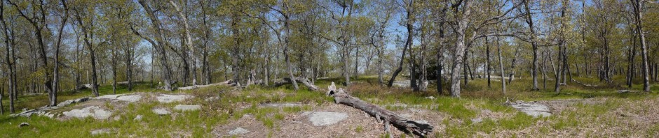
We continued on the Healy Pass Trail, now hiking northwest. Here is a stitched panorama from the Healy Pass Trail:

Stitched panorama from Healy Pass Trail, Banff National Park, Alberta, Canada

Stitched panorama from Healy Pass Trail

Another stitched panorama

Stitched panorama from Healy Pass Trail, Banff National Park, Alberta, Canada

Stitched panorama from Healy Pass Trail

The Healy Lakes were visible, but the smoke from the British Columbia fires continued to plague us:

Healy Lakes, Banff National Park, Alberta, Canada

Healy Lakes

Batya on the Healy Pass Trail:

Batya on the Healy Pass Trail, Banff National Park, Alberta, Canada

Batya on the Healy Pass Trail

We were not the faster hikers, and were always courteous to allow others to pass, whether they were going in the same direction as us, or in the opposite direction. As we reached the Healy Pass, we allowed one group of German men to pass us.

After about another mile, we finally reached a large boulder which presumably marked Healy Pass, but the German men who had passed us had planted themselves on the boulder. In fact, as we approached, they grabbed their backpacks and put them on the boulder next to themselves, blocking any possibility for us to sit down. We instead had to sit on the ground nearby, and to each lunch there.

View from Healy Pass, Banff National Park, Alberta, Canada

View from Healy Pass

I said that I imagined that the boulder marked the location of the Healy Pass. I was surprised that there was no explicit signage to confirm this. There also seemed to be two trails continuing on from this point, whereas the National Geographic map that I had brought only showed one: the Healy Pass Trail continuing to Egypt Lake. Those continuing on were most likely going to be spending at least one night camping. We were only interested in a day hike, so we continued no further.

We retraced our steps southeast on the Healy Pass Trail, and when we reached the junction, we turned south onto the Simpson Trail. At Healy Creek, I spotted a few small fish in the water, which I think are cuthroat trout (Oncorhynchus clarkii):

Cutthroat trout, Banff National Park, Alberta, Canada

Cutthroat trout

The Simpson Pass Trail offered a number of nice meadows, many with streams or ponds, and with mountains in the background:

Meadow on Simpson Pass Trail, Banff National Park, Alberta, Canada

Meadow on Simpson Pass Trail

Another:

Meadow on Simpson Pass Trail, Banff National Park, Alberta, Canada

Meadow on Simpson Pass Trail

Wildflowers:

Wildflowers, Banff National Park, Alberta, Canada

Wildflowers

Another meadow:

Meadow on Simpson Pass Trail, Banff National Park, Alberta, Canada

Meadow on Simpson Pass Trail

More scenery on the Simpson Pass Trail. This appeared to be a small lake, though it is not named on my map:

Lake off Simpson Pass Trail, Banff National Park, Alberta, Canada

Lake off Simpson Pass Trail

This clearing looked like an inviting place to take a nap, but we had miles to go:

A clearing off the Simpson Pass Trail, Banff National Park, Alberta, Canada

A clearing off the Simpson Pass Trail

The Simpson Pass Trail finally left the meadows and clearings behind, and for a while entered a more forested area:

Simpson Pass Trail, Banff National Park, Alberta, Canada

Simpson Pass Trail

After 2.3 km (1.4 miles), we reached the Simpson Pass. Unlike the Healy Pass, the Simpson Pass did not offer a spectacular view, but it marked the boundary between Banff and Mount Assiniboine Provincial Park, as well as the boundary between Alberta and British Columbia:

Border between Banff (in Alberta) and Mt. Assiniboine Provincial Park (in British Columbia), Banff National Park, Alberta, Canada

Border between Banff (in Alberta) and Mt. Assiniboine Provincial Park (in British Columbia)

Batya at the border between the provinces:

Batya at the border between Alberta and British Columbia, Banff National Park, Alberta, Canada

Batya at the border between Alberta and British Columbia

A chubby Columbian ground squirrel (Urocitellus columbianus) was welcoming visitors at the border:

Columbian ground squirrel, Banff National Park, Alberta, Canada

Columbian ground squirrel

We then turned north onto the Lower Simpson Pass Trail:

Lower Simpson Pass Trail, Banff National Park, Alberta, Canada

Lower Simpson Pass Trail

View from Lower Simpson Pass Trail:

View from Lower Simpson Pass Trail, Banff National Park, Alberta, Canada

View from Lower Simpson Pass Trail

Indian Paintbrush (Castilleja miniata):

Indian Paintbrush, Banff National Park, Alberta, Canada

Indian Paintbrush

After 1.3 km (0.8 miles), the Lower Simpson Pass Trail ended at the intersection with the Healy Pass Trail. Here Batya crosses a narrow footbridge at the junction:

Batya crossing bridge at junction of Healy Pass Trail and Lower Simpson Pass Trail, Banff National Park, Alberta, Canada

Batya crossing bridge at junction of Healy Pass Trail and Lower Simpson Pass Trail

We then retraced our steps northeast for 5.9 km (3.7 miles) on the Healy Pass Trail, until we arrived back at Sunshine Village. The hike was 19 km (11.8 miles), said to have an elevation gain of about 959 m (3,100′). I’m not sure the elevation gain is accurate, as while it was a challenging hike, the distance was more challenging than the elevation change.


Posted in Hikes, Vacations | Tagged | Leave a comment