Killington Peak, Rutland County, Vermont

Thursday: We drove south to hike at Killington Peak, which at 4,229′ elevation is the second highest mountain in Vermont.

Whereas Camel’s Hump–which we had attempted to hike earlier in the week–is undeveloped, Killington has a restaurant at the summit, with a gondola leading there. I would prefer to climb peaks that don’t have an easier way to the summit. Maybe that’s a bit of snobbery, as I think that the beautiful view should be restricted to those who choose to climb to the top as I am doing. Maybe I’m also influenced by a bit of laziness, thinking, “Why am I climbing this peak when I could instead drive or ride to the top?” In any event, I have enjoyed a number of hikes even though there were alternate ways to the peak, and we set out this day to climb Killington even though we knew that we would encounter non-hikers there.

Our hike primarily followed the Bucklin Trail, which began on Wheelerville Road, one of the dirt roads that I learned is fairly common in Vermont. Once again, my GPS took a circuitous route to the trailhead, but we got there.

11:44 a.m.: At the first the Bucklin Trail was perfectly level:

Bucklin Trail trailhead, Killington Peak, Rutland County, Vermont

Bucklin Trail trailhead

12:02 p.m.: However, it soon began gaining in elevation:

Bucklin Trail, Killington Peak, Rutland County, Vermont

Bucklin Trail

1:06 p.m.: A tree with a significant hollow provided a good prop:

Batya in front of hollow tree, Killington Peak, Rutland County, Vermont

Batya in front of hollow tree

The red elderberry, Sambucus racemosa, is poisonous when raw but supposedly edible when cooked. I think I’ll pass.

Red elderberry, Killington Peak, Rutland County, Vermont

Red elderberry

Red elderberry, Killington Peak, Rutland County, Vermont

Red elderberry

2:45 p.m.: The Bucklin Trail ended and we turned right (south) onto the Long Trail. After 0.2 miles, we reached the Cooper Lodge, erected by the Green Mountain Club.

Cooper Lodge, Killington Peak, Rutland County, Vermont

Cooper Lodge

From the Cooper Lodge, the Long Trail continued south, but we instead turned east onto the Killington Spur Trail, which led 0.2 miles to the summit of Killington Peak:

Signpost, Killington Peak, Rutland County, Vermont

Signpost

This 0.2 miles included some scrambling, though it wasn’t too taxing:

Killington Spur Trail, Killington Peak, Rutland County, Vermont

Killington Spur Trail

I remembered to look back and was rewarded with a nice view:

Scenery from the Killington Spur Trail, Killington Peak, Rutland County, Vermont

Scenery from the Killington Spur Trail

2:57 p.m.: Batya shows off her scrambling abilities:

Scrambling up the Killington Spur Trail, Killington Peak, Rutland County, Vermont

Scrambling up the Killington Spur Trail


Scrambling up the Killington Spur Trail, Killington Peak, Rutland County, Vermont

Scrambling up the Killington Spur Trail

3:02 p.m.: We reached the summit, and it provided a pretty view!

Panorama from the summit, Killington Peak, Rutland County, Vermont

Panorama from the summit

Another panorama from the summit:

Panorama from the summit, Killington Peak, Rutland County, Vermont

Panorama from the summit

3:18 p.m.: Batya took a photo with my cell phone, which allowed me to upload a report of our adventure to Facebook:

Charlie at the summit, Killington Peak, Rutland County, Vermont

Charlie at the summit

3:29 p.m.: A small trail led us off the bare rock and through a forested area, descending a bit:

Forested area between summit and gondola terminal, Killington Peak, Rutland County, Vermont

Forested area between summit and gondola terminal

We soon reached the gondola terminal and a restaurant, which included restrooms with running water.

3:54 p.m.: From outside the restaurant, I photographed another series of photographs that I was later able to turn into this panorama:

Panorama from restaurant, Killington Peak, Rutland County, Vermont

Panorama from restaurant

4:11 p.m.: We returned to the summit and then began our descent on the spur trail, retracing our steps:

Descending the Killington Spur Trail, Killington Peak, Rutland County, Vermont

Descending the Killington Spur Trail

I did not see Killington Peak listed as one of the alpine tundra regions of Vermont, but the summit itself was bare rock, and just below the summit were trees that were quite short in stature:

Pine, Killington Peak, Rutland County, Vermont

Pine

A last view of the surrounding countryside, as we began our descent:

Scenery from Killington Spur Trail, Killington Peak, Rutland County, Vermont

Scenery from Killington Spur Trail

The total hike was around 7 miles, with an elevation gain of 2,350′. For Killington Peak, it’s well worth skipping the gondola and instead hiking to the top on the Bucklin Trail.

Next: We climb Mount Mansfield, the highest point in Vermont!

Posted in Hikes, Vacations | Tagged | Leave a comment

Zip-lining in Jeffersonville & a Maple Farm in Montpelier, Vermont

Wednesday: As noted previously, I had intended to alternate hiking days with non-hiking days. Thus, Wednesday should have been a hiking day. However, the weather forecast indicated there might be late-afternoon thundershowers, and I thought that it would instead be prudent to go zip-lining, thinking that we could be finished with that before the late afternoon.

From the Internet, I had learned that ArborTrek has a facility in Jeffersonville, near Mt. Mansfield (and not far from Stowe), and decided that would be a good introduction. — We later learned that a more intense zip-line experience is available at Mt. Mansfield itself, with longer and faster rides, but we’re not sorry that we went to ArborTrek, as we did not have much zip-line experience. (It was Batya’s first time zip-lining, and while I have vague recollections of zip-lining as a child at summer camp, that was a long time ago.)

While my Panasonic DMC-GF1 (micro four-thirds) is not a large camera, it is also not a compact camera, and certainly not a rugged GoPro. I’m not sure that there would have been any convenient, safe and secure way to carry my camera with me while zip-lining. So I decided to leave it in my car, especially when I learned that our ArborTrek guides would take photos of us. It turned out that the photos they posted on their Facebook page were very reduced in resolution, and therefore in hindsight I wish that I had asked if I could take my camera with me.

The course included eight zip-lines of various lengths and speeds, two rope bridges, and two rappels. The photos are presented in no particular order. Here we are on one of the rope bridges:

Crossing a rope bridge, ArborTrek Canopy Adventures, Jeffersonville, Lamoille County, Vermont

Crossing a rope bridge

Here is a shot of me beginning a zip-line:

Charlie zip-lining, ArborTrek Canopy Adventures, Jeffersonville, Lamoille County, Vermont

Charlie zip-lining

And a shot of me coming to the end of another zip-line:

Charlie zip-lining, ArborTrek Canopy Adventures, Jeffersonville, Lamoille County, Vermont

Charlie zip-lining

Batya and I were placed in a group of seven, with two guides. The zip-lines typically ran from one tree to another, with platforms added to allow a small group to stand on the tree. One of our guides stopped on the zip-line about 10′ from this platform to take this group photo. The guides were well-trained and we felt very safe.

Zip-line platform, ArborTrek Canopy Adventures, Jeffersonville, Lamoille County, Vermont

Zip-line platform

I had rappelled before, while taking a rock-climbing class in Birmingham, Alabama. But that experience had not been extensive, and had been many years before, so this was a novelty for me.

Charlie rappelling, ArborTrek Canopy Adventures, Jeffersonville, Lamoille County, Vermont

Charlie rappelling

We had not taken rain gear with us, as it was somewhat warm, and as they warned us that once we were placed in the protective harness we would have to stick with whatever clothing we were wearing. We made the right choice, as it didn’t rain.

Another tourist thing to do in Vermont is to visit a maple syrup farm, so after zip-lining, we drove to Morse Farm Maple Sugarworks outside of Montpelier, the state capital. It was well outside of maple sugaring season, so there was no collection or processing happening. We were able to watch a video about the history of the farm and about sugaring, wander around a bit and visit the large gift store.

Old tractor, Morse Farm Maple Sugarworks, Montpelier, Washington County, Vermont

Old tractor

Batya poses next to an old wagon:

Old wagon, Morse Farm Maple Sugarworks, Montpelier, Washington County, Vermont

Old wagon

A short trail in the adjacent woods showed the use of a plastic tubing collection system that has somewhat modernized the collection of maple syrup over the old days, when workers would have to visit each tree separately to empty a bucket placed below a tap.

Maple syrup collection system, Morse Farm Maple Sugarworks, Montpelier, Washington County, Vermont

Maple syrup collection system

A view of the farm from the trail:

Morse Farm Maple Sugarworks, Montpelier, Washington County, Vermont

Morse Farm Maple Sugarworks

We then returned to our motel in Stowe.

Next: We hike Mt. Killington, second-tallest mountain in Vermont.

Posted in Vacations | Tagged | Leave a comment

Great Vermont Corn Maze / Moss Glen Falls / Ben & Jerry’s / Trapp Family Lodge

Tuesday: After yesterday’s hike, we planned for non-hike activities.

The first stop (after breakfast) was a local hardware store. One of my car’s brake lights was out, and while it was due for an annual inspection (in New York), I felt that both for safety reasons and also to avoid a ticket I should fix the light before the inspection. I didn’t have any tools with me, so I bought a small but expensive wrench and a replacement bulb. I cut my index finger while changing the bulb and was able to put the first aid kit in my backpack to good use, as I had a bandage in there.

We then drove to Danville in the eastern part of Vermont, to visit the Great Vermont Corn Maze, regarded as one of the best in America. (Days later, we discovered there was a corn maze right in Stowe, but I don’t regret our trip to Danville.) We entered the maze to find different paths, labeled Eeny, Meeny, Miney, and Moe, and finally sorted out which way to go.

Entrance, Great Vermont Corn Maze, Danville, Caledonia County, Vermont

Entrance to corn maze

The maze was on a hill, so in some places one could see over the stalks and see the beautiful surrounding countryside:

Panorama, Great Vermont Corn Maze, Danville, Caledonia County, Vermont

Panorama from corn maze

Elsewhere, it was flat, and as you can see, the stalks were tall enough:

Batya, Great Vermont Corn Maze, Danville, Caledonia County, Vermont

Batya

The corn maze included a few interesting features, including a boat! Before entering the maze, we had visited an exhibit (with aerial photos) that showed that the layout of the maze was changed every year. I think that the boat was a recurring feature.

Boat, Great Vermont Corn Maze, Danville, Caledonia County, Vermont

Boat

A broader panorama:

Panorama, Great Vermont Corn Maze, Danville, Caledonia County, Vermont

Panorama from corn maze

We had thought we would spend 2-3 hours there, finding our way through the maze (with or without help) and then we would visit a small petting zoo that the facility also had. I don’t know if I have any proficiency at escaping mazes. At first we were traveling in a pretty straight line, parallel to the northern border of the maze, and I wondered if we were going to solve it too quickly. I therefore decided to turn left and try a different direction, and in fact wanted to visit the boat. We never even got to the boat, though. We ended up heading back in the direction of the entrance, and passed under a bridge upon which one of the employees was keeping watch over where the visitors were.

He said that they were monitoring the weather, as they had a concern of thundershowers and especially worried about lightning. (The admission booth had included employees watching a radar image on a computer screen, so they were paying serious attention to the weather!) Therefore he said that he didn’t yet want to give us any hints, as we hadn’t been there so long, but that he wanted to let us know that we might need to evacuate. He also said that it was good to keep in mind that if someone passed a landmark and explored all the routes in that area without finding a way out, that he should remember it in the future. I think he was saying that the direction we were going was a dead end, and in fact we returned to him after a few minutes. I suppose the hint was helpful if one were going under the bridge again, but in most cases we didn’t see that many recognizable landmarks such as the bridge or the boat, but only saw corn. Thus, I don’t know if we would have been able to logically find our way out or not.

As it turned out, when we returned again to the bridge for a third time, the man said that they were going to evacuate the maze and see what happened with the weather. He told us how to enter the emergency exit lane, which we did. I should note that we did have raingear this day, having at least learned a bit from the disaster of the day before. We were able to make it back to the car before it began pouring though. We were sitting in the back seat of the car eating lunch when the employee from the bridge tapped on the window, said the weather was such that they were going to close for the day (even though it was only around 1:00 p.m.), and insisted on refunding our money, even though I tried to decline. While we had only been there 45 minutes, and hadn’t spent hours (or got to play with the animals at the petting zoo), I still felt badly that we had at least 45 minutes of fun without paying anything. So if you’re in Danville during growing season, visit this place!

Driving back to Stowe, we visited Moss Glen Falls, a 125′ waterfall that is one of the highest in the state. It was only a short walk from the parking lot at 44.4853, -72.6273, and included pretty surroundings:

Scenery, Moss Glen Falls, Stowe, Lamoille County, Vermont

Scenery

The waterfall itself was very nice, and we enjoyed the sound of the water for several minutes:

Moss Glen Falls, Stowe, Lamoille County, Vermont

Moss Glen Falls

On the walk out, we noticed a red-legged grasshopper (Melanoplus femurrubrum) laying eggs:

Red-legged grasshopper laying eggs, Moss Glen Falls, Stowe, Lamoille County, Vermont

Red-legged grasshopper laying eggs

It was around 3:30 p.m. by this point, so we drove to Waterbury, home of Vermont’s top tourist attraction, Ben & Jerry’s, where we battled through the crowds to sign up for the factory tour:

Exterior, Ben & Jerry's Factory, Waterbury, Washington County, Vermont

Exterior of Ben & Jerry’s Factory

While waiting, we admired the flavors presently available. I don’t think we’ve tasted a high percentage of them:

Ice cream selection, Ben & Jerry's Factory, Waterbury, Washington County, Vermont

Ice cream selection

Photography was not allowed on the tour (though as an engineer, I’m not sure what an industrial spy could gain from taking a photograph that he couldn’t discern just as easily with his eyes). The tour ended with a small but tasty sample of ice cream.

Afterward, we visited the “flavor graveyard,” which is perhaps sacrilegious, but interesting:

Flavor graveyard, Ben & Jerry's Factory, Waterbury, Washington County, Vermont

Flavor graveyard

Driving the short distance from Waterbury back to Stowe, we detoured a bit before returning to our hotel, to check out the famous Trapp Family Lodge, where the famous family of Sound of Music fame settled. The parking lot featured a nice view of a pasture with cows, with a background of trees and a low mountain range:

View from Trapp Family Lodge, Stowe, Lamoille County, Vermont

View from Trapp Family Lodge

The lodge itself was pleasant, and we visited the lobby and went downstairs to see an exhibit of photographs. Sadly, the gift store closed before we could visit:

Trapp Family Lodge, Stowe, Lamoille County, Vermont

Trapp Family Lodge

Next: Zip-lining!

Posted in Vacations | Tagged | 1 Comment

Camel’s Hump State Park, Chittenden & Washington Counties, Vermont

On Sunday, August 2, we drove up to Stowe, Vermont for a ten-day vacation (eight full days in Vermont and two travel days). We checked into the Stowe Motel & Snowdrift, with Stowe being a popular ski resort that is also pleasant to visit during other times of the year.

I had planned to combine four hikes with other activities, thinking we would alternate by hiking one day and doing something else the next day. As we haven’t been hiking much lately, Batya suggested that I find hikes that were moderate in nature. I agreed, but after some research decided that we should attempt to climb the five tallest peaks in Vermont. I don’t recall if I mentioned that to Batya, but the five tallest peaks in Vermont range from 4,000′ to 4,400′, and the prominence of each peak is significantly less than that, so it’s not as though we were climbing 14,000′ peaks in Colorado.

Monday: For the first hike, I suggested Camel’s Hump, the third-highest mountain in the state, with a peak at 4,083′. Camel’s Hump is named for its distinctive profile, and is perhaps the most famous mountain in the state, being depicted on the state quarter. Its peak is undeveloped, unlike the 1st and 2nd highest peaks, which can be reached by ski lift or gondola.

I learned or was reminded of a number of things from this hike. One is that Vermont has many dirt roads, and that a number of the entrances (or at least trailheads) to hikes in their parks, including important state parks, are reached via dirt roads. This was the case with Camel’s Hump State Park, as the trailhead I had selected (for the Monroe Trail) is reached via a few miles of dirt roads, namely the River Road (parallel to the Winooski River that is north of the park), Camel’s Hump Road, and Ridley Brook Road.

The next thing that I learned (or was reminded of) was that GPS devices don’t always make the best choices. Driving south from Stowe on Route 100, we passed over I-89 and entered Waterbury, with the GPS then directing us clockwise around a traffic circle, northwest on U.S. Route 2 for almost ten miles to Cochrane Road, south across the Winooski River, then southeast for six miles on Duxbury Rd and River Road until reaching the turnoff to Camel’s Hump Road. Instead of that lovely 16 mile drive, the GPS should have directed me to continue around the traffic circle, through a few blocks of Waterbury, across another the river via the Winooski Street Bridge, and then four miles northwest on River Road to Camel’s Hump Road. So the GPS took us 12 miles out of the way.

Anyway, we finally arrived to the Lower Monroe parking lot, at around 1400′ elevation, and began our hike. The trailhead included the typical selection of maps and other data:

Trailhead kiosk, Camel's Hump State Park, Chittenden & Washington Counties, Vermont

Trailhead kiosk

A sign-in box included a sign that a bear had been frequenting the area. We didn’t merit seeing the bear on our hike, though:

Bear warning sign, Camel's Hump State Park, Chittenden & Washington Counties, Vermont

Bear warning sign

While the hike actually began below the shoulder of Camel’s Hump, the Monroe Trail began climbing in elevation immediately. It also started out as a warm day, so I was moving slowly. We also had a late start, whereas my preference would always be to start early.

Monroe Trail, Camel's Hump State Park, Chittenden & Washington Counties, Vermont

Monroe Trail

A small bridge on the Monroe Trail:

Small bridge on the Monroe Trail, Camel's Hump State Park, Chittenden & Washington Counties, Vermont

Small bridge on the Monroe Trail

Camel’s Hump is part of the Green Mountain Range, and the verdant nature of the trail explains how the mountains got the name:

Greenery, Camel's Hump State Park, Chittenden & Washington Counties, Vermont

Greenery

The trail crossed a few small streams:

Rocks in streambed, Camel's Hump State Park, Chittenden & Washington Counties, Vermont

Rocks in Streambed

Clouds began to roll overhead, and I appreciated the accompanying drop in temperature. The nature of the trail changed, as it had initially been dirt, whereas we began encountering many areas with flat rock, as well as rocks that required scrambling:

Batya admires a flat rock, Camel's Hump State Park, Chittenden & Washington Counties, Vermont

Batya admires a flat rock

Unfortunately, before we could reach the peak, the clouds grew darker, and finally it started pouring. Not only pouring, but we were also pelted with hail. Another thing that I learned (or was reminded of) was that when the forecast calls for rain, it is prudent to bring rain gear. Unfortunately, our rain gear was back at the hotel.

We moved a few feet from the trail and tried huddling under tree cover, which didn’t help much. I remembered that I had an emergency mylar blanket in my backpack, and pulled that out. It turns out that it takes a while to unfold those. It also turns out that they aren’t quite big enough for two people. Somehow, we managed to huddle under that for a few minutes, until the rain and hail subsided.

At this point, we were soaked and not very comfortable. We also weren’t sure whether the storm was over and was passing, or whether it would be continuing. We were conscious of the fact that it might not be prudent to continue to the peak of a mountain if there was an elevated risk of lightning. Therefore, we reluctantly decided to abandon this hike.

The Monroe Trail is only supposed to be 3.1 miles, and the Department of Forests map calls it moderately difficult. I’m not sure how high we climbed, but I would estimate about 2 miles, quitting about 1 mile below the top.

We began moving downhill, now moving much more cautiously over the flat stone of the trail, as it was now wet and perhaps slippery in parts. Batya kept the mylar blanket wrapped around herself, either for warmth or as a fashion statement:

Hiking slowly on wet rock, Camel's Hump State Park, Chittenden & Washington Counties, Vermont

Hiking slowly on wet rock

Back at the trailhead, we briefly stopped at a memorial to airman who were killed and injured when their B-24 Liberator crashed on the mountain in 1944. My photo didn’t turn out well.

A stranger memorial was a graveyard for the namesake of the Monroe Trail, Will Monroe, his sister Catherine, and quite a few of Will’s dogs — there were a few other tombstones of dogs that weren’t in this photo:

Tombstones, Camel's Hump State Park, Chittenden & Washington Counties, Vermont

Tombstones

The first thing I did after returning to the hotel room was to put my raingear in my backpack. It was a nice outing, but I was disappointed that we hadn’t made it to the peak, especially since I had set a goal of climbing the highest five peaks in the Vermont.

Next: We get lost in a corn maze

Posted in Hikes, Vacations | Tagged | Leave a comment

Ramapo Mountain State Forest, Bergen & Passaic Counties, New Jersey

We visited Ramapo Mountain State Forest, a 4200 acre forest primarily in Bergen County, New Jersey, with a small percentage of the land in Passaic County. While this was my first visit, the forest is quite close (in distance and in character) to Ringwood State Park, where I hiked previously.

We parked on Skyline Drive, which bisects the forest, and began hiking into the northern portion on the orange-blazed Schuber trail.

Ramapo Mountain State Forest, Bergen & Passaic Counties, New Jersey

Ramapo Mountain State Forest

There are fungus among us:

Fungus, Ramapo Mountain State Forest, Bergen & Passaic Counties, New Jersey

Fungus

The trails we hiked were not wholly contained within the forest, but also ran through a significant tract of Bergen County land, which included Camp Glen Gray, 750 acres developed as a Boy Scout camp in 1917 and sold to Bergen County in 2002. The camp includes a small lake, Lake Vreeland, and a number of fine cabins, such as this one:

Cabin at Camp Glen Gray, Bergen County, New Jersey

Cabin at Camp Glen Gray

While many of the trails were blazed by the New York-New Jersey Trail Conference, we saw other blazes, including one I had not seen before, representing Bergen County:

Bergen County blaze, New Jersey

Bergen County blaze

We turned onto the green leaf-blazed Old Guard trail, and continued hiking north. This young deer–barely visible through the trees–did not get the word that we are harmless to her kind, and she fled from us:

Deer fleeing through the trees, Bergen County, New Jersey

Deer fleeing through the trees

The blaze of the Old Guard trail:

Old Guard trail blaze, Bergen County, New Jersey

Old Guard trail blaze

Slender trees with texture:

Slender trees with texture, Bergen County, New Jersey

Slender trees with texture

Green moss:

Green moss, Bergen County, New Jersey

Green moss

We turned onto the red-blazed Cannonball trail:

Cannonball trail blaze, Bergen County, New Jersey

Cannonball blaze

We turned west on a green-blazed crossover trail, gaining a bit in elevation.

Perhaps this concrete structure was a water settling tank:

Water settling tank, Bergen County, New Jersey

Water settling tank

We soon reaching the yellow-blazed Hoeferlin Memorial trail, which afforded a view from the Erskine Lookout:

View from the Erskine Lookout, Ramapo Mountain State Forest, Bergen & Passaic Counties, New Jersey

View from the Erskine Lookout

We turned south on the yellow trail, then upon reaching an intersection with the green leaf-blazed Old Guard trail, turned west. This soon brought us back into the Ramapo Mountain State Forest, and to another lookout:

Scenic view, Ramapo Mountain State Forest, Bergen & Passaic Counties, New Jersey

Scenic view

Batya was breaking in a new pair of boots that day:

Batya, Ramapo Mountain State Forest, Bergen & Passaic Counties, New Jersey

Batya

I spotted two wrecked vehicles about 50 yards to the east of the trail, and we detoured to investigate. My map didn’t show any old woods roads in the immediate vicinity, so it’s somewhat of a mystery how the vehicles got there. Here’s a Willys Jeep Station Wagon that has seen much better days:

Willys Jeep Station Wagon, Ramapo Mountain State Forest, Bergen & Passaic Counties, New Jersey

Willys Jeep Station Wagon

A front view of the Willys. Perhaps someone will email me with the model year. There are no horizontal crossbars on the grill, but there seem to be brackets behind the grill, so perhaps there had once been such bars?

Willys Jeep Station Wagon, Ramapo Mountain State Forest, Bergen & Passaic Counties, New Jersey

Willys Jeep Station Wagon

Here’s the second vehicle. We have what appears to be an upside down frame and an upright body, which may or may not belong together. Was it also a Willys? The bumper looks the same:

Abandoned vehicle, Ramapo Mountain State Forest, Bergen & Passaic Counties, New Jersey

Abandoned vehicle

The map indicated a short detour of about 0.1 or 0.2 miles to the west to a scenic view from Matapan Rock, and I’m glad we took the few minutes to walk over there:

Scenic view from Matapan Rock, Ramapo Mountain State Forest, Bergen & Passaic Counties, New Jersey

Scenic view from Matapan Rock

We returned to the trail and continued to the end. The trail ended at Skyline Drive about 0.7 miles from where we had parked. According to the map, the trail was supposed to continue to the end, but we could not tell where it continued. Instead, there was a very large clearing filled with mounds of tree bark, manure, etc. Not having much choice, we exited the woods and carefully walked beside Skyline Drive to return to the car.

Posted in Hikes | Tagged , , | Leave a comment

Devil’s Den Preserve, Fairfield County, Connecticut

This was my second trip to Devil’s Den, so for a better write-up of the park and its history, see my post for the first trip.

We began the hike along the Pent Trail and Saugatuck Trail. I didn’t take detailed notes of where I took each photo, and for the most part they are not so distinctive, anyway.

Here I found a few large rocks with some nice texture:

Rocks, Devil's Den Preserve, Fairfield County, Connecticut

Rocks

The preserve isn’t completely flat, but at most one would say that it has a few hills.

Devil's Den Preserve, Fairfield County, Connecticut

Devil’s Den Preserve

A low stone wall probably attests to farming activity two centuries ago:

Stone wall, Devil's Den Preserve, Fairfield County, Connecticut

Stone wall

There are a number of streams in the park:

Stream, Devil's Den Preserve, Fairfield County, Connecticut

Stream

I didn’t realize it at the time I shot this photograph, but the new leaf at upper left is boring a hole through a dead leaf:

New leaf boring hole through dead leaf, Devil's Den Preserve, Fairfield County, Connecticut

New Leaf Boring Hole through Dead Leaf

Some areas were verdant while others seemed to be slow in welcoming the Spring:

Contrast between brown and green foliage, Devil's Den Preserve, Fairfield County, Connecticut

Contrast between Brown and Green Foliage

Pond:

Pond, Devil's Den Preserve, Fairfield County, Connecticut

Pond

I had intended to take the Ambler Trail clockwise through Ambler Gorge and to Den Trail, but missed the turn onto the Ambler Trail. Here’s another stone wall:

Stone wall, Devil's Den Preserve, Fairfield County, Connecticut

Stone wall

We still got to see Ambler Gorge, but just approached it by going counterclockwise on Ambler Trail from Den Trail:

Ambler Gorge, Devil's Den Preserve, Fairfield County, Connecticut

Ambler Gorge

There were a couple of vistas from the Ambler Trail, looking toward the northwest. Here is one:

View from Ambler Trail Vista, Devil's Den Preserve, Fairfield County, Connecticut

View from Ambler Trail Vista

We then turned onto the Donahue Trail.

My friends at GardenWeb (now Houzz.com) tell me that these beautiful pleated leaves belong to American hornbeam (Carpinus caroliniana).

Hornbeam Leaves, Devil's Den Preserve, Fairfield County, Connecticut

Hornbeam leaves

This fallen tree would be spooky at night:

Fallen tree, Devil's Den Preserve, Fairfield County, Connecticut

Fallen tree

We returned to the Den Trail and then headed back to the car. (We had a late start for this hike, and also I had clumsily jammed a toe that morning in our apartment, so I was only up for hiking a few miles.) Here’s a closing view:

Devil's Den Preserve, Fairfield County, Connecticut

Devil’s Den Preserve

Devil’s Den doesn’t offer spectacular vistas or steep climbs, but is still a beautiful place to visit.

Posted in Hikes | Tagged | Leave a comment

Great Swamp National Wildlife Refuge, Morris County, New Jersey

On the first Sunday of Spring, we visited Great Swamp National Wildlife Refuge, which was designated as a national wildlife refuge in 1960, to protect it from the Port Authority’s plan to turn the land into an airport.

We first visited the Wildlife Observation Center on Long Hill Road, an area that featured a boardwalk and a bird blind. While most of the ground was clear, we did notice that there were a few spots still covered by snow or ice:

Icy ground, Great Swamp National Wildlife Refuge, Morris County, New Jersey

Icy ground

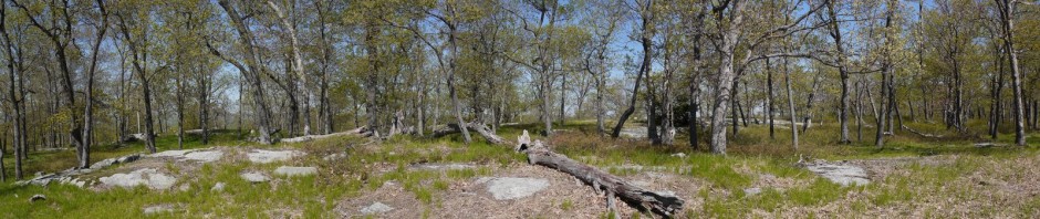
A panoramic shot of a grassy field at the refuge:

Panorama of grassy field, Great Swamp National Wildlife Refuge, Morris County, New Jersey

Panorama of grassy field

We followed the path about 1/2 mile to the “Friends Blind,” a large blind that had room enough for a dozen or more people, with many slits for observing the birds in the fields outside the blind. A large bird feeder was nearby, and a number of birds were flitting in, grabbing a seed, and immediately flying away. One was a hairy woodpecker, though I didn’t get a photograph. This tufted titmouse was more cooperative:

Tufted titmouse, Great Swamp National Wildlife Refuge, Morris County, New Jersey

Tufted titmouse

After a few minutes inside the blind, we left and walked along the boardwalk, passing other snowy spots:

Snowy terrain beside boardwalk, Great Swamp National Wildlife Refuge, Morris County, New Jersey

Snowy terrain beside boardwalk

We then returned to the car and drove north on Long Hill Rd. to the blue-blazed trail. This trail runs 2.4 miles from the north central of the park to the northeast corner of the park. There’s also a 1.6 mile orange trail from the south central of the park that ends on the eastern border of the park, but the blue trail and orange trails do not meet.

We ate lunch, and then began hiking on the trail. While the terrain was very flat, it was slow going, because the ground was snowy in places, and muddy in other places. In places, it seemed that the ground itself was thawing from having been frozen, and once or twice I stepped on what seemed to be solid ground, only to have it collapse an inch or so below me.

Blue trail, Great Swamp National Wildlife Refuge, Morris County, New Jersey

Blue trail

We passed what appeared to be a very straight ditch about two feet deep, at the bottom of which ran a shallow stream. Batya thought that it was man-made, and I was tempted to agree, as it would be unusual to otherwise find such a straight ditch. Perhaps it had been an ancient irrigation ditch.

In addition to the snowy patches, muddy patches, ancient irrigation ditches, there were also a few streams that we had to cross. Here Batya demonstrates crossing a stream by balancing on a slender log:

Batya crossing narrow stream, Great Swamp National Wildlife Refuge, Morris County, New Jersey

Batya crossing narrow stream

The sun casts long shadows on the snow:

Shadows on the snow, Great Swamp National Wildlife Refuge, Morris County, New Jersey

Shadows on the snow

It was a little cool, but not very uncomfortable. We were dressed warmly enough. It was a typically early Spring day in New York, with winter on the way out but still traces of it lingering.

Blue sky, Great Swamp National Wildlife Refuge, Morris County, New Jersey

Blue sky

We continued struggling with water/snow/ice on the trail. On one hand, you can say, “The park’s title has the word ‘swamp’ in it, so what did you expect?” On the other hand, I would think that they would design trails so that they could be used in every season. We finally arrived at one spot where it seemed that it would be very challenging to avoid getting our feet wet.

Wet portion of the blue trail, Great Swamp National Wildlife Refuge, Morris County, New Jersey

Wet portion of the blue trail

We had passed a turnoff onto a yellow trail, which provided a 0.9 mile “long cut” around part of the blue trail. I suggested that we go back and try the yellow trail. We did so, and it was somewhat drier. The trail passed one spot that was very flooded, and we surprised a number of ducks that flew away without me getting any photos. The trail itself was dry, though.

Wetlands, Great Swamp National Wildlife Refuge, Morris County, New Jersey

Wetlands

I spotted a raccoon foraging for food on the far side of a stream, and switched to my telephoto lens, taking a number of shots that weren’t catching him at a good angle. We tried moving closer, and he heard us, fleeing to a nearby tree for protection. I finally caught a shot of his face, peeking out at us. After a while, he decided we were not a threat, and walked off:

Raccoon, Great Swamp National Wildlife Refuge, Morris County, New Jersey

Raccoon

Immediately after meeting the raccoon, the yellow trail rejoined the blue trail at a crooked bridge over the aforementioned stream. We crossed the bridge, continuing on the blue trail:

Crooked bridge, Great Swamp National Wildlife Refuge, Morris County, New Jersey

Crooked bridge

We passed one spot that was very snowy, and wondered what strange combination of factors had allowed the snow there to last so long:

Snowy spot on the blue trail, Great Swamp National Wildlife Refuge, Morris County, New Jersey

Snowy spot on the blue trail

I like the composition of the following photo: the red branches, the blue sky and blue reflection in the water, the sand-colored grass:

Colorful wetlands, Great Swamp National Wildlife Refuge, Morris County, New Jersey

Colorful wetlands

The above photo is one of four that I took at that location while scanning, so I also have a panoramic shot there. I like both the single shot above and the panoramic combination below:

Panorama of wetlands, Great Swamp National Wildlife Refuge, Morris County, New Jersey

Panorama of wetlands

While the blue trail and orange trail don’t meet, I had thought that perhaps we could cover both by walking along the roads that connect them, forming a clockwise loop back to our car. (Blue trail, Woodland Rd., Meyersville Rd., orange trail, Long Hill Rd.) Unfortunately, we had a late start on our hike, and we had experienced slow going because of the wet/snowy/icy conditions. Therefore, as we approached the end of the blue trail, we realized that we would be unable to complete that loop. Therefore, we had a choice of either retracing our path on the blue trail, or else taking a shorter counterclockwise loop back to the car. (Blue trail, Woodland Rd.,, Miller Rd., Pleasantville Rd., Long Hill Rd.) Based on the slow going on the blue trail, we decided that it would be faster to finish the hike by taking the roads back to the car.

However, the blue trail wasn’t ready to let us go so easily. Just as we reached the end of the blue trail, we realized that there was essentially a flooded wetland to the right of the trail, another to the left of the trail, and about a foot of water covering the trail itself. While I contemplated whether there was any way around, or if it was better to retrace our path on the blue trail rather than doing the counterclockwise loop, Batya started wading through the flooded trail. Her boots had previously lost their water-proof quality, and she decided that since her feet were already wet, it didn’t matter to wade through the foot-deep water. At that point I had no choice but to follow. While my boots are waterproof, that doesn’t help when the water is deep enough so that the entire boot is submerged, with water pouring in over the top of the boot.

I quickly waded through the foot-deep water, and we soon afterward reached the parking lot at the eastern end of the blue trail. At that point I took off my boots and socks, drained the water out of the boots, and put them back on (without the socks).

We followed Woodland Rd. about 0.3 miles, walking past the Windmill Farm:

Windmill Farm, Morris County, New Jersey

Windmill Farm

We then turned left onto Miller Rd. for another 0.3 miles, and then left once again onto Pleasantville Rd., where we walked for about 1.5 miles. There were nice homes and small farms on all three of those roads. Pleasantville Rd. bordered the Wildlife Refuge for a while, and in one spot I saw a redtail hawk watching a field, no doubt looking for a tender rabbit:

Redtail hawk, Great Swamp National Wildlife Refuge, Morris County, New Jersey

Redtail hawk

Then we turned left onto Long Hill Rd., and in 0.2 miles were back at the car.

Including the walk at the Wildlife Observation Center, the blue and yellow trails, and the roads, we probably had a hike of about 6.5 miles.

Posted in Hikes | Tagged , | Leave a comment

Connetquot River State Park Preserve, Suffolk County, New York

We finally had a nice-enough day that we felt like going outdoors, though we still didn’t feel like battling Manhattan traffic. Therefore, we went east to Long Island, to Connetquot River State Park Preserve, which I had visited on October 30, 2011.

It had snowed the previous Sunday, and also on Tuesday and Thursday. Luckily, the temperature had warmed up enough that the roads were clear, but there was still plenty of snow on the ground in the park.

On the drive there we saw large numbers of Canadian geese, and we saw a few in the park as well:

Canadian geese, Connetquot River State Park Preserve, Suffolk County, New York

Canadian geese

The lady at the entrance booth took our $8 entry fee and then told us that the park was only open another 4 hours, until 4:00 p.m. New York state parks are completely inconsistent: some have no entrance/parking fee while others have steep fees; some are open until dusk while others close at 4:00 p.m., etc. We were also told that the trails were not plowed, which was not entirely true.

We began hiking on the unplowed green trail, with our boots sinking into the snow. I lamented the fact that I have not yet purchased snowshoes. Every year I think that would be a good idea to do for the future. There were signs that others had been there with snowshoes, and we also saw people with cross-country skis. There were plenty of boot tracks besides ours, as well. Unlike my previous visit, I did not see any horses on this outing . . . there were no Budweiser Clydesdale horse commercials being filmed.

Snowy green trail, Connetquot River State Park Preserve, Suffolk County, New York

Snowy green trail

It was not that cold, and we were well-dressed and comfortable enough. Batya was happy to get out into the great outdoors:

Batya, Connetquot River State Park Preserve, Suffolk County, New York

Batya at Connetquot River State Park Preserve

For a few minutes we had a sunny blue sky, and stopped for lunch. I took off my coat and used it as a seat, while Batya ate standing. However, the wind began picking up and the sky began clouding up once again. Lunch over, I dusted the snow off my coat and put it back on.

Cloudy sky, Connetquot River State Park Preserve, Suffolk County, New York

Cloudy sky

Between the snow and the late start, we did not anticipate hiking the entire length of the park. Instead, we walked north only about halfway, to Bunces Bridge.

Bunces Bridge, Connetquot River State Park Preserve, Suffolk County, New York

Bunces Bridge

The bridge offered a nice view of the Connetquot River:

Connetquot River from Bunces Bridge, Connetquot River State Park Preserve, Suffolk County, New York

Connetquot River from Bunces Bridge

At this point, we turned south onto the blue trail. Whereas we had taken the green trail north to the west of the river, we were following the blue trail south to the east of the river. Here we discovered that some of the trails had been plowed, at least to a certain extent, which made for easier hiking than on the deeper snow on the green trail. Incidentally, I remember from my first visit to this park that the soil is sandy, especially in some places, and that while the park is very flat, the sand can make a long hike longer in places, with feet slipping in the sand. Thus, the snow may have slowed us down a bit, but bare ground in this park also makes for slower travel in some places.

Blue trail, Connetquot River State Park Preserve, Suffolk County, New York

Blue trail

At one point Batya spotted a deer and called it to my attention as it bounded away. I saw the tail end of it, but did not get a photograph. On my previous trip to the park, I had seen large numbers of deer, but they were being shy on this day.

The blue trail returned to the main pond at the southern end of the park, which made for a couple of nice panoramas:

Main pond, Connetquot River State Park Preserve, Suffolk County, New York

Main pond

Main pond, Connetquot River State Park Preserve, Suffolk County, New York

Main pond

It was only around 3:00 p.m. when we returned to the Main Pond. Not wanting to leave an hour before closing, we hiked north once again in the direction of the fisheries, returning to the car and driving away right at 4:00 p.m. I estimate that we hiked 4 or 5 miles over the snowy, flat terrain.

Posted in Hikes | Tagged | Leave a comment

Caumsett State Historic Park Preserve, Suffolk County, New York

We visited Caumsett State Historic Park Preserve, which is located on Lloyd Neck, a peninsula into Long Island Sound. The following two posters present a history of the property, which became a state park in 1961.

Poster at Caumsett State Historic Park Preserve, Suffolk County, New York

Poster at Caumsett State Historic Park Preserve

.

Poster at Caumsett State Historic Park Preserve, Suffolk County, New York

Poster at Caumsett State Historic Park Preserve

The property included a number of historic buildings, including a dairy farm:

Gurnsey Dairy Farm at Caumsett State Historic Park Preserve, Suffolk County, New York

Gurnsey Dairy Farm

The polo stable was designed by John Russell Pope in the manner of Christopher Wren. The exterior was restored in 2010, and continues to provide boarding services:

Polo Stable at Caumsett State Historic Park Preserve, Suffolk County, New York

Polo stable

While there are allegedly miles of trails at the park, in four separate loops, we did not find them to be marked in any way, and with the snow cover it was all but impossible to find the trails. We therefore walked along the roads for the most part.

We came to the main house. None of the buildings appeared to be open to visitors.

Main House at Caumsett State Historic Park Preserve, Suffolk County, New York

Main House

The map indicated that there was a trail down to the shore to the left of the main house, and we did follow a few others who were walking in that direction. A hill led down to a fresh pond, with Long Island Sound behind it:

Fresh Pond and Long Island Sound, at Caumsett State Historic Park Preserve, Suffolk County, New York

Fresh pond and Long Island Sound

Batya and I carefully descended the snowy slope:

Hiking down toward the Fresh Pond, Caumsett State Historic Park Preserve, Suffolk County, New York

Hiking down toward the Fresh Pond

We continued descending the hill, circling around the fresh pond and coming to the shore of Long Island Sound, where I snapped a few shots that I stitched together into a panorama:

Shore of Long Island Sound, Caumsett State Historic Park Preserve, Suffolk County, New York

Shore of Long Island Sound

In theory we could have followed the shore to the left (west) onto a narrow point, but it was a cold and windy day, and before long we left the shore, climbing again into the trees, which provided some shelter from the wind. We found a giant tree stump (cut by a saw, the tree missing), and used that as a table for our lunches, eating standing:

Snowy day in the woods, Caumsett State Historic Park Preserve, Suffolk County, New York

Snowy day in the woods

So we had at least a tiny hike, but this is not a park where one should expect to be able to “lose himself in the woods.” Long Island is obviously relatively flat, and much of this park has been cleared for buildings, roads, pasture, and stables. That leaves some wooded areas, but it’s no Harriman.

We returned to the road and walked down to the southern part of the park, which has incorporated the Henry Lloyd Manor House, built in 1711. I hadn’t realized that I was standing at the rear of the house, or else I would have circled around to have photographed the front.

Henry Lloyd Manor House, Caumsett State Historic Park Preserve, Suffolk County, New York

Henry Lloyd Manor House, Caumsett State Historic Park Preserve

We then returned to the parking lot, passing the dairy once again, where I photographed a few agricultural relics:

Agricultural relics at the dairy farm, Caumsett State Historic Park Preserve, Suffolk County, New York

Agricultural relics at the dairy farm

It was nice to get out and walk in the snow.

Posted in Hikes | Tagged | Leave a comment

Shore Parkway Greenway (eastern section), Brooklyn to Queens, Kings County & Queens County, New York

We previously hiked the western section of the Shore Parkway Greenway and (what we thought) was half of the eastern section, from Brigham Street to the Canarsie Pier.

We decided to finish the remaining section of the Shore Parkway Greenway, from the Canarsie Pier to 84th Street in Queens. As it turned out, the remaining portion was a lesser distance than the Brigham Street-Canarsie Pier walk, and it was far inferior in terms of the view. In addition to having traffic on the inland side of us (which all of the Shore Parkway Greenway has), we very rarely had any view of water on the “shore” side. Instead, this section walked past two abandoned landfills, which presented themselves as high mounds of dirt with only a thin layer of grass over them, separated from the Greenway by chain link fencing.

These were the 110-acre Pennsylvania Avenue Landfill and the 297-acre Fountain Avenue Landfill, which in 1956 were opened by the NYC Department of Sanitation for receipt of residential and commercial waste. Both sites were deeded to the National Park Service in 1974 as part of the Gateway National Recreation Area, though the Pennsylvania Avenue Landfill continued receiving waste until 1980, and the Fountain Avenue Landfill continued receiving waste until 1983. The landfills were capped and have grass, and allegedly there were shrubs and trees planted, though I saw little sign of those. Every few years the City announces plans to rehabilitate the landfills (which is interesting if they are Federal property), but in any event nothing significant is ever accomplished.

Anyway, I will not sully my photoblog with photos of an abandoned landfill, and I only took a few photos that day that were worth posting.

Vegetation along the Shore Park Greenway

Vegetation along the Shore Park Greenway


Vegetation along the Shore Park Greenway

Vegetation along the Shore Park Greenway

New England Aster (Symphyotrichum novae-angliae):

New England Aster (Symphyotrichum novae-angliae)

New England Aster (Symphyotrichum novae-angliae)

Virginia Creeper (Parthenocissus quinguefolia):

Virginia Creeper (Parthenocissus quinguefolia)

Virginia Creeper (Parthenocissus quinguefolia)

At one point we had a view of the World Trade Center:

World Trade Center from the Shore Park Greenway

World Trade Center from the Shore Park Greenway

At another point we actually did have a brief view of Rockaway Inlet:

Rockaway Inlet from the Shore Park Greenway

Rockaway Inlet from the Shore Park Greenway

After our short and disappointing walk to Queens, we returned the same way to the Canarsie Pier to end the walk.

The sections of the Shore Park Greenway that I previously investigated were the better portions. There is little to commend this third portion.

Posted in Hikes | Tagged | Leave a comment