After weeks of temperatures in the 80s and 90s, I took off from work to benefit from a day with temperatures in the low 70s. I drove to the parking lot of Fort Montgomery State Historic Site, where I began my hike. I did not investigate the historic site, and do not believe there is much to see there, other than earthen redoubts. A companion fort, Fort Clinton, was built a short distance to the south, across Popolopen Gorge, but was later demolished during construction of U.S. Route 9W and the Bear Mountain Bridge.
9:15 a.m.: I began hiking west on the 1777W and 1779 Trails, which quickly passed below the Route 9W bridge over Popolopen Gorge. On October 6, 1777, Sir Henry Clinton commanded troops that attacked Forts Clinton and Montgomery. (The American Fort Clinton was named for its commander, General George Clinton, while his brother, General James Clinton, commanded Fort Montgomery.) The British troops divided at Doodletown, with half traveling west to Fort Montgomery, and half traveling east to Fort Clinton. The 1777W and 1777E Trails commemorate those western and eastern routes from Doodletown to the forts, with the trails roughly tracking the routes taken by the British troops. Don’t ask me why we are commemorating a British attack on American soil–I don’t know the answer to that.
As far as the 1779 Trail, that commemorates the route followed by American troops, led by General Anthony Wayne, on July 15, 1779, on their way to attack the British fort at Stony Point.
9:34 a.m.: After hiking for a few minutes and 0.5 mile on level ground at 100′ elevation, I approached an occasionally wet area near Brooks Lake.

1777W and 1779 trails
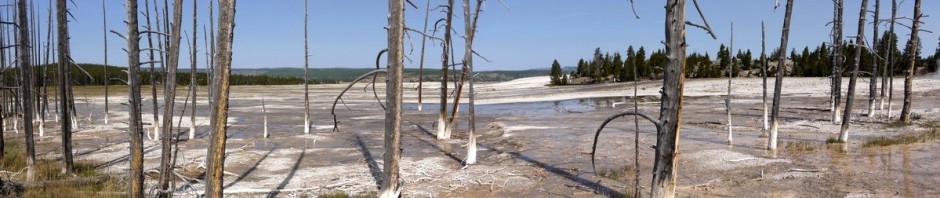
I then detoured onto the Brooks Lake trail, circling clockwise 0.9 miles around Brooks Lake:

Brooks Lake

Brooks Lake
There sure were a lot of Canadian geese:

Canadian geese preening
10:24 a.m.: After circling the lake, I continued to the west on the 1777W/1779 Trails. Here I found an isolated boulder:

Glacial erratic
This was interesting: three trees growing together had grown around a rock a foot off the ground, and a second rock that was two feet off the ground was already well wedged in between the trees.

Triplet trees absorbing rocks
The trails climbed to about 400′ in elevation, running parallel to Popolopen Creek, which I could hear and occasionally hear, 200′ below me. Unfortunately, I could also hear vehicle traffic from the Palisades, which was on the far side of the creek. The trails also crossed a number of roads, including both paved and dirt roads.
After another 0.8 miles, I reached the base of Popolopen Torne, where there was another road with a small parking area. This hill is adjacent to the U.S. Military Academy at West Point. The 1777W and 1779 Trails were joined here by the end of the Timp-Torne Trail. I had visited The Timp on a previous hike, and today was my day to visit The Torne. The Timp-Torne Trail climbed up one side and down the other. Not knowing any better, I took this trail counterclockwise, climbing up the east side and then down the west side. It turned out that the east path was an easy climb, but west path included scrambles on steeply angled pieces of flat rock. As it was a dry day and safe enough, I did the downward scramble, but if I had known what to expect, I would have scrambled up the west side and then walked down the east side. Of course, if it had been wet, I would have only ascended and descended on the east side, as the flat rock would be very slick when wet.
11:09 a.m.: Climbing the east side, I only remember a bit of a view, which presented itself shortly before reaching the top:

View climbing Popolopen Torne
11:11 a.m.: However, I suddenly reached the top of The Torne, at around 700′ elevation, where I was rewarded with a beautiful view of the Hudson River, Bear Mountain Bridge, and Anthony’s Nose:

Bear Mountain Bridge from Popolopen Torne
The Torne also provided views toward the west:

View from Popolopen Torne
Another view of the Hudson:

Bear Mountain Bridge from Popolopen Torne
Here is a fused High Dynamic Range (HDR) image of Anthony’s Nose, the Hudson River, the Bear Mountain Bridge (and the much smaller bridge where I had begun my hike, where Highway 9W crosses the Popolopen Gorge):

Bear Mountain Bridge from Popolopen Torne
The cadets at West Point maintain a memorial to our armed forces atop Popolopen Torne:

Memorial on Popolopen Torne
I didn’t get many photos of the descent down the flat rock on the west side:

Descending Popolopen Torne
One hiking up the west side would see a number of scenic views on the way, unlike hiking up the east side, where my experience was that I didn’t have a scenic view until I reached the top.
12:11 p.m.: The hike up and down Popolopen Torne added another 1.0 mile to my day’s total. Rejoining the 1777W/1779 Trails back around 400′ of elevation, I crossed Popolopen Creek on this small footbridge:

Bridge across Popolopen Creek
A view of the creek from the bridge:

Popolopen Creek
I noticed red raspberries in a few places:

Raspberries
Most of my hiking this day was within Bear Mountain State Park, though the Fort Montgomery State Historic Site may be its own entity, and parts of Popolopen Torne are owned by Scenic Hudson. Following along an old woods road, I left Bear Mountain State Park and entered Harriman State Park. I was again bothered by traffic noise, as now the trail was following a woods road below the Palisades, and close enough that in one place I passed a wheel cover and some other automotive debris. Popolopen Creek had veered off to enter West Point, but the woods road now followed another creek, drainage from Queensboro Lake.
After 1.2 miles, I reached an intersection where the 1779 trail turned into the woods toward the west, while the 1777W and Timp-Torne Trails turned into the woods toward the southeast. I took the 1777W Trail.
There was also a sign on the old woods road at that point that people should be cautious, as a pistol range was coming up. For 0.2 miles, the 1777W Trail detoured slightly away from the woods road, though once past the pistol range it returned to the woods road. I noticed three workers (sitting enjoying lunch or a break) who were at the range, where it appeared a brand new observation tower was constructed.
I had previously mentioned that Popolopen Torne was adjacent to West Point, but by this point the trails were about 0.2 mile outside the West Point property line. So who uses the pistol range? Perhaps it is for use by the park police?
Once past the pistol range, for another 0.2 miles the trails rejoined what became Queensboro Road, passing by a park facility, and exited onto Seven Lakes Drive. The drive quickly passed over the Palisades, and then the trail immediately left Seven Lakes Drive, re-entering the woods. The 1777W Trail left Harriman State Park and returned to Bear Mountain State Park, where after 0.8 miles it intersected the Appalachian Trail.
2:04 p.m.: I left the 1777W Trail, following the AT north.

Appalachian Trail
2:10 p.m.: The trail climbed again, to 900′ of elevation, at which point the AT ran along an abandoned section of roadway. After 1.0 mile, the AT climbed a stairway and continued to the peak of Bear Mountain at 1284′. Having previously visited the peak, I opted to stay on the abandoned roadway, following the blue-blazed bypass trail:

Appalachian Trail
After 0.2 miles, the blue-blazed bypass trail rejoined the AT as it came down from the peak of Bear Mountain and continued to the north. I followed the AT for another 1.4 miles as the trail descended hundreds of stone steps placed decades ago, then passed by Hessian Lake and through the tiny Bear Mountain zoo, to the base of the Bear Mountain Bridge.
3:08 p.m.: This stitched panorama isn’t perfect: the sky above and below the bridge should be the same brightness level. I should switch to manual exposure when shooting pictures to prepare a panorama, but I never remember, and sometimes the resultant automatic exposures cause problems when I later assemble the photos into a panorama.

Bear Mountain Bridge
I then followed the blue-blazes Twin Forts Trail the 0.4 miles between the two forts. In the foreground of this photo, one sees a pedestrian bridge over Popolopen Gorge, while in the background one sees the U.S. Route 9W bridge over the gorge:

Twin Forts Bridge and Highway 9W Bridge
The pedestrian bridge over Popolopen Gorge:

Twin Forts Bridge
From the Twin Forts Bridge, looking east toward the Bear Mountain Bridge (and just above river level, the railroad bridge):

Bear Mountain Bridge and Railroad Bridge
I returned to my car at the Fort Montgomery parking area at 3:15, completing the 8.7 mile hike in a leisurely six hours of hiking.