This day I hiked on the Camp Smith Trail, with temperatures in the 50s, which was much warmer than my prior visit in January 2012.
My first visit had been a solo hike, and I had ascended the Camp Smith Trail from the old Bear Mountain Bridge toll booth, continued to Anthony’s Nose, then descended on the Appalachian Trail to Route 9D, and walked along Route 6/202 back to my car. Today, I was hiking with the group, so we shuttled my car to a parking area where the Appalachian Trail crosses South Mountain Pass Road, and then returned to the old toll booth to begin our hike, around 11:00 a.m.
11:36 a.m.: We reached one of the first scenic views of the hike, and other hikers who were there were kind enough to photograph the five of us:

Posing at a scenic view of the Hudson River
Noon: Another scenic view:

Hudson River
12:14 p.m.: The Bear Mountain Bridge comes into view:

Hudson River and Bear Mountain Bridge
12:33 p.m.: The Camp Smith Trail is accessible from two parking areas. One, as discussed, is at the southern end of the trail, where the old Bear Mountain toll booth has been relocated. The second parking area is about halfway between the southern end of the trail and the northern end of the trail, and it is at the point where Broccy Creek exits to drain into the Hudson. (Within Camp Smith, there is a Broccy Creek Reservoir, at 537′ of elevation, and Broccy Creek runs from there to the Hudson.) We had previously reached an elevation of about 700′, and at this point had descended to around 400′, where we crossed the creek.

Crossing Broccy Creek
12:37 p.m.: We had no idea what this device was, but an Internet search shows that it’s a Suunto product called a Control Marker, used for orienteering. Inside of it was another Suunto product, a Control Punch, that the orienteering participant uses to mark his scorecard, as proof that he reached the control station.

Orienteering Control Marker
12:49 p.m.: A colorful rock:

Colorful rock
Rocks showing stratification:

Rock strata
1:01 p.m.: We stopped for lunch beside a pond. While the temperatures were nice, at times the wind was blowing and chilled us. We debated having lunch at Anthony’s Nose, but thought it prudent to break at this point, where we were protected from the wind.

Pond on Camp Smith Trail
I have complained that the terrain has been dull the last few hikes, and I am happy to see some green begin to appear:

Moss
1:42 p.m.: After lunch, we resume our hike toward the north, regaining the elevation we had dropped in descending to the creek:

Scenic View
1:54 p.m.: This is a northern fence lizard (also known as the eastern fence lizard), which blended well with the fallen log on which it was resting.

Northern Fence Lizard
2:07 p.m.: Now at around 900′, at the scenic view just before the short path to Anthony’s Nose.

Scenic view
2:11 p.m.: Anthony’s Nose, with the stunning view of the Hudson, Bear Mountain, and Bear Mountain Bridge:

The view from Anthony’s Nose
Another view of Bear Mountain, Bear Mountain Bridge, and the Hudson River:

Another view of Bear Mountain and the Bear Mountain Bridge
We stayed at Anthony’s Nose almost an hour, enjoying the view. It was not especially windy, and there were many other people there. (In addition to the aforementioned parking areas at the southern end and middle of the Camp Smith trail, some people park along Route 9D below Anthony’s Nose, and then hike up the Appalachian Trail to the northern end of the Camp Smith trail, which they then follow south to Anthony’s Nose.)
3:05 p.m.: We continued north on the Camp Smith trail, passing a small pond:

Pond
As I mentioned above, on my first visit to Anthony’s Nose, when I had reached the northern end of the Camp Smith Trail, I had turned west on the Appalachian Trail, descending to Route 9D. Today, after 4.3 miles on the Camp Smith Trail, we turned east on the Appalachian Trail, entering part of the Hudson Highlands State Park that I had not seen before.
3:29 p.m.: A tree has suffered a spiral fracture. One of the party thought one fracture looked fresh, while another looked older, and wondered if the tree could have possibly survived the first fracture.

Tree with spiral fracture
A side view of the same tree. This doesn’t look good:

Tree with spiral fracture
3:37 p.m.: The Appalachian Trail had followed a rocky woods road for a while, and I had been happy when the blazes had turned off into a footpath. Here the path reaches the edge of a hill, and we are about to descend from about 800′ to 700′.

Appalachian Trail
3:41 p.m.: The trail was moving east at this point, toward a woods road, but then turned toward the northeast, sticking to the woods.

Appalachian Trail
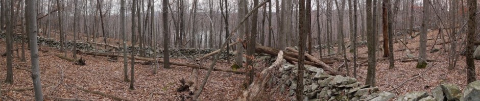
I zoomed in to show the stonework that had gone into preparing the road bed. I found a map that calls this Military Road, as it connects to a road within Camp Smith, the New York State Military Reservation, which is off-limits to hikers. I don’t know if this part of the road, within Hudson Highlands State Park, is ever used by the military or by state park rangers, but from a distance it appeared in excellent shape.

Military Road
4:05 p.m.: The trail descended to about 400′, then deposited us on Military Road, which did indeed look pristine.

Military Road
One of our group spotted a broken skull on the road, which I believe was from a whitetail deer. We continued hiking northeast on the road, which soon intersected South Mountain Pass Road, where I had left my car. The hike along the Appalachian Trail was only 1.2 miles, so our total for the day was only 5.5 miles. I then drove my friends back to their cars as the southern end of the Camp Smith Trail.