Tuesday: This was Julie’s last day in the park. With a flight leaving at 2:00 p.m., she had arranged for the shuttle to pick her up at Apgar Village at noon. Thus, she had very little time left for adventure.
Of my list of hikes that had interested me before the trip, the only one that remained was the Siyeh Pass Trail. Similar to the Highline Trail/Loop Trail, this left from one shuttle stop on Going-to-the-Sun Road and returned to the road at a second shuttle stop. Both hikes were north of Going-to-the-Sun Road. Whereas the Highline Trail was to the west of the Continental Divide, the Siyeh Pass Trail was to the east of it. The Highline Trail roughly paralleled the road, though, whereas the Siyeh Pass Trail diverged from the road to circle Going-to-the-Sun Mountain.
While it sounded like a good hike, it also had the reputation of being a tougher hike than the Highline Trail/Loop Trail, with possibilities of strong winds. The Moon guide also indicated that grizzly bears enjoyed that part of the park, and I wouldn’t have Julie along for company and to fight off grizzly bears. I decided that I would have to skip the Siyeh Pass Trail. Instead, I would go on shorter, easier hikes.
Julie packed her tent and most of her other belongings, and around 9:15 a.m. we walked down to the boat ramp at Lake McDonald, where we rented kayaks. We spent about 75 minutes on the lake, paddling about 1-1/2 miles to the northeast, almost as far as Rocky Point, before returning the 1-1/2 miles to drop off the kayaks. I didn’t take a camera with me in the kayak, as I hadn’t brought an inexpensive camera on the trip that I was willing to risk on the water.
We walked back to the campground, where Julie finished packing, and shortly before noon I drove her and her bulky duffel bag the short distance to Apgar Village, where the shuttle was waiting. I was sad to see her go.
I then drove to Avalanche Creek, where we had briefly investigated the Trail of the Cedars. This day, I intended to first hike to Avalanche Lake, and then on the way back find out if there was any more to the Trail of the Cedars. The sky had turned cloudy and the temperature had dropped. I had previously used most of the clothing I had brought with me, except for my rain gear and a few cold-weather items. However, this was a good day to have rain gear, and I put it in my backpack.
12:36 p.m.: A flat asphalt trail led from the parking lot to the head of the Avalanche Lake Trail–it only took a few minutes to cover the distance. At the trailhead, a sign said that the lake was only 2 miles away, and I also knew from the Moon guide that there was only a 500′ elevation gain. In addition to the bear warning sign that I had seen at all of the trailheads, there was also a mountain lion sign, which I had not seen before:

Bear and Mountain Lion Warning Sign
And Julie wasn’t there to protect me! But at least there were other hikers on the trail, including some with small children, and I presumed that the mountain lion would prefer one of them to me.
12:38 p.m.: The trail immediately climbed a bit, leading to a view of a gorge through which Avalanche Creek ran:

Drop from Avalanche Lake Trail into gorge

Avalanche Gorge

Avalanche Gorge
12:47 p.m.: The gorge did not run far, but Avalanche Creek runs the two miles from Avalanche Lake to Going-to-the-Sun Road, where the creek ran into McDonald Creek. Here is a flat section of Avalanche Creek:

Avalanche Creek
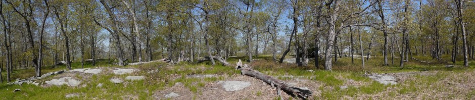
12:57 p.m.: The trail passed through a nice forested area. Here, a tree grew around a rock:

Tree growing around rock
1:01 p.m.: The trunk of a dead tree:

Trunk of dead tree
The sky grew quite dark, and it began to rain earnestly. I was already wearing my rain jacket and put on my rain pants, and put my camera in my backpack, which I covered with the built-in plastic cover.
1:42 p.m.: I reached the near end (the northwest corner) of Avalanche Lake just as the rain stopped. There were a few people there (most of whom had no rain gear), but I suspect there would have been many more people if it had not just finished raining. I set my camera to shoot a bracket of shots at different exposures, and the next four images are each fused together with High Dynamic Range imaging software.

Avalanche Lake and Monument Falls

Avalanche Lake and Monument Falls

Avalanche Lake and Monument Falls

Avalanche Lake and Monument Falls
1:55 p.m.: I had a late lunch and then asked one of the other hikers at the lake to take my photo:

Charlie in Front of Avalanche Lake and Monument Falls
2:11 p.m.: Two men were not far from me, and I heard one of them say, “Hey, I was just talking to that family and they pointed out there’s a black bear over there.” The bear was about 175 yards from us, along the east shore of the lake, and I only had time to get off a few shots before it walked into the woods. I wonder how long it had been in sight before I learned about it. I’m glad that I heard the man, as otherwise I would not have seen and photographed the bear.

Black Bear along shore of Avalanche Lake
I continued hiking on the Avalanche Lake Trail, which followed the west side of the lake (opposite the bear). Along the way, I passed two people heading back toward the trailhead, and one man fishing in the lake.
2:50 p.m.: The trail ended at the southeast end of Avalanche Lake, which I had all to myself.

Southeast end of Avalanche Lake
I soon left the lake, returning along the trail. As it was now dry, I was able to take a few photos that I hadn’t been able to take earlier, when it was raining.
3:55 p.m.: This nicely-textured boulder was beside the trail:

Boulder beside Avalanche Lake Trail
4:03 p.m.: I’m not sure what this is. Remnants of a strangler fig? After all, the nearby Trail of the Cedars was called a rainforest, but could a tropical or subtropical plant survive in Montana?

Avalanche Lake Trail
4:09 p.m.: A tree was somehow surviving being swept away by Avalanche Creek.

Avalanche Creek
4:16 p.m.: I returned to the trailhead. I think the sign indicating 2 miles to the lake meant to the near end of the lake, and that I added an extra 1/2 mile by continuing to the far end of the lake. Thus, my round trip hike was 5 miles.
Adjacent to the head of the Avalanche Lake Trail was a wooden bridge and boardwalk, marking another portion of the Trail of the Cedars, a different part of which Julie had explored earlier.

Bridge over Avalanche Gorge
The bridge provided a beautiful view of Avalanche Gorge, which I think was a prettier view than the upstream part that I had seen from the Avalanche Lake Trail:

Avalanche Gorge

Avalanche Gorge
I followed the boardwalk:

Trail of the Cedars
4:22 p.m.: The trail passed a rock wall:

Rock Wall, Trail of the Cedars
4:24 p.m.: The verdant Trail of the Cedars was nicely shaded, and I began to get a sense of what they meant by rainforest.

Trail of the Cedars

Trail of the Cedars
I completed the 0.7 mile loop and returned to my car. There was still about four hours of daylight left, and I had “only” hiked about 5.7 miles so far, with 500′ of elevation gain. I decided that I had time for one more hike before the end of my vacation. Therefore, I resumed driving west on Going to the Sun Road.
Great pics and sounds like a great trip. I must say, you need a large, mellow dog. While I’m sure Julie is a superb hiking companion, nothing beats the joy of strolling along in the woods with a pup. (I just took my two pups for 3 days of hiking in Shenandoah National Park and I’m not sure who had more fun.)