Friday: While planning the trip, Julie and I had each read the Moon Guide and listed the hikes we were interested in. We both agreed that the 11.6-mile Highline Trail/Loop Trail sounded good.
These trails run between Logan Pass and The Loop. Logan Pass is a pass over the Continental Divide that has a Visitor Center and a large parking lot. The Loop is a switchback on Going-to-the-Sun Road that has a small parking area. The Loop is about 23 miles from Apgar Village, while Logan Pass is about 30 miles away. A shuttle runs between the two locations, so getting back to the car was no problem.
We had a choice of traveling from Logan Pass to The Loop, or vice versa. What’s the difference? Well, The Loop is at a much lower altitude, so starting at Logan Pass meant a climb of about 900′ on the 7.6-mile Highline Trail section, but then a descent of 2000′ on the 4-mile Loop Trail section. Starting at The Loop meant a climb of about 2000′ and then a descent of 900′. Some people find it easier to climb than descend, but I was ambivalent. The descriptions of the hike assume hikers will start on the Highline Trail and finish on the Loop Trail. Another factor was that a ranger-led hike was available, starting at 9:00 a.m. from Logan Pass. We therefore decided to start at Logan Pass with the Highline Trail, and to get there in time for the ranger-led hike.
The visitor center at Apgar Village told us to allow 1-1/2 hours to travel the 30 mile distance to Logan Pass. Not only is the road narrow and winding with steep drop-offs, but there was also construction on the road that resulted in only one lane being open. We therefore left around 7:15 a.m.
We arrived at Logan Pass around 8:45, easily found parking, and wandered around for a few minutes before we found the group gathering for the hike. While waiting for the ranger, I snapped a few photos.
8:42 a.m.: This is Reynolds Mountain, a 9125′ peak on the Continental Divide, south of Logan Pass.

Reynolds Mountain
9:01 a.m.: Julie and I pose behind the sign at Logan Pass, with Reynolds Mountain behind us on the left.

Charlie and Julie at Logan Pass
9:19 a.m.: Our ranger actually didn’t show up until around 9:10, as she hadn’t allowed enough time for the drive from West Glacier/Apgar to Logan Pass. There were about a dozen hikers, and we quickly got started, crossing to the west side of Going-to-the-Sun Road and climbing the trail.
The Highline Trail ran roughly parallel to the road, though generally out of sight of it. The trail also paralleled the Continental Divide for most of the way, except that the mountains quickly gained in altitude above Logan Pass, while the trail followed at a lower level.
The guidebook had said that the beginning of the trail was the most narrow part, and made some people nervous, as there was a sheer drop to the road below. I found the trail to not be so narrow, and there was a cable attached to the rock wall to the right to assist those who felt nervous.

The Highline Trail climbs above Going-to-the-Sun Road
Having mentioned Going-to-the-Sun Road, I should add that while it travels from the west side of the park to the east side, its name is not developed from the fact that it follows the path of the Sun across the sky. Rather, the road is named for Going to the Sun Mountain, in the northeast part of the park.
9:28 p.m.: Here is another view of Reynolds Mountain, on the left:

Reynolds Mountain
The mountains to our right were Pollock Mountain, Bishops Cap, and Mount Gould. At the beginning of the hike, the Highline Trail passes the “Garden Wall,” an alpine area featuring wildflowers and other vegetation. Thus, the hike offered more than just panoramic views of the mountains to the south and west.

Wildflowers

Wildflowers
10:04 a.m.: This is 8987′ Heaven’s Peak, which was about six miles southwest of us:

Heaven’s Peak
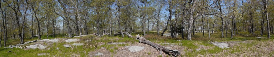
10:40 a.m.: Heaven’s Peak is also visible in the middle of this wide-angle panorama.

View from the Highline Trail
At this point the Highline Trail was about 7000′ or 7250′ in elevation, close to the highest point on the trail. The next photo shows the wall to our right (northeast), which was about 2000′ higher. At least part of the wall is an arête, a thin ridge of rock that separates two valleys, formed due to glacial action. The triangular white area between the arête and the blue sky is a corner of Gem Glacier, with most of it only being visible from the east side of the Continental Divide.
A glacier is a persistent body of ice that is at least 25 acres in size, and 100′ thick, that slowly moves across the landscape. Gem Glacier is too small to officially be considered a glacier, but as it is still moving, the park continues to call the ice field a glacier.

Arête and Gem Glacier
The ranger told us a bit about the geology of the park. Much of the rock in Glacier was argillite, formed as muds were compacted into rock, 1.6 billion to 800 million years ago. It is therefore “rotten rock” not suitable for technical climbing, as it will crumble rather than hold support anchors. It is also noticeable that the argillites include both red and green colors. The red represents iron oxide compounds, and the ranger said that the green rocks were formed without oxygen being present, whereas the red rocks were formed with oxygen present, leading to the formation of the red iron oxide.

Red and green argillites
Some of the rocks also had nice patterns. For example, as mud dried, it cracked, and when the pressure led to the mud’s lithification into solid rock, the cracks remained as a pattern:

Rock with mud cracks
10:55 a.m.: More scenery:

View from the Highline Trail
11:06 a.m.: Another panorama:

View from the Highline Trail
11:16 a.m.: We stopped for a break, and I photographed a Columbian ground squirrel from about 12 feet away:

Columbian ground squirrel
11:36 a.m.: Our break ended, but others were still enjoying the day by sitting on a boulder:

Resting on a boulder
Looking south again, with Reynolds Mountain at center:

Reynolds Mountain
11:50 a.m.: This is a view toward the southwest, with McDonald Creek being visible.

Southwest view from Highline Trail
12:16 p.m.: Looking to the wall above us to the northeast.

Highline Trail
12:29 p.m.: In this view toward the southwest, one can see a bit of Lake McDonald in the valley between the two mountains.

Southwest view from the Highline Trail
1:31 p.m.: An hour later (and after a lunch break), the view had not changed much toward the southwest, with Lake McDonald still being visible in the upper left of the photo:

View from the Highline Trail
2:30 p.m.: The Granite Park Chalet, built in 1914, came into view. At the time, rich tourists enjoyed vacations in the Swiss Alps. An effort was made to market Glacier National Park to attract some of those rich tourists (as well as those of more modest means), by exhorting them to “See America First.” These remote buildings were called “chalet,” with the architecture invoking those of the Alps. The chalets are not accessible by vehicle, but are nonetheless very popular. Many hikers spend a night at one or two of the park’s chalets, using them as a base for other hikes.

Granite Park Chalet, Highline Trail
We stopped at Granite Park Chalet to use the outhouse, and we also peaked into the store/cafe. This marked the end of the 7.6-mile Highline Trail, and all we had left was the 4 mile Loop Trail and its 2000′ descent to The Loop.
We also learned that we were losing our ranger at this point, as she announced that the ranger-led portion of the hike was over. I guess when the park publication said that it was a ranger-led hike on the Highline Trail, they really meant only on the Highline Trail, and not including the Loop Trail back to the road. Julie and I began our descent on the Loop Trail. The ranger soon caught up and flew past us downhill, and we never saw her again.
The views on the Loop Trail were not as inspiring as those on the Highline Trail, though at times it was still pretty. I’m undecided as to whether I prefer hiking uphill or downhill. Uphill is definitely harder on my cardiovascular system, but downhill is harder on my feet. As we descended, I began developing a blister on the bottom edge of my right heel.
3:44 p.m.: Julie leads the way on the Loop Trail:

Descending the Loop Trail
4:16 p.m.: A few minutes before reaching The Loop, we caught sight of the parking area there. It seemed very close to me, and I was surprised that it then vanished. Apparently we had to circle around a bit to get to it. We also crossed a pedestrian bridge across a stream.

Loop Trail, near The Loop
We finally reached Going-to-the-Sun Road at The Loop, and caught a shuttle back to Logan Pass, where we had parked the car. We then drove back to the campsite at Apgar.
I drove from there to the KOA campground and their showers. Julie had never heard of KOA before. I had heard of the chain of campgrounds before, though I never stayed at one. They are more expensive than the public campgrounds offered by the Federal and State governments, but Julie said that she could understand why KOA would be a draw for families. KOA offered a pool, a nice store, and was very well maintained, with a nice lawn and flower beds.
Next: A hike to Iceberg Lake!