This was my second visit to this park. The last time the parking fee had been $8, but no one was there to collect it. This time, it was up to $10, and there was an attendant present to collect the fee.
On my first visit in 2010, when I hiked trails in the southwest part of the park, it was about 93 degrees. I drank about 3 liters of water that day.
On this second visit, I hiked trails in the southeast part of the park, thus not repeating any of the trails I had been on before. It was “only” about 85 degrees, but the humidity was very high. I hiked very slowly as a result, and drank one liter of water and a liter of Powerade.
12:30 p.m.: I began by following the park road (Reservation Road) to its eastern end, parking in an empty tent campsite. The road actually continues, but is not open to the cars of visitors past the point where I parked. I walked east on the closed road 0.4 of a mile, reaching Boutonville Oak. A website states that “[t]he base of this giant white oak measures 14′-8″ in circumference and branches extend outward 73′ tip to tip.” The website says that it is second in size only to the Bedford Oak; Bedford is the adjacent town in Westchester County, so I presume that means that this tree is the second largest white oak in the county.

Boutonville Oak
12:50 p.m.: I then walked back to my car, stopping at one point where a clearing afforded a view of hills toward the south.

Looking South
Reaching my car, I drove 0.9 miles to the parking lot at the Trailside Nature Museum. It had been closed on my last visit, and I didn’t even bother checking to see if it was open on this day. I began hiking southeast on the orange trail, which soon reached what I imagine is an exhibit associated with the museum.
1:13 p.m.: This is a small Lenape wigwam, with a canoe in the background.

Delaware wigwam
1:38 p.m.: A stone wall:

Stone wall
After 0.75 miles hiking southeast on the orange trail, I reached marker 51 and turned south onto the white-blazed trail. I followed this 0.7 miles to marker 20, then followed the white-blazed Rock Trail for 0.25 miles to the Indian Rock Shelter, where I had lunch:

Indian rock shelter
2:29 p.m.: Resuming my hike, I immediately came to marker 18 and turned southwest, enjoying additional rock formations on the way:

Rock wall
I followed the trail 0.3 miles to marker 21, then turned onto the red trail, which I followed south for 0.35 miles. My goal was marker 61, where I expected to find a very short connecting trail back to the Rock Trail. I found a blaze marking an intersection, though there was no number. I suspected that it had to be the marker I wanted, and I followed it about 50′ to the Rock Trail.
2:57 p.m.: I turned northeast on the Rock Trail, which after 0.1 miles led to Raven Rocks, with a steep dropoff of about 350′ down to Stone Hill River providing a nice view to the south:

View from Raven Rocks
A detail of the mansion:

View from Raven Rocks
A detail of the upper right corner, showing that the tall “tree” is actually a disguised antenna tower:

Antenna tower disguised as tree
There were a number of people enjoying the picnic facilities at the park, but I only saw two hikers on this day, just as I arrived at Raven Rocks.
3:17 p.m.: I continued hiking to the northeast on the Rock Trail. Perhaps 100′ in front of me, a brown flash zipped across the trail and disappeared into the trees to my left, flashing a white tail. I advanced on the trail and again spooked the deer, which again bounded away from me. However, I was still able to find him with my telephoto lens:

White-tailed deer
I moved a bit to get a view from a different angle. The white spots indicate that he is still a fawn. I don’t know where mamma was, but fawns typically don’t become weaned and lose their spots until November:

White-tailed deer
After 0.6 miles, I reached an intersection with marker 58, and turned right, which after 0.05 miles led me to marker 17 and the intersection with the blue trail. I took this to the left, moving northwest.
The blue trail would take me up to the highest point in the park, at 860′. That was a gain of about 350′, and while that wasn’t much of an altitude gain, the combination of the heat and humidity was such that I was satisfied to move very slowly.
3:59 p.m.: Before the trail began gaining elevation, there was a nice flat area which was very green:

Lush greenery
4:06 p.m.: A rockface signaled the beginning of the gain in elevation:

Rock wall
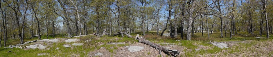
A huge tree lay fallen and shattered beside the trail. I wished that someone had been hiking with me, to serve as a model to indicate the scale of this tree:

Shattered tree
4:14 p.m.: After 0.6 miles, which included at least one scramble uphill, I reached the highest point in the park. At one point a fire tower had been here, though now only a few broken stones remained from the foundation. The site included a lot of flat bare rock:

Bare rock at old fire tower site
Another view at the high point, showing a bench and an old pump shaft and spout:

Bare rock at old fire tower site
A close-up of the pump shaft and spout:

Shaft and spout of cast iron pump
After another 0.3 miles on the blue trail, I reached marker 15. I turned west, and after 0.05 miles reached marker 13. I then turned northwest onto the orange trail, which led 0.9 miles through a series of tent sites and lean-to sites back to the Trailside Nature Museum, arriving at my car right at 5:00 p.m.
If I’ve estimated correctly, this was only a 5.8 mile hike, and there was not much elevation gain. Still, it was nice to get out and get some exercise, despite the heat and humidity.
My drive home was not bad. Westchester County is not that far, and I appreciate that it’s on the east side of the Hudson River, which also makes it much easier for me to visit from Queens.