The weather finally cooperated, so I drove to Harriman, where I parked in the Elk Pen off Highway 17 and began climbing the Appalachian Trail (AT) northbound (actually east-southeast) into the park. There’s a pretty steep 400′ climb up Green Pond Mountain at the start of the hike, from about 600′ to 1000′ elevation, which made me stop to catch my breath for a moment. But I was fine the rest of the day, with the elevation for the most part pretty steady from 1100′ to 1300′. I carried my fleece jacket with me, but it spent most of the time in my backpack, as the weather was warm enough, especially when coupled with my exertion.
Here’s a tree that has fallen and gotten hung up on another tree:

Tree hung up on second tree
In a number of places the grass was a vibrant green. I believe that owing to the mild winter, the vegetation started growing earlier this year than last year. That is, it was was still green in late April 2011, but I think the grass is taller this year than last year at that time.

Appalachian Trail
I don’t have comments for every photo, but Harriman has a very nice blend of bare rock, trees, elevation changes/views, water, sky, etc.

Looking downhill

Scenic view

Bare rock

Appalachian Trail

Appalachian Trail
After 1.0 mile on the AT, Island Pond came into view. I had been on the trail the year before, so this was not new territory for me.

Island Pond
This is another view of the rotary gravel sorter that I photographed the year before, which was used to separate iron from gravel.

Rotary gravel sorter
After another 0.7 miles, I came to the Lemon Squeeze. The previous time I was on this trail, I was with a group that turned off here onto another trail. This time I was on my own, and I wanted to continue on the AT, which meant going through the Lemon Squeeze.

Lemon Squeeze
This doesn’t look so bad: more of a ducking action than a squeezing action.

Lemon Squeeze
After ducking under the rock in the previous photo, I found myself in a small boulder-enclosed clearing that offered a patch of sunlight and a few trees. How does one get out of here? The blazes say straight ahead, but it doesn’t look like there’s much of an opening there between those rocks.

Lemon Squeeze
Oh, maybe the entrance that I had to duck through wasn’t the Lemon Squeeze, after all. This definitely looks much more like a squeeze. Somehow I made it through there, trying not to scratch either myself or my backpack on the walls.

Lemon Squeeze
The AT turned northeast at this point, and continued up Island Pond Mountain, offering sun and green grass.

Island Pond Mountain

Island Pond Mountain
The terrain was far from uniform, though. Some spots were shady and thus there wasn’t much grass, some spots were wet and sloppy, and this spot was shady and rocky:

Appalachian Trail
About 1.5 miles past the Lemon Squeeze, the AT turned briefly onto an old woods road called Surebridge Mine Road.

Surebridge Mine Road
Just past the turn I came to Greenwood Mine. Here’s a nice piece of rock that I found in the road:

Rock
This is Greenwood Mine, now a water-filled hole:

Greenwood Mine
I continued on the AT, which very soon left the woods road for another footpath, this time climbing Fingerboard Mountain:
Fingerboard Mountain

Fingerboard Mountain
I had earlier reflected on the wide range of colors I was seeing, with green grass, blue skies, brown for tree trunks and dead leaves, and white and gray for the bare rock. But I was missing red. Finally, I found some vegetation that had at least some red to it.

Fingerboard Mountain
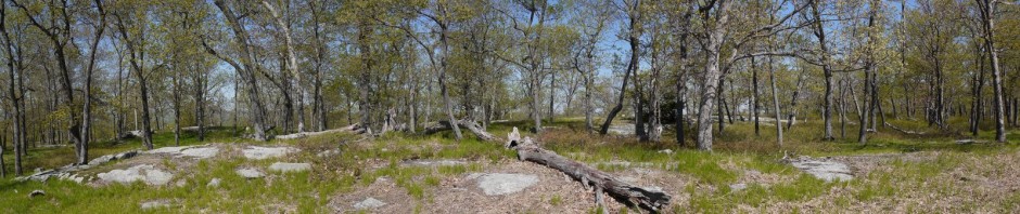
This looked like a good place for lunch, and also a good place for a 360′ panoramic shot. (The larger version is 700 KB, so don’t load this unless you have a fast connection.)

About 0.7 miles past Greenwood Mine, I came to the lean-to shelter at Fingerboard Mountain.

Shelter on Fingerboard Mountain
At this point I left the AT, turning onto the blue-blazed Hurst trail. This was only 0.4 miles long, crossing under telephone lines and dead-ending at Seven Lakes Road. Here’s a shot of the road, with a bicyclist, and Lake Tiorati behind.

Seven Lakes Road & Lake Tiorati
Lake Tiorati:

Lake Tiorati
Having now hiked 4.3 miles from my car, I decided it was time to head back. There are so many trails at Harriman that it’s almost always possible to make at least a partial loop. Leaving Seven Lakes Drive, I began hiking south-southwest on a woods road that is shown on the map but not labeled there. It was very easy to follow, though. At first it was lushly carpeted:

Woods road
The ground changed a bit, but it was still easy to follow the woods road:

Woods road
I had planned to turn off the woods road at the unmaintained Bottle Cap trail, but I missed the turnoff, and decided that rather than backtrack and look for it, I would just continue on the woods road.

Woods road
After 0.9 miles, the woods road ended at the red-blazed Arden-Surebridge trail, and I turned right (west) onto that. My map showed unnamed mine workings in the area, and these water-filled pits could be the remnants of a mine.

Mine workings

Mine workings
They say that moss grows on the north side of a tree, and that seems fairly accurate.

Mossy tree
I continued on the red-blazed trail for 1.7 miles, past “Times Square” (a boulder that marks an intersection with a number of trails) and back to the Lemon Squeeze. Then I rejoined the Appalachian Trail and followed it back another 1.7 miles to the Elk Pen and my car.

Appalachian Trail
I estimate the hike was 8.6 miles. It was a pretty day and a lot of fun.