Sunday: I joined DaveTrek for another Memorial Day event. This was my first visit to the Delaware Water Gap. Two others from Queens rode with me. We met the rest of the DaveTrek group at the Visitor’s Center at Kittatinny Point, New Jersey, where we were transported by van to the launching point at Smithfield Beach, Pennsylvania.
10:39 a.m.: Gentlemen—start your paddling.

Smithfield Beach
And we’re off. In honor of Memorial Day, I brought my U.S. flag, and I placed this ensign in the position of honor at the stern (i.e., I put the staff between my back and the seatback of my rented kayak).

Posing at Delaware River, with American flag
11:35 a.m.: The Delaware River was very placid, not unlike the Pine Barrens of southern New Jersey the year before. One difference, though, was that this stretch of the Delaware never got as narrow as some locations of the Batsto River, and we also did not have to worry about downed trees, unlike the Batsto River. So it was smooth sailing—er, paddling.

Kayaking on Delaware River
11:47 a.m.: I spotted a raccoon gingerly climbing down a tree. I pointed him out to a couple of other DaveTrek boaters. I took a few photos, but I don’t think any turned out adequately to post.
12:25 p.m.: There were one or two areas of turbulence, but I don’t know if I actually saw any whitewater. If so, it was only Class 1.

Delaware River
The year before, the group found a big beach for lunch. This year, I was toward the front of the pack instead of the rear, and if anyone organized a lunch meeting I don’t know about it. In other words, I kept paddling and drifting until I suddenly realized (when I saw the I-80 bridge) that I was almost back to Kittatinny Point, which would mark the end of our water adventure. I therefore pulled my kayak onto a tiny spit of land. There may have been room for another kayak or canoe there, but no one joined me. Many sailed past, and apparently didn’t eat their lunch until after they returned to Kittatinny Point.
12:38 p.m.: Following are three stitched panoramas, including a couple of views of my kayak. When I exited for lunch, I temporarily remounted my flag to the front of the cockpit, out of necessity, as I couldn’t figure out how to mount it in the stern without me anchoring it between my back and the seat.

Shore of Delaware Water Gap

Kayak beached beside Delaware River

Kayak beached beside Delaware River
There’s a lot going on in this shot: in the foreground, a tree on the beach of my lunch spot; in the background, the water and mountains, with a passing kayak visible through the upper branches of the tree. But wait—there’s more: is that a snake resting in the tree?

Delaware Water Gap
Yes, seen here from the kayak after launching, it’s a Northern water snake (Nerodia sipedon).

Northern Water Snake
1:39 p.m.: Fortified by lunch, I resume paddling south, getting closer to the I-80 bridge.

I-80 Bridge
1:55 p.m.: After six miles on the Delaware, I pulled into the beach at Kittatinny Point.

Kittatinny Point, Delaware Water Gap
It was a cloudy day, and I foolishly had neglected to put on sunscreen. I soon realized that my legs were very burnt. I hope they’ll eventually heal.
We were told not to even report to the barbecue/camping site until 4:00, which left a lot of time to kill. I began playing Frisbee with a lovely lady, but another lovely lady—one of my passengers from Queens—wanted to visit Dingmans Falls, in Pennsylvania. Loathe to leave the Frisbee lady behind, I suggested that she come with us, but she was a driver and didn’t feel that she could leave her group there. [My other passenger also declined, and he said that he’d catch a ride to the barbecue/camping site with someone else.]
So my passenger and I began driving on Old Mine Road, soon becoming lost as the road branched without a sign telling us which branch to follow. I eventually plugged in my GPS, which directed us to Dingmans Ferry. There we found this bridge across the Delaware River (the photograph is actually from our return trip, heading east). [The Dingmans Ferry Bridge is the last privately owned toll bridge on the Delaware River.]

Dingmans Ferry Bridge
4:41 p.m.: We arrived at the Dingmans Falls Visitor Center. Following the footpath, we first arrived at Silverthread Falls, with a vertical drop of 80′.

Silverthread Falls
We continued on the path, which ran along a nice stream.

Stream
4:51 p.m.: We soon arrived at Dingmans Falls, which has a 130′ drop.

Dingmans Falls
5:06 p.m.: A path and series of steps led to the top of Dingmans Falls:

Dingmans Falls
We then returned over the Dingmans Ferry Bridge, again got lost (even with the GPS, which was telling us to drive offroad), but eventually made it to Rivers Bend Group Campsite. This was around 6:30 p.m., and we were afraid that all the food would be gone. In fact, the salad appetizers were gone, but the main course of burgers and hot dogs was just getting started, and we waited in line and soon had a bit of food.
Monday: Some people came only for boating, some only for the barbecue, etc., so it is hard for me to say how many were there at any one time. I believe there were about 70 camping, though. Here’s the campsite in the morning.

Rivers Bend group campsite
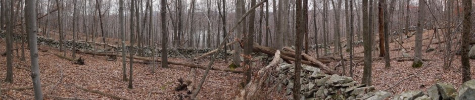
1:19 p.m.: We eventually broke camp and drove to Millbrook Village. This was a community which was occupied until the 1960s. A few of the buildings are original to Millbrook (though possibly relocated), and others are relocated from elsewhere or reproductions.
I think this was considered a wagon storage shed:

Wagon storage shed
The George Trauger house, ca. 1860.

George Trauger house
Inside the Trauger house:

Inside the George Trauger house

Millbrook Village

Millbrook Village

Millbrook Village
2:30 p.m.: We then set off on a hike, south along the original roadbed of the Columbia-Walpack Turnpike, as it paralleled the Van Campens Brook. It was very hot. Not every camper came to Milbrook Village, and not everyone who came to Milbrook Village decided to hike. And many of those who did begin the hike dropped out along the way.
After 0.5 miles, we came to the Watergate Recreation Site.

Watergate Recreation Site

Watergate Recreation Site
3:14 p.m.: We continued on, paralleling Van Campens Brook.

Van Campens Brook
“Savta” (grandmother), our oldest weekend participant, crosses a bridge over the brook.

Bridge across Van Campens Brook, Delaware Water Gap, NJ

Van Campens Brook
3:54 p.m.: At least the greens now look much more vibrant than from my photos on the hikes of a few weeks ago. But it was hot.

Van Campens Glen Trail
4:02 p.m.: After another 0.5 miles (i.e., only covering 1 mile in 1-1/2 hour, quite possibly the slowest progress ever made in the history of the human race), we finally came to a place where the brook became prettier, and there were many nice swimming holes, and some short waterfalls, and we had some tree cover protecting us from the sun. It was also later in the afternoon, and thus cooler. Unfortunately, we were down to about 12 hikers by then.

Van Campens Glen Trail
4:59 p.m.: Toward the end of the hike, I spotted a tree with a hollow area in its base.

Van Campens Glen Trail
Holding the camera inside the tree, pointing out, I snapped a self-portrait.

Self portrait
5:15 p.m.: Many people were enjoying a number of spots along the brook for swimming. Two miles into our hike, we reached the parking/picnic area of Van Campens Glen. Owing to the lateness of the day/the heat/the snail pace of our hikers, Dave hitched a ride back to his truck, and then shuttled a few other drivers to their cars and back, eventually carrying all of us to Millbrook Village.

Van Campens Glen
All-in-all, it was a very enjoyable weekend. I had been dreading the drive home, because the previous Memorial Day at the Pine Barrens ran into horrendous traffic returning to NYC. But there was no traffic coming home from western NJ! My only complaint (other than only getting in a 2-mile hike instead of my usual 8-mile hike) is the sunburn. I’ve tried various remedies, such as aloe and Shea butter.