Tuesday: I had met Julie briefly the evening before, near Curry Village’s grocery store, and we agreed to meet the next morning for breakfast. There is a hearty all-you-can-eat buffet available at a restaurant in Curry Village, and I enjoyed cereal and milk, sliced peaches and pears, orange juice and coffee. Of course, the restaurant also had pancakes, eggs, and meats from various and sundry animals.
The park service does provide a free shuttle within Yosemite Valley. It’s too bad that they don’t also have free shuttles to more distant locations, such as Glacier Point, Mt. Dana, or the Mariposa Grove of Giant Sequoias, all of which I visited by driving to them. After breakfast we rode the shuttle to the El Capitan stop. Here’s El Capitan: with its granite walls rising 3,000′, it is a favorite of rock climbers. I didn’t see anyone climbing, but they would just be tiny specks on the wall. I do not like this photo very much because of the perspective distortion. I should have been farther away (and/or higher) or at least taken a couple of shots to make a panorama.

El Capitan
Here is a nicer shot, of the Merced River, which is south of El Capitan:

Merced River
These are Cathedral Spires, across the Merced from El Capitan. I also wish I’d made a panorama of this shot:

Cathedral Spires
We returned to Curry Village, and registered for a rafting trip. I had to return to my cabin to change into more suitable clothing and to switch cameras. For rafting, I took my compact digital camera, a Panasonic DMC-FX35. We had to carry the raft about 100′ from the concession facility to the bank of the Merced. The raft wasn’t all that heavy, but obviously it was very bulky, and on the sides it had four handles (right front, right rear, left front, left rear). That would be great if there were four people to carry a raft, but as there were only two of us, those handles didn’t help, because if we each held onto the front handles on either side, the rear of the raft would drag on the ground (which presumably would eventually wear a hole in the material), and if one of us carried by a front handle and the other by a rear handle, the raft would tilt either and drag a front or rear corner on the ground. So we tried carrying the raft on our heads, which was not all that comfortable. We also tried carrying by a metal D-ring at the front and rear, but that was hard on the hands. Somehow, we finally got the raft to the river.

Rafting on the Merced River
As you can see in this next shot, there were areas along the route that were very shallow. I guess that’s why they have rafts instead of kayaks, which would probably run aground. The Merced passes under three or four bridges along the route, and rafting is not allowed when the river is too high. So the season in late May through September. On the other hand, because most of the snow (or all of it?) melts by August, the river can be low in August and September, meaning that people may have to carry their raft through some especially low areas. So it sounds as though late May through July is the best time to go.

Merced River
Julie is enjoying the scenery, with Half Dome behind her:

Julie on the Merced River with Half Dome behind her
A bridge comes into view:

Bridge over the Merced River
Above the bridge, one can see Yosemite Falls, the highest waterfall in North America, with a 2425′ drop:

Bridge over the Merced River, Yosemite National Park, California
Another bridge:

Stone Bridge over the Merced River
A closer view of Yosemite Falls:

Rafting on the Merced River in sight of Yosemite Falls
A nice panorama shot:

Rafting on the Merced River
There are plenty of mule deer at Yosemite, and they are not very shy:

Mule Deer beside Merced River

Mule deer
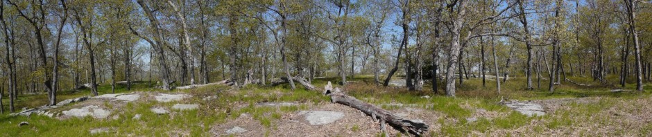
After our rafting trip and lunch, we decided to drive up to Glacier Point. (We did not want to do anything too strenuous this day, as we were saving our energy to hike up to Half Dome on Wednesday.) This is a view from an overlook on Glacier Point Road.

Scenic view from overlook on Glacier Point Road
After about an hour’s drive, we arrived at Washburn Point, near the end of Glacier Point Road. Half Dome, our objective for the next day, appears roughly at the center of the shot. From Washburn Point, one has almost the perfect vantage point to understand why the rock formation is called “Half Dome,” as the wall on the left appears almost vertical, as though someone sliced a dome in half. The peak of Half Dome is at 8842′. The upper waterfall is Nevada Fall, with a 594′ drop. The dome to its left is Liberty Cap, with a peak at 7076′, and the shorter formation to its left is Mount Broderick, with a peak at
6706′. The lower waterfall is Vernal Fall, with a 317′ drop.

Half Dome from Washburn Point
Here’s another view just focusing on Half Dome, Mount Broderick, Liberty Cap, Nevada Fall and Vernal Fall:

Half Dome, Mount Broderick, Liberty Cap, Nevada Fall and Vernal Fall
This is a view of the Clark Range, which separates the drainage basins of the Illilouette Creek from the uppermost portions of the Merced River:

Clark Range
We then drove just a few short minutes to the end of Glacier Point Road, to Glacier Point itself, at 7214′ in elevation. This is a photo of a California ground squirrel, commonly seen in Yosemite. They live in burrows in the ground, instead of in trees. They appear as if they have a white collar.

California ground squirrel
This is a stitched panorama. I failed to take a shot of the rock in the lower right corner, so there is a blank (black) area in the lower right corner. Starting at the right of the photo, we can again see Half Dome. (We’ve moved to the left of our previous viewpoint from Washburn Point, so we can see more of the near-vertical wall of Half Dome than we could see from Washburn Point.) In the lower center of the photo, one can see Yosemite Valley and Curry Village. (There’s a tiny bit of aqua that is Curry Village’s swimming pool.) That is, we have driven an hour to reach a point that is very close to Curry Village, only 3200′ higher. At the left of the panorama, you can see Yosemite Falls:

Yosemite Falls, Half Dome, Yosemite Valley and Curry Village
I’ll assume that someone accidentally dropped some human food, rather than doing so intentionally. The Park Service says that human food isn’t healthy for animals, but they don’t know any better. (Some human food isn’t that healthy for humans, either.)

California ground squirrel eating cheese puff
Next: Half Dome!